Alert

Alerts

To see around
See more
Open
Close
Show
Show
Show
Show
Show
Show
Show
Show
Show
Show
Show

Oups... It would appear that Cirkwi does not have permission to use your location.

Presentation
Description
Map
Points of interest
Ratings and reviews
See around

Calan The Lec'h Circuit

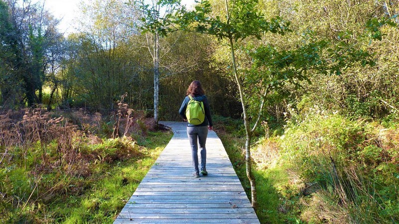
On the platforms
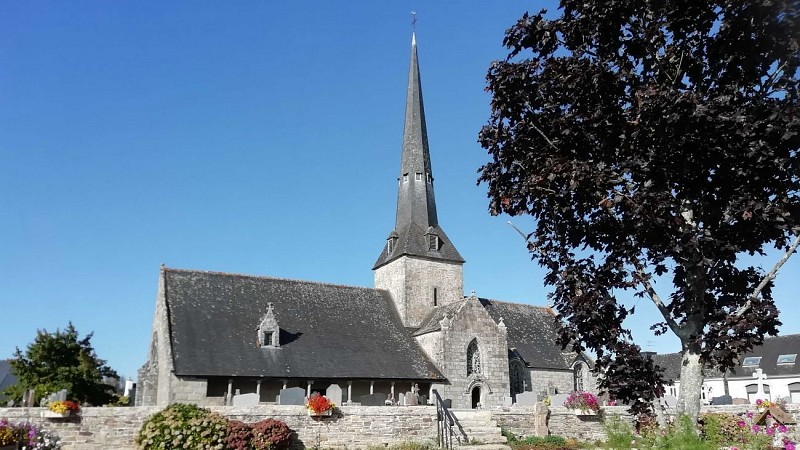
Romanesque church of Calan
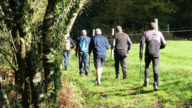
Along the fields
Credit : Lorient Agglomération

Description

Starting point: Place du Four near the town hall

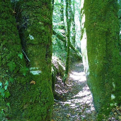
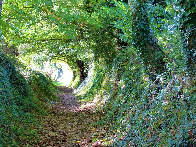
The circuit du Lec'h will take you along streams and through wetlands, along sunken paths and through villages, to discover the countryside around Calan. An opportunity to discover its rural heritage, houses, wells, bread ovens, fountains..., but also its lec'h, a funerary stele dating from the Iron Age. Don't miss its beautifully restored Romanesque church.


You are walking in natural, private sites. Remain on the marked paths, respect nature, infrastructures and cultivated areas. For your comfort and safety, wear suitable hiking clothing.

"Certain allergenic species may be present along hiking trails, such as grasses, birch, alder, mugwort, ragweed, and olive trees. To plan your outings, you can consult the pollen monitoring data for the Lorient Agglomeration area and the recommended precautions to take via this link: https://www.lorient-agglo.bzh/actus/suivi-des-pollens/ "

Technical Information

Walking
Difficulty
Easy
Duration
2h15mn (1d)
Dist.
8.4 km
Show more

Altimetric profile

Starting point

1 Place du Four , 56240   Calan
Lat : 47.87439Lng : -3.32306

Points of interest

image du object

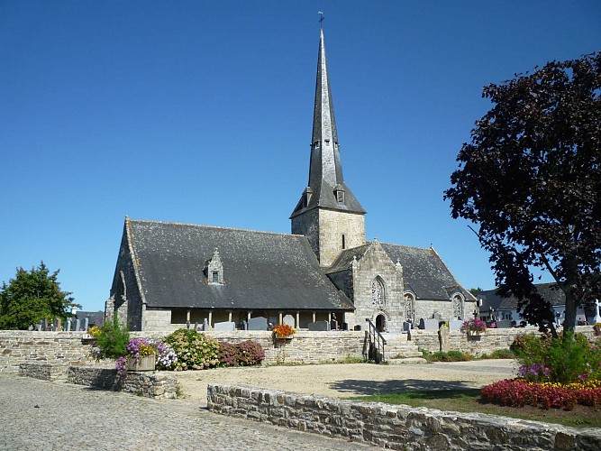
The Romanesque church of the Trinity

A true masterpiece of Breton Romanesque art, the listed Trinity Church was enhanced by several restorations between 1978 and 2000. The work revealed three main construction campaigns, two in the Romanesque period and one in the 15th century. The nave and transept still have bays with arcades resting on square piers from the end of the 10th century, others from the 12th century with capitals sculpted with geometric decorations, volutes, latticework and foliage. Fragments of ochre and brown paintings from the 11th or 12th centuries, rare Breton testimonies of Romanesque mural painting, were uncovered. They represent the Last Supper and Hell. In the 15th century, perhaps in 1425 as indicated by a date inscribed on the eaves of the roof frame, the choir and its aisles were rebuilt with three bays with broken arches and a bay opening onto the chevet to the east. Outside, while the lantern tower of the transept is a reminder of the Romanesque origin of the building, the elevations date from the first quarter of the 15th century. The gallery, unique in Morbihan, is comprised of a series of columns and a frame with capitals and hammerbeams carved with faces supporting the sloping roof. Built in the 16th century, unusually, it includes the south porch and an ossuary in its western part. A skylight was created in the roof slope to combat the darkness created by this arrangement. The preserved parish enclosure still houses the cemetery, a rare occurrence today.

2 Place de l'Église 56240 Calan
- Lorient Agglomération -
Consulter
image du object

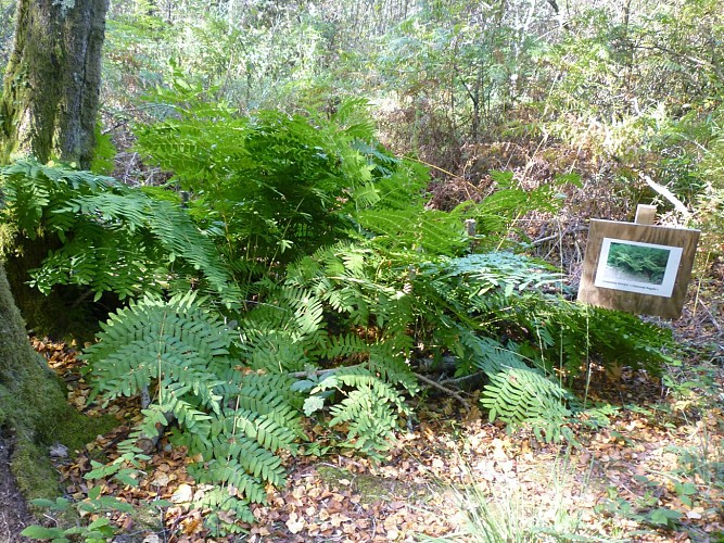
Royal Fern, queen of the wetland

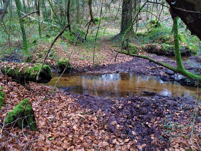
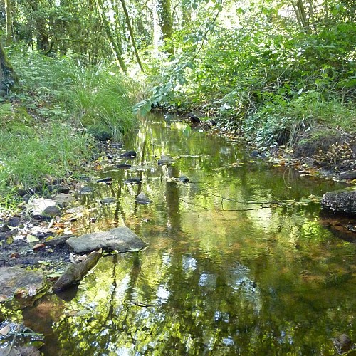
The route runs along the bottom of the valley through a wetland area which plays a fundamental role in the water cycle. Acting as a regulator, it stores water in the winter and releases it to the river during dry periods. It is also a purifying filter and helps improve water quality. The dense vegetation of the wetland includes various characteristic species that like to live with their feet in the water. In winter, the waterlogged brown soils, dotted with tall clumps of sedges with sharp grasses, willow and birch with thin, twisted trunks covered in fluorescent green mosses, make for a hushed atmosphere. The summer is more exuberant. The colour green bursts through. Ferns, nettles, water hemlock and angelica cover the ground and border the stream. The leaves of the trees form a protective canopy. This poor, peaty soil is also home to the royal fern, a large, light green clump of ferns that can grow up to 1.5 metres in diameter. In the spring, stems slowly unfurl from the thick stumps to form large bipinnate fronds. Unlike other ferns, the sporangia of the royal fern do not develop on the back of the pinnate leaves, but at the top of the fronds in the form of pinkish beige to reddish brown panicles, hence its other name of flower fern. The spores disseminated at maturity ensure the survival of the fern. Present all around the globe, it is nonetheless becoming rarer. It is protected in several French regions, in the Finistère and the Ille-et-Vilaine in Brittany.

- Lorient Agglomération -
Consulter
image du object

An agricultural plateau

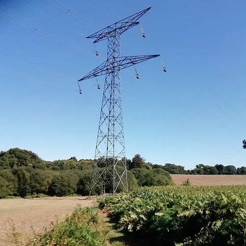
Farming represents 20% of the economic activity in Calan. More than 50% of the land in the parish is devoted to farming, half of which is for cereal crops and corn, with forage and grassland accounting for a third. Seven of its eleven farms are dedicated to livestock, milk and meat production. The landscape on this plateau bears witness to these activities, but also shows how it has changed since the 1950s.  In the 19th century and until the 1960s, before farming was reorganised and mechanized, there were about thirty plots of land surrounded by embankments on either side of this road. Comparing aerial photographs from the 1960s and the present day reveals the former footprint of the embankments in lighter colours. In 1843, on the Napoleonic land registry, the combination of wide strips of farmland and thin strips of moorland at mid-slope is a reminder that the moor, with its heather, broom and gorse, was not a useless wilderness, but a resource exploited by farmers for generations. This resource, regularly cleared, uprooted, burned and then reseeded, provided area for grazing, forage and firewood. The buzzing above your heads and the pylon are other marks of the changes in our society. They bring electricity to our territory to meet our growing energy needs. In addition to this high-voltage line supplying the Finistère department, another very high-voltage underground line passes through Calan in the east towards the Côtes d'Armor. Calan plays an important role in this scheme with an electrical transformer station installed in an old quarry.

- Lorient Agglomération -
Consulter
image du object

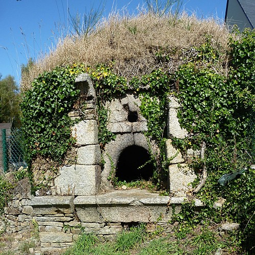
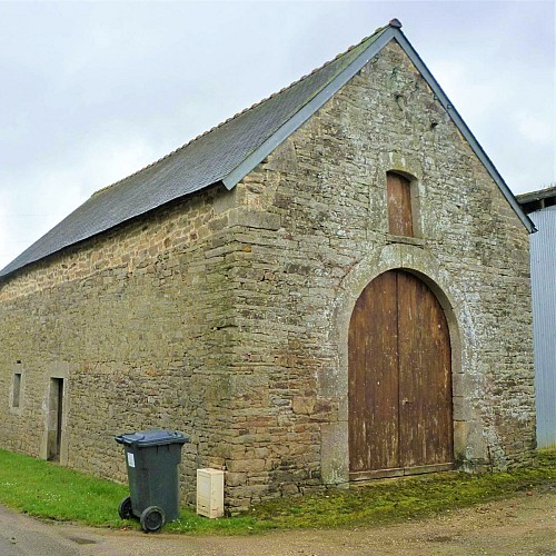
Kerihuel

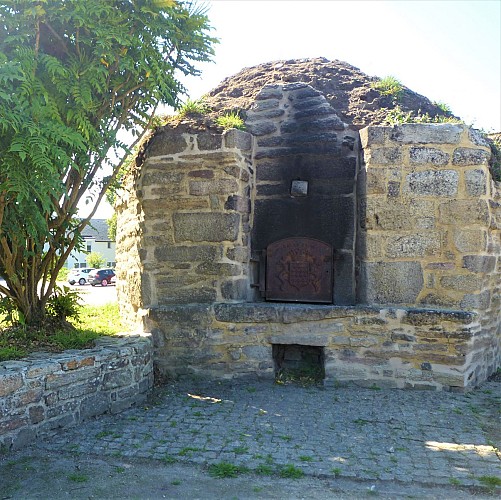
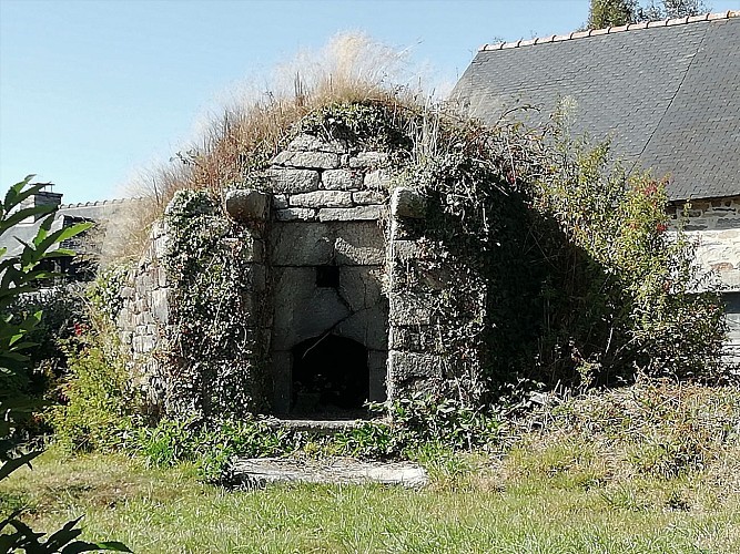
Recently built up, Kerihuel, the “upper village”, still has some old buildings, partly converted when rural buildings were updated in the 19th and 20th centuries. These houses, recognizable by their symmetrical and standardized rectangular windows, sometimes reuse older bays. They can be found on other houses: segmental arch door and segmental arch windows from the 16th and 17th centuries, from the second half of the 18th century. In 1843, this hamlet had fourteen buildings. Several longères, placed around courtyards, confirm the existence of six or seven farms. The bread oven, with its low-arched mouth, was already here too. Located at the heart of Kerihuel, this shared equipment was used by the whole village. Each family in turn had to provide a bundle of wood or heath and manage the fire, before they could bake their dough. Analysis of the Napoleonic land registries of the area reveals that this type of construction was very common in the 19th century. The largest villages sometimes had several. In 1843, Calan had 26 ovens, including the village oven, i.e. nearly one per hamlet. One of them, marked in yellow at Poulgourio, is in ruins, and demonstrates that bread ovens were already common in the 18th century. Another, at Kercrohennec, extended by a shelter, is of the barn oven type. Others were built after this date, like the one in the village of Kergarenne. Many of them became useless in the 20th century and were destroyed. There are ten left in Calan, including three in the town. Three of them are of the barn-oven type. It is essential to preserve these constructions showing the technical skills of past masons. Once the base of the “chapel” walls was built, an earthen mound was erected to guide the construction of the dome. The earth was then evacuated through the mouth of the oven. The floor was made of clay or paved with stones. Many were lined with firebrick at the end of the 19th century / start of the 20th century to increase their heating capacity.

5208 Kerihuel 56240 Calan
- Lorient Agglomération -
Consulter
image du object

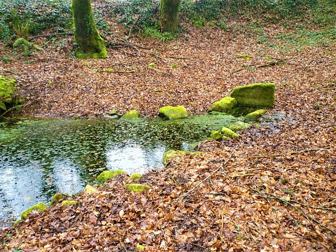
The fountain of Kerandiot 

Preserved in its original state, the modest fountain of Kerandiot shows how life developed around springs, vital to the domestic life of villages before the arrival of tap water in the 1960s. It is surrounded by ashlars laid on edge, one of which is bevelled, thus reused, and is extended by a widening basin also surrounded by stones. It was probably used as a washhouse, as the sloping stone near the spring suggests, but perhaps also as a watering place. This fountain appears on the Napoleonic land registry of Calan in 1843 which lists twelve springs. It is likely that there was at least one per hamlet. Only one at Kergueris is cited as a washhouse, a reminder that these rectangular basins were built mainly after 1851, following State aid granted for their construction. Located below the hamlets in the wetlands, difficult to access, springs also competed with wells built by dowser masons near the houses. Curiously, not one of them appears on the Calan land register in 1843. However, among the twelve still present, some are older, such as the one at Poulgourio bearing the date 1776 on its lintel. Although inventories carried out in neighbouring towns confirm that the construction of wells intensified after 1850, as did the construction of washhouses, the conditions of the land registry inventory, which varied in accuracy from one commune to another, and perhaps also the population's distrust of surveyors, may explain these gaps.

- Lorient Agglomération -
Consulter
image du object

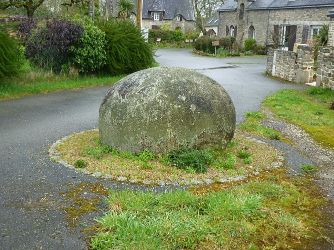
Le Lec'h de Kerandiot

This hemispherical stone cut in granite is a sign of the Gallic settlement in our region in the 5th and 4th centuries before our era. Called a lec'h, it was once part of a group of three funerary stones indicating the presence in this area of a burial ground associated with a nearby Iron Age village. Aerial surveys have revealed enclosures which were probably contemporary with these stelae at Kerbiron, Mane Duel and Cosqueric. Burnt bones were placed in urns or small chests in the ground. More than one thousand steles have been identified in the Morbihan, including two others in the town of Calan, which are now difficult to locate. They vary in shape. Sometimes tall and elongated, they are usually low, ovoid or hemispherical like this one, and sometimes decorated with cupules.  These incinerations disappeared at the end of the 4th century before our era and some steles were broken. Others were later Christianized, engraved with a cross or moved near a religious building. Many of them became wheel chasers at the corner of buildings, were used as property markers or were built into embankments. Rosensweig, in his archaeological inventory in 1859, describes the stones of Kerandiot: “three rounded lec'h, one that went into the construction of a wall; another overturned next to it; the third, remarkable for its size, 2 meters in diameter and 1.50 m high, at the foot of a very old oak tree.” He adds: “It is one of the extremely rare cases where we found these kinds of stones elsewhere than in the vicinity of a chapel.” In the 1980s, the archaeologist Daniel Tanguy reported the three stelae of Kerandiot, grouped on this small square on the site of an ancient chapel dedicated to St. Conneth. Was it Saint Connec, a former disciple of Saint Caradec, who gave his name to a town in the Côtes d'Armor department? It's hard to say. The remaining stele, 1.40 metres in diameter and 1 metre high, is decorated with two cupules on its top. One of them has been hollowed out.

661 Kerandiot 56240 Calan
- Lorient Agglomération -
Consulter
image du object

Mell beniget Kaelan

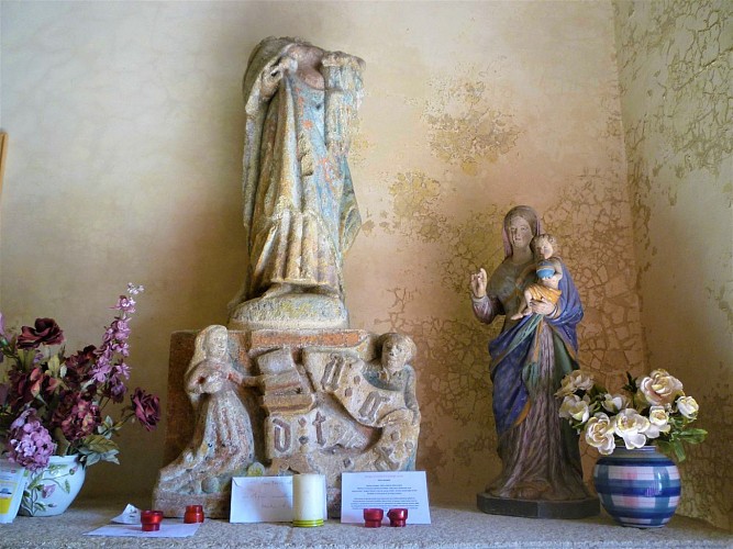
Now back at the starting point, linger a while to visit the Romanesque church. Inside, the furnishings have been enriched over the centuries: an altarpiece and its statuary, in particular a Holy Trinity, from the end of the 17th century; a baptismal font, high altar and censer from the 18th century; statues, banners, choir stalls and baptismal font enclosure from the 19th century The remains of a 15th-century Virgin and Child were found decapitated and buried in the cemetery. This practice was used in the past when people did not want to keep a statue. From the 16th century, a holy water font and two bas-reliefs of the Annunciation and the Crucifixion from an old granite altarpiece have been preserved. For a long time, the church of Calan housed a very special stone, which has mysteriously disappeared, although its presence was known after the 1939-1945 war. Roc'h Kaelan, stone of Calan, or Mell benniget Kaelan, which can be translated as blessed ball of Calan or blessed mallet of Calan. Although we don't really know what it looked like, similar objects are reported around Brittany in churches and chapels, especially in the Morbihan. The Locmeltro stone in Guern is an impressive example: a spherical granite ball 20 cm in diameter weighing no less than 3.5 kg. But what was it for? There are two opposing theories. For some, it could be a sacred stone, a sort of viaticum, that the dying person kissed or that was placed on the forehead as a rite of passage from life to death. For others, it could be a form of euthanasia tool used to put an end to the suffering of the dying, a rite found in many ancestral cultures around the world. In the popular memory, some speak of it jokingly, such as the testimony of this Calan woman born before 1939: “In Calan, whenever there was a long period with no deaths, we used to say: if this continues, we'll have to go and get the mell beniget from the church.” Others confirm its function to release the dying according to the sayings of the elders.

1 Place de l'Église 56240 Calan
- Lorient Agglomération -
Consulter

Ratings and reviews

To see around
See more
Open
Close
Show
Show
Show
Show
Show
Show
Show
Show
Show
Show
Show
Caution!
We have no information on the difficulty of this circuit. You may encounter some surprises along the way. Before you go, please feel free to inquire more and take all necessary precautions. Have a good trip! 🌳🥾