Tours
Activities
Places of interest
Where to eat
Where to sleep
Discover Clermont-Ferrand: Stay at IBIS STYLES CLERMONT FERRAND GARE
Are you the owner?Nestled in the heart of Clermont-Ferrand, the city offers a unique blend of natural beauty and rich history. Start your day with a visit to the magnificent Notre-Dame-de-l'Assomption Cathedral, entirely built from Volvic lava stone. For nature enthusiasts, the Puy de Dôme, a famous Auvergne volcano, offers stunning hikes and an unparalleled panoramic view of the Chaîne des Puys. For a cultural exp...See more
Walking around IBIS STYLES CLERMONT FERRAND GARE
See more suggestionsStroll through the walking routes of IBIS STYLES CLERMONT FERRAND GARE.
See more suggestions


What to do in IBIS STYLES CLERMONT FERRAND GARE
See more suggestionsBook your activities in IBIS STYLES CLERMONT FERRAND GARE now and get ready for adventure.
See more suggestions


")
IGN cards
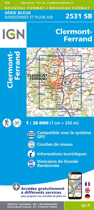
2531SB - CLERMONT-FERRAND
Editor : IGN
Collection : TOP 25 ET SÉRIE BLEUE
Scale : 1:25 000
13.90€

TOP75015 - CHAINE DES PUYS - MASSIF DU SANCY
Editor : IGN
Collection : TOP 75
Scale : 1:75 000
9.80€

148 CLERMONT FERRAND SALERS PNR DES VOLCANS D'AUVERGNE
Editor : IGN
Collection : TOP 100
Scale : 1:100 000
8.40€

D42-43 LOIRE HAUTE-LOIRE
Editor : IGN
Collection : CARTES DÉPARTEMENTALES IGN
Scale : 1:150 000
5.90€

D15-19 CANTAL CORREZE
Editor : IGN
Collection : CARTES DÉPARTEMENTALES IGN
Scale : 1:150 000
5.90€

D03-63 ALLIER PUY-DE-DÔME
Editor : IGN
Collection : CARTES DÉPARTEMENTALES IGN
Scale : 1:150 000
5.90€

EUROPE
Editor : IGN
Collection : DÉCOUVERTE DES PAYS DU MONDE IGN
Scale : 1:2 500 000
7.00€
What to visit in IBIS STYLES CLERMONT FERRAND GARE
See more suggestionsTake a boat tour around IBIS STYLES CLERMONT FERRAND GARE.
See more suggestions


Where to eat in IBIS STYLES CLERMONT FERRAND GARE
See more suggestionsCome and taste typical dishes of IBIS STYLES CLERMONT FERRAND GARE.
See more suggestions


Where to sleep in IBIS STYLES CLERMONT FERRAND GARE
See more suggestionsDiscover available accommodations around IBIS STYLES CLERMONT FERRAND GARE.
See more suggestions


