Alert
Alerts
Hike : From Clermont Cathedral to the summit of the Puy-de-Dôme
Description
An iconic route linking the historic centre of Clermont-Ferrand to the summit of the Puy de Dôme! A major walking route rising from the lava fields near the cathedral to the summit of the Auvergne volcanoes, ideal for sustainable transport.
A legendary long-distance walking route stretching from the heart of Clermont-Ferrand to the giant of the Dômes
Setting off from Place de la Victoire at the foot of the Volvic stone cathedral, this hike offers a true continental adventure: linking the city to the summit of the Puy de Dôme, the highest point of the Chaîne des Puys tectonic region (a UNESCO World Heritage Site). This route allows you to witness the gradual transformation of the landscapes, from urban alleyways to volcanic mountain pastures.
Highlights of the route:
• A car-free adventure: Accessible directly via Clermont-Ferrand’s public transport network, this route is perfect for fans of eco-friendly hiking.
• A spectacular finale: After crossing the plateau, the final ascent to the summit is rewarded with a breathtaking 360° view across the whole of Auvergne.
• Flexible return options: You can either take the rack railway (Panoramique des Dômes) back down to the Maison de Site to catch the shuttle buses to Clermont-Ferrand, or walk back.
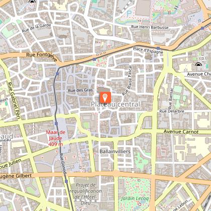
Starting point: Clermont Cathedral, Place de la Victoire, towards ‘Chamalières’ / Square de Verdun, Chamalières / spa district, Royat.
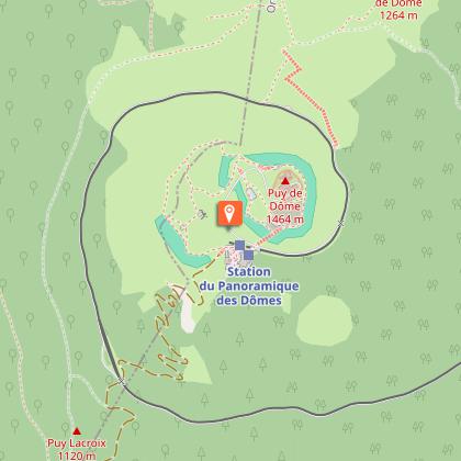
From the summit of the Puy-de-Dôme, take the rack railway (fee applies) back down to the Maison du Site, then return to the city centre on the P36 bus
Difficulty: The total elevation gain between Place de Jaude and the summit of the Puy-de-Dôme.
This route involves a significant elevation gain. A good level of fitness and suitable kit (hiking boots, warm/windproof clothing for the summit) are essential.
Technical Information
Altimetric profile
Starting point
Steps
Additional information
Updated by
Clermont Auvergne Volcans - 31/07/2026
www.clermontauvergnevolcans.com
Report a problem
Environments
Close to a public transportation
Bus stop < 500 m
Less than 10 minutes from a bus stop on foot
Tips
Access by streetcar (line A), "Gaillard" or "Jaude" stop
We recommend that you follow the tour using the Mikhes application, which guides you step by step for a simplified discovery. Download the application at the bottom of the page and start your tour.
Open period
All year round daily.
Contact
Phone : 04 73 98 34 00
Website : https://www.clermontmetropole.eu/en/bouger-se-divertir/a-la-decouverte-de-lagglo/itineraires-de-randonnees/21-idees-de-circuits-dans-lagglomeration-clermontoise/
Location complements
Bus T2C | Ballainvilliers stop: bus lines B, C, 8, 9, 10, 12, 13, 27. Place de Jaude stop: Tram A, bus lines B, C, 9, 10. Gaillard stop: Tram A, lines 5, 32.
Data author
