Alert
Alerts
Le chemin des Écoliers
Description
On this walk, you'll follow the impetuous little river La Tiretaine, which rises near La Font de l'Arbre, not far from the Puy de Dôme, and disappears into the underground world of Clermont-Ferrand.
Technical Information
Altimetric profile
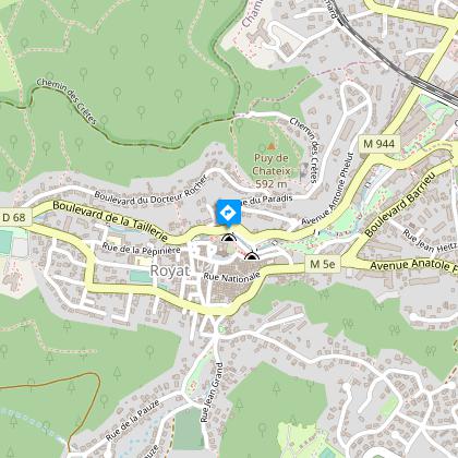
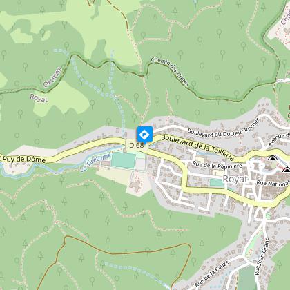
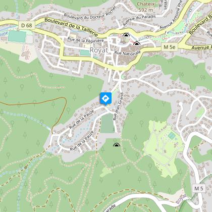
Starting point
Steps
Additional information
Sustainable tourism
Access by bus, line E5, Barreiras stop
Tips
- The Laveuses cave.
- Basalt organs.
- View of the Chaîne des Puys.
- The Ternant cross.
- View of the puy de Gravenoire.
- The fortified Romanesque church of Saint-Léger.
- Royat thermal baths.
- The spa park.
Updated by
Conseil départemental du Puy-de-Dôme - 02/06/2026
www.puydedome-tourisme.com/
Report a problem
Environments
In the country
Forest location
Close to a public transportation
Bus stop < 500 m
Presence of livestock and guard dogs
Less than 10 minutes from a bus stop on foot
Distinctions
Listed PDIPR
Open period
From 01/01 to 31/12 daily.
Subject to favorable weather.
Topo guides and map references
Topo guides references :
2013 - Randonnez-vous - Discovering the Puy-de-Dôme - Conseil départemental du Puy-de-Dôme
Contact
Phone : 04 73 29 74 70
Email : royat@clermontauvergnevolcans.com
Website : https://www.clermontauvergnevolcans.com/
Facebook : https://fr-fr.facebook.com/Clermont.Tourisme
Location complements
In Royat, go up rue Auguste Rouzaud to the Grotte des Laveuses parking lot (below the Saint-Léger church).
Mobilité Douce | Barreiras stop, line 5. Royat place Allard stop, line B, 550 m away.
Reception complements
For your own safety, always take a bottle of water, a hat, warm clothing and footwear suitable for walking.
Depending on weather conditions, certain itineraries are not recommended in bad weather (fog) or are not practicable, or even forbidden, during the winter season.
Some sites are fragile, so stay on the marked trails. Avoid picking wild flowers and disturbing wildlife. Pick up your garbage.
Animals are not allowed on some routes.
Guidebook with maps/step-by-step
1/ From the start sign in the parking lot, cross the footbridge, turn right (grotte des Laveuses and basalt organs) and climb the stairs. Go straight on and climb Boulevard de la Taillerie to the traffic circle.
2/ At the traffic circle, turn left into chemin du Breuil for 50 m, then right along the sports field. After 200 m, turn left onto a track leading up into the woods. Take a staircase on the left and follow the path, ignoring a footbridge on the right, to reach the road. Follow it to the entrance to the arboretum parking lot.
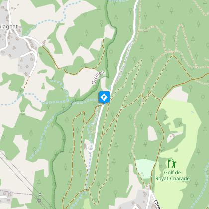
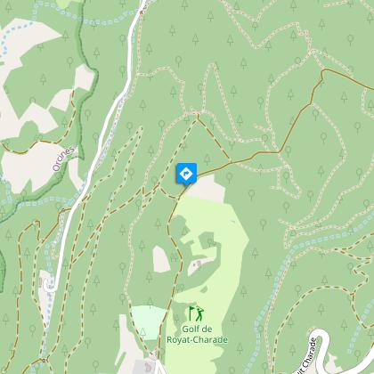
3/ Turn left on a good path that climbs into the woods and turns right after 50 m, then left 250 m further on. Go straight ahead at the crossroads. Stay on this main, winding track. Ignore the side roads until you reach a T-junction on the edge of the Charade golf course.
4/ Turn left, then right at the downhill junction to Rocher du Salut. From here (with views of the puy de Gravenoire, the Clermont-Ferrand conurbation, Limagne and Livradois-Forez), go straight downhill to a T-junction. Turn right onto Chemin de la Pauze and drive down to the first house in Royat. Turn left down the tarmac road through the housing estate to the chapel/war memorial.
5/ Go down the street to the left of the chapel. At the traffic circle, go straight ahead, then turn left into rue Jean Grand, which crosses boulevard Romeuf and continues, offset to the left, into rue Nationale. Go under the porch opposite and follow rue de l'Arcade. Reach Place de l'Eglise (Saint-Léger Romanesque fortified church), go around it to the right and down the stairs to the left to reach the start parking lot.
Proposed and managed by the Conseil départemental du Puy-de-Dôme - PDIPR.
Animals
Yes. All dogs must be kept on leashes because of the presence of herds.
Data author
