Tours
Activities
Places of interest
Where to eat
Where to sleep
Discover L'Insolite Camping in Brassac-les-Mines, Puy-de-Dôme
Are you the owner?Welcome to L'Insolite Camping, in the heart of Auvergne! From Brassac-les-Mines, Puy-de-Dôme, enjoy a variety of activities and local attractions that will make your stay unforgettable. Explore the majestic Chaîne des Puys, a UNESCO World Heritage site, where picturesque hikes offer breathtaking views. Be sure to visit the Château des Martinanches, a medieval gem, for a dive into the region's hist...See more
Walking around L'INSOLITE CAMPING
See more suggestionsStroll through the walking routes of L'INSOLITE CAMPING.
See more suggestions


What to do in L'INSOLITE CAMPING
See more suggestionsExplore L'INSOLITE CAMPING through its many bookable activities.
See more suggestions")


IGN cards
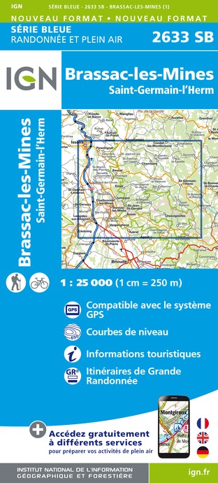
2633SB - BRASSAC-LES-MINES SAINT-GERMAIN-L'HERM
Editor : IGN
Collection : TOP 25 ET SÉRIE BLEUE
Scale : 1:25 000
13.90€

TOP100D43 - HAUTE-LOIRE LE PUY-EN-VELAY BRIOUDE GORGES DE L'ALLIER
Editor : IGN
Collection : TOP 100
Scale : 1:100 000
8.40€

148 CLERMONT FERRAND SALERS PNR DES VOLCANS D'AUVERGNE
Editor : IGN
Collection : TOP 100
Scale : 1:100 000
8.40€

D42-43 LOIRE HAUTE-LOIRE
Editor : IGN
Collection : CARTES DÉPARTEMENTALES IGN
Scale : 1:150 000
5.90€

D03-63 ALLIER PUY-DE-DÔME
Editor : IGN
Collection : CARTES DÉPARTEMENTALES IGN
Scale : 1:150 000
5.90€

D15-19 CANTAL CORREZE
Editor : IGN
Collection : CARTES DÉPARTEMENTALES IGN
Scale : 1:150 000
5.90€

EUROPE
Editor : IGN
Collection : DÉCOUVERTE DES PAYS DU MONDE IGN
Scale : 1:2 500 000
7.00€
What to visit in L'INSOLITE CAMPING
See more suggestionsExplore the cultural heritage of L'INSOLITE CAMPING.
See more suggestions


")


Where to eat in L'INSOLITE CAMPING
See more suggestionsFood enthusiasts will love L'INSOLITE CAMPING's restaurants.
See more suggestions


Where to sleep in L'INSOLITE CAMPING
See more suggestionsFind an ideal lodging in L'INSOLITE CAMPING.
See more suggestions


