Alert
Alerts
Saint-Jean-Saint-Gervais
Description
A hike in the land of basalt columns on a wooded and varied course accessible to all. A bewitching and impressive stroll towards the cliffs of the Oulette valley (shepherd's crook) or in front of the waves of the Salient waterfall (nearby).
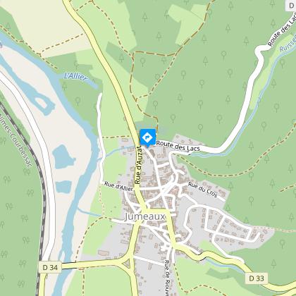
Starting point - In front of the church go to the right then to the left by the rue d'Esteil, 80 m further on follow the rue de Cros on the right, then go up by the chemin des Montes. In front of the allotment turn left (view of the village of Jumeaux and the hillock of Nonette). Allow the roads to the right and at the end of the allotment go up to the left. Ignore the first path on the right and go up to the kennel. Continue the ascent without taking into account the paths on either side until the crossroads under the high voltage line.
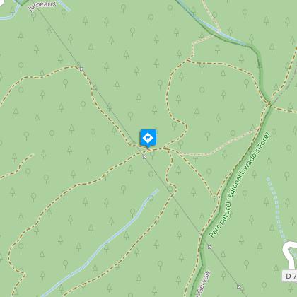
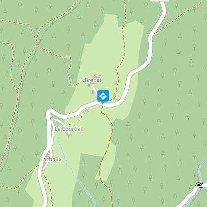
1 - Continue straight ahead and take the first track on the left. Leave the path on the right and go down to the T-junction, continue to the left on a wide path. At the crossroads go straight ahead, ignoring the paths to the left and right until you reach the intersection (stele). Go down to the right until you reach the hamlet of Brenat. Go down to the right until you reach the road.
2 - Continue opposite on the unpaved road (on the right refuge for birds of prey) continue in the undergrowth until you reach the road. Go to the right and immediately to the left below the road. At the D132, continue to the right until the crossroads.
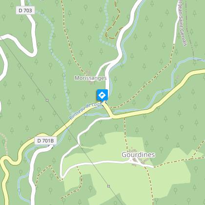
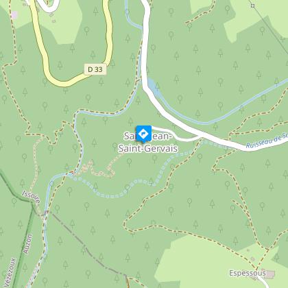
3 - Turn left, cross the 2 bridges "Moulin de Gourdine" and turn right. Go up to the hairpin bend and down the path to the right until you reach the road. Continue on the left until you reach the pond and after that go up on the left by the road. At the crossroads, continue to the right until Saint-Jean-Saint-Gervais (church and town hall).
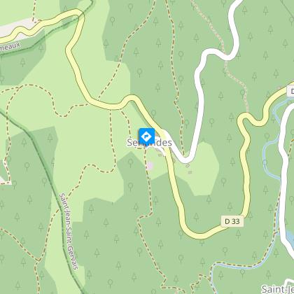
4 - After going around the church go down the path (large cross). Continue the descent to the "Moulin de Saint-Jean" (respect private property). Go right, cross the stream on the footbridge. Turn right for 200 m and then go up the road to the left and after 50 m, turn left again (Roman road). Further up the hill, ignore the path on the left and continue until you reach the entrance of Serlandes.
5 - Turn left up to the road. Go left, then leave the road at the second road on the left (viewpoint on Jumeaux, the Puys chain, the puy de Dôme). At the fork turn right (beware 2 paths with green markings cross) go down to the village of Jumeaux. Turn right and continue straight ahead. Leave rue du Ruisseau on the left, continue rue des Aubettes, rue de la Liberté and then rue de l'Eglise to reach the starting point.
Technical Information
Altimetric profile
Starting point
Steps
Additional information
Tips
- View of the village of Jumeaux, the Butte de Nonette, the Chaîne des Puys and the Puy de Dôme.
- LPO refuge for birds of prey.
Updated by
Conseil départemental du Puy-de-Dôme - 02/06/2026
www.puydedome-tourisme.com/
Report a problem
Environments
In the country
Forest location
Presence of livestock and guard dogs
Distinctions
Listed PDIPR
Open period
From 01/01 to 31/12 daily.
Subject to favorable weather.
Location complements
A75, exit n°17 towards Jumeaux on the D214. Cross the "saut du loup" bridge at Auzat-sur-Allier. Follow the D34 towards Jumeaux.
Contact
Phone : 04 73 89 15 90
Email : tourisme@capissoire.fr
Website : http://www.issoire-tourisme.com
Reception complements
For your own safety, always take a bottle of water, a hat, warm clothing and footwear suitable for walking.
Depending on weather conditions, certain itineraries are not recommended in bad weather (fog) or are not practicable, or even forbidden, during the winter season.
Some sites are fragile, so stay on the marked trails. Avoid picking wild flowers and disturbing wildlife. Pick up your garbage.
Animals are not allowed on some routes.
Guidebook with maps/step-by-step
1/ In front of the church, turn right, then left on rue d'Esteil. After 80 m, turn right on rue de Cros, then uphill on chemin des Montes. In front of the housing estate, turn left (view of the village of Jumeaux and the Butte de Nonette). Leave the tracks on your right and turn left at the end of the housing estate. Ignore the first track on the right and climb up to the kennel. Continue uphill, ignoring the paths on either side, until you reach the crossroads under the high-voltage power line.
2/ Go straight on and take the first track on the left. Leave the right-hand track and descend to the T-junction, continuing left on a wide track. At the crossroads, go straight on, ignoring the left and right paths, until you reach the intersection (stele). Go right down to the hamlet of Brenat. Go right down to the road.
3/ Go straight ahead on the unsurfaced track (on the right is a refuge for birds of prey) through undergrowth to the road. Turn right, then immediately left below the road. At the D132, turn right as far as the crossroads.
4/ Turn left, cross the 2 "Moulin de Gourdine" bridges and turn right. Climb up to the hairpin bend and take the right-hand path down to the road. Continue left to the pond, then left again along the road. At the crossroads, turn right to Saint-Jean-Saint-Gervais (church and town hall).
5/ Go around the church and down the path (large cross). Continue downhill to the "Moulin de Saint-Jean" (respect private property). Turn right, cross the stream on the footbridge. Turn right for 200 m, then left up the path and left again after 50 m (Roman road). Further up the hill, ignore the left-hand track and continue to the entrance to Serlandes.
6/ Go left up to the road. Go left, then leave the road at the second turning on the left (view of Jumeaux, the Puys chain, the Puy de Dôme). At the fork in the road, turn right (2 green paths intersect) and descend to the village of Jumeaux. Turn right and continue straight ahead. Leave rue du Ruisseau on your left, continue along rue des Aubettes, rue de la Liberté and rue de l'Eglise to reach the starting point.
Proposed and managed by the Conseil départemental du Puy-de-Dôme - PDIPR.
Animals
Yes. Dogs must be kept on a leash due to the presence of herds.
Data author
