Alert
Alerts
The hills of Lempdes
Description
Lempdes-sur-Allagnon is interesting for its listed hall dating from 1835, crowned with a framework valued as an architectural masterpiece. We cross puys, volcanic plateaus… Many views over the Livradois, the peaks of Nonette and Usson.
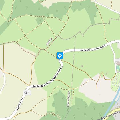
Starting point - From the starting sign, cross the bridge over the Béal, cross the public garden on the left, climb the stairs and take the footbridge over the Allagnon. Pass between the tennis court and the village hall; at the road, turn left and follow the campsite. At the three successive forks, turn right to join the D654.
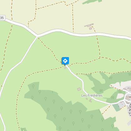
1 - Take the track opposite; at the fork, stay to the left and to the next one. Before the road, turn right towards the water tower. At the intersection, turn right on the upward track that goes around puy Ferrat. At the top of the hill, continue to the right (view of the Montcelet tower). Go straight ahead in Scoularoux then, in the bread oven, go to the right. Ignore the path on the left and continue (view of the Nonette hill, the Livradois mountains) until you reach the reservoir.
2 - Take the right track and continue straight ahead until you reach Moriat. At the stone cross, go along the castle wall to the left. After a fountain, stay to the right (entrance of the castle); at the next crossroads (another fountain), take the rue de la Vizade opposite. At the end of the village (cross), continue straight ahead until you reach a curve on the left. Cross the stream, continue opposite until you reach the D654.
3 - Continue opposite by the rue Filiol which goes to the campsite, turn left to find the path taken on the way there; after the footbridge, turn right. Follow the path that runs along the wall, cross the bridge near the washhouse. Turn immediately to the left on the path along the Béal to reach the starting point (at 100 m in the town centre, church and listed hall).
Technical Information
Altimetric profile
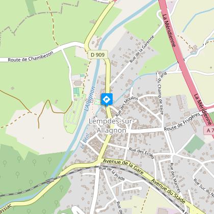
Starting point
Steps

Additional information
Tips
- View of the Montcelet tower, the Butte de Nonette and the Livradois mountains.
- The Allagnon river.
- Heritage features: bread oven, stone cross, fountain and washhouse.
Updated by
Conseil départemental du Puy-de-Dôme - 02/06/2026
www.puydedome-tourisme.com/
Report a problem
Environments
In the country
Presence of livestock and guard dogs
Distinctions
Listed PDIPR
Open period
From 01/01 to 31/12 daily.
Subject to favorable weather.
Location complements
From the A75, exit 19 to Lempdes-sur-Allagnon (Haute-Loire). Park at Place du Bosquet, by the roadside, 200 m after the entrance sign.
Contact
Phone : 04 73 89 15 90
Email : tourisme@capissoire.fr
Website : http://www.issoire-tourisme.com
Reception complements
For your own safety, always take a bottle of water, a hat, warm clothing and footwear suitable for walking.
Depending on weather conditions, certain itineraries are not recommended in bad weather (fog) or are not practicable, or even forbidden, during the winter season.
Some sites are fragile, so stay on the marked trails. Avoid picking wild flowers and disturbing wildlife. Pick up your garbage.
Animals are not allowed on some routes.
Guidebook with maps/step-by-step
1/ From the start sign, cross the bridge over the Béal, turn left through the public gardens, climb the stairs and take the footbridge over the Allagnon. Pass between the tennis court and the village hall; at the road, fork left and walk alongside the campsite. At the third fork in the road, turn right onto the D654.
2/ Take the track opposite; at the fork, keep left and at the next fork, keep left. Before the road, turn right towards the water tower. At the crossroads, turn right onto the uphill path around Puy Ferrat. At the top of the hill, keep right (view of Montcelet tower). Go straight through Scoularoux, then right at the bread oven. Ignore the left-hand path and continue (view of the Butte de Nonette, the Livradois mountains) to the reservoir.
3/ Take the right-hand track and go straight on to Moriat. At the stone cross, turn left along the castle wall. After a fountain, keep right (castle entrance); at the next crossroads (another fountain), take rue de la Vizade opposite. At the village exit (cross), continue straight ahead until you come to a bend to the left. Cross the river and continue straight ahead until you reach the D654.
4/ Go straight ahead on Rue Filiol, which leads to the campsite. Turn left to find the path you took on the outward journey; after the footbridge, turn right. Follow the path along the wall, crossing the bridge near the wash-house. Immediately turn left on the path along the Béal to reach the starting point (at
100 m in the town center, listed church and market hall).
Proposed and managed by the Conseil départemental du Puy-de-Dôme - PDIPR.
Animals
Yes. Dogs must be kept on a leash due to the presence of herds.
Data author
