Tours
Activities
Places of interest
Where to eat
Where to sleep

Uncover the charm of Vodable, Puy-de-Dôme, Auvergne

Are you in charge of the destination?
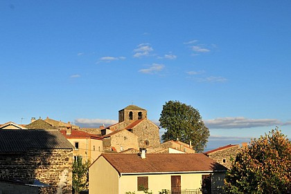
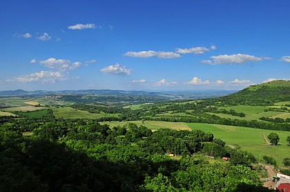
Nestled in the picturesque setting of Auvergne, Vodable, Puy-de-Dôme, is a captivating destination for lovers of nature and history. This charming village offers a plethora of activities that will delight visitors. Begin your discovery by strolling through the authentic streets of Vodable, where the medieval heritage reveals itself at every turn.

Continue your exploration with the hiking trails...
See more

Walking around Vodable

See more suggestions
Hiking trails in the Vodable area.
See more suggestions
The lime and the wood of Jaby
2.6 km

The lime and the wood of Jaby

A remarkable hike for the built heritage of Mareugheol with one of the most beautiful villages in Auvergne and for the variety of landscapes and environments such as lime, streams and couzes. Nice views. Starting point - Go down rue du Fort. Walk along the surrounding wall, cross the square between fountain and washhouse (fort, fountain and washhouse). Go left between two stone walls, go up to the second crossroads; go left to a stone cross. 1 - Continue straight ahead (view on the plateau de la chaux du Broc) ignoring the adjacent paths. At the entrance to the village of Villeneuve, at the cross, turn left to the church (Villeneuve-Lembron castle and square tower). 2 - Turn right. Continue along the Mousteloux path until you reach a fork. Go to the right (another PR opposite), go up in the woods the path between low walls to the plateau (Villeneuve lime). Turn left on the path. After the fence, stay on the main road until you reach an intersection with a wide road at the wireless relay. 3 - Turn right (viewpoint). Progress between grazing and hardwood coppice. Pass in front of the water tank before going down to a road. Cross it and go down chemin du Moulin to an intersection before a building (old mill). 4 - Turn right above it, follow the stream for 500 m, go up to the right the small path leading to the village of Pouzeix. Cross it (bread oven, vat room for laundry, shoeing machine). Cross the road, pass under the power line, continue for about 700 m until you reach the intersection with a small undergrowth path. 5 - Go down to the right the chaotic path between low stone walls. In the descent, on the left: shepherd's hut. At the fork, go left. When you see the village below, go straight ahead and get off at Mareugheol to return to the start.

3 h
11 km
Easy
Parking du Fort 63340 Mareugheol
Show
Vodable and Colamine
2.6 km

Vodable and Colamine

A hike through the Lembron valley, south of Issoire. Starting point - From the starting sign located on a bus shelter, go down rue du Fort. Turn right, go between the fountain and the washhouse (Fort Villageois, church). At the end of the square, go up on the left the rue des Jardins then the rue du Teurail. At the T-junction, turn left and continue straight ahead until the first junction after leaving the village (stone cross, view of the plain and the villages of Le Lembron). 1 - Go down to the left. Cross the road and continue opposite for 150 m. Turn right along a wet ditch and continue to a footbridge crossing the Lembronnet. Immediately turn left onto the path along the stream. In Antoingt, turn left until you reach the place de la Fontaine. 2 - Turn right and go around the church by the Place du Foussat (octagonal bell tower, information panels, work to be done). At Place de l'Église, go down to the right. At the end of the Place du Square, go up Rue de la Pougère. At the crow's feet, continue straight ahead along the Chemin du Chamaret. At the first crossroads (iron cross), continue in front. At the fork, go up the path to the right, until you reach Vodable. At the Cross of Nazareth (cross, washhouse, fountain), turn left. At 150 m, cross the Chemin des Remparts and climb the narrow rue de l'Église (Christ of the 15th century). Cross the Place du Marchidial (fountain). Cross the door (Porte Neuve) and go up rue du Rocher to the left until you reach a flat spot. 3 - Go up to the right by the path of Panassat (view on the chain of Puys, the church of Ronzières, the plateaus of Gergovie, Corent, Pierre-sur-Haute). Ignore the paths on the right to an old oven. Go down to the right and then immediately to the left on a grassy path, for 30 m. Turn left again. In front of the entrance of the castle, turn right into the rue des Dauphins d'Auvergne and then go down the rue de la Liberté. In the bread oven, continue the descent via rue Gaultier de Biauzat. Cross the D124 to reach the church directly (Romanesque church of Colamine 11th century). Cross the cemetery and join a small road. Take it to the right. At a crossroads (iron cross), continue on the road to the left. Turn left after an agricultural shed to go down a wide path to a crossroads (view of Vodable, Solignat, Livradois, Forez). 4 - Go down to the left until you reach a washing-drinking trough. Turn right to cross Longchamp until you reach Place du Coudart (fountain and washhouse). Turn left on Chemin du Bourly. Reach Mareugheol directly by road (view of the plain and the villages of Le Lembron, Le Forez, Le Livradois).

3 h
11 km
Easy
Parking en face du Fort Villageois 63340 Mareugheol
Show
Dauzat-sur-Vodable
3.4 km

Dauzat-sur-Vodable

From Ternant-les-Eaux, the path leads to the chapel of Dauzat-sur-Vodable perched on a volcanic peak. The descent into the forest leads to several ferruginous springs. Starting point - From the starting sign (Romanesque church, bread oven, old well, old washhouse, water trough) go up the steep street behind the church chevet. At the last house turn right on the asphalt road until you reach a first road on the left. Take it to the road. 1 - Go up the road for 10 m, turn right and climb a stony path. At the top follow the asphalt road on the right and then the first asphalt road on the left until you reach the road. Take this one on the right then a wide track on the left up to a crossroads. Turn right to reach a crossroads (view of the hillock of Vodable and the Puy d'Ysson). 2 - Go down to the right, ignoring the right and left paths to the bottom of the valley. Continue straight ahead until you reach the crossing on the plateau (360° viewpoint: view of the Sancy massif, the Puys chain, the Allier plain, the Livradois-Forez mountains). 3 - Turn left. Continue until you reach the T-junction in front of a dry-stone hut. Turn right and then left 150 m further on. At the crossing, continue straight ahead towards Dauzat-sur-Vodable (view of the priory and the site of the old castle) until you reach the war memorial. 4 - Cross the road, go down to the left on the asphalt road then grassy. Continue in the undergrowth. Leave a path on the left. At the next crossroads, continue straight on the main road on the ridge until you reach a footbridge crossing Rivaux Creek. 5 - Take it, then cross a step ladder. Cross the meadow and take the path in the valley along the stream (ferruginous source). In a curve, leave a path to the right. Join the D148 which brings you back to the starting point.

3 h
12 km
Easy
Eglise - Le Bourg 63340 Ternant-les-Eaux
Show
Villeneuve, Boudes, Chalus
4.5 km

Villeneuve, Boudes, Chalus

This route takes you back in time of three villages marked by the power of the former local lords, the Chalus and Aureilles (castles, village fort, keep, churches and castle chapels, statue of Saint-Verny). Starting point - From the starting point (15th century church and Renaissance castle), walk along the church, go up on the left and continue along the Chemin de Mousteloux. After the second stone cross, continue straight up (leaving another PR on the right) to reach the pass (641 m) ignoring the side roads. Go down to Boudes, between woods and meadows, until you reach the first vineyards (view of Boudes, its ochre lands, the Dauphiné d'Auvergne). 1 - Go to the left above the vineyards, on the hillside, then go down the first path to Boudes. Take the D48 on the left for 10 m, then turn right into a small passage leading to the Place de la Mairie. Go along it, pass in front of the weighbridge and continue on rue du Coufin then on the D48. After 250 m, at the level of a hangar, go up a wide dirt road on the left until you reach a crossroads in view of the Château de Chalus (view of Nonette, Saint-Germain-Lembron, le Livradois). 2 - Go up on the left to reach Chalus. Cross the D125 and, on Place de la Fontaine, head towards the castle (castle and Sainte-Foy church). Go around it on the right, rue du Rabichou, then continue on the left by a path. At the cemetery (view of Vodable, Solignat, Villeneuve, Le Lembron), continue down. Turn left, then right onto a small road (Chapelle Sainte-Madeleine). At the intersection, turn left onto a wide track at the bottom of the hillsides, until the second crossing. 3 - Go up on the left then, after about 70 m, turn right. At the crossroads of five paths, continue to climb up the widest. At the intersection, turn right between the stone wall and a trough catchment to reach the starting point.

3 h
9 km
Easy
Devant le château 63340 Villeneuve
Show
The five villages
4.9 km

The five villages

A loop where you can stroll through the 5 villages and where each of them keeps a precious testimony of the past (churches, oppidum, castle...). The path passes from valley to valley and reveals the Dauphiné d'Auvergne and the mountains that border it. Starting point - From the starting sign, at the back of the castle take the Tourzel road on the right. After the stream follow the alley to Meilhaud's first house. Turn left for 10 m and follow the wall to the right. Continue along rue du Pré Clos. At the tipping point turn left until you reach the fountain. 1 - Turn right into rue des Remparts, then rue d'Antaillat. At the end of the village go straight ahead and climb the Way of the Cross. On the plateau take the grassy path to the left. At the intersection, continue to the right (panorama on the puy d'Ysson, the Sancy massif, the puy de Lavelle, the villages of Chidrac, Saint-Cirques-sur-Couze and Meilhaud). Go beyond the large dry stone walls and continue until you reach the wide stone path. 2 - Turn right on it. At the road go down the wide path to the left (view of the Livradois-Forez mountains and the hillock of Vodable). Cross the Gripet stream and climb to Ronzières. At the intersection, under the farm, turn left and at the sewage treatment plant go up to the right towards the village centre. Continue along rue du Coudrat to the church (Romanesque church) and its enclosure (orientation table). 3 - Exit through the porch, go around the small tower and the church (oppidum) on the right. Go down the path to the left along the fence. At the crossroads in the woods turn right. At the exit of the wood turn left. In view of the Gripet stream, turn left and cross the bridge. Go up to the village of Tourzel. At the fork take the stairs to the left and turn right immediately. Cross the village by the rue du Dauphiné d'Auvergne to a fork at the exit. 4 - Turn left, continue straight ahead, leaving a path on the right. At the T-junction, take the wide road on the right, and continue down to Saint-Vincent. On the asphalt road take opposite rue de la Cure. At the crossroads, turn right into rue des Fontaines and then rue du Mas. At the exit of Saint-Vincent continue on the main road. At a fire hydrant go left, rue de la Tour Madame to enter Saint-Cirgues-sur-Couze and join the castle (Château de l'Anglade, 18th century).

4 h
14 km
Medium
Devant le château Saint-Cirgues-sur-Couze 63320 Les Deux Rives
Show
The Puy of Lavelle
4.9 km

The Puy of Lavelle

From Saint-Vincent you can walk along the rather arid hills characteristic of the south of the Puy-de-Dôme. We climb to the top of the puy of Lavelle with a beautiful view of Issoire, the Lembron and the Sancy massif. A hike appreciated for its panoramic views. Starting point - Follow the street towards the D26, then take the first street on the right. Walk along the cemetery, then the stadium. Turn left to take a street parallel to the D26 for 100 m. To cross it. Follow the D629 in front for 100 m then turn right onto a paved road. Continue the ascent until the first intersection and then turn left. Ignore two paths on the left. Continue until you reach the D629. Take it to the right until you reach Lavelle. 1 - Turn left on rue de La Ribe. Pass in front of the church to take the rue de La Chapelle on the left. Continue on rue du Suquet. At the end of the village, on the right, basalt organs. At the next two intersections, take the right lane. After two wooden benches, go up to the right to follow a track climbing in the moor between junipers. Follow the track on the right (view of Clémensat, the church of Saint-Floret and the Monts Dore) around the rocky summit, bordering a cliff (view of Lavelle and Saint-Vincent). Continue the climb up to a wide path. Turn right and go down to a crossroads. 2 - Go to the left. At the fork, turn right until you reach the entrance to Clémensat. 3 - At the T-junction, turn left. At the next one, go down to the right. At the next crossing, continue the descent to the left (view of the puy de Lavelle). Turn right on a small path that goes down quickly into a ravine and joins the D26 at Saint-Floret (stone cross). Cross the road, turn right to a footbridge. 4 - Cross it, turn left to follow the Couze Pavin, cross the D28, pass over a lock, continue along a path and then a path and reach the starting point at Saint-Vincent.

3 h
11 km
Easy
Parking en face de la Mairie 63320 Saint-Vincent
Show
Clémensat
5.8 km

Clémensat

From the medieval village of Saint-Floret, you can cross the Pède bridge to discover orchards, meadows and old terraced vineyards. Beautiful views over the village and the gorges of the couze Pavin. Starting point - From the sign in Saint-Floret, on the Hôtel des Voyageurs car park, place du Marronnier, crossroads between the D26 and the D627, follow the Couze upstream, along the D26, towards Saurier for 200 m. 1 - Just before the speed bump, take the Chemin de la Rochette on the right, which climbs through the gardens to the top of the hill. 2 - 20 m after the power line, take the wide track on the left and go down in front of the houses. At the first crossing, turn left and follow the EDF line (during the ascent, point of view on the village and the church of Chastel). Ignore the first crossing by staying on the left then, when you reach the crow's feet, continue on the right the path that goes up on the plateau. Cross the car park under the power line and take the road in front of it. 3 - Take the road on the right towards the village of Clémensat. Cross the village to the fountain and continue on the road to Saint-Floret. At the end of the village, opposite the campsite, turn left for 20 m and then right (on the climb, view on the terraces: pailhats) and continue until you reach a path on the right (view on the church of Chastel located on the other side of the valley). 4 - Leave the path to follow this path which goes down perpendicularly to the right, then 300 m further on take a left on 400 m. Turn right on the small steep path that goes down in front of the village. At the cross, take the road on the right and cross the village to return to the starting point.

2 h
6 km
Very easy
Parking - Hôtel des voyageurs - Place du Marronnier 63320 Saint-Floret
Show
La Chaubasse
5.8 km

La Chaubasse

This plateau of summer pastures offers panoramic views of the points of the Massif Central. Its natural spaces conceal many treasures: peat bogs, lakes and waterfalls.... Starting point - From the Place du Marronnier, cross the Couze on the old bridge, (16th century Pède bridge, oratory housing a polychrome wooden virgin with a child), follow the D627 towards the church of Chastel, until the sign indicating the exit of Saint-Floret. Turn left at the cross. Go up to the road, follow it on the right, and then turn right again for 50 m. 1 - Turn left onto a wide track. At the fork, go up on the left, in the middle of the orchards. Take the road on the right, then the first track on the left. Follow it straight on, until you reach a new fork at the entrance to the village of Orphange. 2 - Leave the three drinking troughs on the left, cross the village. At the exit, continue straight on the road (view on Sancy and the peak of Brionnet). In the village of Le Montel, turn left. After the last houses, climb between hedges to a wide path. Take it to the right for 50 m (viewpoint), then turn left on the first path up to the Chaubasse plateau (at the top, very wide panorama). Always go down the same path (leave the transversal paths) to the hamlet of Chazeras. 3 - Turn left, pass in front of the water trough and the washhouse. Continue straight ahead on the hillside. At the fork, follow the right track, until you reach a T-junction. 4 - Go down to the right (view of the Couze valley and its various villages, as far as Issoire), pass under the high voltage line and take the first path on the left until you reach the road you cross. 5 - Possible return to the Chastel site (chapel, ossuary, necropolis). Go down to Saint-Floret by the grassy path, to the right of the hill (Way of the Cross and halfway down the hill, stone cross engraved with a heart, view over the village and the castle). At the road, turn right, cross the Couze on the footbridge, and follow the road on the left to reach the starting point.

3 h
11 km
Easy
Traverser la Couze sur le vieux pont - Place du Marronnier 63320 Saint-Floret
Show

What to do in Vodable

See more suggestions
Explore the bookable activity options in Vodable for all tastes and ages.
See more suggestions
Lemptégy Volcano
38 km

Lemptégy Volcano

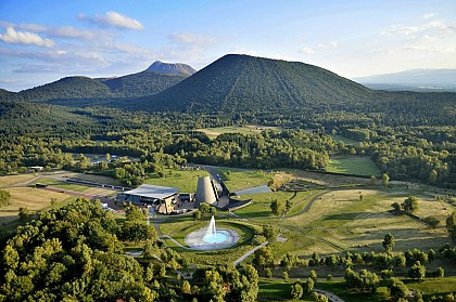
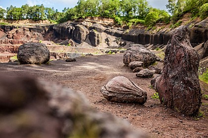
Explore the heart of a real volcano... Located at the center of the tectonic "Chaîne des Puys - Faille de Limagne" UNESCO World Heritage Site, we offer you the unique and unusual opportunity to discover the inside of a 100% natural volcano. Discover the secrets of volcanology with a 2h30 interactive tour of the Lemptégy volcano, comprising 5 stages: - The "volcano and men" tour: this fun, interactive introduction to the visit will familiarize you with the volcano and give you a better understanding of its metamorphosis. A 30-minute self-guided tour. - Guided exploration of the volcano's anatomy: meet your guide on foot or by train. He'll share all his geological and volcanological knowledge with you: bombs, volcanic chimneys, lava flows... and you'll leave with scoria (solidified lava). A wealth of information to help you better understand the landscape around you. - L'âme de Lemptégy": an unusual journey into the site's industrial past, with a visit to the old pozzolan extraction machines once used by quarrymen. - The immersive "Volcano 'Express" attraction: this sensory and emotional experience reveals all the secrets behind the formation of the Chaîne des Puys and the Faille de Limagne. What if the fault were to reopen... Will you reach your destination? - The dynamic 4D film "Aux Origines": enjoy an unprecedented flight over the volcanoes of Auvergne and relive the history of the volcano as if you were there, from its eruptions to the present day. While you're there, treat yourself to a gourmet break at the Volcan de Lemptégy restaurant. The chef offers traditional regional dishes (sausage/aligot, truffade, petit salé...). You can also stroll through the new boutique and discover a wide range of regional products, souvenirs, books... LE REVEIL DU VOLCAN" NIGHT TOUR: a breathtaking nocturnal experience! Entering at night, you'll be propelled into the heart of the Lemptégy Volcano for an extraordinary experience. Along the way, you'll plunge into an erupting volcano and discover magical creatures. A new world to discover and a new way to experience Volcan de Lemptégy. 1.5 km on foot. Prices and schedule: see website. IN JULY AND AUGUST

31 route des Puys Les Maisons Rouges 63230 Saint-Ours
Book from 0 €Book
Show

What to visit in Vodable

See more suggestions
Engage in outdoor activities in Vodable.
See more suggestions
Where to eat in Vodable

See more suggestions
Explore the culinary traditions of Vodable.
See more suggestions

Where to sleep in Vodable

See more suggestions
Enjoy your stay with accommodations in Vodable.
See more suggestions
Caution!
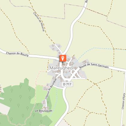
We have no information on the difficulty of this circuit. You may encounter some surprises along the way. Before you go, please feel free to inquire more and take all necessary precautions. Have a good trip! 🌳🥾