Tours
Activities
Places of interest
Where to eat
Where to sleep
Explore Vulvoz, a hidden gem in Jura, Franche-Comté
Are you in charge of the destination?Located in the heart of Franche-Comté, Vulvoz in Jura is a perfect destination for nature and history enthusiasts. Surrounded by lush, rolling landscapes, this charming town offers a multitude of activities for all ages and interests. Begin your journey with a hike along the picturesque trails around the town, where you will find breathtaking panoramas and diverse flora. Mountain biking enthusiast...See more


What to do in Vulvoz
See more suggestionsPlan your leisure time in Vulvoz by booking activities that suit your preferences.
See more suggestions


IGN cards
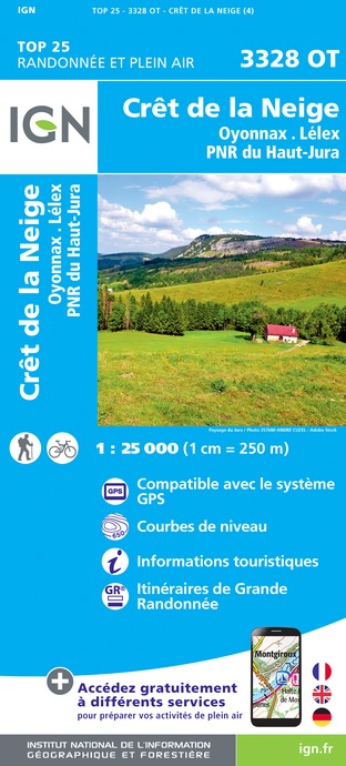
3328OT - CRÊT DE LA NEIGE OYONNAX LÉLEX PNR DU HAUT-JURA
Editor : IGN
Collection : TOP 25 ET SÉRIE BLEUE
Scale : 1:25 000
13.90€

TOP75012 - HAUT-JURA
Editor : IGN
Collection : TOP 75
Scale : 1:75 000
9.80€

TOP100D01 - AIN BOURG-EN-BRESSE AMBÉRIEU-EN-BUGEY PAYS DE GEX
Editor : IGN
Collection : TOP 100
Scale : 1:100 000
8.40€

TOP100D39 - JURA PAYS DE DOLE ET VAL D'AMOUR CHAMPAGNOLE LES ROUSSES PNR DU HAUT-JURA
Editor : IGN
Collection : TOP 100
Scale : 1:100 000
8.40€

TOP100D74 - HAUTE-SAVOIE ANNECY THONON-LES-BAINS MASSIF DU MONT BLANC CHAÎNE DES ARAVIS
Editor : IGN
Collection : TOP 100
Scale : 1:100 000
8.40€

202 JURA ALPES DU NORD
Editor : IGN
Collection : TOP 200
Scale : 1:200 000
6.80€

89026 - GRANDES TRAVERSÉES DU JURA - GTJ
Editor : IGN
Collection : DECOUVERTE DES CHEMINS
Scale : 1:105 000
9.10€

D01-69 AIN RHÔNE
Editor : IGN
Collection : CARTES DÉPARTEMENTALES IGN
Scale : 1:150 000
5.90€

D25-39 DOUBS JURA
Editor : IGN
Collection : CARTES DÉPARTEMENTALES IGN
Scale : 1:150 000
5.90€

NR15 AUVERGNE-RHÔNE-ALPES RECTO/VERSO MASSIF ALPIN
Editor : IGN
Collection : CARTES RÉGIONALES IGN
Scale : 1:250 000
6.80€

NR09 BOURGOGNE FRANCHE-COMTÉ
Editor : IGN
Collection : CARTES RÉGIONALES IGN
Scale : 1:250 000
6.80€

NR14 AUVERGNE-RHÔNE-ALPES RECTO/VERSO MASSIF CENTRAL
Editor : IGN
Collection : CARTES RÉGIONALES IGN
Scale : 1:250 000
6.80€

EUROPE
Editor : IGN
Collection : DÉCOUVERTE DES PAYS DU MONDE IGN
Scale : 1:2 500 000
7.00€
What to visit in Vulvoz
See more suggestionsVisit the museums and galleries of Vulvoz.
See more suggestions


Where to eat in Vulvoz
See more suggestionsCome and taste typical dishes of Vulvoz.
See more suggestions


Where to sleep in Vulvoz
See more suggestionsChoose from a variety of lodgings in Vulvoz.
See more suggestions


