Alert
Alerts
The gorges of the Flumen
Description
Within the large classified site of the gorges of the Flumen, this sporty hike unravels the mysteries of the Jura’s karstic geography with each fold, waterfall, torrent and belvedere.
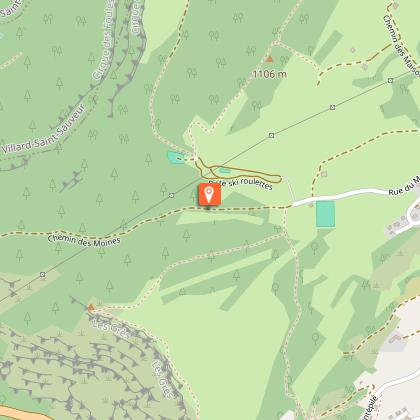
From the REPLAN, the circuit (yellow waymarking) heads down “Chemin des Moines” (The Monks’ path) to the D 436 in MONTBRILLAND.
Head up the road following along the right border and head past La Roche percée for around 20 m.
A stony trail descends to the right and crosses over a few screes. At Bas des Grès, continue right until you come to the Flumen and use the walkway next to its concrete penstock to cross it.
> Flumen waterfalls, 15 mins out-and-back. Head up the path to your left; Head past a dam and continue until you come to the upsurges. Surrounded by high waters, head up the stony path to your right and then turn left (copse) to reach the waterfalls.
On returning from the waterfall, the path heads down the left embankment to the Electricity factory.
The steep trail to your left heads through Sous la Riote and up to the ridge on a tricky ascent (700 m difference in level), before exiting onto the LA ROCHE BLANCHE BELVEDERE. A grassy trail heads due south and, following along the fence, meets up with a road. Follow the road to your left for 500 m heading to the houses in La Cernaise.
Between two buildings, turn left and join up with the D 25 in CHAMPIGNON DE LA CERNAISE. A forest trail which is muddy in places heads down to your left towards Les Moulins. Head 150 m down the “route des lacets de Septmoncel”, before turning left and joining up with a lesser bend called “le virage des Savants” (the Wise men’s bend).
> The viewpoint from Saut du Chien and the MOULIN D’AVAL WATERFALL can be accessed in a few minutes via the road to your left.
From the “Virage des Savants”, climb the bank opposite you and cut through the bends twice, heading up to the CHAPEAU DE GENDARME.
> The foot of the Chapeau de Gendarme can be accessed within 10 mins there-and-back to your right by following a trail parallel to the road.
When you return, a steep trail heads through the pastures and follows along the ridge before reaching SUR LES GRES. Return to your point of departure via a path that heads down to the right through a dry grassland.
Technical Information
Altimetric profile
Starting point
Points of interest


Additional information
Public transport
To visit and get about in the High-Jura, visit www.reshaut-jura.fr, the eco-mobility portal listing all means of transport within the Park.
Advice
Take care along the cliffs before Roche Blanche and in Sur les Grès; on the roadside and at the crossings between Montbrillant and La Roche Percée; as well as between Les moulins and the Chapeau de Gendarme. The trail to access the Flumen waterfalls can be slippery during humid weather. This trail passes through pastures with livestock and forest paths. To respect the owners and farmers granting you passage, and for the security of livestock and wild fauna, we ask that you remain on the waymarked paths. Use the adapted passageways to get across fencing and be sure to close gateways behind you. Please keep your dog on a lead if you have one. Wild flowers are beautiful, they may be rare and protected and often wilt quickly. Do not pick them! They will delight the next hikers. In case of forest works (felling, skidding, etc.), for your safety, know when to stop and turn around.
Advised parking
at the Replan (head 1 km west of the village via “rue Centrale” from “place Dalloz”)
Access
10 km east of Saint-Claude via the D 436 until Septmoncel. In the heart of the village, at “place Dalloz”, head up to the Replan to your left via “rue Centrale” and then “rue du Mont”.
Arrival
Le Replan Septmoncel
Ambiance
The scenery alternates between gorges and inviting valleys, ridges perched in curves patiently carved out over thousands of years... Nature that is both accessible and wild awaits you on this circuit, as do its specificities such as La Cernaise’s mushroom-like fold, la Roche Blanche and the Chapeau de Gendarme. Folded, wrinkled, vaulted and carved... These unmissable features of the Jura’s geomorphology are still quite young compared to Earth’s long history.
Departure
Le Replan Septmoncel
