Tours
Activities
Places of interest
Where to eat
Where to sleep

Discover the charms of Le chatelet-en-brie, Seine-et-Marne

Are you in charge of the destination?
This page guides you through the attractions and activities accessible from Le chatelet-en-brie, Seine-et-Marne, Ile de France, ideal for enriching your stay. Discover local sites, walking trails, and cultural specialties of the region. Ensure the text remains informative and inviting, with a maximum of 400 words

Walking around Le chatelet-en-brie

See more suggestions
Hikes for all levels in Le chatelet-en-brie.
See more suggestions
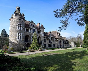
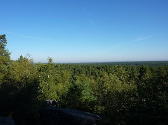
Le Châtelet-en-Brie : The Castle Path
268 m

Le Châtelet-en-Brie : The Castle Path

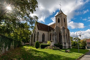
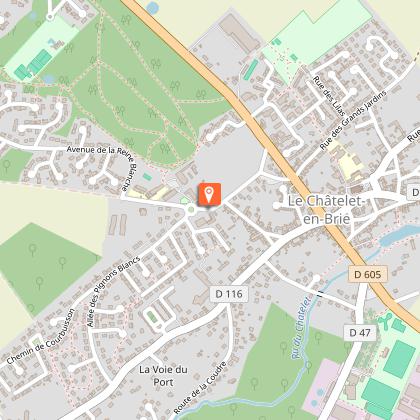
A pleasant stroll through Le Châtelet-en-Brie, a small town in the Brie region overlooking a spring which is said to have been the reason for its original settlement. Certified by FFRandonnée. Description of the route : 1. With the castle in front of you, leave to the left, then right at the roundabout. Pass the car park on the right and take the woodland path on the same side. Take the path on the right and cross the residential area. Cross the RD605 and follow Rue de la Loge aux Bergers. At the bend, go straight ahead into the path, then turn right into the Passage de la Peupleraie. It crosses a street and leads onto Rue des Grands Jardins. 2. Make a right then a left and, by the Passage des Marjolets, pass in front of the church to reach the RD213. Turn right, then left into Rue Saint-Hubert. Turn left into Rue Baudra, which continues as Rue des Dames de Poissy. Go down on the right by the path running along the washhouse. 3. Go around the basin on the right, cross the bridge over the Châtelet stream and go uphill on the right. Cross the RD605 and go up Route de Féricy. Pass the cemetery and the wastewater treatment plant opposite the sports complex, then go down the woodland path on the right. When you reach the road, make a right then a left and cross the bridge over the stream again. 4. Climb the grassy path on the right up to Rue de Fontaine-le-Port. Make a right then a left and enter the grassy path, then another path on the right passing between houses. Leave the path on the left, make a wide left curve and cross a paved road. Then leave the left path and, following a right curve, reach the paved Allée des Pignons Blancs. Turn right, then left into Chemin des Guyottes. Turn left into the path, which continues as a paved road. After a right-angle turn to the left, rejoin Allée des Pignons Blancs. 5. Turn right twice, leave the road on the left, and continue along the gravel path which makes a right-left turn, continuing as a paved passage. Turn left into Rue de Rambouillet, then left into Rue Saint-Augustin, and finally left into Rue du 19 Mars 1962 to return to the starting point. Municipality crossed : Le Châtelet-en-Brie Distance : 5 km - Duration : 1h40 - Marked trail : Yellow - Difficulty : Easy Access to the map : www.cirkwi.com/fr/circuit/353267-le-chatelet-en-brie-le-chemin-du-chateau

2 h
5 km
Very easy
5000 2 Rue du 19 Mars 1962 77820 Le Châtelet-en-Brie
Show
Barbeau Forest
3.6 km

Barbeau Forest

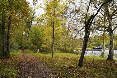
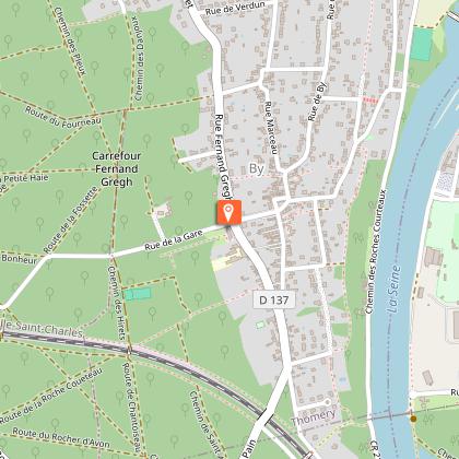
The route in the Barbeau state forest takes place between small valleys and a balcony overlooking the Seine, to observe the flora of the undergrowth and the fields. Certified by FFRandonnée. Description of the route : 1. At the station, follow the RD39 to the right, cross the junction (be careful) and continue for 100 m. Turn left into the first underpass under the railway line. Take the road and cross the bridge over the Châtelet stream (washhouse). 2. Continue straight ahead, turn left, pass in front of the town hall and turn right and go up on the right towards the church. Go left and go down the Sentier des Rossignols until you reach Rue du Général Roux, turn right and take the Sentier de l’Ermitage on the right. Go up, leaving the bridge on the left, to reach the Chemin des Chasses. Go straight for 100 m, then turn right and take Rue des Sablons on the left up to the water tower. Continue straight ahead to a junction. 3. Take Rue de Bellevue on the left, which enters the woods. Follow Rue de la Forêt on the left, then turn right, crossing a stream to enter the Barbeau state forest (follow the markings carefully). Cross the RD47. 4. Take a path on the right that goes down to the RD107. Follow it to the left for 250 m. 5. Take the path on the right that climbs through the fields. It bends to the right (marking is limited due to lack of support) and reaches a junction. 6. Continue straight, going down towards Héricy via the Chemin du Cormier. At the first houses, turn left onto Rue de la Croix-Neuve then right onto Rue de la Cave-Sainte-Geneviève. Cross Rue de la Fontaine-du-Sault and meet it again 50 m further down. Reach the Héricy church. Turn right, follow the RD39 towards Melun for 50 m, then turn left onto Rue du Fossé-Chevalier and reach the Seine. Turn left and follow the right bank of the river. 7. At the end of the landscaped promenade, turn left onto Avenue de Saint-Marc and reach Héricy train station on the right. 8. Arrival. Municipalities crossed : Fontaine-le-Port and Héricy Distance : 9.5 km - Duration : 3h – Marked trail : Green - Difficulty : Easy Access to the map : www.cirkwi.com/fr/circuit/282885-la-foret-de-barbeau

3 h
9.5 km
Very easy
Gare de Fontaine-le-Port 77590 Fontaine-le-Port
Show
Walk in Sivry-Courtry
3.8 km

Walk in Sivry-Courtry

This walk allows you to discover the village of Sivry-Courtry and the hamlet of Courtry. You will see the chapel, the dovecote, the château of Courtry and its farm, as well as the Ormoie farm, all of which bear witness to the village’s medieval past. The devastation caused by the Hundred Years’ War in the region led to the reconstruction of fortified farms from the 16th century onwards. Sivry-Courtry allows you to see several farms representative of this Briard architecture. You will discover the remains of the old public fountain, the Saint-Henriette washhouse, and the Chaumont farm. The walk, step by step… 1. The walk starts in front of Saint-Germain Church in Sivry-Courtry. Take Rue de la Mairie, which runs alongside the church. Take a moment to admire the church. 2. After crossing the RD605 carefully, continue straight along Rue de la Libération, then immediately turn left onto Rue des Granges. Continue straight along this road. 3. Rue des Granges becomes the local road from Sivry to Milly. Walk alongside a football field on your left. Keep to the right on this road from Sivry to Milly, then turn right onto a rural path. Continue straight through the woods. 4. Turn left onto the rural path known as the Goulot path. Follow it and continue straight, crossing the Goulot stream. 5. Take the second right onto the rural path from Melun to Courtry. Continue straight until you enter the village of Courtry. On your right, you will see the castle of Courtry and its farm (private property). 6. Continue straight along Rue du Château, then turn right onto a small square. Take a moment to admire the dovecote in the center of the square. Turn right again and continue along Rue de la Mare. 7. Rue de la Mare becomes the rural road from Courtry to Châtelet-en-Brie. Continue straight along this path. You will cross over the Goulot stream. 8. At the end of the path, turn left then right onto the local road from Sivry to Saveteux. On your right, you will see the ruins of the old public fountain. Continue straight along the local road, which becomes Rue de la Libération as you enter Sivry-Courtry. 9. Carefully cross the RD605 and continue straight along Rue de la Mairie which will bring you back to Saint-Germain Church. Municipality crossed : Sivry-Courtry Distance : 7.5 km – Duration : 2h30 – Unmarked trail Access to the map : www.cirkwi.com/fr/circuit/293722-balade-de-sivry-courtry-a-courtry

3 h
7.5 km
Very easy
19 Bis 1 Domaine de la Belle Allée 77115 Sivry-Courtry
Show
Petit Barbeau walking trail - Seine et Forêt, marked trail
4.9 km

Petit Barbeau walking trail - Seine et Forêt, marked trail

The Office de Tourisme du Pays de Fontainebleau has published this tour, which takes you from the charming village of Samois-sur-Seine to discover a wide variety of tree species. Between the Seine and the forest, take advantage of this walk to recharge your batteries! The walk starts from the Petit Barbeau parking lot. The route takes you along the banks of the Seine, sheltered by the forest. Along the way, walkers are invited to observe the diversity of the forest's tree species and to discover a number of carefully preserved remarkable trees (blue paint circle). In this setting, it's not unusual to come across numerous species of birds. This itinerary invites you to observe the diversity of forest species and discover some of the remarkable trees carefully preserved along the banks of the Seine. Remarkable trees are identified and listed, and the most remarkable are classified by rarity, size, botanical peculiarity or sometimes curious shape... These trees are marked with a blue circle. The alliance of river and forest is favorable to many bird species: many woodpeckers, common buzzards, sparrowhawks and woodcock frequent the forest, while the river is home to cormorants, grey herons, kingfishers and many species of ducks. Cold winters bring rare species to the Seine. A dive into the heart of beautiful biodiversity. Difficulty: Easy. Please note: you may come across cyclists. Accessibility: accessible to people with reduced mobility, except for certain sandy sections. Loop Length: 10 km Duration: approx. 1 h 30 Orange mountain bike signpost Starting point Parking du Petit Barbeau 77920 Samois-sur-Seine Corresponding map IGN Top 25 N°2417OT How to get there From Samois Drive through Samois and along the Seine to the Petit Barbeau parking lot. From Fontainebleau-Avon Take the D210 to the Valvins bridge crossroads. Turn towards Samois and continue along the Seine to the Petit Barbeau parking lot. This itinerary has been developed by ONF and AFF. To discover other itineraries, don't forget to use the balade branchée application.

3 h
10 km
Parking du Petit Barbeau, Samois-sur-Seine 77300 Fontainebleau
Show
Féricy, from Javot to Sainte-Osmanne
5.2 km

Féricy, from Javot to Sainte-Osmanne

This itinerary takes you through fields, woods, and villages, the plateau overlooking a valley on the edge of the Barbeau forest, which faces the Fontainebleau forest across the Seine. Certified by FFRandonnée. Route description : 1. With your back to Rue de Ferland, walk along the village hall, cross the second parking area, take the access ramp and follow the path on the right. Turn left onto Route de la Plaine, cross the RD107, then turn left onto Rue du Bon Puits and enter the hamlet of Montceau. Turn right twice, then follow the paved path of Fontaine Ory on the left until you reach the hamlet and the fountain of the same name. 2. Go down to the left, the paved road becomes a dirt track. Turn left, then right on the paths, following the edge parallel to the Vallée Javot stream. Reach the RD210, leave Vallerand bridge on your right and go up to the left (caution), turn right onto a path, then right again onto the next one. Turn left twice to climb into the field, then go right and left. 3. Follow Rue du Montceau on the right, then Rue de Lorette on the left (RD110), then Rue de l’Église on the right. In front of the church take the path on the right along the castle park which leads to Route de Barbeau. Turn right, and in the bend, take the second path on the left. It runs along the edge, alternating between fields and woodland edges. Leave the path on the left and reach the washhouse. 4. Turn left, Rue de la Fontaine, then 400 m further on, turn left, Chemin de Champagne. Take the second path on the right, which leads back to Rue de Ferland then return to the starting point on the left. Municipality crossed : Féricy Distance : 7,1 km - Duration : 2h20 – Marked trail : Blue - Difficulty : Easy Access to the map : www.cirkwi.com/fr/circuit/353264-fericy-du-javot-a-sainte-osmanne

2 h
7.1 km
Very easy
1 rue de Ferland 77133 Féricy
Show
Walk in Féricy
5.3 km

Walk in Féricy

Féricy offers a long walk between fields, narrow streets and woodland where you will discover a colorful heritage. Féricy is a village that will surprise you with both its charm and the unusual stories that have taken place there. Along the way, you will read often amusing anecdotes involving a giraffe from afar, a Queen of France whose wish was fulfilled, a rebellious lover, and even an Irish saint… The village is first mentioned in the 9th century under the name Feracium. Thanks to the reputation of its spring and its church dedicated to Sainte-Osmanne, Féricy became an important place of pilgrimage. This walking loop invites you to follow in the footsteps of members of the royal court and to discover the quality of life in a village set in a truly green and peaceful environment. The walk, step by step… 1. With your back to the sports field, turn right, walk down Rue de Ferland and continue straight along Rue de l’Église. On your left, you will pass the impressive Sainte-Osmanne Church. 2. Continuing along the street to the left, you enter the Domaine de la Salle park. At the entrance to the park, on the left before the porch and at the bottom of the stairs, you can see the Sainte-Osmanne spring. Feel free to explore the park, which features many beautiful trees, including a remarkable sycamore maple. 3. Leave the Domaine de la Salle and continue straight along Rue de l’Église. Turn left onto Rue de Lorette, then right onto Rue du Montceau. 4. On Rue du Montceau, turn left onto the Chemin des Soudis path. After the big bend to the right, leave this path at the panel and follow the orchard on your left. Continue along the path as it curves to the right. At the end, you will find another panel. Turn left to discover the bridge called Pont de la Girafe. 5. Turn around. Retrace your steps. Continue straight along the uphill dirt path, then turn right at the ground marker. You will enter the woods. The forest path leads to Rue de la Gennerie, which you should follow to the left until you reach the Pont de Vallerand. 6. Turn around. Retrace your steps for a few meters, and take the green path on your left. Follow it until you reach a panel, then turn left onto Chemin des Plaudis and walk along the length of the field. 7. At the end of the field, turn right onto Chemin de la Fontaine Ory and follow it uphill until you reach the junction with the Chemin des Rougereaux. You will reach the Fontaine Ory washhouse. Continue along the road until you reach Route de la Plaine at the entrance to the village. 8. Once in the village, turn left onto Rue du Montceau. Follow this long central street, then turn left onto Rue de Lorette to return to the parking area on Rue de Ferland. Municipality crossed : Féricy Distance : 5.4 km - Duration : 1h30 – Unmarked trail Access to the map : www.cirkwi.com/fr/circuit/770069-balade-a-fericy

2 h
5.4 km
Very easy
3 Bis place Héron de Villefosse rue de Ferland 77133 Féricy
Show

What to do in Le chatelet-en-brie

See more suggestions
Book your activities in Le chatelet-en-brie now and get ready for adventure.
See more suggestions
L'Escale
9.7 km

L'Escale

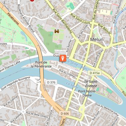
Welcome to your home! Producers, artists, event organisers (associations, private and public companies, etc.). You are looking for a venue for your event: Concerts, theatres, all types of trade fairs, conferences, general meetings, etc. The l'Escale team will find the best solution for you and advise you on how to tailor-make your event. Facing the River Seine, close to the city centre and station, this attractive 2,500m2 venue is ideal for cultural events and social gatherings. Spacious, modern, warm and surprising The "L'Escale - Melun" venue comprises a reception hall, a bar area, a catering office, 3 fully-equipped dressing rooms and a catering area.... So don't hesitate to contact them for your future events. SEATING CAPACITY Bleachers: 700 seats + 10 PRM (if control room at back of hall) or 669 (if control room in middle tier) + 10 PRM Grandstands: 130 seats x 2 Parterre seats: 167 Standing capacity: 2200 STAGE DIMENSIONS Stage width : Stage edge - Stage back: 11 m Stage curtain - back of stage: 8.15 m Stage nose - Stage curtain: 1.45 m Back wall - Stage curtain: 1.45 m (backstage) Length : Garden - Courtyard from wall to wall: 16.30 m Garden - Courtyard between pendillions: 11 m Height : Under stage grid: 6.40 m Stage floor indoors: 1.25 m TICKETS - By telephone or on site: Espace Saint-Jean - 26 place Saint-Jean 77000 Melun // 01 64 52 10 95 (from July 2023, the sales point will be moved to the Astrolabe multimedia library, due to works at the Espace Saint-Jean, more information at https://www.ville-melun.fr/) - By internet: culturetvous.fr or Auchan, Fnac, Carrefour, Leclerc FOR MORE INFO TECHNICAL DETAILS https://www.melunvaldeseine-tourisme.com/sites/default/files/lescale-fiche-technique-2023-09.pdf VIRTUAL TOUR OF THE VENUE https://goo.gl/maps/x5sQUYKQWwCQ56uu6 CULTURAL SEASON 2023/24 https://culturetvous.fr/fileadmin/07_-_Culturetvous.fr/02_-_Agenda/Saison_culturelle_23-24/saison24_Program_BD.pdf ITINERARY https://www.google.com/maps/dir//48.529796,2.666331

Avenue de la 7e Division Blindée Américaine 77000 Melun
Book from 0 €Book
Show

What to visit in Le chatelet-en-brie

See more suggestions
Taste the culinary specialties of Le chatelet-en-brie.
See more suggestions
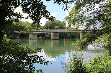
Château des Dames and its park
316 m

Château des Dames and its park

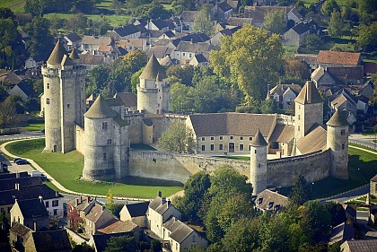
The Château des Dames at Châtelet-en-Brie takes its name from the nuns of the Royal Abbey of Saint-Louis de Poissy, holders of the lordship of the Châtelet lands from the 14th century to the Revolution. The Château des Dames was built in the 14th century following the donation of the estate to the nuns of the Royal Abbey of Saint-Louis de Poissy by King Philip the Fair. They turned it into a fortified farm, with both a defensive and an agricultural role. They kept it until the French Revolution, when the lordship was sold as national property. The property has had a succession of owners, who have run the farm without making any major alterations to the château. In 1861, Polycarpe Maclou Poussié purchased the estate. He was a prosperous notary in Aubervilliers. He was a member of the Municipal Council of Châtelet-en-Brie, a member of the Melun Agricultural Society and vice-president of the Horticultural and Botanical Society. Between 1877 and 1885, he completely renovated the castle with architect Pierre-Victor Cuvillier. He built a castle and modern farm buildings inspired by medieval architecture. These constructions were carried out according to a layout quite close to the pre-existing structure. The Château des Dames then became a family residence enhanced by a park. Through the prosperity of its farm, in operation until the 1960s, it functioned in near self-sufficiency. Between 1965 and 1978, the lands, the farm and the castle were gradually sold. In 1998, the municipality of Châtelet-en-Brie became the owner of the castle, the farm and its park, to enhance the building and turn it into a cultural venue. The Château des Dames now houses : inside the castle, the Media Library, and in the courtyard, the socio-cultural hall "Le Manège". The park is a place for walking open to all.

Rue du 19 mars 1962 77820 Le Châtelet-en-Brie
Show
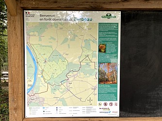
Domanial Forest of Barbeau
3.8 km

Domanial Forest of Barbeau

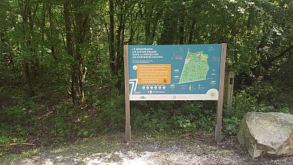
Located between Fontaine-le-Port and Féricy, the Domanial Forest of Barbeau offers vast panoramic views of the Seine and the Fontainebleau massif. This forest is home to sessile oaks, dominant, with a hornbeam understory. The massif of approximately 390 hectares has the particularity of being located on a limestone base covered by silt, clay, sand and Brie millstone. The lack of relief of this plateau and the presence of clay mean that rainwater has difficulty infiltrating, stagnates and made necessary the creation of drainage canals. Its other particularity is to still be treated, in almost its entirety, as coppice with standards, a result of its historical heritage. Indeed, it was until the Revolution, an ecclesiastical wood, placed under the authority of the Maîtrise des Eaux et Forêts which authorised it to practice this type of exploitation. The products served to supply Paris with firewood and framework and were transported very easily by the Seine from two landing stages at Fontaine-le-Port, so aptly named. Managed by the Office National des Forêts, the Barbeau forest is a production forest. It hosts several American red oaks and bald cypresses, species native to Florida. In the heart of the Barbeau forest, scientists have installed a measurement station, equipped with sensors that allow the measurement of matter and energy exchanges between the forest ecosystem and the atmosphere. Indeed, since 2003, the Plant Ecophysiology team of the ESE Laboratory (CNRS / Université Paris-Sud / AgroParisTech) has been working on an experimental forest site. Their activities are focused on understanding the processes that govern the functioning of the tree and the forest ecosystem as a whole. Since 2005, a major investment has been undertaken on the site, notably through a measurement station located at the top of a 35-metre-high pylon and dedicated in part to measuring exchanges of carbon dioxide (CO2) and water vapour (H2O) between the forest and the atmosphere. The Barbeau site is part of the ICOS network (Integrated Carbon Observation System), a new European research infrastructure dedicated to the observation and precise monitoring, over the long term (more than 20 years), of greenhouse gas fluxes. ICOS tracks carbon fluxes in Europe and the surrounding areas by measuring ecosystems, the atmosphere and the oceans through a network of integrated measurements.

Route de Féricy 77590 Fontaine-le-Port
Show
Domaine de la Salle
5 km

Domaine de la Salle

The Domaine de la Salle, in Féricy, brings together a manor house, several buildings, a 9 hectare plot of land and magnificent trees in the park open to the public. The history of the Domaine de la Salle is closely linked to that of the village of Féricy. The history of the Domain begins around 50 BC with the occupation of the Domain by its first owner Fericius or Fericiacus, who is said to have given his name to the village. Around 481, the Domain became the prerogative of the Frankish Kings and was entrusted to a vassal, taking the name of Domaine de la Salle. Pépin le Bref then gave the Domain to the Abbey of Saint-Denis, a donation confirmed in 775 by his son Charlemagne. In 1380, the Domain was sold to the Sainte-Chapelle by Pierre Despoix and Isabelle d'Auxy, his wife. In 1532, by the wish of the Canon of the Chapel, Jehan Parent, it became a parish church. In 1791, Regnaud sold the Domain to Louis Marie Pomponne Pinson de Ménerville, the king’s counsellor. The latter, having emigrated to Brussels during the Terror, returned to France in 1799 and then acquired the presbytery adjoining the church in 1835 and incorporated it into the outbuildings' courtyard. It is to him that we owe the current appearance of the Domaine de la Salle. In 1838 he built the current mansion, a "neo-classical manor" type with 4 levels. Neglected, fallen into abandonment, the Domaine de la Salle could have ended up in ruins, but that was without counting on the determination of the municipality, which acquired the property in 2006 following the death, without an heir of the last owner, and the dedication of the many volunteers who work to bring it back to life. Despite a fire in 2012 that destroyed part of the Manor House, little by little the site is being restored, it is the subject of numerous projects and already hosts a variety of events. The Domaine de la Salle incorporates many heritage and landscape elements : a manor house commonly known as "le château", outbuildings, a pond, a washhouse, the famous Saint-Osmanne spring and a vast tree-filled park. Walkers are invited to discover the variety of fauna and flora throughout the seasons, while respecting the surroundings. Among the spectacular trees, one can note a cedar and a cypress that punctuate the large meadow, a Japanese pagoda tree, a grey poplar, a Virginia tulip tree, a giant sequoia, pedunculate oaks, hornbeams and a sycamore maple (listed as a "remarkable tree of Seine-et-Marne"). Along and to the north of the canal, one can identify a copper beech, bald cypresses, a honey locust, and Italian poplars.

1 rue de l'Église 77133 Féricy
Show
Notre-Dame de Roiblay Chapel
6.7 km

Notre-Dame de Roiblay Chapel

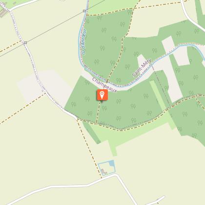
In the middle of a centuries-old wood in Champeaux, stands a little chapel (property of the municipality of Saint-Méry) implanted at the edge of the GR1. Here existed since the end of the 17th century, a priory with a chapel whose foundations still exist in part today. On the hillside which dominates the Ancœur stream valley, a listed site, stands a little chapel. Located on the municipality of Champeaux, but property of the municipality of Saint-Méry, by a decree of June 24th 1910, it is located at the edge of the long-distance hiking path, the GR1. On this location existed, since the end of the 17th century, a priory with a chapel whose foundations partially still exist today. Prosperous during the 13th and 14th centuries, it suffered the backlash of jurisdictional conflicts in the parish of Blandy and was only served by priests or hermits in the 16th century. The chapel continued, especially during the 16th and early 17th centuries, to be an important place of pilgrimage. In 1789, during the Revolution, community properties were seized and the chapel was sold in 1791 to Mr. Sarrazin de Maraize, Seigneur of Saint-Méry, for 200 livres. Named Mayor of Saint-Méry, Mr. de Maraize died there in 1794. The chapel was demolished during the Convention. The children of Mr. de Maraize had it rebuilt in 1803 and endowed it with a statue of the Virgin. It then served as a burial place for the family. Restored in 1859 by Mr. de Forestier, grandson of Mr. de Maraize through his mother, it remained in this family branch until 1867, then was offered to the municipality of Saint-Méry.

Rue du Moulin de Chaunoy 77720 Champeaux
Show
Sensitive Natural Area : Les Bordes Chalonges
7.1 km

Sensitive Natural Area : Les Bordes Chalonges

The ENS Les Bordes Chalonges, covering an area of 65 hectares, overlooks a meander of the Ancœur stream, a small watercourse that has carved its bed into the Brie plateau. The woodland is part of the Villefermoy forest massif of around a thousand hectares. In old French, "Borde" means a small house or a small agricultural holding, which differs from a farm by the absence of an enclosing wall. The Bombon area has always been dedicated to agriculture : wheat, oats, sugar beet on the richest land, and vines on the sunny slope of the Ancœur. The end of the 19th century saw the rise of large-scale farming. Thus, from 1870 to 1900, the vineyard shrank from 40 to 10 hectares, the woodland reclaimed the fallow land, while cereal crops doubled their surface area and the optimisation of yields reduced the number of farms from 91 to 7 ! It was at this time that the mill, the press and the oil mill, which until then had allowed everyone to process the fruit of the harvests, ceased their activity. The quarrying of millstones from the 17th century in the surrounding area probably explains the presence, not far from the pond, of a broken millstone. But this activity remained minor in comparison with the millstone quarries of La Ferté-sous-Jouarre (departmental ENS of the Bois de la Barre). In the 19th century, several sand and sandstone quarries were in operation for construction and paving. In the course of history, the site has belonged to many families. One of its most illustrious owners was Pierre-Marie Durand, the famous "King of the Kilowatt". In 1941, then mayor of Bombon, he purchased various plots to form an estate of 1,400 hectares, representing 93% of the municipal territory, of which Les Bordes Chalonges forms a part. These were subsequently acquired by the Department in two steps : the northern part in 1992 and the southern part in 2002. Before its acquisition by the Department, it was primarily subject to silvicultural management : the northern part was transformed into a poplar grove in 1977, while, from 1980, the southern part was managed to transition from coppice to an oak high forest, where 11 hectares of ash trees were also planted. Today the management of the site is ensured by the Fédération Départementale des Chasseurs de Seine-et-Marne in partnership with the Office National des Forêts. The forest ponds are home to 7 species of amphibians and certain heritage floristic species such as the bladderwort. The variety of woodland allows for the existence of a rich variety of birds, including in particular the middle spotted woodpecker, the coal tit and the wood warbler. The mown wet meadows along the banks of the Ancoeur constitute a remarkable habitat in Seine-et-Marne. Many butterflies are present there. Two marked trails allow visitors to discover the hidden treasures of the site. Natural environments present : woodland, riverbanks, ponds Site interests : botany, entomology, ornithology, amphibians Particularities : Ancoeur valley Managing and coordinating body : Fédération Départementale des Chasseurs de Seine-et-Marne.

Route Départementale 408 77720 Bombon
Show
The Val d'Ancoeur : a protected site
7.1 km

The Val d'Ancoeur : a protected site

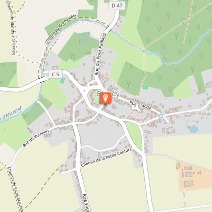
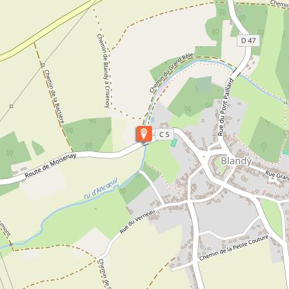
The history begins like a fairy tale : "Once upon a time the Val d'Ancoeur..." with its castles, its legends and the 3 names of this small stream, which has become a myth, that from Ancoeur becomes Ancoeuil to end as the Almont... before flowing into the Seine. (Extract from the website of the Departmental Archives) The Ancoeur stream is a watercourse that has its source in the municipality of Grandpuits-Bailly-Carrois at an altitude of 125 m. It then takes the name of "Ancoeuil" in the municipality of Moisenay and joins, after a journey of 25 km from its source, the Bassin de la Poële of the Vaux-le-Vicomte castle. At the exit of this basin, it flows into the "Almont" 5 km downstream into the Seine at Melun. It constitutes, with its tributaries, a catchment area of approximately 306 km². The Ancoeur stream flows through the municipalities of Grandpuits-Bailly-Carrois, La Chapelle-Gauthier, Bréau, Bombon, Saint-Méry, Blandy-les-Tours, Moisenay, Maincy and Melun. Classified as an "Exceptional Site" since October 14, 1985 by the Regional and Inter-Departmental Directorate for the Environment and Energy of Île-de-France, the Ancoeur stream offers enchanting landscapes. The classified site covers 1,861 hectares. Along the watercourses — the Almont, the Ancoeuil (or Ancueil) and then the Ancoeur — the Val d'Ancoeur unfolds its panoramas : villages, forests, castles (Vaux-le-Vicomte, Blandy-Les-Tours...) but also, at the confluence of the Seine, urbanised areas. "The Ancoeur is a very low-flow river, highly irregular and regularly at risk of running dry. The annual runoff depth within its catchment area is 96 millimeters annually, which is among the lowest in France, more than three times below the national average, and above all well below the average for the entire Seine basin (approximately 240 millimeters). The constant flow of the Ancoeur has, however, for centuries made it possible to operate the many mills. The large number of hydraulic structures, such as canals, basins and ponds, small reservoirs and mills, give the landscape a particular identity centred on water and its management. This is to be understood in relation to the wet character of the land." A place of life, production and creation, the Val d'Ancoeur brings together major heritage sites across the entire territory : churches and works of art dating back to the 12th century, castles, farms, mills, rural dwellings, small rural heritage... It has also become a subject of reflection and aesthetic admiration thanks to the artists who have captured its beauty and interpreted it in their own way. - The Ancueil ("Anqueil" in its 17th-century spelling) gave its name for example to a majestic statue in the park of Vaux-le-Vicomte, located to the left of all the grottos (1659–1662), facing the Tibre installed to the right in 1659. - The painter Paul Cézanne immortalised the bridge called Pont de Maincy in 1879 (now held at the Musée d'Orsay). - And the sculptor Auguste Rodin dedicated magnificent drawings to the collegiate church of Champeaux (1890–1917), as testimony to his admiration. For several years, the Communauté de Communes Brie des Rivières et Châteaux and the Communauté d'Agglomération Melun Val de Seine have joined forces to develop a Landscape Plan, revealing the assets of the Val d'Ancoeur. An opportunity for the protection and enhancement of the landscape heritage. The perimeter, which is based on the classified site, encompasses 11 municipalities across an area of approximately 56 km². It extends over a straight-line distance of nearly 17 km.

77115 Blandy
Show
Domanial Forest of Villefermoy
7.7 km

Domanial Forest of Villefermoy

Former ecclesiastical forest and royal hunting ground of King Louis XVI, the Domanial Forest of Villefermoy, in Seine-et-Marne, became state property in the 19th and 20th centuries. It is today a Natura 2000 zone. 60km from Paris and 20km from Melun, located on the municipalities of Échouboulains, Les Écrennes, Valence-en-Brie, Pamfou, La Chapelle-Gauthier, Fontenailles, La Chapelle-Rablais, Coutençon and Laval-en-Brie, this vast and beautiful oak forest is composed of two entities separated by an agricultural zone : the "Forêt de Villefermoy" to the West and the "Bois de Saint-Germain-Laval" to the East. The Villefermoy massif has a long history that can still be found today in the layout of forest roads and above all in the presence of ancient remains. Although its existence has only been attested since the Carolingian era, human activity there is far older. Humans did indeed roam this woodland domain as far back as the Neolithic. It has been inhabited and used, temporarily or permanently, since the Gallo-Roman era. As a former ecclesiastical forest, it was the property of the abbeys of Barbeau, Preuilly, Saint-Germain des Prés and the Commanderie de l'Ordre de Malte de la Croix en Brie before the Revolution. An extension of the Haie de Brie, it served, in the Middle Ages, as a natural boundary between the possessions of the Count of Champagne and the domain of the King of France. The monks exploited it to produce timber and firewood which they used in their abbeys. A forest warden, "Hugues garde des bois" (Hugo custos nemorum), was moreover appointed as early as 1140 in order to oversee the woodland and its exploitation ! The forest gradually became, through exchanges and acquisitions, state property during the 19th and 20th centuries. Its management was then entrusted to the Eaux et Forêts administration and subsequently to the Office National des Forêts (ONF) in 1964. Located at the heart of the humid clay plateau of the Brie, its surface extends over 2641 hetares and presents a fairly flat relief (between 105 and 135m in altitude). It includes a network of ponds and wetlands that shelter a great diversity of amphibians, including several protected species : European tree frog, Grass frog, Spotted salamander, Palmate newt... Rich in more than 120 bird species, it is part of the Natura 2000 zone "Massif de Villefermoy". There are 7 rare and protected nesting species : European honey buzzard, Hen harrier, Black kite, Common kingfisher, Grey-headed woodpecker, Middle spotted woodpecker and Black woodpecker. Populated by roe deer, wild boar and hares, Villefermoy is structured by large straight alleys interspersed with star-shaped crossroads, which bear witness to a long hunting tradition. The fertile soils of the Domanial Forest of Villefermoy are very favourable to the growth of sessile oak. Some of them reach exceptional dimensions. A few remarkable trees are listed and preserved during felling. Since 2006, the living heritage has led the State to classify the entire massif as a Natura 2000 zone (European ecological protection network) for the preservation of birdlife. In total, 4,790 hectares, of which 55% is state forest, are part of the "Natura 2000 Special Protection Zone Massif de Villefermoy" (ZPS). Several kilometers of paved road, gravelled or natural terrain roads are open to the public at Villefermoy. Some paths are marked, such as the long-distance hiking trail of Thibaud de Champagne, the short hiking trails of Grand Grippon and Bois des Moines or walking circuits (paths of the Brie Nangissienne, loop of the 2 massifs). Equipped areas (Huit Routes, Ru Guérin, Pavé de Boulains, Grandvilliers) with car parks, picnic tables, and information points allow walkers to fully enjoy the forest. Other parking areas are also distributed along the roads crossing the massif. (see map)

77820 Les Écrennes
Show

Where to eat in Le chatelet-en-brie

See more suggestions
Experience Le chatelet-en-brie's gastronomy.
See more suggestions

Where to sleep in Le chatelet-en-brie

See more suggestions
Choose a comfortable accommodation in Le chatelet-en-brie.
See more suggestions
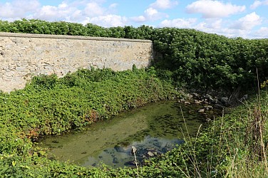
Centre International de Séjour Le Rocheton
9.5 km

Centre International de Séjour Le Rocheton

The centre is located in La Rochette, on the edge of the Fontainebleau forest and in the heart of a 10-hectare wooded park. Its green, peaceful setting and proximity to many sites of interest make Le Rocheton an ideal base for discovering the region. Whether you're on your own, with family, friends, an association, a school, a work group, a walker or a climber, whether you're coming as a neighbour or from another continent to relax or to work, the whole team at Le Rocheton is here to welcome you and to meet your needs. What's more, Le Rocheton is ideally located close to many sites of interest: exceptional residences, the Châteaux of Fontainebleau, Vaux le Vicomte and Blandy les Tours, the medieval town of Provins, museums, theme parks, etc. Activities : - A covered and fenced volleyball/tennis/archery pitch with a suitable synthetic surface - A city stadium (volleyball / mini football / badminton / handball / tennis / basketball) on an adapted synthetic surface - 4 squash courts are planned for 2017 in collaboration with the French Squash Federation. Services : - Tourist breaks (groups or individuals) - Educational breaks (with a tailor-made programme of activities) - Room hire for private events - Seminars and study days - BAFA training courses Whatever the nature of your project, the teams at Le Rocheton are here to help make it unforgettable. (Tourism & Handicap label since April 2019).

Rue de la Forêt 77000 La Rochette
Show
Campanile Melun-Dammarie-les-Lys
12 km

Campanile Melun-Dammarie-les-Lys

The Campanile Melun Sud - Dammarie-les-Lys hotel is located near Melun and Paris. Its relaxing setting makes it an ideal stopover during a stay in the Paris region. The hotel has 47 bright, spacious air-conditioned rooms, some of which are accessible for people with reduced mobility. Double, triple or family, we offer a wide choice of rooms to meet your needs. They all have a private bathroom, a writing desk, a telephone, an alarm clock, a free WIFI connection and a television with Canal + and Canal Satellite channels. You can also book a cot if required. A courtesy tray is available in your room so you can enjoy a tea or coffee break at any time of day. You will receive a warm welcome at the Campanile Melun Sud - Dammarie-les-Lys hotel from our bilingual French/English staff. To ensure your complete satisfaction, the hotel also has a free car park and a key dispenser allowing you free access to your room. A seminar room for up to 50 people can also be booked. Whether you're planning a business meeting, a banquet or a cocktail party, our space has all the facilities you need for a successful event. Take advantage of the restaurant for your meal breaks! A buffet breakfast is served every morning in the dining room or on the terrace. At lunchtime or dinnertime, don't miss out on our varied, well-balanced dishes, deliciously prepared with seasonal produce. To ensure your peace and quiet, meal trays can also be delivered to your room until 11pm.

346 Rue du Capitaine Bernard De Poret 77190 Dammarie-les-Lys
Show
Caution!
We have no information on the difficulty of this circuit. You may encounter some surprises along the way. Before you go, please feel free to inquire more and take all necessary precautions. Have a good trip! 🌳🥾