Tours
Activities
Places of interest
Where to eat
Where to sleep

Explore Clermont-ferrand at ACE HOTEL CLERMONT LA PARDIEU

Are you the owner?
Welcome to ACE HOTEL CLERMONT LA PARDIEU, the perfect starting point for exploring the treasures of Clermont-Ferrand, Puy-de-Dôme in Auvergne!

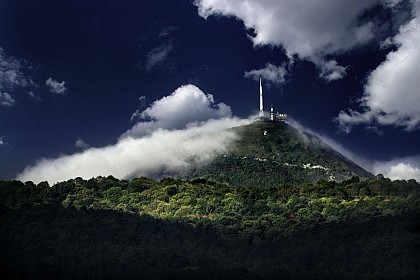
Upon your arrival, bask in the majesty of the Chaîne des Puys, a UNESCO World Heritage site. Whether hiking or cycling, these extinct volcanoes offer breathtaking views.

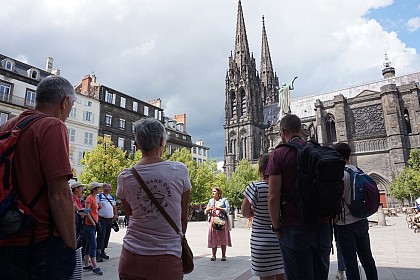
Don't miss a visit to the majestic Notre-Dame-de-l'Assomption Cathedral, an archite...
See more

Walking around ACE HOTEL CLERMONT LA PARDIEU

See more suggestions
Enjoy outdoor walks in ACE HOTEL CLERMONT LA PARDIEU.
See more suggestions
Hike : The Gergovie plateau from Pérignat-lès-Sarliève
2.8 km

Hike : The Gergovie plateau from Pérignat-lès-Sarliève

Starting from the square in Pérignat-lès-Sarliève, this long circular walk offers a real taste of history and nature. It involves a gradual climb towards the iconic Gergovie plateau and the Puy de Mardoux, in the heart of the wine-growing hillsides. A long circular walk taking in geology, vineyard landscapes and a key site in Gallic history Starting from the centre of Pérignat-lès-Sarliève (with an alternative route available from Romagnat), the ‘The Gergovie Plateau from Pérignat-lès-Sarliève’ walk is a superb journey through the hillsides of the Val d’Allier and the Comté. This route elegantly combines the great outdoors, landscapes shaped by wine-growing and an immersion in one of France’s most famous historical sites. Highlights of the walk: • The legendary Gergovie Plateau: A walk across the site of the famous battle between Vercingetorix and Julius Caesar, offering exceptional panoramic views of the Chaîne des Puys (UNESCO), the Sancy massif and the Limagne plain. • Geological features: A remarkable stretch at the foot of the Puy de Mardoux, a unique volcanic hill overlooking the valley. • Landscapes and rural heritage: A walk through hillsides once entirely devoted to vineyards, charming villages and refreshing woodland. • Gradual ascent: A steady gradient with no sudden changes in slope. Practical information & Technical details: • Start / Finish: Car park near the square (Rue Marcel-Magard – 63170 Pérignat-lès-Sarliève) — Alternative start from Rue de la République / Romagnat. • Signposting: Yellow circles in both directions A substantial hike requiring good walking boots and a sufficient supply of water, as the Gergovie plateau is very open and exposed to both wind and sun.

5 h
15 km
Rue Marcel-Magard Parking près du square 63170 Pérignat-lès-Sarliève
Show
GTMC-VTT - Stage 12 - Clermont-Fd > Volvic
3.8 km

GTMC-VTT - Stage 12 - Clermont-Fd > Volvic

The GTMC-VTT, from Clermont-Ferrand to Volvic. The GTMC mountain bike route continues from Clermont-Ferrand (historic start of the GTMC mountain bike race) to Volvic. From Clermont-Ferrand, the historic departure point for the GTMC mountain bike race, you gradually gain altitude as you head towards the Chaîne des Puys and its 80 volcanoes. Under the gaze of the impressive Puy de Dôme, you'll discover a variety of landscapes, from a 2,000-year-old town to sunny hillsides planted with fruit trees and vines. The route ends in chestnut woods and volcanic cheires, with their chaotic vegetation and morphology. All along the way, the mountain biker's attention is irresistibly drawn to the volcanoes. Volvic, famous for its water and volcanic stone, is the finishing point of this stage. Departure is from Clermont Ferrand railway station. We climb gently up to Place Delille, which we cross before plunging down in front of a large secondary school to follow a long straight line. From set of traffic lights to set of traffic lights, the MTB GTMC takes us to the tarmac slope leading to the Col de Bancillon (alt. 551m). A short but steep descent on a farm track takes us to the Blanzat sports complex. We have to find a passageway to cross it and then climb back up to Blanzat on tarmac. Superb trails through fruit groves and meadows to the village of Malauzat. From Malauzat, we climb through a chestnut grove that takes us right up close to the Chaîne des Puys. Playful, relatively easy trails.

2 h
20 km
Medium
40 Avenue de l'Union Soviétique 63000 Clermont-Ferrand
Show
Hike Between the Banks of the Allier and the Limagne Hills | Lempdes
4.3 km

Hike Between the Banks of the Allier and the Limagne Hills | Lempdes

Starting at the Lempdes town hall, this long, picturesque loop connects the banks of the Allier River to the hills of the Limagne region. It’s a nature-filled route packed with opportunities for scenic detours to the Puys d’Anzelle and Puys de Bane. A taste of nature, from the cool waters of the Allier to the plateaus and hills of Limagne Starting from the Lempdes Town Hall parking lot, the “Between the Banks of the Allier and the Limagne Hills” trail offers a wonderful getaway into the heart of the plains and hills of eastern Clermont. Passing through a wide variety of natural habitats, this hike invites you to discover the volcanic and riverine environment from a new perspective. Highlights of the hike: • Diverse landscapes: Wander through the meanders of the Allier River, vast open plateaus, and the contours of the Limagne hills. • Panoramic detours: Take advantage of the recommended detours toward Puy d’Anzelle and Puy de Bane to admire a sweeping panoramic view of the Clermont-Ferrand metropolitan area and its surrounding mountain ranges. • Accessibility: An ideal loop for a half-day nature getaway just a stone’s throw from the city. Practical Information & Technical Profile: • Start/Finish: Town Hall Parking Lot (Rue Saint-Verny - 63370 Lempdes) • Trail Markings: Yellow circles in both directions • Public Transportation: T2C bus (Line E4, “Mairie de Lempdes” stop) This route is accessible and features very gentle terrain. Be sure to wear comfortable walking shoes and bring water for the open sections across the plateaus.

4 h
12 km
Rue Saint-Verny Parking de la Mairie 63370 Lempdes
Show
Mountain Bike Trail: Between the Banks of the Allier and the Limagne Hills | Lempdes
4.3 km

Mountain Bike Trail: Between the Banks of the Allier and the Limagne Hills | Lempdes

Starting in Lempdes, this smooth and accessible mountain bike trail connects the banks of the Allier River to the hills of the Limagne region. It’s an ideal route for mountain bikes or e-mountain bikes, winding through plains, farm roads, and offering panoramic views of the surrounding volcanic peaks. A smooth and varied mountain bike loop between the cool banks of the Allier and the Limagne Plain Starting from the parking lot at Lempdes Town Hall, the mountain bike version of the “Between the Banks of the Allier and the Limagne Hills” circuit offers a beautiful, smooth ride just outside the Clermont-Ferrand metropolitan area. With its smooth terrain, the route combines the pleasure of riding along the river with the exploration of farm trails in the Limagne basin. Highlights of the mountain bike route: • A very accessible terrain: Smooth trails, wide paths, and very gentle elevation changes that are perfect for a family mountain bike outing or a ride on an e-MTB. • Varied scenery: Ride along the wild meanders of the Allier River before reaching the open spaces of the plain. • Panoramic views: Enjoy beautiful vistas of the Puy d’Anzelle, the Puy de Bane, and the entire volcanic landscape that frames the city. Practical Information & Technical Profile: • Start/Finish: Town Hall Parking Lot (Rue Saint-Verny - 63370 Lempdes) • Bike Types: Mountain Bike / E-Mountain Bike / Gravel Bike / Sturdy Hybrid Bike • Markings: Yellow circles in both directions • Public Transportation Access: T2C bus (line E4, “Mairie de Lempdes” stop) Wearing a helmet is recommended for everyone. Be careful on the shared-use sections along the Allier River and adjust your speed at intersections with farm roads.

2 h
12 km
Easy
Rue Saint-Verny Parking de la Mairie 63370 Lempdes
Show
Hike : The three puys | Romagnat
4.6 km

Hike : The three puys | Romagnat

Starting from Romagnat, a long, challenging loop perfect for keen walkers! This demanding route takes in Montrognon, the outskirts of Gergovie, the hills of Jussat, Puy Giroux and the charming village of Opme with its castle. An exceptional, challenging walking route taking in volcanic landscapes, castles and charming villages Undoubtedly one of the ‘big leagues’, the ‘Les trois puys’ circuit sets off from the car park at Romagnat Town Hall. Designed for seasoned walkers and fitness enthusiasts, this ambitious loop offers a rich blend of history, geology and varied landscapes, linking several peaks and iconic sites to the south of the Clermont-Ferrand conurbation. Highlights of the walk: • A succession of major peaks: Passing through the volcanic hills of Montrognon, the slopes of Jussat and Puy Giroux. • Historical and built heritage: A walk through the medieval village of Opme and its castle, exploring the surroundings of the famous Gergovie plateau and discovering local heritage. • Exceptional panoramic views: Constant panoramic views of the Chaîne des Puys, the Gergovie plateau, the Limagne plain and the Sancy massif. • Diverse landscapes: A rhythmic alternation of woodland paths, ridge trails, former vineyard slopes and picturesque village lanes. Practical information & Technical profile: • Start / Finish: Town Hall car park (63540 Romagnat) • Signposting: Yellow circles in both directions • Transport access: T2C bus (line 3, ‘Romagnat SALINS’ stop or services to the village centre) Route warning: a physically demanding route featuring significant uphill sections (notably a steep cumulative climb from Pérignat). Please ensure you have suitable walking shoes, walking poles, a supply of water and a packed lunch for the day.

6 h
18 km
Mairie de Romagnat Parking 63540 Romagnat
Show
Mountain bike route: Les Trois Puys | Romagnat
4.6 km

Mountain bike route: Les Trois Puys | Romagnat

Starting from Romagnat, a long, challenging and varied mountain bike circuit, suitable only for regular riders! A route combining stunning climbs towards Montrognon, Jussat and Puy Giroux, as well as exhilarating descents near Opme Castle. A challenging and comprehensive mountain bike and e-MTB route, designed for experienced riders Starting from the car park at Romagnat Town Hall, the mountain bike version of the ‘Les trois puys’ route is a long, challenging loop that ranks among the finest off-road rides in the area. Suitable only for experienced mountain bikers and e-MTB enthusiasts looking for a fast-paced ride, this route offers an excellent combination of sprints, challenging climbs and technical sections amidst the volcanic peaks. Highlights of the mountain bike route: • A series of challenging climbs: Tackle the slopes up to Montrognon, the Jussat climbs and Puy Giroux for a real test of endurance. • Technical skill & riding: A wide variety of terrain, including fast-rolling woodland tracks, challenging single-track sections, balcony-style sections and technical descents. • Exceptional heritage: The route passes at the foot of Opme Castle and circles the famous Gergovie plateau. • Ideal for e-MTBs: The length and total elevation gain make this a perfect route for making the most of the electric assist in sport mode. Practical information & Technical profile: • Start / Finish: Town Hall car park (63540 Romagnat) • Type: Mountain bike / E-MTB (Touring / Cross-Country) • Signposting: Yellow circles in both directions • Transport access: T2C bus (line 3, ‘Romagnat SALINS’ stop) Mountain bike warning: a challenging route with significant climbs (particularly the steep cumulative gradient from Pérignat). Requires good control of braking and handling on descents. Bring a repair kit and sufficient water.

3 h
18 km
Medium
Mairie de Romagnat Parking 63540 Romagnat
Show

What to do in ACE HOTEL CLERMONT LA PARDIEU

See more suggestions
Explore the bookable activity options in ACE HOTEL CLERMONT LA PARDIEU for all tastes and ages.
See more suggestions
Castle of La Batisse
9 km

Castle of La Batisse

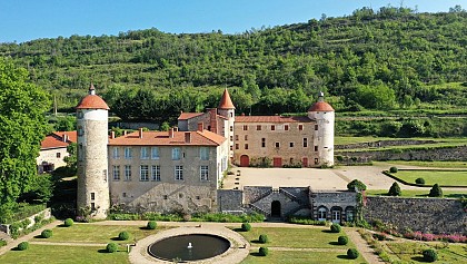
Château de la Batisse, located in Chanonat, is classified as a Historic Monument, as is the entire estate, and is surrounded by a garden that has been awarded the "Jardin Remarquable" label. Originally built in the 13th century as a defensive tower, the Château de La Batisse became a fortified castle in the 14th century. In the 18th century, it was transformed into a true pleasure estate, which is admired today for its rich history, its remarkable architecture, and its gardens—unique in the Auvergne region. Open year-round, the castle hosts both private and professional events, all while coming alive with an inspiring cultural program. Unique exhibitions, exceptional events, and timeless experiences make the site a space for creativity and cultural transmission. Contemporary art, historical reenactments, performances, concerts, and immersive evenings invite visitors to rediscover the château in a new light. Whether you’re a history buff, an art lover, or simply curious, everyone can enjoy unique experiences in the heart of this place steeped in history. Events From June 20 to August 30, 2026, set amid 19 hectares of nature and gardens designated as “Jardin Remarquable” (Remarkable Garden) and traversed by the Auzon River, the estate offers visitors a true respite of freshness and discovery. Shady woods, French-style gardens, waterfalls, orchards, a maze, wooden play structures, and art installations punctuate the visitor experience: Gallery of Auvergne portraits in the maze — Denis Pourcher Lava stone sculptures integrated into the gardens — Thierry Courtadon Floral sculptures in the Roseraie pond — Alexis Boyer “In Search of the Enlightenment”: busts of great philosophers hidden in the grove along the Allée des Cascades Summer 2026 Program Music Festival – June 20, 2026: storytelling during siesta time in the orchard, a costumed procession in the style of Napoleon III, and a free festive evening at the Moulin du Château starting at 6:30 p.m. (in partnership with Auzon Collectif), featuring concerts by local artists, food, and a friendly atmosphere. Concert Evening – July 13: concert featuring Les Frères Maulus followed by a barbecue. Guided Tours of the Château: starting July 8, Wednesdays and Sundays at 3:00 p.m. Napoleon III-themed costumed processions (afternoon): June 20, July 8, August 9 Storytelling tours (afternoon): July 8, August 5 “The Musketeers & Milady” event (July 15–August 13, every Wednesday): performances and fencing workshops.

Route de Varennes 63450 Chanonat
Book from 0 EURBook
Show
Lemptégy Volcano
16 km

Lemptégy Volcano

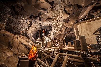
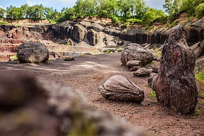
Explore the heart of a real volcano... Located at the center of the tectonic "Chaîne des Puys - Faille de Limagne" UNESCO World Heritage Site, we offer you the unique and unusual opportunity to discover the inside of a 100% natural volcano. Discover the secrets of volcanology with a 2h30 interactive tour of the Lemptégy volcano, comprising 5 stages: - The "volcano and men" tour: this fun, interactive introduction to the visit will familiarize you with the volcano and help you better understand its metamorphosis. A 30-minute self-guided tour. - Guided exploration of the volcano's anatomy: meet your guide on foot or by train. You'll learn all about the volcano's geology and volcanology: bombs, volcanic chimneys, lava flows... and leave with scoria (solidified lava). A wealth of information to help you better understand the landscape around you. - L'âme de Lemptégy": an unusual journey into the site's industrial past, with a visit to the old pozzolan extraction machines once used by quarrymen. - The immersive "Volcano 'Express" attraction: this sensory and emotional experience reveals all the secrets behind the formation of the Chaîne des Puys and the Faille de Limagne. What if the fault were to reopen... Will you reach your destination? - The dynamic 4D film "Aux Origines": enjoy an unprecedented flight over the volcanoes of Auvergne and relive the history of the volcano as if you were there, from its eruptions to the present day. While you're there, treat yourself to a gourmet break at the Volcan de Lemptégy restaurant. The chef offers traditional regional dishes (sausage/aligot, truffade, petit salé...). You can also stroll through the new boutique and discover a wide range of regional products, souvenirs, books... LE REVEIL DU VOLCAN" NIGHT TOUR: a breathtaking nocturnal experience! When you enter the site at night, you'll be propelled into the heart of the Lemptégy Volcano for an extraordinary experience. Along the way, you'll plunge into an erupting volcano and discover magical creatures. A new world to discover and a new way to experience the Volcan de Lemptégy. 1.5 km on foot. Prices and schedule: see website. Only in July and August, according to the Volcano calendar.

31 route des Puys Les Maisons Rouges 63230 Saint-Ours
Book from 0 €Book
Show

What to visit in ACE HOTEL CLERMONT LA PARDIEU

See more suggestions
Savor the local cuisine of ACE HOTEL CLERMONT LA PARDIEU.
See more suggestions
Campus des Cézeaux
2.2 km

Campus des Cézeaux

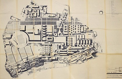
Designed in the late 1960s, the Cézeaux campus has rewritten its history since the 1980s, placing an emphasis on contemporary architecture. The Cézeaux campus is located on a basalt table that is now part of the city. Its design was conceived in 1963 by Parisian architects Daniel Badani (1914-2006) and Pierre Roux-Dorlut (1919-1995), in collaboration with Clermont-Ferrand architects Jean-Louis Douat, Antoine Espinasse and Paul Lanquette. The project includes buildings dedicated to teaching, a library, a university restaurant and student accommodation. The architecture is sober and functional, based on a rational plan and an industrialized construction system. A prefabrication plant has been set up on site. However, only the first phase of the initial project was built between 1968 and 1973. In the 1970s, the campus was enriched with works of art as part of the 1% artistic program. Victor Vasarely took over the central square with a paving designed according to the principles of Optical Art, an aesthetic based on visual illusions. Destroyed in 2007 due to its poor condition, the work was replaced by Riu-Kiu, a motif created by Vasarely in 1956 and realized by his pupil Bruno Allart. This enamelled sheet metal mural now adorns the amphitheatre building. Other notable works include La Dématérialisation (1972) by Francis Pellerin (1915-1988), Les Murs-Fontaines (1972) by Ervin Patkaï (1937-1985), part of which has been preserved, and Silhouettes formant un réceptacle à l'enseignement dispensé par la Connaissance (1978) by Michell (b. 1936). Since the 1990s, the campus has been rewriting its history by showcasing contemporary architecture: Polytech (architects Bresson, Combe and Ondet, then Panthéon); the Laboratoire de Physique Corpusculaire (architects Brenac and Gonzalez); the Institut National de Recherche en Sciences et Technologies pour l'Environnement et l'Agriculture (IRSTEA, architects Hauvette and Atelier 4), with its maple sunshades; the Institut Français de Mécanique Avancée (IFMA, architects Ameil and Jalicon), whose shape evokes the industrial world; the Laboratoire Magmas et Volcans (Groupe 6 Architects), with its unstable volumes, like a magma in motion. Captions for photographs and visuals : 1 - Ground plan of the Cézeaux campus, circa 1970 2 - Construction of the Cézeaux campus, circa 1970 3 - Place Vasarely, circa 1970 4 - Sculpture by Ervin Patkaï and Place Vasarely, circa 1970 5 - Sculpture by Ervin Patkaï, circa 1970 6 - Sculpture by Michelle Bargoin dit Michell, circa 1970 7 - Aerial view of the Cézeaux campus, circa 1970 8 - Riu-Kiu, wall decoration in enamelled sheet metal by Vasarely (motif) and Bruno Allart (realization)

Avenue des Landais 63170 Aubière
Show
Maison vigneronne - Second model
2.6 km

Maison vigneronne - Second model

The winemaker’s house is testimony to a previously prosperous business : vine growing From the second half of the 19th century, it changed to reflect the economic and social success of wine makers. The winemaker’s house is testimony to a previously prosperous business in Aubière and on all the hillsides of Limagne from the Middle Ages to the 19th century: vine growing The region has two types of winemaker houses. The first type is the traditional winemaker house located in the village centre. A narrow construction, it houses both the business premises and the living quarters: a vat room for pressing, fermentation and conservation of wine on the ground floor, a single room for living on the first floor, accessible via an outside staircase, and an attic beneath the roof. The second type of house was developed in the second half of the 19th century, at the height of vine growing. It reflected the economic and social success of the winemaker. These houses, a series of which can be found on Rue Chambon, are more imposing and generally have an extra floor for living quarters. They use Volvic stone for the window and door frames, storey separation panels, cornices and corner quoins. They have balconies with guardrails in metalwork or cast iron. They also have courtyards and technical buildings that give the residence a certain professional dimension, focused on the exclusive and important business of wine production. Musée de la vigne et du vin, 24 avenue Jean Noëllet in Aubière, recounts the history of the vineyards of Basse-Auvergne and its expertise, from planting to the winemaking process.

Rue Pasteur 63170 Aubière
Show
Les coteaux secs de Cournon-d'Auvergne
2.6 km

Les coteaux secs de Cournon-d'Auvergne

A protected site, the dry hillsides of Cournon d'Auvergne formed by the Vaugondières plateau and the summit of the puy d'Anzelle are home to a remarkable ecosystem resulting from a long agricultural history and a sheltered microclimate. To the north of Cournon-d'Auvergne, the Vaugondières plateau and the summit of the puy d'Anzelle constitute a natural area of around 50 hectares protected by an arrêté préfectoral de protection de biotope since 1992, and included in the Natura 2000 network. This network expresses the European Union's desire to preserve natural or semi-natural sites of great heritage value, due to the exceptional flora and fauna they contain. The site's rich animal and plant life is the result of a long agricultural history and a sheltered microclimate. The site is monitored and managed by the French League for the Protection of Birds. A special agricultural history At the end of the 19th century, the plateau was covered in vines. Phylloxera and mildew forced farmers to uproot the vines. The vines gave way to lawns grazed by sheep. A fauna and flora characteristic of dry grasslands then developed. Maintained by sheep until 1960, today's dry grasslands are preserved by man to prevent the colonization of shrubs and undergrowth. A little corner of Provence in Cournon-d'Auvergne The area enjoys a sheltered microclimate due to the Foehn effect. Clouds are held back by the relief of the Sancy and Puys massifs, so rainfall is low, but is also rapidly absorbed by the marl-limestone soil. This, combined with the south-facing slopes, creates a warmer climate. As a result, the flora and fauna are typical of Mediterranean regions. Nearly 270 species of flowers have been recorded, some of them protected for their rarity. 54 species of butterflies and nearly 30 nesting birds have also been inventoried.

Carrefour Anne-Marie Menut 63800 Cournon-d'Auvergne
Show
Large cellars
2.6 km

Large cellars

With over 900 caves, Aubière bears traces of a vine growing business that was once significant in the region. These caves fashioned outside the village were perfectly suited to storing wine. Aubière has more than 900 caves, over an area of 3 hectares, intended mainly for storing wine. They are located outside the village due to the closeness of the water table which prevents them from being built beneath the houses. They are hollowed out on hillsides, the door placed downstream, with variable depth of several metres in order to reduce staircases and handling operations. They are vaulted to withstand the weight of the earth covering them. Buried in this way, they maintain a constant cool temperature of 10° C and high humidity, which is favourable to wine making. The caves are ventilated by a ventilation duct with an outlet at the surface. After the arrival of phylloxera in the late 19th century, the wine growing business shrank drastically and many caves were reconverted for cheese ripening, including for Saint-Nectaire. At the peak of the district is a cinder block edifice, the former Savaron cheese dairy housing an extensive network, over several levels, created by connecting former caves. Enthusiasts from the ASCA association for saving the Aubière caves have been working for several years now to protect them. Aubière has two other cave sites: Caves de la Croix de l’arbre, Rue Pasteur under Plateau des Cézeaux, and the Petites Caves, Rue de Pérignat, also under Puy d’Aubière. The Musée de la vigne et du vin (wine museum), 24 avenue Jean Noëllet in Aubière, recounts the history of vineyards in Basse-Auvergne and their expertise, from planting to the wine making process.

Rue Adèle 63170 Aubière
Show
Place des Ramacles
2.7 km

Place des Ramacles

The Place des Ramacles owes its name to a story dating back to the Middle Ages until the 19th century, from the era of fiefdoms to the peak of vine growing. Aubière used to be divided into two fiefdoms, one belonging to the counts of Auvergne and the other to the bishop. The village fort outer wall, identifiable on the land register, encompassed the château and the church. Its remains are still visible: at the end of Rue Voltaire (Porte des Ramacles), Place des Ramacles (ditches), Place du Roudet (wall), and a very strange alleyway known as “manhole” which joins Rue Voltaire via Impasse Beauvert. The property of the lord of the manor, the Ramacles were a vast and humid plateau planted with willow trees, alders or poplars, between the outer wall and the Artière. Once a year, the Baron of Aubière authorised the residents to do “remailles”, meaning to cut all the branches of the willow or alder trees. “Remaille” led to remacle(s), then ramacles, hence Place des Ramacles. The houses, built against the ruins on the north face of the Place des Ramacles, had no outlet on the square. In the early 19th century, for more direct access to their vat rooms and caves, winemakers opened their houses onto the south by building several staircase bridges. They were built without municipal authorisation, above the reach of the stream, used as a washing station, running along the walls. Through legal means, in 1819 the owners obtained the right to keep these bridges, “provided they maintained the washing stones for public service and permitted and facilitated at all times their use through convenient surroundings.” They were later named “ramaclés”. Only four of them remain today. A commemorative fountain can be found: la fontaine de l’amitié (1969), in tribute to the Americans who came from the 55th artillery regiment to the town, in 1918 (sculptors: Fernand Auteroche and René Fontanel).

place des ramacles 63170 Aubière
Show
Château-Mairie de Pérignat-lès-Sarliève
2.9 km

Château-Mairie de Pérignat-lès-Sarliève

The Pérignat-lès-Sarliève town hall is located in a château whose origins date back to medieval times. Nearby is a former 11th century chapel. In the Middle Ages, the château was owned by the Lords of Pérignat, but changed hands several times over the centuries, becoming in 1609 the property of Guy Durant, tax collector in Clermont. His coat of arms can be seen above the entrance to the château. His descendants owned the château until 1940. The château, its outbuildings and grounds were acquired by the commune in 1953. The town hall moved in in 1976. The château's keep dates back to the Middle Ages. Its extensions date from the Renaissance and 17th centuries. The château comprises two main buildings set at right-angles to each other. In the corner, an overhead staircase tower distributes the floors. The watchtowers (overhanging turrets) originally placed at the corners of the building tell us about the size of the château before it was enlarged. They also indicate the defensive nature of the medieval château, as do the gunports on either side of the gateway to the courtyard. Nearby, the former chapel dates back to the 11th century. The oriented edifice is built on an elongated plan comprising a nave and a choir with a semicircular chevet. Romanesque in character, the side walls and upper part of the bell tower are pierced by arched openings. After the construction of Saint-Michel church (1869-1870), the former chapel was disused and used as the town hall from 1870 to the early 20th century. It then became a community hall. Access by bus: line S10 stop "Eglise de Pérignat".

Place Dorier 63170 Pérignat-lès-Sarliève
Show
Clermont-Ferrand station
3.8 km

Clermont-Ferrand station

Completed in 1945, the Clermont-Ferrand train station is an example of modernist architecture. It has Architecture Contemporaine Remarquable (remarkable contemporary architecture) status. The first train station in Clermont-Ferrand was inaugurated in 1855 for goods transport and passenger travel. An entire new neighbourhood was created to the east of the historic centre of Clermont-Ferrand and urban planning created wide avenues leading to the station. A new parish (Saint Joseph), businesses and hotels completed the development. But the only parts remaining of this first station are the side lodges. The present-day station was completed in 1945. It was the SNCF architect-engineer Paul Peirani who designed it, based on the model for the station at Le Havre (1929-1931) by architect Henri Pacon. The building is an example of modernist architecture with wide bay windows for maximum lighting in the entrance lobby, refined and simple lines, and an emphasis on light. The entrance lobby is decorated with enamelled lava stone by Jean Jaffeux. The clock tower is a recurring feature in train station architecture, since it is a symbol of punctuality and speed. The Clermont-Ferrand train station was awarded “Architecture Contemporaine Remarquable” (remarkable contemporary architecture) status in 2023. Since thermal spa resorts were becoming popular in the 19th century, it became important to establish train connections with them. Royat was connected from 1886 after the construction of a huge viaduct in 1881. Previously, spa visitors left the train at Clermont-Ferrand and finished their journey by horse and carriage. This is what Napoleon III did when he visited Clermont-Ferrand and Royat in 1862.

40, avenue de l'Union Soviétique 63000 Clermont-Ferrand
Show

Where to eat in ACE HOTEL CLERMONT LA PARDIEU

See more suggestions
Restaurants in ACE HOTEL CLERMONT LA PARDIEU will captivate you.
See more suggestions

Where to sleep in ACE HOTEL CLERMONT LA PARDIEU

See more suggestions
Book a pleasant stay in ACE HOTEL CLERMONT LA PARDIEU.
See more suggestions
Caution!
We have no information on the difficulty of this circuit. You may encounter some surprises along the way. Before you go, please feel free to inquire more and take all necessary precautions. Have a good trip! 🌳🥾