Alert
Alerts
Hike : The Gergovie plateau from Pérignat-lès-Sarliève
Description
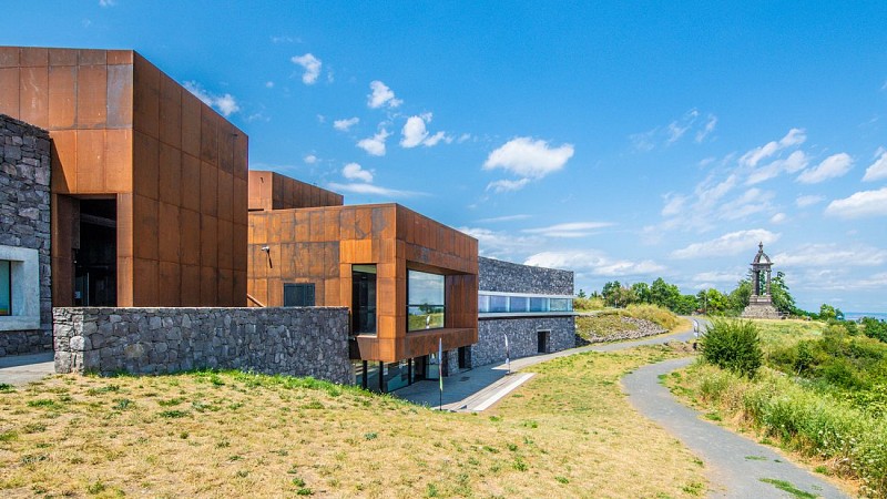
Starting from the square in Pérignat-lès-Sarliève, this long circular walk offers a real taste of history and nature. It involves a gradual climb towards the iconic Gergovie plateau and the Puy de Mardoux, in the heart of the wine-growing hillsides.
A long circular walk taking in geology, vineyard landscapes and a key site in Gallic history
Starting from the centre of Pérignat-lès-Sarliève (with an alternative route available from Romagnat), the ‘The Gergovie Plateau from Pérignat-lès-Sarliève’ walk is a superb journey through the hillsides of the Val d’Allier and the Comté. This route elegantly combines the great outdoors, landscapes shaped by wine-growing and an immersion in one of France’s most famous historical sites.
Highlights of the walk:
• The legendary Gergovie Plateau: A walk across the site of the famous battle between Vercingetorix and Julius Caesar, offering exceptional panoramic views of the Chaîne des Puys (UNESCO), the Sancy massif and the Limagne plain.
• Geological features: A remarkable stretch at the foot of the Puy de Mardoux, a unique volcanic hill overlooking the valley.
• Landscapes and rural heritage: A walk through hillsides once entirely devoted to vineyards, charming villages and refreshing woodland.
• Gradual ascent: A steady gradient with no sudden changes in slope.
Practical information & Technical details:
• Start / Finish: Car park near the square (Rue Marcel-Magard – 63170 Pérignat-lès-Sarliève) — Alternative start from Rue de la République / Romagnat.
• Signposting: Yellow circles in both directions
A substantial hike requiring good walking boots and a sufficient supply of water, as the Gergovie plateau is very open and exposed to both wind and sun.
Technical Information
Altimetric profile
Starting point
Additional information
Updated by
Clermont Auvergne Volcans - 10/09/2026
www.clermontauvergnevolcans.com
Report a problem
Tips
We recommend that you follow the tour using the Mikhes app, which guides you step by step to simplify your discovery. Download the app at the bottom of the page and start your tour.
Open period
All year round daily.
Data author
