Tours
Activities
Places of interest
Where to eat
Where to sleep
Camping Les Loges: Discover Nonette and Puy-de-Dôme
Are you the owner?Welcome to Camping Les Loges, your ideal starting point for exploring the magnificent region of Nonette, in Puy-de-Dôme, Auvergne. Begin your journey by visiting the charming village of Nonette, perched on its basalt rock and offering breathtaking views of the valley and the Allier river. Hiking enthusiasts will find paradise in the Auvergne Volcanoes Regional Natural Park with its numerous trails...See more
Walking around CAMPING LES LOGES
See more suggestionsWalks and discoveries in CAMPING LES LOGES.
See more suggestions


What to do in CAMPING LES LOGES
See more suggestionsDiscover surprising activities in CAMPING LES LOGES and book the ones you like.
See more suggestions")


IGN cards

2532SB - ISSOIRE VEYRE-MONTON
Editor : IGN
Collection : TOP 25 ET SÉRIE BLEUE
Scale : 1:25 000
13.90€
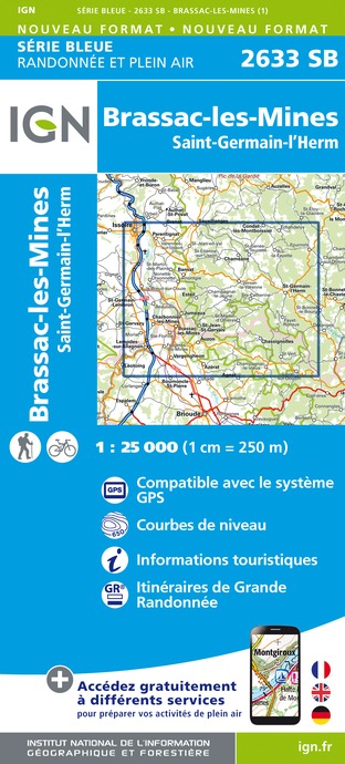
2633SB - BRASSAC-LES-MINES SAINT-GERMAIN-L'HERM
Editor : IGN
Collection : TOP 25 ET SÉRIE BLEUE
Scale : 1:25 000
13.90€

TOP75015 - CHAINE DES PUYS - MASSIF DU SANCY
Editor : IGN
Collection : TOP 75
Scale : 1:75 000
9.80€

TOP100D43 - HAUTE-LOIRE LE PUY-EN-VELAY BRIOUDE GORGES DE L'ALLIER
Editor : IGN
Collection : TOP 100
Scale : 1:100 000
8.40€

148 CLERMONT FERRAND SALERS PNR DES VOLCANS D'AUVERGNE
Editor : IGN
Collection : TOP 100
Scale : 1:100 000
8.40€

D42-43 LOIRE HAUTE-LOIRE
Editor : IGN
Collection : CARTES DÉPARTEMENTALES IGN
Scale : 1:150 000
5.90€

D15-19 CANTAL CORREZE
Editor : IGN
Collection : CARTES DÉPARTEMENTALES IGN
Scale : 1:150 000
5.90€

D03-63 ALLIER PUY-DE-DÔME
Editor : IGN
Collection : CARTES DÉPARTEMENTALES IGN
Scale : 1:150 000
5.90€

EUROPE
Editor : IGN
Collection : DÉCOUVERTE DES PAYS DU MONDE IGN
Scale : 1:2 500 000
7.00€
What to visit in CAMPING LES LOGES
See more suggestionsExperience the annual festivals of CAMPING LES LOGES.
See more suggestions


Where to eat in CAMPING LES LOGES
See more suggestionsThe restaurants of CAMPING LES LOGES await you.
See more suggestions


Where to sleep in CAMPING LES LOGES
See more suggestionsBook a pleasant stay in CAMPING LES LOGES.
See more suggestions


