Tours
Activities
Places of interest
Where to eat
Where to sleep

Experience Les Milles et Une Yourtes at Biol, Isère

Are you the owner?
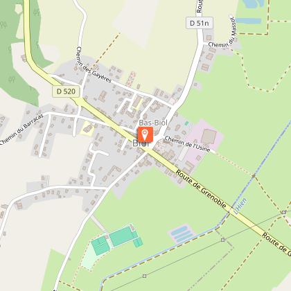
Located in the charming village of Biol in the Isère region of Rhône-Alpes, Les Milles et Une Yourtes offers a delightful setting for an unforgettable holiday. Discover a variety of activities: hike through scenic nature trails, delve into local history by visiting nearby castles and museums, or savor fresh farm products at the quaint local markets. Biol is also a perfect starting point for cyclin...See more

Walking around LES MILLES ET UNE YOURTES

See more suggestions
Hiking routes in LES MILLES ET UNE YOURTES.
See more suggestions
King’s forest at Biol le haut (long)
937 m

King’s forest at Biol le haut (long)

The ingredients for a beautiful hike : chestnut and oak forests to the south, supplemented by plains (long variant) to the north, all punctuated by beautiful views of the Dent du Chat, Dévoluy, Mont Blanc, Chartreuse and Belledonne. From the Biol le Haut car park and crossroads post, follow the yellow signs and the following signposts: Aux Bois > Les Trois Coches > Le Foulu > Bois Bessay > Les Chasseurs > Le Crépon > Les Planches > Le Sibuet > Le Bouteau > Les Azimets > Aux Bois > Return to Biol-le-Haut Follow the narrow road up towards Les Bois, stopping in front of the Americans' stele and the viewpoint indicator on your left to look out from left to right over the Bugey peaks, the Monts du Chat, the Epine range, the Chartreuse mountains and the Vercors peaks. On a clear day, you can even see Mont Blanc! You then enter the Biol woods. At Les Trois Coches, head in the direction of Le Foulu through small hamlets bordered by meadows and copses before returning to the forest on wide, undulating paths to Les Planches. At this point, you leave the woods and take wide paths bordered by agricultural plains. After Les Azimets, the vineyard huts line the path as it gradually climbs back up into the woods before reaching your starting point. Alternatively, start from the Chasseurs car park, accessible from the route de Flachères (400m after the ST DIDIER DE BIZONNES village exit sign, take the track on the right - find your way by the electricity pole at the bottom).

5 h
18 km
Medium
Parking Intersection Rue du 19 mars 1962 et Chemin du Barracas 38690 Biol
Show
Mountain bike loop - The sources of the Hien
2.5 km

Mountain bike loop - The sources of the Hien

A beautiful mountain bike loop that will take you into Biol's and Belmont's woods. A host of views of the Chartreuse, Mont du Chat, Bugey and Pilat peaks await you. ROUTE: From the car park by the church in Biol, head out onto the marshes. Cross the Hien at the footbridge and drive through farmland to the fortified house. Continue for about 400m to La Moutonnière before taking a well-shaded path. Continue towards Belmont. On the right-hand side of the path, there is a picnic table (in the sun) where you can take your first break. When you reach Belmont, look out for the beautiful church on your left and the fortified house with its imposing 4-sided tiled roof just before the church on your right. This is where the route gets tricky! There is one climb after another to reach the woods on the heights of Biol. But it's also as you get higher that you'll be able to enjoy panoramic views of the surrounding mountains (Vercors, Chartreuse, Monts du Chat). As you leave the forest at Le Crépon, the Monts du Lyonnais (Pilat massif) come into view. After another section on a forest track, you can return to the orientation table at the ‘Aux bois’ post. The path towards Les Azimets climbs up and down, offering numerous views of the Bugey peaks in particular. After a succession of small roads and a fine descent, you come to the Ravoux pond. On the right, the path climbs into the woods. The path is very pleasant and strewn with broom in flower in April and May. The Vallin forest takes you along the start of its main path with its very tall trees. A shady picnic table awaits you on the right just before the ‘St-Joseph’ sign. At this crossroads, take the small path beside the gate towards Torchefelon. At Marmonnière, we highly recommend a diversion to discover the orientation table located next to the 3 oaks village hall in Torchefelon. Picnic tables are also available near the church. After Le Bessay, a pleasant path leads down to Les Sources. After a short climb, you'll still enjoy lovely views of the mountains, before the road leads back down to Biol. MARKING AND SIGNS : Follow the following signs and signposts: BIOL > Le Moulin > Moutonnière > Belmont-église > Bois Bessay > les Chasseurs > Le Crépon > les Planches > les Trois Croches > Aux Bois > les Azimets > le Rapoux > Dessus Mirieu > les Quatre Sapins > Forêt de Vallin > St-Joseph > Marmonière > le Bessay > les sources > Mont-Martin > BIOL

3 h
28 km
Medium
Parking Place Jean-Baptiste 38690 Biol
Show
Combe Lambert and the ridge path
4 km

Combe Lambert and the ridge path

A walk through Montrevel's woods which will make you discover a part of our dauhpinoise history. Then the landscape will open on one of the most beautiful views of the Vals du Dauphiné. MARKINGS AND SIGNS : Follow the yellow signs and the following signposts: La Touqueta > Chemin de Combe Lambert > Vaux > Bois du seigneur > Châtaignier de Bourrique > Radio-balise > Chardenouse > Doissin > Notre-Dame d'Artézieux > Retour MONTREVEL ROUTE : Take the path that climbs alongside the church to reach the woods of Montrevel. This is where the village once had its castle, so well evoked by the place known as ‘Château Désert’. Look up at the Trois Croix oratory and admire the view over the Hien valley and the wooded hills of Biol. Go through the pretty hamlet of Vaux and take the short, steep climb on your left to reach the path that joins the woods. From the Bois du Seigneur onwards, the landscape opens up completely. In the foreground, the medieval castle of Virieu with its round towers pierces the hills opposite. In the background, the Chartreuse mountains, the Epine range and the Monts du Chat and Bugey come into view. View of Mont Blanc on a clear day. Then descend to Doissin. On the way back to Montrevel, admire the buildings of an old tile factory as you head towards the marshes. Pass by the Notre-Dame d'Artézieux chapel before returning to the village centre and its old houses. VARIATION : In very hot weather, we recommend a shadier option. From ‘La Touqueta’, follow the forest track towards ‘Bois vert’, then ‘Taillis’ to return to the loop at ‘Bois du Seigneur’. This will extend the walk by around 1km, with an additional climb of around 40m.

4 h
13 km
Easy
Parking de l'église 38690 Montrevel
Show
Combe Lambert
4 km

Combe Lambert

Explore the many hamlets that line Combe Lambert, winding your way through forests and meadows. From Montrevel, walk up alongside the church and onto the gravel path. Go past the farm buildings and turn right after the meadows onto the path. It joins a track that you need to take uphill. Just before the forest, turn right onto the track leading to "La Touqueta". Continue straight ahead until you reach the hamlet. Cross the hamlet to the left and join the Chemin de Combe Lambert. Continue uphill as far as "Vaux". Take the steep section of road on the left, which soon gives way to an undulating track. Cross between the houses to reach "Les Serves", then continue straight ahead on the track. At the crossroads on the way down, turn right on a rising level. The path leaves the meadows and continues through the forest to reach "Bois du Seigneur". Turn left, following the path downhill to "Les Taillis". Continue right along the track past a pond to the Bois Vert. From here, turn left and stay on the road at the next crossroads. Come to a right-angle bend where there is an old tree and continue straight ahead on the track. This joins "La Touqueta" further on. The return journey takes the same route. Throughout the route, follow the yellow markings and the following junctions: MONTREVEL > La Touqueta > Chemin de combe Lambert > Vaux > Bois du Seigneur > Taillis > Bois vert > La Touqueta > MONTREVEL Translated with DeepL.com (free version)

4 h
9.8 km
Easy
Parking de l'église 38690 Montrevel
Show
Around Torchefelon
4.4 km

Around Torchefelon

This hike will take you exploring the Vallin forest,where you'll find the Rompu and Ravoux ponds and others, as well as a limestone stream and a ferruginous one. The hike ends with a beautiful panoramic view. Follow the yellow markings and the following signposts: TORCHEFELON > Torchefelon-Mairie > Marmonière > Saint-Joseph > La Thébaïde > Etang de Vallin > La Thébaïde > Saint-Joseph > Les Quatre Sapins > Dessus Mirieu > Le Rapoux > Le Bessay > Marmonière > Torchefelon-Mairie > TORCHEFELON From the salle des fêtes car park, take in the panoramic view described by the orientation table (view of the Chartreuse and Epine massifs, the Monts du Chat and Bugey - Mont-Blanc in the background on a clear day). Follow the signposts for the ‘Forêt de Vallin’ through the village of Torchefelon. At the ‘Saint-Joseph’ crossroads, the route makes a pleasant loop through the Forêt de Vallin, passing the Etang de Vallin and the pond. Complete the loop and return to Saint-Joseph. Pass the ‘Forêt de Vallin’ car park and then the ‘Les Quatres Sapins’ signpost. Then head towards ‘Dessus Mirieu’, pass the Ravoux pond and follow the path up the Gadizieu stream. Continue on past ‘Dessus-Mirieu’ and join the D520 at the ‘Le Rapoux’ signpost. Walk carefully along it on the left for 50m, then find the Brumière path on your left. It leads to the ‘le Bessay’ signpost, then continue as far as ‘Marmonière’ and cross Torchefelon to return to the starting point.

4 h
13 km
Easy
Parking 45 chemin de Marmonière (salle des fêtes) 38690 Torchefelon
Show

What to do in LES MILLES ET UNE YOURTES

See more suggestions
Explore the bookable activity options in LES MILLES ET UNE YOURTES for all tastes and ages.
See more suggestions
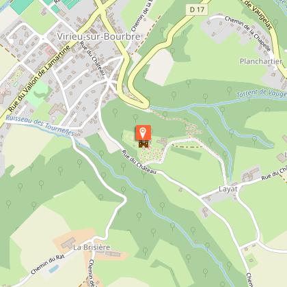
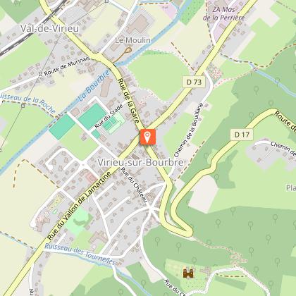
Virieu Castle
9.7 km

Virieu Castle

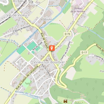
Built in 1010. Military heritage and french gardens characterize the monument. You would particularly enjoy Louis XIII's room, the medieval kitchen, the XVIIe chapel and the peculiar donjon. Come and discover the Virieu's castle during a one hour visit with our team of tour guide. You will start your visit in front of an impressive entrace door with 2115 original nails, topped by its pediment, bearing the Virieu coat of arms. Then, you will be in the castle's court of honor, just in front of its dungeon. You can see at your right the cannons offered by Louis XIII in 1622, placed under the arcade gallery in brick of Italian style. a few steps and you will be in the peaceful atmosphere of Virieu's chapel. Inside of it, one can admire a beautiful cross path. With a few steps under the gallery, you can access to the ancient kitchen, which now used as a dining room. You will discover the monumental fireplace with its low arch and its XIIIth century fireback, a souvenir of the ancient Chartreuse de la Sylve Bénite. You will also be able to appreciate its furniture before entering the Great Hall full of history. The King's bedroom, impressive and majestic room, called like that because the King Louis XIII slept there in 1622, has kept its original aspect and part of its furniture. You will then reach the White Room, which should have been a chapel The visit touch to its end near the dungeon, which is now a memorial dedicated to the Resistance during German's occupation from 1940 to 1944.

1245, Rue du Château Virieu 38730 Val-de-Virieu
Book from 0 €Book
Show

What to visit in LES MILLES ET UNE YOURTES

See more suggestions
Attend events organized in LES MILLES ET UNE YOURTES.
See more suggestions
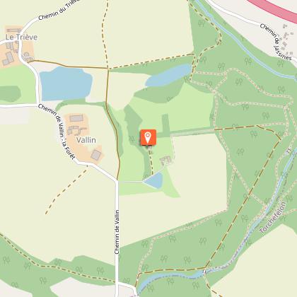
Vallin Castle
5 km

Vallin Castle

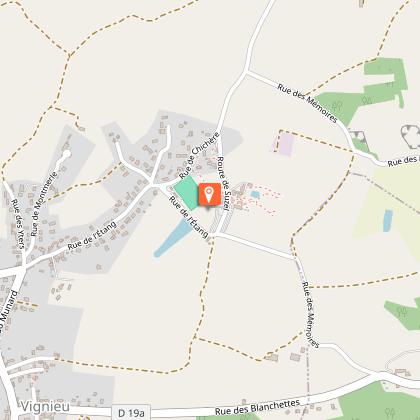
Built in the 14th century the castle was restored on the 17th and 18th century. The castle is composed with a main building, with "dauphinois" rooftops, a round tower, a chapel stuck to a medieval tower, and a courtyard. Overlooking the valley of La Tour-du-Pin, nestled in the heart of more than 200 hectares of forests, meadows and ponds, the Vallin Castle, a haven of peace and greenery, offers a preserved natural setting. Built in the 14th century, by the Vallin family who owned it directly for five centuries, it is a private historic residence, was partly redesigned and embellished in the 18th century. The murals in the neo-Gothic lounge and romantic dining room are unique in the area, as is the fountain and the tuff cave fireplace. In the park, the linden alley, with its 300 meters of length, its 70 magnificent trees and its 2 alleys of charmiles and romantic holly, the majestic cedars of Lebanon, offer a preserved natural setting. Located on the edge of the Vallin forest, the property can be the starting point of various family hikes. For twenty years, the Vallin Castle has been the subject of a major restoration campaign that has earned it the labels "Patrimoine Historique" and "Patrimoine en Isère" as well as national awards "VMF-Jeunes" in 2000 and "VMF-Barclays Bank" in 2011. The building has obtained the label "Heritage in Isère", rewarding the heritage quality of a building of departmental interest.

923 chemin de Vallin 38110 Saint-Victor-de-Cessieu
Show

Where to eat in LES MILLES ET UNE YOURTES

See more suggestions
Restaurants in LES MILLES ET UNE YOURTES offer a friendly atmosphere.
See more suggestions

Where to sleep in LES MILLES ET UNE YOURTES

See more suggestions
Enjoy our accommodation recommendations in LES MILLES ET UNE YOURTES.
See more suggestions
Caution!
We have no information on the difficulty of this circuit. You may encounter some surprises along the way. Before you go, please feel free to inquire more and take all necessary precautions. Have a good trip! 🌳🥾