Alert
Alerts
Valley of Hien and King's Forest
Description
From the starting point, this hike offers a magnificent view of the Mont Blanc chain. You will discover the surrounding mountains at the orientation table. Stop for your picnic at the Belmont landscaped area or at the hunters' cabin.
ROUTE
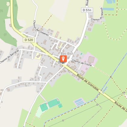
From Biol Le Haut car park, follow the direction of Reveret and Biol and follow the small stream to the footbridge. Join the D520, cross it carefully and then follow the D51 for 200m to reach the "La Moutonnière" post. Continue straight ahead until you reach Belmont, where you can have a picnic on an area arranged towards a (private) pond.
In Belmont, head towards "Bois Bessay" then pass the posts "les Chasseurs", "le Crépon" and "Les Planches" through the Poullins woods and the king's forest. After 1.4km, in the direction of "Les 3 Coches", there is a hunters' cabin (always open, with water, except in winter).
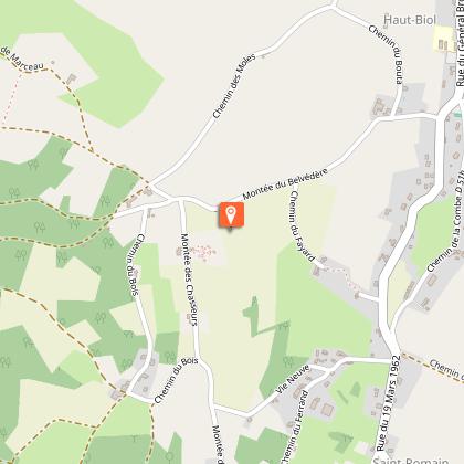
After the "Aux Bois" post, go back and forth to the orientation table. Finally, go down the small road to reach the departure car park.
WAYMARKING AND SIGNPOSTING
Follow yellow markings along the route and the following crosswards :
BIOL LE HAUT > Révéret > Biol > Le Moulin > Moutonnière > BELMONT > Bois Bessay > Les Chasseurs > Le Crépon > Les Planches > Les Trois Coches > Aux Bois > Retour BIOL LE HAUT
Technical Information
Altimetric profile
Starting point
Points of interest

Additional information
Tips
Biol, is a village with a rich heritage with a 15th century fortified house, its washhouse and its halls. In Belmont, admire the fortified houses with their traditional Dauphinois roofs. On the way, you will discover a stele in memory of the Americans' stay during the 2nd World War.
Updated by
Isère Attractivité - 15/04/2026
www.alpes-isere.com
Report a problem
Environments
In the country
Forest location
Village -2 km away
Open period
All year round daily.
Subject to favorable weather.
Contact
Phone : 04 76 32 11 24
Email : tourisme@valsdudauphine.fr
Website : http://www.tourisme-valsdudauphine.fr/
Facebook : https://www.facebook.com/valsdudauphinetourisme/
Location complements
From Bourgoin Jallieu take the D1085 towards Grenoble, after Nivolas Vermelle, turn left onto the D520, after 4km at "Le Rapoux", turn right, direction Biol le Haut, the car park is 100m after the church.
Topo guides and map references
Topo guides references :
Mapguide Les Vals du Dauphiné
Map references :
IGN card blue series 3133E
Tricky passages
Be careful crossing the D520 and along the D51.
