Tours
Activities
Places of interest
Where to eat
Where to sleep

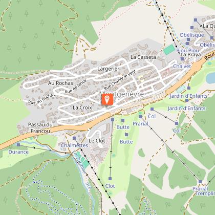
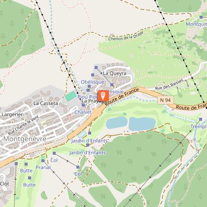
Montgenevre, Hautes-Alpes, Provence-Alpes-Côte d'Azur

Are you in charge of the destination?
Nestled in the stunning Hautes-Alpes, Montgenèvre is a picturesque and charming mountain resort that masterfully blends tradition and modernity. Situated at an altitude of 1860 meters, this resort offers breathtaking views of the Alps and a multitude of activities for all ages and seasons. In winter, Montgenèvre transforms into a paradise for snow sports enthusiasts with its alpine ski slopes, Nor...See more

Walking around Montgenevre

See more suggestions
Explore the walking circuits of Montgenevre.
See more suggestions
Espace Trail Montgenèvre 3000 - Parcours 1
67 m

Espace Trail Montgenèvre 3000 - Parcours 1

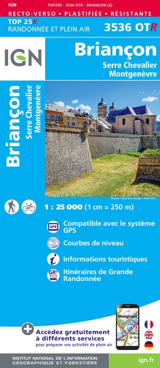
Route 1 - The Sestrières Wood fitness trail From the Espace Prarial, start on the French side towards the tree climbing area and cross a magnificent larch forest for 3 km (practically flat, even flat going down) to reach the belvedere and a breathtaking view of the upper Durance valley and the Briançonnais forts. The return journey will be via a small path (the health trail) still in the woods. Ideal course for the resumption of running, in the morning as well as in the afternoon, as it is very shaded. Snow Trail course laid out in the winter in the winter Multi-Activity Zone and used by the Sky Race Solidaire in the summer. Highest point: 2059 m (Belvedere) Type of route: loop Distance: 6 km Duration: 45 min to 1h30 Height gain: 125 m Height loss: 125 m Good advice and equipment You will evolve under your own responsibility in the mountains, even in the high mountains, with the ascent of Chaberton 3131 m for the most daring. The Espace Trail 3000 is certainly one of the highest trail areas in France. Inform yourself about the weather forecast before setting off on the red and black courses of the ETM. Your equipment must be adapted: lighter on the green and blue courses, but still with a 50 cl maximum water bottle and a windbreaker. It will be much more important on the red and black courses where mountain equipment is required. In a small rucksack adapted to running you will find energy gels, a water reserve of at least one litre (no water point or very little on the high altitude routes), a waterproof jacket with hood, a survival blanket, a whistle, an IGN 3536R map which covers all the routes, some compeed and thoughts, a telephone and a headlamp which can be useful at the end of summer.

7 km
Espace Prarial 320 Route d'Italie 05100 Montgenèvre
Show
Randonnée - La transfrontalière
286 m

Randonnée - La transfrontalière

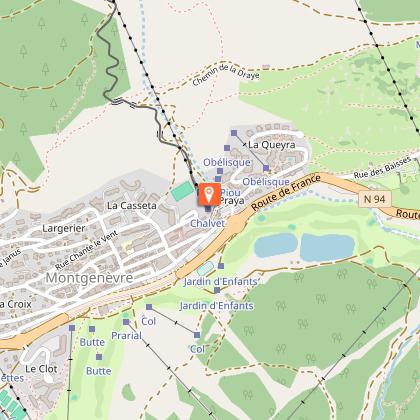
Ideal for families This pleasant walk through the woods will take you to the Italian village of Clavière. This route is very suitable for a family walk as it is not particularly difficult and is generally shaded You can admire many mountain flowers and enjoy the beautiful light through the trees. Highest point: 1860 m Route type: loop Distance: 6 km Duration: 2 h Height gain: 200 m Height loss: 200 m ITINERARY 1. Then go to the bus station. Take the road from the back of the bus station towards the lakes area. Go straight on until you reach the end of the second lake (Lac du Peychier) where you turn right 2. At the next crossroads, turn left (direction Clavière) and cross the Doire (La Dora). Continue to follow the track in the direction of Clavière (be careful, you are going along the golf course, so do not pass the barriers for safety reasons) 3. At the next intersection, turn left towards Clavière and follow the path down to the village. Once there, turn left to cross a small wooden bridge. Turn right immediately, cross the large bridge and turn left. Walk along the children's playground and you will find the church of Clavière on your right 4. For the return journey, go to the main road in Clavière and drive up it towards Montgenèvre. At the exit of the village, cross the plexiglass gallery, then the road to go to the place called La Valetta and take the path that goes up towards Montgenèvre (le Collet). This leads you to the entrance of the Montgenèvre motorhome area. Cross the road to take the path back to the village.

2 h
5.4 km
22 Gare Routière 05100 Montgenèvre
Show
Randonnée - Le Rocher Diseur
415 m

Randonnée - Le Rocher Diseur

First in the forest, this hike takes you to a magnificent viewpoint over the Clarée valley, then to the high altitude restaurant Les Terrasses. You can take advantage of this ride to go down on the Monty Express sled. Remember to get a sledge ticket before you go up. Highest point: 2130 m (Restaurant d'altitude Les Terrasses) Type of itinerary: loop Distance: 8 km Duration: 2 h 50 Elevation +: 370 m Elevation -: 370 m ITINERARY 1. From the Tourist Office, go left (opposite the office) into rue de l'église, then at the first crossroads turn right into rue de la Praya. Follow Rue de la Praya 2. Turn right onto Rue du Rocher Diseur, then right again onto Rue de la Combe. You are now leaving the village 3. Turn right onto the path leading up into the wood, towards Rocher diseur. 4. You reach a track, turn left on the track, to the place called Sous le Rocher Diseur. 5. Go straight up the rocky spur towards Rocher Diseur. At the top, you can admire a large part of the Clarée valley and in the distance Briançon and its forts. On your right, a military pill 6. Go straight back along the track to the junction with the path you came up on. Do not take the path, continue to follow the track (ETM 10 markings) to the Terrasses restaurant where a beautiful view of the mountain side of Les Chalmettes awaits you. 8. To go back down to the village, turn right just after the children's playground, direction Montgenèvre centre and follow the track which first winds along the rail sledge and then away from it (ETM 10 markings, steep track at the start). 9. At the end of the track, turn left onto Rue de la Combe and follow the same route as before to find the Tourist Office.

3 h
7.9 km
Office de Tourisme 767 Route d'Italie 05100 Montgenèvre
Show
Randonnée - Le lac des Anges par le Télémix des Chalmettes
424 m

Randonnée - Le lac des Anges par le Télémix des Chalmettes

From the top of the Chalmettes telemix, you will descend quietly to the Anges lake before reaching the banks of the Durance. From the lake you can enjoy a beautiful view of Mont Chaberton and learn about the rocks around you thanks to the geological panels at the entrance to the lake. Highest point: 2200 m (Top of the Chalmettes telemix) Type of route: loop Distance: 4 km Duration: 1h 20 (+ 10 min TMX) Ascent +: 40 m Ascent -: 420 m ITINERARY 1. Take the Chalmettes telemix 2. On arrival, turn right and follow the track down to the Gondrans plain. 3. At the first junction, turn left towards the chalet and lake and climb the small slope to reach the lake. Walk halfway around it to the geodrome 4. From the geodrome, turn right onto a path that leads down towards Montgenèvre. At the crossroads turn left to reach the Gondrans chairlift 5. Pass the chairlift and take the La Durance mountain bike trail down to your right. The track is wide, but stay well to the edge of the track to avoid any accident with a cyclist. A path goes off to the right and crosses the Durance stream which is still just a stream, so don't take it. Go straight on. 6. You will cross the Durance without realising it (it goes underground). At the next crossroads, leave the mountain bike track and turn left onto the path (towards the Durance bridge). Go along the Durance river 7. You reach a track, turn right and walk up the track to the nets (staying on the edges as you share the track with mountain bikers). 8. At the nets, turn left through the special pedestrian crossing to find yourself on the other side of the nets. Follow the path on your left which descends quietly to the Durance bridge (do not enter the golf course which is on your right). From the bridge, walk back down to the Chalmettes car park.

2 h
5.9 km
TMX des Chalmettes A côté de Durancia 05100 Montgenèvre
Show
Randonnée - Le Lac des Anges
468 m

Randonnée - Le Lac des Anges

First in the undergrowth, you join a forest track to reach the Gondrans meadows and the Lac des Anges. The return journey is along a pleasant path alongside the Durance. Highest point: 2161 m (Lac des Anges) Type of route: loop Distance: 6.5 km Duration: 2.5 hours Ascent +: 360 m Ascent -: 360 m ITINERARY 1. Meet in front of the Durancia centre. Take the path that runs alongside the building on the left (towards Espace multi-activité) 2. At the Durance bridge, continue straight ahead (towards Lac des Anges) along the tennis courts. At the white sign Source de la Durance, turn right. Follow the path and continue until you reach a small bridge. Go straight on until you reach a track 3. Follow the track on the right (ETM 3 markings) to the Gondrans chairlift. 4. Go past the chairlift and continue up the piste (ETM 4 markings) 5. At the yellow sign indicating Le Chenaillet, turn right. Walk a few metres on the track, then leave it to follow a path on your left that slowly diverges from it and leads to the entrance of the lake and the geodrome. 6. For the return journey, take the same route to the foot of the Gondrans chairlift. Pass the chairlift and take the La Durance mountain bike track which goes down on your right (on the edge of the track, priority to mountain bikers). 7. At the next crossing, leave the MTB track and turn left onto the path (towards the Durance bridge). Walk along the Durance. 8. You reach a track, turn right and go up the track to the nets. 9. At the nets, turn left through the special pedestrian crossing. On the other side of the nets, follow the path on your left which descends quietly to the Durancia.

3 h
6.3 km
TMX des Chalmettes A côté de Durancia 05100 Montgenèvre
Show

What to do in Montgenevre

See more suggestions
Explore the bookable activity options in Montgenevre for all tastes and ages.
See more suggestions
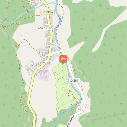
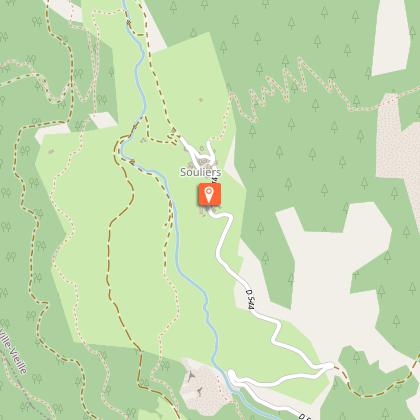
Les Drayères mountain hut
24 km

Les Drayères mountain hut

Ski instructors and mountain guides Anne & Boris welcome you at the bottom of the Clarée valley. The refuge is ideally located in an area rich in lakes, at the start of a wide variety of itineraries. Friendly and comfortable: The atmosphere is warm and friendly. The refuge team welcomes you for a night, a stay, a meal or a snack. Warm up by the stove after your mountain outing and enjoy a moment of sharing or relaxation in the new lounge. A library and board games await you. In the bright and spacious dining room, you can enjoy a beautiful view of the valley floor. Each dormitory is equipped with cosy comforters, so a fitted sheet is all you need. There are also hot showers and a place to dry your shoes. The refuge belongs to the FFCAM. We can accommodate 64 people in dormitories of 4, 6 and 8 places. Whenever possible, we reserve a dormitory for the same group. The dining room and 4 dormitories for 32 people (with blankets) are at your disposal when you're not on guard duty. Please leave the refuge clean and pay for your night in the box inside the refuge. To facilitate our organization and the smooth running of the refuge, we ask you to book your half-board on line or by telephone during the seasons on +33 (0)4 92 21 36 01. Cuisine: We offer simple, healthy, home-cooked cuisine! Most of the products we use are organic or locally grown. If you wish, we can prepare snacks for your hikes the following day. Just let us know when you arrive at the refuge. All day long, we serve à la carte meals and offer the possibility of eating on the terrace in the sun or inside by the stove. In the evening, a communal meal is served in the dining room. For those with special dietary requirements, we'll do our best to accommodate. NEW YEAR'S EVE Come and enjoy the early winter powder at the refuge des Drayères. Whether you're ski touring or snowshoeing, it's ideally situated at the center of many easy itineraries. In a magical setting, you'll find the refuge in its coat of snow. We offer a convivial mountain meal, homemade mulled wine and a festive aperitif... Simplicity and sharing after a beautiful day in the mountains are part of the magic of life in a refuge during the winter season. Try the New Year's Eve experience at the Drayères refuge! For bookings, ensure your bed on our online reservation, deposit required: 10€ per person per night. For further information, please contact us by telephone on 06.45.74.07.93 Please do not hesitate to contact us for further information: Mail : refugedesdrayeres@gmail.com Phone : 04.92.21.36.01 Facebook : Gardien Refuge des Drayères

Haute Vallée de la Clarée 05100 Névache
Book from 0 €Book
Show

What to visit in Montgenevre

See more suggestions
Explore the cultural heritage of Montgenevre.
See more suggestions

Where to eat in Montgenevre

See more suggestions
Restaurants in Montgenevre offer a friendly atmosphere.
See more suggestions
Where to sleep in Montgenevre

See more suggestions
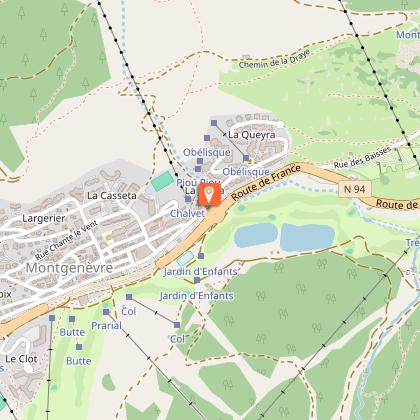
Explore accommodation options in Montgenevre.
See more suggestions
Les Drayères mountain hut
24 km

Les Drayères mountain hut

Ski instructors and mountain guides Anne & Boris welcome you at the bottom of the Clarée valley. The refuge is ideally located in an area rich in lakes, at the start of a wide variety of itineraries. Friendly and comfortable: The atmosphere is warm and friendly. The refuge team welcomes you for a night, a stay, a meal or a snack. Warm up by the stove after your mountain outing and enjoy a moment of sharing or relaxation in the new lounge. A library and board games await you. In the bright and spacious dining room, you can enjoy a beautiful view of the valley floor. Each dormitory is equipped with cosy comforters, so a fitted sheet is all you need. There are also hot showers and a place to dry your shoes. The refuge belongs to the FFCAM. We can accommodate 64 people in dormitories of 4, 6 and 8 places. Whenever possible, we reserve a dormitory for the same group. The dining room and 4 dormitories for 32 people (with blankets) are at your disposal when you're not on guard duty. Please leave the refuge clean and pay for your night in the box inside the refuge. To facilitate our organization and the smooth running of the refuge, we ask you to book your half-board on line or by telephone during the seasons on +33 (0)4 92 21 36 01. Cuisine: We offer simple, healthy, home-cooked cuisine! Most of the products we use are organic or locally grown. If you wish, we can prepare snacks for your hikes the following day. Just let us know when you arrive at the refuge. All day long, we serve à la carte meals and offer the possibility of eating on the terrace in the sun or inside by the stove. In the evening, a communal meal is served in the dining room. For those with special dietary requirements, we'll do our best to accommodate. NEW YEAR'S EVE Come and enjoy the early winter powder at the refuge des Drayères. Whether you're ski touring or snowshoeing, it's ideally situated at the center of many easy itineraries. In a magical setting, you'll find the refuge in its coat of snow. We offer a convivial mountain meal, homemade mulled wine and a festive aperitif... Simplicity and sharing after a beautiful day in the mountains are part of the magic of life in a refuge during the winter season. Try the New Year's Eve experience at the Drayères refuge! For bookings, ensure your bed on our online reservation, deposit required: 10€ per person per night. For further information, please contact us by telephone on 06.45.74.07.93 Please do not hesitate to contact us for further information: Mail : refugedesdrayeres@gmail.com Phone : 04.92.21.36.01 Facebook : Gardien Refuge des Drayères

Haute Vallée de la Clarée 05100 Névache
Book from 0 €Book
Show
Caution!
We have no information on the difficulty of this circuit. You may encounter some surprises along the way. Before you go, please feel free to inquire more and take all necessary precautions. Have a good trip! 🌳🥾