Tours
Activities
Places of interest
Where to eat
Where to sleep
Montgenevre, Hautes-Alpes, Provence-Alpes-Côte d'Azur
Are you in charge of the destination?Nestled in the stunning Hautes-Alpes, Montgenèvre is a picturesque and charming mountain resort that masterfully blends tradition and modernity. Situated at an altitude of 1860 meters, this resort offers breathtaking views of the Alps and a multitude of activities for all ages and seasons. In winter, Montgenèvre transforms into a paradise for snow sports enthusiasts with its alpine ski slopes, Nor...See more
Walking around Montgenevre
See more suggestionsExplore the natural surroundings of Montgenevre.
See more suggestions


What to do in Montgenevre
See more suggestionsExciting adventures await you in Montgenevre, book now.
See more suggestions


IGN cards
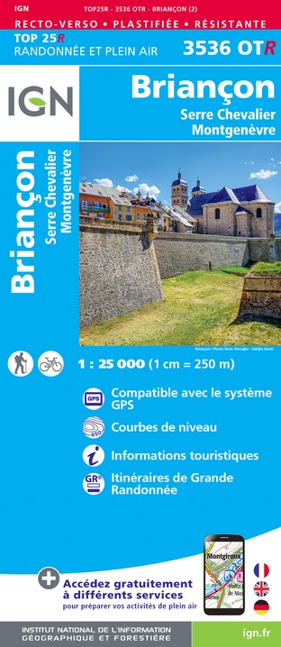
3536OTR - BRIANCON RESISTANTE SERRE CHEVALIER MONTGENÈVRE
Editor : IGN
Collection : TOP 25 RÉSISTANTE
Scale : 1:25 000
17.20€

3536OT - BRIANÇON SERRE CHEVALIER MONTGENÈVRE
Editor : IGN
Collection : TOP 25 ET SÉRIE BLEUE
Scale : 1:25 000
13.90€

TOP75005 - BRIANCONNAIS QUEYRAS
Editor : IGN
Collection : TOP 75
Scale : 1:75 000
9.80€

202 JURA ALPES DU NORD
Editor : IGN
Collection : TOP 200
Scale : 1:200 000
6.80€

D38 ISÈRE
Editor : IGN
Collection : CARTES DÉPARTEMENTALES IGN
Scale : 1:150 000
5.90€

D04-05 ALPES-DE-HAUTE-PROVENCE HAUTES-ALPES
Editor : IGN
Collection : CARTES DÉPARTEMENTALES IGN
Scale : 1:150 000
5.90€

NR16 PROVENCE-ALPES-CÔTE D'AZUR
Editor : IGN
Collection : CARTES RÉGIONALES IGN
Scale : 1:250 000
6.80€

NR15 AUVERGNE-RHÔNE-ALPES RECTO/VERSO MASSIF ALPIN
Editor : IGN
Collection : CARTES RÉGIONALES IGN
Scale : 1:250 000
6.80€

NR14 AUVERGNE-RHÔNE-ALPES RECTO/VERSO MASSIF CENTRAL
Editor : IGN
Collection : CARTES RÉGIONALES IGN
Scale : 1:250 000
6.80€

EUROPE
Editor : IGN
Collection : DÉCOUVERTE DES PAYS DU MONDE IGN
Scale : 1:2 500 000
7.00€
What to visit in Montgenevre
See more suggestionsRelax in the parks of Montgenevre.
See more suggestions


Where to eat in Montgenevre
See more suggestionsThe restaurants of Montgenevre await you.
See more suggestions


Where to sleep in Montgenevre
See more suggestionsBook your stay at one of Montgenevre's accommodations.
See more suggestions


