Tours
Activities
Places of interest
Where to eat
Where to sleep

Camping Around Aveyron: Discover L'hospitalet-du-Larzac

Are you the owner?
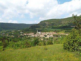
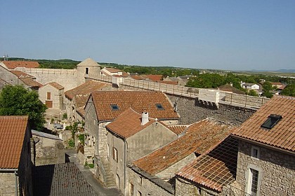
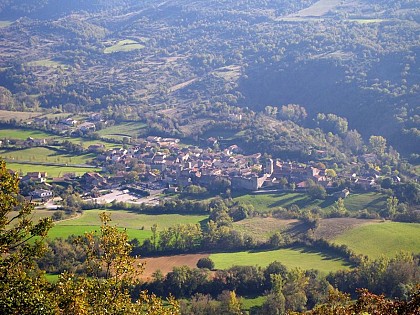
Nestled in the heart of Aveyron, L'hospitalet-du-Larzac reveals itself as a gem of the Midi-Pyrénées region. Nature and heritage enthusiasts will be thrilled by the array of activities and attractions around this charming village. Dive into history by visiting the Templar and Hospitaller sites of Larzac, just minutes from your campsite. Hiking enthusiasts will find joy on the trails weaving throug...See more

Walking around CAMPING AU TOUR DE L'AVEYRON

See more suggestions
Walks and hikes around CAMPING AU TOUR DE L'AVEYRON.
See more suggestions
Canoles Trail via the forest house
3 km

Canoles Trail via the forest house

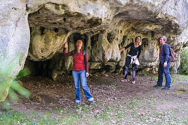
In the forest, all the fantasy of the karst relief unfolds along the way: rock shelters, stone arches, caves… right up to the canoles, rocky notches barely wider than a backpack! Annual closure of access to Canoles from October 1st to November 30th in accordance with the municipal decree of September 25, 2025 n° AR-ADM-2025-17. From the parking area, follow the track towards Canalettes for approximately 2.5 km (crossing two cattle grids). Leave the track to the left and take a path through the woods. After about 170 m, on the right, you'll find a cavity with a hole in the ceiling called "La grotte éclairée" (the illuminated cave). Continue along the marked path until you reach the track. Follow it to the left for 200 m to reach the Canalettes forest house. Go through the gate just past the house. 100 m further on, make a short out-and-back detour to the left through the ONF (National Forestry Office) arboretum to see the lavogne (a traditional water tank). Then continue to the left; the path descends slightly. 150 m further on, follow the signs for "Abri des Canalettes" (Canalettes Shelter), pass the Mousterian shelter, and continue on a small path that climbs gently and then veers left. At the intersection with another path, turn right and continue for approximately 600 m. The path turns south and the ground becomes sandy; a rocky chaos comes into view on the right. The path is well-defined and leads to a stone arch. Pass under it and immediately turn right. Go past a large, pyramid-shaped rock, then head left to pass Le Crâne du Géant (the Giant's Skull). Continue straight ahead, leaving a cave with a built section on your right. The path climbs slightly to reach "Le sanctuaire de l'homme mort" (the Sanctuary of the Dead Man) on the left. Continue along the rocks sculpted by water and erosion to arrive at "La Grotte de la Sorcière" (the Witch's Cave). Leave the cave to your right and continue along the path. At the crossroads, turn right onto the path through the forest. Further on, the ground becomes sandy and stony, leading to the entrance of the first canole. Take the small path to the right that descends between two cairns (piles of stones erected by hikers to mark a location) to visit the canole. At the back, there is a cave with a sinkhole (bring a flashlight). Retrace your steps to the cairns and descend to the right. 50 meters further on, take the path on the right that leads to the second canole. Make the round trip. At the exit of the canole, continue straight ahead on the path through the forest. It opens onto a clearing. Cross it and then continue straight ahead through the woods to reach a second clearing. Turn left to visit the Sébillère cave. Retrace your steps and continue straight ahead on a wide path to reach the track at the cattle grid. Cross the fence and turn right to return to the starting point.

3 h
9 km
Easy
Show
The "canoles" via the Durzon spring
7.4 km

The "canoles" via the Durzon spring

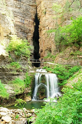
A refreshing hike along the eastern edge of the Larzac, where water—the plateau’s hidden treasure—surfaces in various forms: the Durzon spring and the dampness of the "canoles", natural, moss-covered fissures. From the car park, cross the bridge, turn right at the cross, and—70m later—continue right onto the dirt track. Leave the tufa bridge on your right and veer left. 200m further on, at the fork, keep right and continue for 800m to the spring. The path climbs above the spring (a steep ascent through woods and rocks for 500m). Then, the path winds through the woods for 1km before intersecting a wide track. Turn right and pass the Mousterian shelter. The path rises gently, then veers left. At the next junction, turn right and continue for 600m. The track heads due south, leading to a stone arch. Pass beneath it and bear right, passing by rock formations. Continue straight ahead, leaving a first cave on your right, then "Sanctuaire de l’Homme Mort" (Sanctuary of the Dead Man) on your left. Follow the path alongside water-sculpted rocks to the "Grotte de la Sorcière" ( the Witch's Cave) and leave it on your right. 50m further on, at the junction, turn right. The ground becomes sandy and stony, leading to the entrance of the first "canole" (a narrow, rocky fissure). Take the path to the right to explore it. At the far end, there is a cave with a vertical shaft (bring a flashlight). Retrace your steps and head back down to the right; 50m further on, turn right again to reach the second "canole". Walk to the end and back. Upon leaving the "canole", continue straight along the forest path, crossing a clearing and a stretch of woods before reaching a second clearing. Take a short detour to the left to see the "grotte de la Sébillère" (a cave),  then continue along a wide track until you reach the junction with the main trail (cattle grid). Turn left onto the trail. After about 700m, leave it by turning left onto a path through the woods. Pass "la grotte éclairée" (the illuminated cave) and follow the marked path until you reach the track again. Follow the track to the left as far as the Canalettes forest house. Take a short detour behind the farmhouse to see the "lavogne" (cobbled watering place) and the arboretum. Then continue along the track towards La Portalerie for 300m. Bear left onto the grassy path heading towards Pas de la Mule. After 500m, make a sharp left turn and continue descending along the track for 600m through the forest. Turn right onto a narrow path at a concrete marker post inscribed with the number 21. The path winds along before beginning the descent through the rocks. Pass through Pas de la Mule and continue downhill until you reach the path running alongside the Durzon river (point 2). Turn right to return to the starting point.

4 h
13 km
Medium
Show
De St-Jean-d'Alcas à Sylvanès
16 km

De St-Jean-d'Alcas à Sylvanès

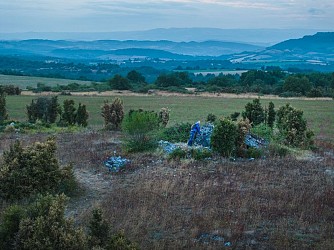
This hike which provides some amazing contrasts joins up with the Mascourbe agro-pastoral plateau, then runs down into the pleasant Sorgues valley and eventually ascends the forested mountain towards Sylvanès. Walk along the St Jean d’Alcas fort by heading west. At the first intersection take left a small descending road. The road then runs uphill. Leave the right road and in a left hand curve take opposite the first bouissière in the direction of Mascourbe via the dolmens. Soon you will make out on your right a cazelle in good condition. A bit further on, the path runs across a cultivated field and nearby, the beautiful building of Ramondenc is worth seeing. The path rises on the Causses and reaches the 2 dolmens of Mascourbes.    Enjoy the beautiful view over the Lévezou, the Larzac, the Escandorgue, and the Montagne Noire. As you reach a small road, take it on your left to walk past the Borie which is an ancient farm of the Hospitaller Commandery in St Félix. At the signboard indicating Mascourbe, just before the first house, take left into the bouissière which leads to the plateau. At the junction with a trail, take the trail to the right. 500 m further on the trail reaches a power line, fork to the left to come up to the stone cross of Mascourbe which overlooks the Sorgues valley. Walk by the main trail down to the bottom of the Cantillergues dale. Just before entering the village of St Félix, the trail turns into a sunken path that runs to the centre of the village. St Félix is an ancient Hospitaller Commandery and has kept evidences of its past: fountain, washing place, St Jean gate, battlements, covered passages, heritage house and 13th century Old bridge. From the ancient inn, take the calade (road paved with cobblestone) that runs down to gardens and the Sorgues river. Cross the bridge over the river and take the small road to the right towards St Caprazy for approximately 700 m, then in a left curve take right the path that leads to St Caprazy (ancient medieval hamlet). The path crosses a first trail, then a second one just before joining the Vareilhes farm. Before reaching Vareilhes take left into the splendid bouissière that goes up to the Loubière. Once you’ve reached the Loubiètre pass, take the trail to your right and immediately after walk downhill to the            left to reach the Bâtisse farm. Walk down to the right to reach the D540 after the Mas Nau and take right that road for 500 m. Before the small car park, take a track which starting point is not clearly visible and which runs down after a curve on the left side of the road, throughout a field first, then along a hedge. Ford the Vernhes brook. Reach the Combalou hamlet, walk downhill to the right to join the D540. After the bridge take the road to the left, pass through the hamlet of Rigal before reaching Sylvanès

5 h
18 km
Medium
Show
From St-Jean-d’Alcas to the Mascourbe plateau
16 km

From St-Jean-d’Alcas to the Mascourbe plateau

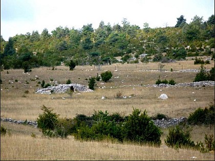
Saint-Jean-d’Alcas Fort, a Cistercian jewel is the starting point for a trip back in time and an exploration of the Mascourbe plateau, along dolmens and evidences of agro-pastoralism. From St-Jean d’Alcas fort, walk along the protective wall heading to the West, then carry on along the road. At the first intersection walk downhill to the left and keep walking on the small road. In a left curve, let a road marker indicating the direction of Mascourbe via the Puech and 50 m after take a “bouissière” (box hedges). After approximately 1 km, cross the road that links Saint-Jean- d’Alcas to Saint-Félix de Sorgues and continue through the “bouissière”. The track leads to a field, walk around it to the right, then tread across it up to a trail. Carry on along that trail to the right. After approximately 450 m, leave the trail on the left to make a short 100 m round trip to the dolmen des Places. At the next intersection of trails take the one that runs down to the left. After 350 m, get through the door of the stock grid, walk along the fence up to a sheepfold. Go through the gate (close it properly) and carry on to the right of the fence. The path continues Southward. At the signpost of a path intersection, turn right towards Mascourbe. Go through another stock grid, then continue to the right towards Mascourbe via the 2 km long "buissière" which is the ancient path linking the chartreuse de Nonenque with Mascourbe. At the exit of the "buissière", turn to the right on the trail. At the junction with the road take it to the right, walk past the Borie du Commandeur, and shortly after take for 200m the small ascending road to the left. At the marker to your right, head towards Saint-Jean d’Alcas. The path runs alternately through a typical caussenard landscape and cultivated areas to reach the two dolmens in Mascourbe. You will enjoy some beautiful panoramas towards the Larzac, the Combalou and the Levézou. As you walk down to St-Jean d’Alcas, you pass close to the beautiful Ramondenc farm. As you get close to St-Jean d’Alcas you will notice on the left side a well preserved cazelle. The circuit ends by retracing your steps by the small road you took at the start. © Laurent PRIVAT - Asso des Amis de St-Félix

3 h
10 km
Easy
Show

What to do in CAMPING AU TOUR DE L'AVEYRON

See more suggestions
Choose from a variety of activities in CAMPING AU TOUR DE L'AVEYRON and book your favorites.
See more suggestions
Alti Aigoual resort
32 km

Alti Aigoual resort

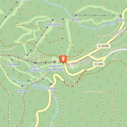
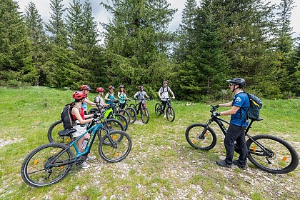
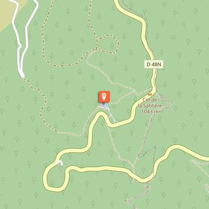
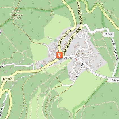
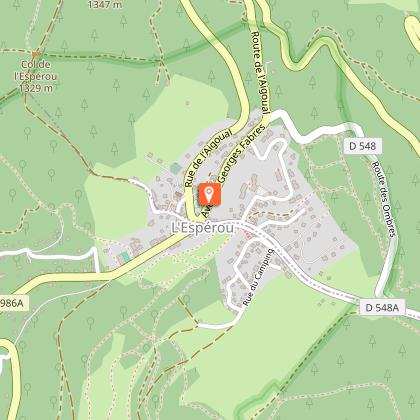
Family-friendly mid-mountain ski resort on the slopes of the Aigoual massif. At the Col de Prat-Peyrot, multi-activities all year round: hiking, horse-drawn carriage rides, electric-assisted mountain biking, horse-riding, accrofilet. Winter season - altitude 1440 m: 13-hectare ski area. Exposures: northwest and south. All information on opening times, resort opening hours and webcams can be found daily on the resort's website: www.stationaltiaigoual.com Ski pass sales on site. - Downhill skiing 10 runs: 4 green (Sources 1 and 2, Ermitage 2 and 3), 3 blue (Ermitage 1, Cougourles, Tindelles), 3 red (Tindelles and Cougourles). 1 Family Parc: 3 modules on the Ermitage 3 track. the natural Cougourles, a red-rated run left in its natural state for committed skiers! (Beginners not permitted). - Nordic skiing: 50 km of marked and groomed trails. More than 50 kilometers of cross-country ski trails are marked at the resort. Some trails are even approved by the French Ski Federation to host national competitions! Some 20 kilometers are regularly groomed to ensure that everyone can enjoy the trails. - Snowshoeing, pedestrians, dogs, multi-activities: Not permitted on cross-country ski trails. 3 new loops from the heart of the resort are marked out for family fun in the snow, snowshoeing or other snow activities: the green "Sapinière" trail, the blue "Point sublime" trail and the red "Observatoire" trail. The latter is reserved exclusively for snowshoeing. Departure and arrival behind the buildings. - Tobogganing: 2 toboggan runs: 1 at the resort, 1 at L'Espérou. Le Chalet" self-service restaurant with menu and daily specials. Ample parking. Please note: no equipment rental at the resort; rental is available at L'Espérou, the last village before arriving at the resort. For information on road conditions, visit www.inforoute30.fr or www.inforoute48.fr

col de Prat-Peyrot / Mont-Aigoual 30570 L'Esperou
Book from 0 €Book
Show
Cigale Aventure - Climbing
33 km

Cigale Aventure - Climbing

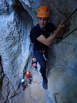
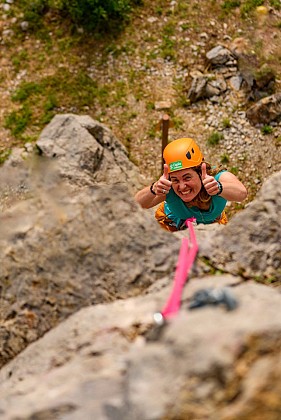
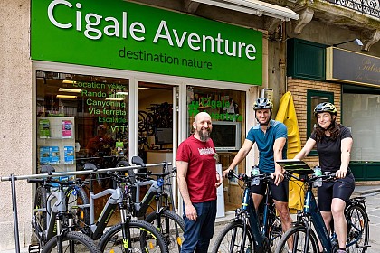
From discovery to guiding on major routes, Cigale Aventure's instructors know the best climbing spots in the Languedoc region like the back of their hands. There's no doubt that you'll have a great time climbing and surpassing your limits. Discover the vertical environment or improve your skills with our climbing activities, designed for beginners and experts alike: Sport climbing : Experiment and progress technically during our "moulinette" sessions: you climb one-length routes in pairs, alternately belaying each other, with the advice of your instructor. During the session, you have the opportunity to try out different routes, adapted to your level. This is the classic session, perfect for an initiation, a discovery, to discover the cliff when you're new to the gym, or to progress technically. Adventure Course Our cliff adventure courses are real abseiling treks. They are not very technical, with simple climbs and big abseils. You don't need to be an experienced climber to try them out, but you do need to have no fear of heights. It's sure to be a thrill! Long routes If you've already been climbing with a lead rope, gradually become autonomous on multi-pitch routes, experimenting in a safe and friendly environment. Learn the right moves, climb management and safety techniques. In just a few belays, you'll gain height, guided by your expert instructor. With Cigale Aventure, you can enjoy other adventures: bike rental, cycling holidays, canyoning, caving, via-ferrata, canoeing. Visit our website to find out about all our activities.

3, rue de l'horloge 30120 Le Vigan
Book from 0 EURBook
Show

What to visit in CAMPING AU TOUR DE L'AVEYRON

See more suggestions
Enjoy the green spaces of CAMPING AU TOUR DE L'AVEYRON.
See more suggestions
Where to eat in CAMPING AU TOUR DE L'AVEYRON

See more suggestions
Savor culinary specialties in CAMPING AU TOUR DE L'AVEYRON.
See more suggestions
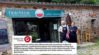
The Mutfak Kitchens of Anatolia
39 km

The Mutfak Kitchens of Anatolia

Anouck and Gürkan offer dishes flavored and spiced with Turkey and Greece at the foot of Mont Aigoual. Turkish-Greek-Kurdish-inspired TRAITEUR. Catering and delicatessen. Local & organic. + Private events, celebrations, seminars, training courses. Because going to La Mutfak (cuisine in Turkish) also means learning about other cultures, through gastronomy, dare to pass through the door of the charming Atelier-Boutique on the road to Mont Aigoual. You'll find daily takeaways and a delicatessen from Greece and Turkey. EVERYTHING IS HOMEMADE! Afiyet Olsun! Enjoy your meal! TO EAT IN OR TAKE AWAY Or nibble on a picnic while walking in the mountains or by the river Off-season: subscribe to our WhatsApp list to receive schedules and menus! Summer: Our small terrace in the shade of the plane tree is open from Wednesday to Sunday. ON THE MENU according to season and chef's moods Tasting plate at 9€ with 3 mezzés of the day, a falafel, a borek + in summer only; Greek-inspired salads, fresh and original sandwiches, köfte our melting ground beef balls, roast chicken... A menu of MEZZES that change with the seasons (non-exhaustive and changing list): HAYDARI: yoghurt with garlic, dill & mint HOUMOUS ORIGINAL: chickpeas with sesame seeds EZME: mashed seasonal vegetables FALAFELS: 1000-spice chickpea dumpling with sesame-lemon sauce BÖREK CIGARETTES: Feta and herb rolls GÖZLEMES : Kurdish pancakes filled with seasonal products FRITES MAISON : with Oregano & sweet pepper or plain DELICIOUS DAILY DESSERTS EVERY WEEK! BAKLAVA MAISON: millefeuille garnished with pistachios, walnuts and orange blossom syrup MOELLEUX DU JOUR: with almond and candied orange, lemon verbena, pistachio glaze or others KURABIYE: various small cookies with changing recipes Every SATURDAY, we're at the market in Le Vigan And at nearby public events... Follow us on social networks Instagram and Facebook la.mutfak

lieu dit CLUNY D986 route de Valleraugue juste après le coopérative des oignons doux 30570 Saint-André-de-Majencoules
Book from 0 €Book
Show

Where to sleep in CAMPING AU TOUR DE L'AVEYRON

See more suggestions
Discover available accommodations around CAMPING AU TOUR DE L'AVEYRON.
See more suggestions
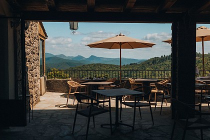
The Amorié
57 km

The Amorié

In the heart of the historic Cévennes, l'Amorié is nestled in one of the many folds of the Cévennes mountains. The reception is done in an authentic hamlet with an architecture preserved for more than three centuries. This exceptional location allows for numerous nature activities all year round. The buildings can accommodate 28 people: 6 rooms from 2 to 6 single beds (including 10 bunk beds), living spaces open onto large covered terraces, a dining room and a sanitary block inside. L'Amorié is a group lodging approved by the Ministry of Youth, Sports, Popular Education and Associative Life. Authorization number 303 290 001. The Association Départementale des Francas du Gard was created more than 60 years ago. It is a popular education movement, an association that complements the public and secular school system. It brings together men and women who work on a daily basis to bring to life the national project "With children and young people, together for education! It develops a program of interventions in favor of associations and communities that organize leisure, educational, social or cultural activities for the inhabitants of the department. Today, it federates a network of about 60 municipalities and 25 associations. Since 2013, the Association has wanted to develop its educational project on the center "l'Amorié" and more particularly on the following themes: environmental education and sustainable development, art, culture and intercultural learning to live together. Today, the reception and environmental education center "L'Amorié" in Thoiras (30) has become the ambassador of the environmental and eco-citizenship project of the Association Départementale des Francas du Gard in the department and the Occitanie region. It is located in the heart of the Cevennes, close to a multitude of sports, cultural and leisure activities

Pallières Thoiras 30140 Thoiras-Corbès
Show
Caution!
We have no information on the difficulty of this circuit. You may encounter some surprises along the way. Before you go, please feel free to inquire more and take all necessary precautions. Have a good trip! 🌳🥾