Tours
Activities
Places of interest
Where to eat
Where to sleep

Discover the magic of La grave with MAISON FAMILIALE LA ROMANCHE

Are you the owner?
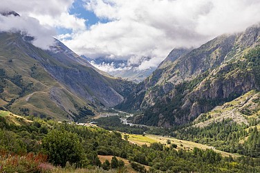
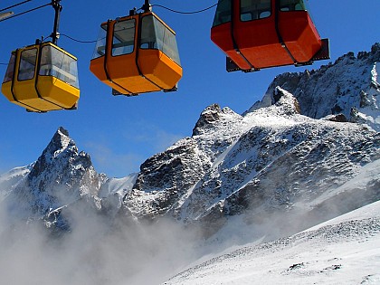
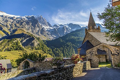
Nestled in the heart of the Hautes-Alpes, MAISON FAMILIALE LA ROMANCHE invites you to explore the wonders of La Grave and its surroundings. Located in the stunning Provence-Alpes-Côte d'Azur region, La Grave is the perfect destination for nature lovers, history buffs, and outdoor sports enthusiasts. Start your adventure with a visit to the majestic La Meije glacier, a must-see site offering breath...See more

Walking around MAISON FAMILIALE LA ROMANCHE

See more suggestions
Explore the hiking trails around MAISON FAMILIALE LA ROMANCHE.
See more suggestions
The Cruq des Aiguilles loop
137 m

The Cruq des Aiguilles loop

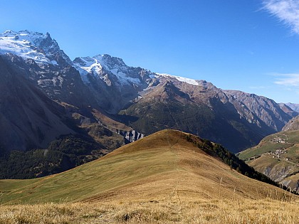
The Lac du Goléon site is only accessible to hikers after a climb from Valfroide; the proposed itinerary over the beautiful "Cruq des Aiguilles" pass offers a varied, more alpine alternative. From Les Hières, follow the good carriageway along the valley towards Valfroide and 500 m before the Entraigues parking lot, turn left onto the tractor track towards "la Sauce"; Cross the hamlet then climb (east) towards the Serre Coupa kidney; spot and follow the path that winds steeply up the "côte Lombarde" and at around 2200 m reaches flatter grassland that leads to the ruins of Puy Garnier (2346 m). From this point continue northwards, crossing a small stream and continuing slightly uphill to pass close to the water catchment area (drinking water supply for the hamlets of La Grave). It's easy to spot the Cruq des Aiguilles, an attractive U-shaped pass 300 m higher up. Climb the first steep slope up to the ridge overlooking the valley (ruiniform rocks), then after a short flat at the foot of the pass, reach the pass via a steep, stony slope (2707 m). The descent to the refuge and lake is on the other side (east), over grassy slopes cut by small rocky projections. After a well-deserved break, take the steep, stony downhill path through hay meadows to the hamlets of Valfroide, then the wide track back to the starting point of the itinerary at Les Hières. PS: it is possible to drive from Les Hières to the Entraigues parking lot, but the junction is difficult.

7 h
13 km
Hard
Parking des Hières Les Hières 05320 La Grave
Show
Signal de La Grave loop
1.4 km

Signal de La Grave loop

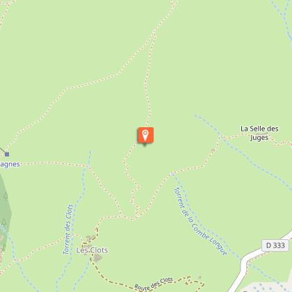
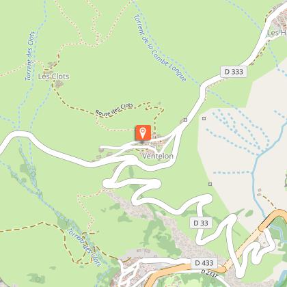
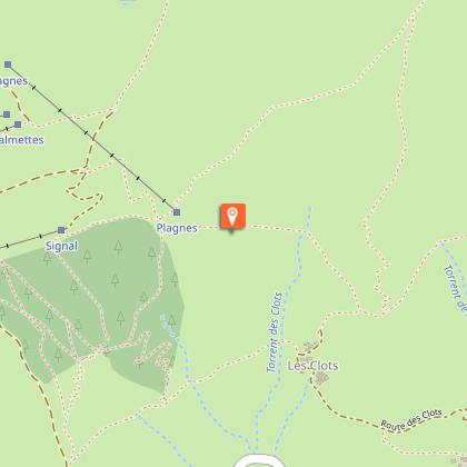
The Signal de La Grave towers a thousand meters above the Romanche valley. Its summit offers a panoramic view of the entire canton. It also offers exceptional views of the northern slopes of the Meije. The summit also offers views of the Goléon peak and the Martignare valley, which opens the door to Savoie. The climb from La Grave is steep and south-facing, so it's best to start early in the morning. Along the way, you can refresh yourself at the fountains of Ventelon, Les Clots and Les Terrasses. Loop details : From the La Grave Tourist Office, walk up through the village towards the church, leaving it on your left and continuing straight on uphill, passing the last houses and forking off very quickly to the right towards Ventelon, a hamlet that can be reached in about an hour; walk up the hamlet and take the good track that leads to "Les Clots" (1916 m), pass in front of the fountain and 100 m further on take the path on the right that climbs up. At the next junction, turn right towards Celle des Juges, then 200 m further on, leave the path which continues up the steep Cote Belle slope; follow the path, in places poorly marked, which leads to a small collet (2252 m) on the Signal ridge, and follow it to the right as far as the summit (2446 m) (cairn). Descend by the same route as before, but when you reach the collet, continue along the "côte rouge" ridge: reach the top of the Chazelet lifts and turn right towards Les Plagnes. Once you've reached a good track, turn left and continue along it, passing under the small state forest, as far as the oratory (orientation table); cross the small road and take the GR 54 opposite, which leads to Les Terrasses and then across the "champs Lombards" to La Grave.

6 h
12 km
Hard
D 1091 Devant l'office de tourisme La Grave 05320 La Grave
Show
The letter carrier's path
1.4 km

The letter carrier's path

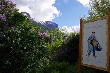
Until the 1970s, the letter carrier made his rounds on foot. Follow in his footsteps along the GR54 trail from La Grave to Le Chazelet. Your path will be embellished by painted flower "stamps" that the letter carrier may have lost along the way. From the La Grave tourist office, walk up through the village towards the church, leaving it on your left, and continue straight on uphill, passing the last houses until you come across the first painted sign depicting "le facteur" (the letter carrier). At the first little hairpin, you should already have discovered three small panels explaining the following plants: "Centaury", "Yellow Foxglove" and "Aster". Continue along the steep path in front of you, cutting across the next hairpin. You're now on the GR54 path up the "Champs Lombards" to the village of Les Terrasses. Once you've reached the foot of Les Terrasses village, take the small path in front of you (not on the right). Pass the "Le Bleuet" house and continue up the street through the village. Look out for 5 small signs. Continue past the "Saint Matthieu" church, then cross the road to take the small path to the right of the fountain. Once at the top of the path, you'll take a short stretch of road, and at the first fork in the road on your right, pick up the path again to go behind the house above the cemetery. Cross the road again to pick up the path in front of you. You're now at the Col des Portes at 1835m, where you'll find the Oratoire du Chazelet and the Perchoir. Take the road down towards the village of Le Chazelet, and at the next junction keep to the left. The last small signpost is opposite the "Relais d'Emparis". From Le Chazelet, return down the same path or via the chapel of Notre Dame de Bon Repos.

2 h
2.4 km
Easy
Office de tourisme de La Grave Départementale 1091 La Grave 05320 La Grave
Show
The GR54 from La Grave to Arsine
1.5 km

The GR54 from La Grave to Arsine

Path linking the village of La Grave to the small village of Arsine after Villar d'Arène via the GR54. Starting from the tourist office in La Grave, follow the departmental road until you reach the village exit toward Villar d'Arène. Across from the “Le Sérac” hotel, head down the small road toward the arboretum. At the bottom of the descent, continue straight ahead to cross the Romanche River and the bridge. Take the path to the left of the bridge. At the fork, follow the GR50/54, which climbs toward Les Vernois. From here, you’ll be looking up at the Tabuchet Glacier and La Meije. Continue on, then cross the Chal d’Outre woods via a wide trail. The trail leads to a small bridge that takes you into the village of Villar d’Arène; follow the GR50/54 without crossing the river to continue the hike. Continue along the trail beside the Romanche River for about 45 minutes. At the “Pont des Brebis,” turn left onto the small road to reach Arsine, near the campground or the guesthouse. On the return trip, take the same route as on the way there until you reach Villar d’Arène, then cross the bridge over the Romanche. Pass the Saint-Martin Church, then follow the Romanche River until you cross it again a little further on. Continue until you rejoin the original route. "YOU ARE HIKING IN THE HEART OF THE ÉCRINS NATIONAL PARK The Écrins Massif is an exceptional area, open to all, with a natural, cultural, and scenic heritage that is truly unique. To protect these treasures, the heart of the park is marked by blue-white-red flags, and certain regulations must be followed within this area. Please review these regulations as you plan your hike to help preserve this shared resource at ecrins-parcnational.fr."

2 h
5.7 km
Easy
Devant l'office de tourisme à La Grave 05320 La Grave
Show

What to do in MAISON FAMILIALE LA ROMANCHE

See more suggestions
Enjoy unforgettable moments in MAISON FAMILIALE LA ROMANCHE by booking activities for everyone.
See more suggestions
Fishing
1.4 km

Fishing

In La Meije country, in a sumptuous setting, fishing is a real pleasure! Come and enjoy the peace and quiet during your vacation, alone or with family and friends, close to the glaciers, where the trout have a field day! A river, La Romanche, and fish-filled high altitude lakes such as Lac du Pontet and Lac Noir, as well as a turquoise-colored lake, are sure to please. When you buy a fishing card from a dealer, you automatically become a member of the Association Agréée de Pêche et de Protection des Milieux Aquatiques (Association for Fishing and Protection of Aquatic Environments) on which the dealer depends. The price of a fishing pass enables the Associations to carry out their missions: monitoring fishing, negotiating and exploiting fishing rights for the benefit of a large number of anglers, fish management and restocking, and protecting species and aquatic environments. The Romanche : A steep river, the Romanche rises beneath the La Plate des Agneaux glacier (in the northern part of the Ecrins National Park) and flows into the Drac south of Grenoble. A superb river. The upper Alpine limit of the Romanche stops below the village of La Grave. On this upstream section, from the source, you can fish for fario trout and brook salmon in a fabulous setting with the Col du Lautaret and the emblematic peaks of the Écrins as a backdrop. Below the village of Villar d'Arène, the Romanche quickly becomes powerful. Positions and counter-currents are well marked. The fishing here is very fast, and you need to be quick on your feet and very attentive, otherwise you'll miss a lot of fish that often go unnoticed. Access is easy from the D1091, and there are several bridges. Arsine lake: A small lake is located near Villar d'Arène at the Arsine bridge: the Arsine lake. Here, we fish for fario trout and rainbow trout in accordance with 1st category watercourse regulations. Nearby high-altitude lakes: Several high-altitude lakes surround the canton of La Grave and Villar d'Arène. Some are renowned for their fishing, such as Lac Le Noir, Lac de Puy Vachier, Lac du Goléon and Lac du Pontet. "You can get there after a few hours' hiking. Loaded down with all your gear, you sometimes have to get yourself motivated to get over the last climb. Nothing too terrible, but all the same, with shortness of breath and "heavy" legs, the appearance of the lake is a reward... these lakes have to be earned. Then fishing takes on a whole new meaning: the silence, the taste of the air, the color of the sky, the stones, the grass and the water, the whisper of the drag on the reel, or the quick splash of a gobble. Nothing but the simplest things. All to be enjoyed. Time stands still. You're fine, you're fishing. Hautes Alpes Fishing Federation / "Guisane-Romanche" AAPPMA

D 1091 La Grave 05320 La Grave
Book from 0 €Book
Show
Trail de la Meije
1.9 km

Trail de la Meije

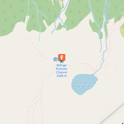
Come and visit La Grave and Villar d'Arène while running. In the upper Romanche valley, you will have the chance to reach for the sky and have the chance to see breathtaking landscapes. Between mountain landscapes with views of the Écrins massif and a guaranteed conviviality, passionate runners will be able to tread the trails of the Pays de la Meije while setting themselves a sporting challenge! Trail running is an outdoor activity on hilly and sometimes steep trails. But the most important thing to remember is that it's a sport that's sure to give you a thrill, and allow you to contemplate the peaks while simply enjoying nature! The Trail de la Meije offers something for everyone, with 3 routes on Sunday and a vertical kilometer on Saturday. These routes will take runners around La Grave, Villar d'Arène and their hamlets, along some of the most legendary trails in the Hautes-Alpes. There's something for everyone, from vertical kilometers to marathons, from 27km to 16km, not forgetting the children's race. So don't wait any longer, come and discover the warm and welcoming atmosphere of high-altitude villages! THE DIFFERENT ROUTES : THE FRÉAUX VERTICAL KILOMETER Distance: 4.8 km & 1200 D+ (vertical kilometer) To warm up for Sunday's races, a vertical kilometer is proposed on Saturday, with the participation of Les Téléphériques des Glaciers de la Meije. The program includes 4.8km and 1200m D+, starting from the hamlet of Fréaux and climbing steeply to the Puy Vachier lake and the Chancel refuge. At the top, a refreshment station awaits you and you can enjoy the view, before reaching the station at 2400m and taking the gondola back down to La Grave. LA BOUCLE DE L'AIGUILLON 15 km & 650 D+ (altitude gain) This 15 km route takes you through the Haute Romanche valley in a dreamy landscape, facing the Meije. It's a lovely loop that takes you on a quick tour of the canton. It starts at the village hall in La Grave, an authentic mountain village, then climbs along the banks of the Romanche through a larch forest, before entering the village of Villar d'Arène. The first refreshment station awaits you in the square in front of St Martin's church. Then the climb up to Lac du Pontet gives you the chance to take in the view from above. This is followed by a beautiful balcony traverse on a mountain pasture path to the Col de l'Aiguillon, where you can enjoy a new viewpoint. A fast, then technical descent takes you back to Villar d'Arène, where the same refreshments await you before returning to La Grave on the GR54 in the heart of the Ecrins National Park. THE MEIJE TROPHY 27 km & 1650 D+ (altitude gain) The 27 km Trophée de la Meije is a route that takes you through a multitude of mountain landscapes. Starting on a single track in a larch forest, runners cross terraced mountain pastures before arriving at a pleasant high-altitude lake. You'll then reach the highest point of the race at 2707m, with an obligatory stop at the Goléon refuge. The second part of the route features a beautiful panorama of the Meije and a descent along a ridge line overlooking the canton. Competitors on the 45km will then switch to the vallon de la Buffe, where you'll reach the hamlet of Le Chazelet, before a final descent through the slate to head for the village of La Grave. This wild and varied route is sure to leave a lasting impression! THE MEIJE MARATHON 45 km & 2500 D+ This marathon trail takes you deeper into the remote corners of Meije country, starting in La Grave. This demanding course takes place at an altitude of over 1,600 meters, culminating at 2,707m to be exact. You'll enjoy the view of the Goléon refuge and its lake. After the Col du Cruq, a bit of well-marked "off-trail" awaits you to reach the Signal de La Grave and a beautiful panoramic descent over the ridge. Next, head for the refuge du Pic du Mas de la Grave before tackling the final climb to the famous Plateau d'Emparis. In September, this mountain plateau bears a striking resemblance to the famous South American altiplano. A loop on this plateau takes you to two mountain lakes with views of the Écrins massif. Finally, a long descent takes you to the finish in the village of La Grave.

Route des Grands cols 05320 La Grave
Book from 0 €Book
Show
Goleon Mountain Hut
4.1 km

Goleon Mountain Hut

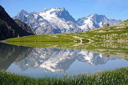
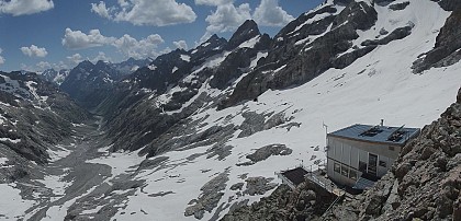
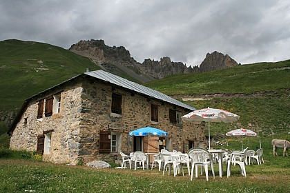
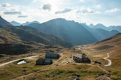
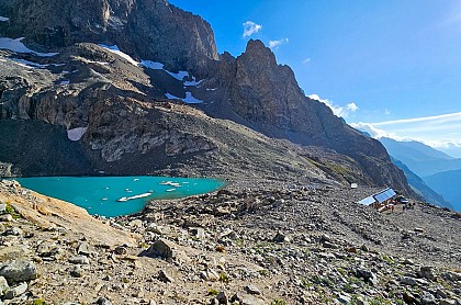
The accessible refuge du Goléon awaits you summer and winter alike, in an exceptional setting between lake and Meije. The wardens warmly welcome you to spend the night or grab a bite to eat in this little refuge of character. The hut keepers, Myrtille and Lucile, welcome you, with a big smile, to the hut located near Goléon Lake, facing La Meije. Nestled in the Goléon valley, near the lake (200 meters) and facing La Meije, the Goléon hut welcomes you in an exceptional setting. Made of stone and wood, this building, built in 2009 by its owner will seduce you with its rustic beauty. In summer the place is ideal to spend a night with family or friends in a warm and authentic mountain hut. In winter, the valley lends itself perfectly to ski touring. Don't hesitate to stay several nights to explore the hidden corners of this beautiful valley. Drinks and lunch à la carte, half-board or dinner, breakfast only (booking in advance is required). They cook as much as possible with local, seasonal and organic products. Fishing (in authorized period) : in the lake of Goléon is possible. The lake is stocked with brook & brown trouts by the fishing federation. The lake is classified 1st category. Fishing will be open from the 3rd Saturday of June to the 2nd Sunday of October. Mountaineering courses from the hut : make sure to have the right gear ! Aiguille du Goléon (3472m) : Easy route - 3h30 Aiguille Méridionale d'Arve (3514m) : Course D - 4 to 5 h Hikes from the refuge : Glacier du Goléon (3000m) : 4h30 (return) Lombard pass (3092m) : 5h (return) Crux des Aiguilles (2589m) : 1h15 (return) Col du Goléon (2973m) : 2h30 (return) If you decide to camp around the mountain hut, you are welcome to join for a drink, dinner and breakfast.

Refuge du Goléon Les Hières 05320 La Grave
Book from 0 €Book
Show
Domaine Nordique du Pays de la Meije
4.8 km

Domaine Nordique du Pays de la Meije

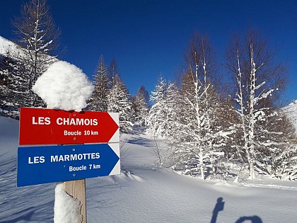
At the foot of the Lautaret Mountain pass, under the summits and glaciers, the Pays de la Meije Nordic Area is a magic spot surrounded by majestic and wild beauty. In this haven of peace the groves of trees give shelter to many wild animals. The site is in the heart of nature, at the gateway to the Ecrins National Park, in a sumptuous corner of the Hautes Alpes. You'll be in a world of your own, an unspoilt place where contemplation is the order of the day, under the watchful eye of chamois, ermines, white hares and foxes. This area is ideally suited to Nordic skiing and snowshoeing. The cross-country ski trails are relatively flat, in the undergrowth and on the valley floor, except for the loop through the hamlet of Arsine. - Cross-country ski trails: divided into three loops of 3, 7 and 10 km, with varied but fairly easy profiles. - Walking trail: Villar d'Arène - La Gravière (8 km) - Snowshoe trail: tour of Villar d'Arène hamlets (11 km). - Natural outdoor skating rink with skate rental (at Gîte le Pas de l'Âne). - Toboggan runs: one at Arsine and one at Jouvencelles, opposite Villar d'Arène. - Ski field hockey: enjoy a game with family and friends. Hockey equipment (you'll need to bring your own skis) is available at the chalet every weekend and Wednesday outside school vacations, and every morning during school vacations. - Relaxation and observation area with armchairs and spotting scopes on a lovely wooden terrace next to the chalet. With the sun shining down on the high peaks in the depths of winter, the site benefits from excellent snow quality and good snow cover throughout the winter season. Reminder: pedestrians and snowshoe hikers, please respect the dedicated areas. Cross-country ski trails are strictly reserved for skiers (municipal decree of 11/01/1986).

Chalet du pisteur Arsine 05480 Villar-d'Arêne
Book from 6 EURBook
Show
Refuge du Pic du Mas de la Grave - Chez Polyte
5.4 km

Refuge du Pic du Mas de la Grave - Chez Polyte

The mountain hut is located in the heart of an alpine area particularly conducive for hiking during Summer as well as Winter. It also provides an ideal stopover on the GR54 from the well known Tour de l'Oisans. The winter shelter open for 6 people, wood, gas, dishes, blanket. Welcome to "chez Polyte" (nickname of the last inhabitant of the area). The Pic du Mas de la Grave refuge is built on the ruins of the Baraques des Salomons. It is located in the commune of La Grave, 6 km/1h30 from the hamlet of Le Chazelet, at the bottom of the La Buffe valley, facing the majestic north face of the Meije (3983 m). The refuge is the ideal stopover for climbing the Mas de la Grave peak, an "easy 3000" with a magnificent 360° panorama of the Écrins, Aiguilles d'Arves, Grandes Rousses, Savoie and Mont Blanc. It also offers access to the Emparis plateau and its lakes, and crossings between the plateau and the Goléon. We'll be delighted to welcome you for lunch and dinner, and offer cosy accommodation in small dormitories sleeping four to six. We can also advise you on suitable itineraries, depending on weather conditions and your interests. South-facing terrace with exceptional panoramic views, games, books, pétanque, musical instruments (piano and guitar), Finnish sauna... Ideal for relaxing after a hard day's work. A 6-person winter hut with wood-burning stove, crockery and blankets is open out of season. All information is available on the refuge's website, so don't hesitate to consult it before booking to find all the information you need: www.refugedupicdumasdelagrave.fr Looking forward to meeting you, The wardens

Vallon de la Buffe Le Chazelet 05320 La Grave
Book from 0 €Book
Show

What to visit in MAISON FAMILIALE LA ROMANCHE

See more suggestions
Discover the local markets of MAISON FAMILIALE LA ROMANCHE.
See more suggestions
Natura 2000 - Upper Romanche
1.5 km

Natura 2000 - Upper Romanche

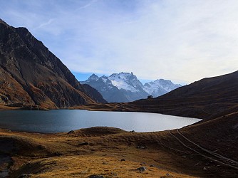
The world's largest network for preserving biodiversity. Natura 2000 was created out of a desire to maintain this biodiversity while taking social, economic, cultural, and regional activities into account. Detailed text by Maryline Pomard. For over a century, the intensification of agriculture, urban development, and the growth of infrastructure and transport networks have led to fragmentation and loss of the biological diversity that makes the European continent so rich. Natura 2000 was born out of a desire to maintain this biodiversity while taking into account social, economic, cultural, and regional activities. With the dual objective of preserving biological diversity and enhancing the value of its territories, Europe has been working since 1992 to create an ambitious network of sites spanning the whole of Europe: the flight of migratory birds is a poetic reminder that nature and its preservation know no borders. This network is now complete: it covers nearly 18% of the European Union's land area (almost 1 million km²) and 150,000 km² of its seas and oceans, representing more than 26,000 sites. "An exceptional natural heritage: Located at the crossroads of the Alps and the Mediterranean, the Hautes-Alpes offer a wide variety of natural environments. These habitats enable species of flora and fauna to complete their life cycles. Fragile and sensitive, these environments are sometimes mistreated. However, their preservation is often linked to the maintenance of respectful human activities. The site: Emparis-Goléon Plateau The “Emparis-Goléon Plateau” site covers a single municipality: La Grave. Covering an area of 7,476 hectares, this site is entirely located within the Écrins National Park. The site is bordered to the south by the Romanche (1,132 m) and extends to the peaks of Pic du Mas de la Grave, Aiguilles d'Arves (3,514 m), and Goléon. It includes the Emparis Plateau and the valleys of Gâ (or Buffe), Martignare, and Maurian (or Goléon). The site's biological diversity is exceptional. Its location on the border between biogeographical areas (inner Alps, intermediate Alps), climatic zones (Northern Alps and Southern Alps), great geological variability and contrasting geomorphology create highly diverse ecological conditions that are favorable to the development of numerous plant and animal species. The landscape is strongly linked to agricultural and pastoral activities. The biologically rich hay meadows surround the hamlets and extend significantly into the Buffe valley. Above approximately 2,200 m, the landscape gives way to mountain pastures, home to herds of cattle and sheep. There are some remarkable wetlands here, particularly in the Goléon valley and on the Emparis plateau. The site comprises 26 habitats (or natural environments) of Community interest, five of which are priority areas for conservation. Natura 2000 offers ways to invest in the preservation of the natural environment: pastoralism is by far the most important activity in economic terms and the one that covers the largest area: agro-pastoral habitats represent around 50% of the site's surface area, with eight mountain pastures (78% of the site) farmed by 14 farmers. The effective conservation of habitats and biodiversity depends on maintaining extensive agro-pastoral practices such as mowing and grazing. Through agri-environmental measures, farmers are committed to conserving natural habitats and biodiversity by delaying mowing to promote the plant cycle and allow reproduction, Avoid repeated passage and grazing of animals in sensitive areas (wetlands, etc.). A contract signed by the municipality and financed by the State and Europe enabled the creation of a footpath and the installation of an information panel on the edge of the Goléon marsh, a wetland sensitive to human activity (2013). Awareness-raising and environmental education are key elements of the Natura 2000 approach: “better understanding for better protection.”

Mairie de la Grave D 1091 La Grave 05320 La Grave
Show
Notre-Dame de l’Assomption church
1.5 km

Notre-Dame de l’Assomption church

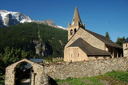
The church was built around the 11th century. It is the oldest monument in the area and has been a listed building since 1959. With the Pentitents Chapel it forms a beautiful architectural complex at the heart of the village of La Grave. This magnificent Lombard Romanesque building has been placed under the protection of Notre-Dame de l'Assomption. It is surrounded by a cemetery where the tombs are dominated by typical La Grave crosses. The triangle in the center of the crosses represents the Holy Trinity, and the circle the oneness of the Father, Son and Holy Spirit. The cemetery is a temporary resting place. When the tour of the cemetery is complete, the brass heart placed on each cross is hung on a panel on the church wall. The church was formerly known as Notre-Dame des Basses-Arènes. It has undergone many changes over the centuries. In the 15th century, the church was rebuilt, retaining certain architectural features, such as the 11th-century cul-de-four vaulted choir. The church was damaged during the Wars of Religion (1557) by Lesdiguières' troops. Major repairs were carried out in the early 17th century (1606). The nave was altered several times. When it was restored in 1856, the original barrel vaulting was replaced by a tufa vault, and the roof was raised. The Pénitents blancs chapel, located behind the church, was built in the 17th century. At the time, it was completed by the chapels of the Hières and Chazelet penitent brotherhoods, which have now disappeared, and the Villar d'Arène chapel, which is still standing. Only the chapels of the main towns have survived. Religious fervour is evident even in the remote mountain pastures, where dozens of oratories and mission crosses can be discovered along the way.

Place de l'Eglise La Grave 05320 La Grave
Show

Where to eat in MAISON FAMILIALE LA ROMANCHE

See more suggestions
The restaurants of MAISON FAMILIALE LA ROMANCHE await you.
See more suggestions

Where to sleep in MAISON FAMILIALE LA ROMANCHE

See more suggestions
Discover the best lodging options in MAISON FAMILIALE LA ROMANCHE.
See more suggestions
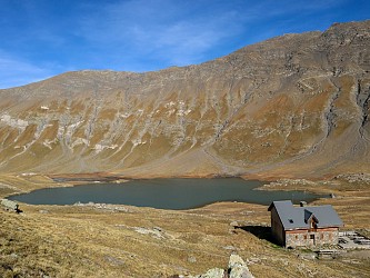
Goleon Mountain Hut
4.1 km

Goleon Mountain Hut

The accessible refuge du Goléon awaits you summer and winter alike, in an exceptional setting between lake and Meije. The wardens warmly welcome you to spend the night or grab a bite to eat in this little refuge of character. The hut keepers, Myrtille and Lucile, welcome you, with a big smile, to the hut located near Goléon Lake, facing La Meije. Nestled in the Goléon valley, near the lake (200 meters) and facing La Meije, the Goléon hut welcomes you in an exceptional setting. Made of stone and wood, this building, built in 2009 by its owner will seduce you with its rustic beauty. In summer the place is ideal to spend a night with family or friends in a warm and authentic mountain hut. In winter, the valley lends itself perfectly to ski touring. Don't hesitate to stay several nights to explore the hidden corners of this beautiful valley. Drinks and lunch à la carte, half-board or dinner, breakfast only (booking in advance is required). They cook as much as possible with local, seasonal and organic products. Fishing (in authorized period) : in the lake of Goléon is possible. The lake is stocked with brook & brown trouts by the fishing federation. The lake is classified 1st category. Fishing will be open from the 3rd Saturday of June to the 2nd Sunday of October. Mountaineering courses from the hut : make sure to have the right gear ! Aiguille du Goléon (3472m) : Easy route - 3h30 Aiguille Méridionale d'Arve (3514m) : Course D - 4 to 5 h Hikes from the refuge : Glacier du Goléon (3000m) : 4h30 (return) Lombard pass (3092m) : 5h (return) Crux des Aiguilles (2589m) : 1h15 (return) Col du Goléon (2973m) : 2h30 (return) If you decide to camp around the mountain hut, you are welcome to join for a drink, dinner and breakfast.

Refuge du Goléon Les Hières 05320 La Grave
Book from 0 €Book
Show
Refuge du Pic du Mas de la Grave - Chez Polyte
5.4 km

Refuge du Pic du Mas de la Grave - Chez Polyte

The mountain hut is located in the heart of an alpine area particularly conducive for hiking during Summer as well as Winter. It also provides an ideal stopover on the GR54 from the well known Tour de l'Oisans. The winter shelter open for 6 people, wood, gas, dishes, blanket. Welcome to "chez Polyte" (nickname of the last inhabitant of the area). The Pic du Mas de la Grave refuge is built on the ruins of the Baraques des Salomons. It is located in the commune of La Grave, 6 km/1h30 from the hamlet of Le Chazelet, at the bottom of the La Buffe valley, facing the majestic north face of the Meije (3983 m). The refuge is the ideal stopover for climbing the Mas de la Grave peak, an "easy 3000" with a magnificent 360° panorama of the Écrins, Aiguilles d'Arves, Grandes Rousses, Savoie and Mont Blanc. It also offers access to the Emparis plateau and its lakes, and crossings between the plateau and the Goléon. We'll be delighted to welcome you for lunch and dinner, and offer cosy accommodation in small dormitories sleeping four to six. We can also advise you on suitable itineraries, depending on weather conditions and your interests. South-facing terrace with exceptional panoramic views, games, books, pétanque, musical instruments (piano and guitar), Finnish sauna... Ideal for relaxing after a hard day's work. A 6-person winter hut with wood-burning stove, crockery and blankets is open out of season. All information is available on the refuge's website, so don't hesitate to consult it before booking to find all the information you need: www.refugedupicdumasdelagrave.fr Looking forward to meeting you, The wardens

Vallon de la Buffe Le Chazelet 05320 La Grave
Book from 0 €Book
Show
Lac du Pave alpine hut (FFCAM)
8.1 km

Lac du Pave alpine hut (FFCAM)

At the heart of a mountain cirque, between Le Pavé, Roche Méane and Pic Gaspard, on the shores of a glacial lake, this small mountain refuge offers a trip having an Himalayan air in one of the most secret and wild valleys from the massif des Ecrins. The ascent route is 4 hours starting from Arsine and has 1150m height difference Climbing up to Lac du Pavé is first and foremost a magnificent hike, then a close-up view of the high mountains. Set in the heart of a majestic cirque, the new refuge du Pavé is part of a breathtaking scenery.... High mountains in their purest form. Recently renovated, and manned for the first time this summer, the new Pavé refuge will welcome mountaineers, climbers, experienced hikers and all nature lovers. You'll discover a refuge whose design was dictated by the surrounding environment, combining comfort and sobriety. Pauline, the janitor, will do her utmost to ensure that you have a great time in the mountains! Conviviality and good humor are the order of the day! The refuge offers quick access to a wide range of mountaineering and climbing routes, from the easiest to the most challenging. The most popular summit is the Pic nord des Cavales: one of the most beautiful easy mountaineering routes in the Ecrins massif, on excellent granite. Pointe Emma, which has the same characteristics, is also covered by numerous rope parties. These two summits offer numerous routes of varying difficulty, and both offer remarkable views over the Etançons valley and the south face of the Meije. Pointe des Chamois, next to Pointe Emma, is perfect for a quick introductory run. Fans of the great races of the wild Oisans will turn to the Pic Gaspard and its south-southeast ridge: the famous Devies-Gervasuti. Vertical enthusiasts should head for the foot of the south face of Le Pavé. Here you'll find three routes, including one of the most difficult climbs in the massif, with a 7b pitch at 3500 m! Long-distance climbers will enjoy the beautiful and demanding Pavé - Meije orientale traverse. A must in this sector. For snow climbers, the Col du Pavé is the ideal out-and-back route. From the col, you can also reach the Promontoire refuge or vice versa (serious route: steep, crevassed glacial terrain). Finally, don't forget the Grande Ruine and the famous Col du Diable. Due to global warming, this great couloir is no longer widely used, and you have to look for good snow conditions very early in the season.

05480 Villar-d'Arêne
Book from 0 €Book
Show
Caution!
We have no information on the difficulty of this circuit. You may encounter some surprises along the way. Before you go, please feel free to inquire more and take all necessary precautions. Have a good trip! 🌳🥾