Alert
Alerts
L'Aiguillon from Les Hières


Description
Starting from the village of Les Hières (1770m), this route takes you up to the Aiguillon (2095m), a viewpoint offering 360° panoramic views of the Meije region.
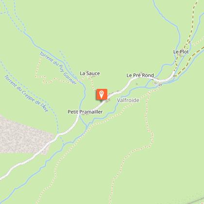
From the entrance to the village of Les Hières, follow the carriage path along the valley towards Valfroide /Entraigues.
Cross the torrent du Maurian at the small wooden bridge on the right;
Then take the narrow path up to l'Aiguillon. Allow 1h30 to reach the summit.
For the return journey, follow the same route.
Technical Information
Altimetric profile
Starting point
Additional information
Environments
Mountain location
Village 2 km away
Presence of livestock and guard dogs
Updated by
Office de tourisme des Hautes Vallées - La Grave - La Clarée - L'Izoard - 29/10/2025
www.hautesvallees.com/la-grave/
Report a problem
Open period
From 15/05 to 30/11 daily.
Subject to favorable snow and weather conditions.
Contact
Phone : 04 76 79 90 05
Email : lagrave@hautesvallees.com
Website : https://www.hautesvallees.com/la-grave/
Type of land
Stone
Ground
Animals
Yes. Dogs must be kept on a leash.
Data author
