Tours
Activities
Places of interest
Where to eat
Where to sleep

Discover Septmoncel, Jura, Franche-Comté: Natural and Cultural Treasures

Are you in charge of the destination?
Welcome to Septmoncel, nestled in the Jura, Franche-Comté. This charming town is surrounded by stunning landscapes and numerous activities that will enchant both nature lovers and culture enthusiasts.

Marvel at the breathtaking Cascade du Flumen, where crystal-clear waters cascade down into a deep gorge. For hikers, the Monts Jura offer a variety of marked trails ranging from leisurely walks to...
See more

Walking around Septmoncel

See more suggestions
Enjoy outdoor walks in Septmoncel.
See more suggestions
The gorges of the Flumen
497 m

The gorges of the Flumen

Within the large classified site of the gorges of the Flumen, this sporty hike unravels the mysteries of the Jura’s karstic geography with each fold, waterfall, torrent and belvedere. From the REPLAN, the circuit (yellow waymarking) heads down “Chemin des Moines” (The Monks’ path) to the D 436 in MONTBRILLAND. Head up the road following along the right border and head past La Roche percée for around 20 m. A stony trail descends to the right and crosses over a few screes. At Bas des Grès, continue right until you come to the Flumen and use the walkway next to its concrete penstock to cross it. > Flumen waterfalls, 15 mins out-and-back. Head up the path to your left; Head past a dam and continue until you come to the upsurges. Surrounded by high waters, head up the stony path to your right and then turn left (copse) to reach the waterfalls. On returning from the waterfall, the path heads down the left embankment to the Electricity factory. The steep trail to your left heads through Sous la Riote and up to the ridge on a tricky ascent (700 m difference in level), before exiting onto the LA ROCHE BLANCHE BELVEDERE. A grassy trail heads due south and, following along the fence, meets up with a road. Follow the road to your left for 500 m heading to the houses in La Cernaise. Between two buildings, turn left and join up with the D 25 in CHAMPIGNON DE LA CERNAISE. A forest trail which is muddy in places heads down to your left towards Les Moulins. Head 150 m down the “route des lacets de Septmoncel”, before turning left and joining up with a lesser bend called “le virage des Savants” (the Wise men’s bend). > The viewpoint from Saut du Chien and the MOULIN D’AVAL WATERFALL can be accessed in a few minutes via the road to your left. From the “Virage des Savants”, climb the bank opposite you and cut through the bends twice, heading up to the CHAPEAU DE GENDARME. > The foot of the Chapeau de Gendarme can be accessed within 10 mins there-and-back to your right by following a trail parallel to the road. When you return, a steep trail heads through the pastures and follows along the ridge before reaching SUR LES GRES. Return to your point of departure via a path that heads down to the right through a dry grassland. 

6 h
14 km
Easy
Show
Les Platières
3 km

Les Platières

A pretty open route through high pastures from la Vie Neuve des Molunes, a sector which is characterised by its dispersed habitat. On the corner of the stopover gite AUX MOLUNES - LA VIE NEUVE, the trail starts on the path (yellow waymarking) along the hay fields towards les Granges. Staying on this path, head past a small ridge to your left and gradually descend. The path cuts through a small forest and opens onto a meadow. Take the grassy path that is more or less marked out descending along the ridge to the right. (Note to your left a former farm with a granary). Cut through a forest and exit onto a small road. Follow this road to the left to les Granges. The road to your right will take you to the houses in Laisia. A stone path ascends to the right towards les Platières. Bordered by ashes, it quickly ascends and opens out onto the combe at the summit. Cross this combe and head back down, opposite your, through the woods, to the hamlet of Les Platières. Take the very stony path to your left into the forest (white and red waymarking). Head to an open combe and follow a trail to your left into the pasture of Les Platières (cycling path). Go past a small lodge, down into a pasture to your right (cycling path) and reach the west ridge. Follow an old, little marked, path to the left of the valley that will take you to the crossroads in Cariche. The path (two cycling paths), descends through the meadows and heads up to a beautiful farm. Heads back downhill via a stone path to your left. You will come to a road, which you will follow to return to your starting point.

2 h
7.3 km
Very easy
Show
The Crêt de la Vigoureuse
4.8 km

The Crêt de la Vigoureuse

From Lajoux, the highest village in the Jura, with the sounds of the cattle in the summer, a pleasant walk will lead you to the viewpoint on the crêt de la Vigoureuse, through forests, undergrowth and pastures. From LAJOUX, the trail cuts through the village towards Mijoux (white and red waymarking), heading past the front of the Maison du Parc. At Route Royale, the road ascends steeply and reaches a pasture (cycling path). The path continues pleasantly until it reaches Trécombe. Branch off to your left (yellow waymarking) on a forest path that is rocky, muddy and hilly. Exit through the pasture and descend the combe to the left (grassy path) for 300 m before coming to the intersection at La Pièce du Châtelain to your right. The grassy trail heads over the low wall (cycling path) before ascending (white and red waymarking) through a pasture along the edge of the forest. Take a road (cycling path) to Sermangindre (chalet). Cross a second cycling path to follow the trail parallel to the road, across several pastures until your reach La Pièce d’Aval. Head up the road to the left (yellow waymarking) for 300 m then take the “chemin de la Combe du Sous” to your left. Head past La Balise d’Amont before coming to Sous la Vigoureuse. The forest trail ascends to the right into the clearing of the CRET DE LA VIGOUREUSE. The hilly trail descends once more to your right towards Lamoura, to reach the Forest of the Vigoureuse. The stony and muddy path branches off to the left to reach the combe and the houses in Chez Gauton. The path heads right and descends back towards the village of Lajoux via Route Sur les Champs. Return to your starting point (red and white waymarking) in LAJOUX via the road to your left.

3 h
9.7 km
Very easy
Show
Around Pièce d’Aval
4.8 km

Around Pièce d’Aval

Devilishly hilly, roaming from pastures to undergrowth near Lajoux, this MTB trail offers some beautiful grassy tracks against the backdrop of the High Jura mountain range and the Crêt de Chalam, for those willing to look up. From LAJOUX, the trail cuts through the village towards MIJOUX (32 Blue MTB waymark), heading past the front of the Maison du Parc. At Route Royale, the road ascends steeply and reaches a pasture (2 MTB paths). The path continues pleasantly until it reaches Trécombe. Branch off to your left on a forest path that is rocky, muddy and hilly (MTB path). Exit through the pasture and descend the combe to the left (grassy path) for 300 m before coming to the intersection at La Pièce du Châtelain to your right. The grassy trail heads over the low wall (MTB path) before ascending through a pasture along the edge of the forest (MTB path). Take a road (MTB path) to Sermangindre (chalet). Cross a second cycling path to follow the trail parallel to the road through several pastures (MTB path) until you come to La Pièce d’Aval (MTB path). Head up the road to the left for 300 m then take the “chemin de la Combe du Sous” to your left (MTB path). Head past La Balise d’Amont before coming to Sous la Vigoureuse (MTB path), and later the houses in Chez Gauthon (MTB path). Continue on this path through a small woods (MTB path) that then joins up with the Route Sur le Champs. Return to your starting point in LAJOUX via the road to your left.

1 h
8.7 km
Very easy
Show

What to do in Septmoncel

See more suggestions
Find the best activities in Septmoncel and book easily online.
See more suggestions

IGN cards

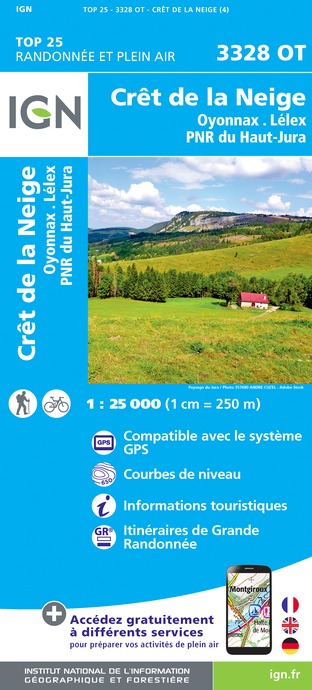
3328OT - CRÊT DE LA NEIGE OYONNAX LÉLEX PNR DU HAUT-JURA
Editor : IGN
Collection : TOP 25 ET SÉRIE BLEUE
Scale : 1:25 000
13.90€
TOP75012 - HAUT-JURA
Editor : IGN
Collection : TOP 75
Scale : 1:75 000
9.80€
TOP100D39 - JURA PAYS DE DOLE ET VAL D'AMOUR CHAMPAGNOLE LES ROUSSES PNR DU HAUT-JURA
Editor : IGN
Collection : TOP 100
Scale : 1:100 000
8.40€
TOP100D74 - HAUTE-SAVOIE ANNECY THONON-LES-BAINS MASSIF DU MONT BLANC CHAÎNE DES ARAVIS
Editor : IGN
Collection : TOP 100
Scale : 1:100 000
8.40€
TOP100D01 - AIN BOURG-EN-BRESSE AMBÉRIEU-EN-BUGEY PAYS DE GEX
Editor : IGN
Collection : TOP 100
Scale : 1:100 000
8.40€
202 JURA ALPES DU NORD
Editor : IGN
Collection : TOP 200
Scale : 1:200 000
6.80€
89026 - GRANDES TRAVERSÉES DU JURA - GTJ
Editor : IGN
Collection : DECOUVERTE DES CHEMINS
Scale : 1:105 000
9.10€
D01-69 AIN RHÔNE
Editor : IGN
Collection : CARTES DÉPARTEMENTALES IGN
Scale : 1:150 000
5.90€
D25-39 DOUBS JURA
Editor : IGN
Collection : CARTES DÉPARTEMENTALES IGN
Scale : 1:150 000
5.90€
NR15 AUVERGNE-RHÔNE-ALPES RECTO/VERSO MASSIF ALPIN
Editor : IGN
Collection : CARTES RÉGIONALES IGN
Scale : 1:250 000
6.80€
NR09 BOURGOGNE FRANCHE-COMTÉ
Editor : IGN
Collection : CARTES RÉGIONALES IGN
Scale : 1:250 000
6.80€
NR14 AUVERGNE-RHÔNE-ALPES RECTO/VERSO MASSIF CENTRAL
Editor : IGN
Collection : CARTES RÉGIONALES IGN
Scale : 1:250 000
6.80€
EUROPE
Editor : IGN
Collection : DÉCOUVERTE DES PAYS DU MONDE IGN
Scale : 1:2 500 000
7.00€
SUISSE
Editor : IGN
Collection : DÉCOUVERTE DES PAYS DU MONDE IGN
Scale : 1:303 000
7.00€

What to visit in Septmoncel

See more suggestions
Experience the annual festivals of Septmoncel.
See more suggestions

Where to eat in Septmoncel

See more suggestions
Establishments in Septmoncel offer dishes for all tastes.
See more suggestions

Where to sleep in Septmoncel

See more suggestions
Find lodging to suit your needs in Septmoncel.
See more suggestions
Caution!
We have no information on the difficulty of this circuit. You may encounter some surprises along the way. Before you go, please feel free to inquire more and take all necessary precautions. Have a good trip! 🌳🥾