Tours
Activities
Places of interest
Where to eat
Where to sleep

Explore Cassis with HOTEL CASSITEL

Are you the owner?
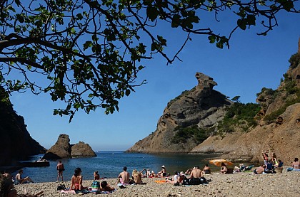
Nestled in the heart of Cassis, HOTEL CASSITEL offers a gateway to a region abundant with natural and cultural wonders. Begin your exploration at the Calanques National Park, renowned for its dramatic cliffs and crystal-clear waters. Hiking enthusiasts will love the rugged trails offering stunning views of the Mediterranean. For the more adventurous, kayaking and rock climbing are must-try activit...See more

Walking around HOTEL CASSITEL

See more suggestions
Discover the trails of HOTEL CASSITEL.
See more suggestions
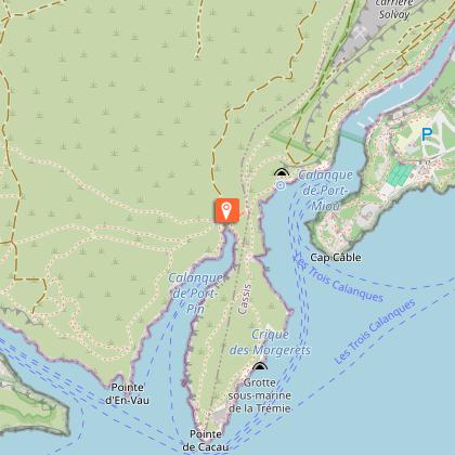
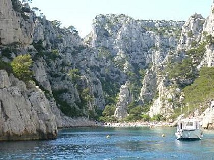
Hike to En-Vau Calanque passing by Port-Pin Calanque
1 km

Hike to En-Vau Calanque passing by Port-Pin Calanque

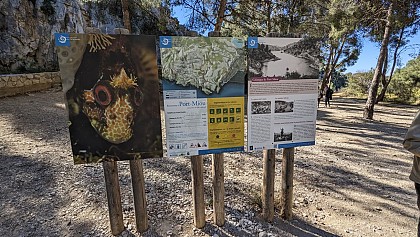
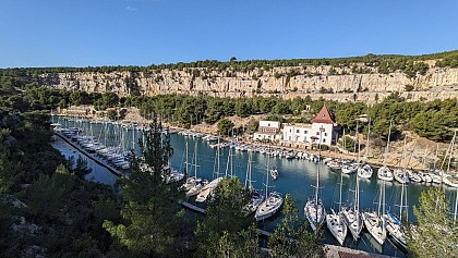
Hike to the popular Calanque d'En-Vau. Departure from the Bestouan peninsula in Cassis. The itinerary is difficult, requiring the use of the Portalet passage, redesigned in 2022. The route is considerably shorter than that from Le Logisson. The starting point is the "Balli de Suffren" bus stop. When you get off the bus, turn around and go back a few meters to take Avenue des Calanques on your left. At the next intersection, turn left again to follow the avenue down to the bottom of the Port-Miou Calanque. "Port-Miou" is Provençal for "good harbor", and this deep inlet offers excellent shelter for boats on windy days and in rough seas (1). On your left, you'll see large signs for the Parc National des Calanques marking the start of the path. At the start, it's a wide track that runs for 1 kilometer through a former industrial site, the Solvay stone quarry. Cassis stone is a shell limestone of marine rather than lacustrine origin, highly resistant and therefore highly appreciated as a building material in Provence, before the advent of concrete. The site was in operation until 1982. Along the way, you'll see the Cassis "château" on your left (2). At the crossroads, follow the GR signs (red/white or green). You pass close to the trou du souffleur (3). The path descends through the pines towards the Calanque de Port-Pin (4). [Then two options: 1/ The option chosen for this itinerary is to follow the GR to continue the route to reach the Portalet passage, which leads down to the bottom of the Calanque d'En-Vau (5). 2/ Take a detour (not marked on this itinerary) to explore the En-Vau plateau, discover the former Piolet refuge and enjoy several vertiginous viewpoints overlooking the Calanque d'En-Vau. In this case, follow the blue markers which also lead down to the Portalet descent]. Leave the Calanque de Port-Pin, continuing to follow the GR markers. It climbs until you reach the passage du Portalet. Here, in order to limit the gradual degradation of the path and natural habitats, channel visitor flows and reinforce hiker safety, the National Park authorities have undertaken work to redesign the path. Crossing the Portalet passage is a tricky business. It is therefore important not to deviate from the itinerary and to follow the signs. Once you've reached the bottom of the valley, follow the red markers to reach the coastal part of the Calanque d'En-Vau. Hikers, please don't leave any garbage behind. Don't follow the bad examples that are still recurrent. There are no maintenance workers to collect abandoned garbage. Sooner or later, it will end up in the sea. For the return journey, it's the same route in the opposite direction: follow the red markings up to the Portalet rise. Then green and white/red markings guide you to Port-Miou. One last climb and you're back on the Avenue des Calanques and at the bus stop to return to your car. We would like to thank the ©Parc national des Calanques for permission to use its gpx trail.

4 h
7.6 km
Medium
2 Avenue Notre-Dame 13260 Cassis
Show
A walk along the Little Prince trail
1.7 km

A walk along the Little Prince trail

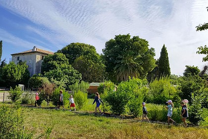
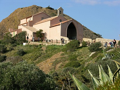
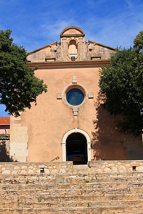
On the Bestouan peninsula, the Little Prince trail pays tribute to Antoine de Saint-Exupéry's book, the second best-selling and most translated book in the world after the Bible. This is a family-friendly tour. Good to know about access: During the tourist season (between Easter and All Saints' Day), we recommend parking your car at the Gorguettes parking lot at the entrance to Cassis, then taking the shuttle bus to the Calanques, stop: "Presqu'île". Information on timetables is available at: www.cassis.fr/vie-pratique/les-transports/les-transports-urbains/les-navettes-parking-relais-des-gorguettes/ The tour is easy on the eyes, even if it does include a few steps cut into the rock. Welcome to the Presqu'île de Port-Miou (1), which runs alongside the calanque of the same name (2). The walk starts at the junction of Avenue Notre-Dame and Avenue de la Plage Bleue, where the Parc National des Calanques welcome sign is located. Just follow the enamelled plaques, which provide information on the history of the area and the Calanques (3), (4). Walk along, keeping the bottom of the Port-Miou calanque on your right. At some point, you'll reach a fork in the road (5). Keep to the right to complete a small loop which will bring you back to this point and take you around Bestouan (6). Continue on your right towards a chapel (7). Continue past the tennis courts to reach the esplanade with its panoramic view of Cap Canaille (8). Lean over the wall to catch a glimpse of the large rocky slabs of Plage Bleue (9). Take time to admire the beauty of the glistening Mediterranean Sea, and let the words of the Little Prince resonate within you: "You can only see well with your heart; what is essential is invisible to the eye". (10) Complete your loop by passing under the tall pines of the presqu'île parking lot. Continue straight ahead to reach the junction of Avenue de la Plage Bleue and Avenue Jean-Jacques Garcin. Turn left to return to the starting point.

1 h
1.8 km
Very easy
39 Avenue Notre-Dame Au croisement de l’avenue Notre-Dame et de l’avenue de la Plage Bleue 13260 Cassis
Show
Cassis : On the Soubeyran plateau
1.9 km

Cassis : On the Soubeyran plateau

Hike on the Cap Canaille massif, the famous cliff with red and yellow colors which overhangs Cassis. Round trip itinerary of 3 hours, medium level. Like an invitation to take flight, to travel... the Cap Canaille massif! The Mediterranean stretches as far as the eye can see, the bay opens to travelers, the cliffs offer their vertiginous peaks to the assaults of the sea, the Trois Secs mark the end of the land... And then, the Bec de l'Aigle rock stands there, like a sentinel. Depending on the light and your imagination, you can see the head of a bird of prey, an eagle sitting in the water, a capuchin... Lined with viewpoints, the famous route des Crêtes climbs, turns, flirts with the sea, swirls in the wind. It allows the less courageous to enjoy these superb views. This wide rocky plateau offers a view of the islands of Marseille up to Cap Sicié, towards Toulon. While continuing, an esplanade will allow you, in full safety, to enjoy the spectacle which is offered to your eyes: in the distance, the big blue, with your feet, the vacuum... Continuing your way, the Soubeyrannes cliffs are cut out, as if worked by a lacemaker. While going up, the path treads a typically Mediterranean low scrubland: kermes oaks or "reganéou", brooms, rockroses, aphyllantes... So many species left to reconquer the spaces ravaged by successive fires (1957-1980). Le rocher de la grande tête : From the top of its 394 m, the view is breathtaking, offering a real condensed view of Provence. To starboard, Marseille, the creeks and Cassis. To port, La Ciotat, the Cap Canaille and Toulon in the distance. To the north, the distant peaks of the Sainte-Baume and Garlaban. At the Semaphore, you will have the best view of La Ciotat, the Bec de l'Aigle rock, and the Ile Verte, a classified site protected by the General Council of the Bouches-du-Rhône, and the area around the orientation table offers a perfect picnic area.

3 h
7.6 km
Easy
Départ parking 13260 Cassis
Show
Bouches-du-Rhône in Landscapes - La Ciotat, the Gentle Way
7.3 km

Bouches-du-Rhône in Landscapes - La Ciotat, the Gentle Way

From the old port to the Bastide Marin, the soft path of La Ciotat is a safe route on foot, by scooter or by bike, vegetated, laid out on an old railway line, ideal for families with children. On the route of an old railway line, the VOIE DOUCE allows you to cross the city on a landscaped path. It is to discover the different districts of La Ciotat that you will leave, following the evolution of the urbanization around the railway line. It is a walk to stroll and discover as much the Mediterranean flora as the heritage such as the old station or the bastide marin. Benches allow the visitor to make stops to breathe in the scents of plants and trees. - Departure from the Tourist Office. Follow boulevard Anatole France then George Clémenceau. At the end of this avenue, leave Avenue du President Wilson on your right and take the next right: Avenue Frédéric Mistral. - The soft route is on your left at the start of Avenue Frédéric Mistral. Throughout the walk, you will discover Mediterranean vegetation that surrounds the route. - Passage over the Pont du Vallat de Roubaud. On the way, the old Batignolles stop - a small station dating from the time of the little Batignolles train which brought people from the station to the city. - Safe passage to cross the D559 - Continue on Avenue Guillaume Dulac for about 300m to arrive at Bastide Marin. - La Bastide Marin and its gardens extend over 15000m². Its illustrious owners were long-distance sailors. Knights of the Order of Malta, they traveled the Mediterranean, braving the storms, weaving commercial and friendly ties from the West to the East.

2 h
5.6 km
Very easy
Office de tourisme 13600 La Ciotat
Show
394m above the sea
7.3 km

394m above the sea

From the small oasis of Mugel, passing the balcony of the chapel of Notre Dame to the highest point of the highest maritime cliff in Europe (394m), this hike offers a palette of colors. From the deep blue of the sea to the azure blue of the sky of Provence, from the red ocher of this tormented relief, to the immaculate white of the limestone incursions, and the multitude of greens painted by the vegetation of the place. The particular heritage of this corner of Provence offers you surprising scenic beauty unveiled by captivating belvederes over the bay of Cassis and that of La Ciotat, many local stories of which have made the notoriety of these particularly endearing and picturesque towns. From the tourist office car park, walk along Quai Ganteuame and Quai F. Mitterrand to bypass the Old Port of La Ciotat. Head towards Avenue des Calanques, follow it to the Mugel site. Take the avenue du Mugel or let yourself be tempted by a visit to the Parc du Mugel. A path allows you to climb up to the viewpoint of the terrace. If you continue directly, follow the avenue du Mugel, follow the avenue Cardianl-Maurin to the right and then to the left the chemin de la Garde until the intersection of two roads. Another hook that is worth the detour, the promontory of the Chapelle Notre-Dame-la-Garde will leave you with a spectacular impression. Go up there, take the Traverse de la Garde and the landscaped path that leads to the chapel. Otherwise, continue straight on the Chemin du Semaphore which climbs gradually. Keep right when the road diverges to the left. Continue 100m. In front of a “private property” sign, take the balcony path on the left which runs along a low wall of the semaphore, ignoring the other paths. Pass in front of the semaphore, follow the path on the right which bypasses it to reach the Route des Crêtes. Follow it for 100m to the directional sign. Head right towards “La Ciotat by the Sainte-Croix chapel. Stay on the ridge. It is gradually moving towards the southeast. Walk along stone walls. After the ruins of the Sainte-Croix chapel, go down the Chemin de Sainte. Arriving in town, this path becomes tarred. Continue on this path, crossing avenue François Billoux and taking the stairs. Follow avenue de la Pétanque, then avenue Galliéni, place des Esquiros and rue Gueymard on the right to find the starting point: the Old Port of La Ciotat.

4 h
11 km
Easy
Office de tourisme 13600 La Ciotat
Show
Hiking from Luminy to the Sugiton belvedere
8.5 km

Hiking from Luminy to the Sugiton belvedere

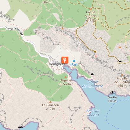
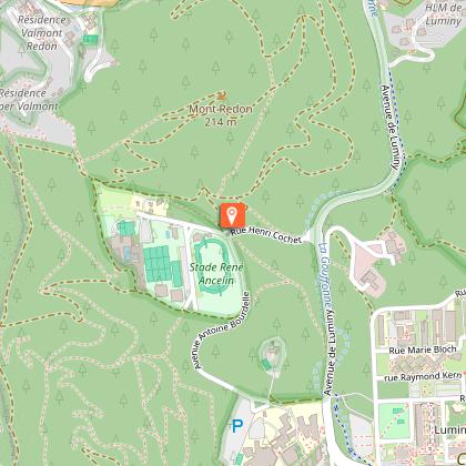
An easy stroll to the Sugiton belvedere, from where you can see most of the Calanques. Suitable for an all-terrain stroller. Ideal for walkers who don't like big differences in altitude, or who don't have much time, but still want to discover the Calanques on foot. Whichever means of transport you use (bus, bike or car), the hike starts in front of a gate that gives access to the Luminy estate. Have you brought enough water? No ? Then take advantage of the fountain a few meters behind you, under the trees, to fill your water bottle. The hike starts in the heart of the Luminy campus. At the end of the Second World War, the Luminy estate came under state ownership. While preserving the natural character of the site, the 1960s saw the development of a campus at its center, while the outlying areas were handed over to the City of Marseille in 1963 for leisure and recreation facilities. Designed by René Egger, the city's official architect, the campus was inspired by Anglo-Saxon models and adapted to the constraints of the site, between natural heritage and relative isolation. The École d'art et d'architecture, with its patios, galleries, calades and pilings, was recognized as a twentieth-century heritage site in 2007. In September 2023, the École Nationale Supérieure d'Architecture (ENSA) left its historic site, inaugurated in 1968. The 7,000m² available are now looking for a new vocation. Today, the entire facility is home to some 10,000 people, including students, professors, researchers and contractors. At the start of the walk, you pass through a beautiful wooded area with century-old trees. In the past, Luminy and Sugiton were part of the same forestry and agropastoral estate. The slightly uphill path culminates at the Col de Sugiton. Then fork right and the trail (1) takes you to the foot of the belvedere, where it ends. The reward is a 360° panoramic view (2) of the Calanques, Cap Canaille, the fishing hamlet of Morgiou (3), the Riou archipelago jutting out over the ridges, Mont Puget, the cliff of the roofs (4) and the infinite beauty of the Mediterranean Sea. During the Calanque de Sugiton quota period, this itinerary remains accessible and is not affected by the access reservation. To return, simply follow the same itinerary in the opposite direction.

5 km
Very easy
5 171 avenue de Luminy 13009 Marseille
Show
Hiking through the countryside, east of Marseille
9.8 km

Hiking through the countryside, east of Marseille

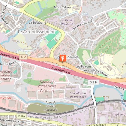
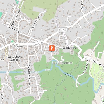
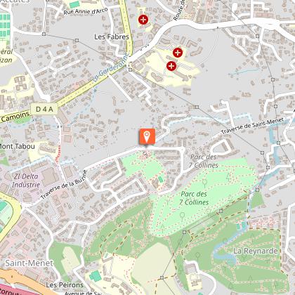
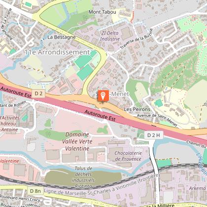
A walk to discover the outlying districts of the city center, nestled at the foot of the Garlaban massif and crossed by diversions of the Marseille canal. At the same time, you'll come across a trail in the footsteps of Marcel Pagnol. The starting point for this walk is in Eoures (0), at the "Eoures village" bus stop. To reach it from central Marseille, take RTM bus line 12 from the "Timone" metro station. Pass the church (1), the "aux tropiques" shop (2) and then fork left onto boulevard du Monument until the next intersection with rue Arnould, where you turn left. Go straight ahead, skirting a large park which conceals a beautiful, unseen country house, until you reach a traffic circle. Go down Rue de Ruissatel. You'd be forgiven for thinking that this was once the countryside, with a handful of beautiful mansions, bastides and, above all, a majority of farmland producing early vegetables and olive oil. Green spaces at the foot of the 445-meter-high Ruissatel hill. You've now reached the heart of the village of Les Camoins. On your right, a gate leads to a modern fountain (3). Go around the church of Sainte-Agathe and down the rue of the same name, then the rue Saint-Roch. If the church is open, you can still admire a wooden bust of this Saint-Roch. In the 19th century, this narrow street was home to a post office, where the omnibus to Marseille departed and arrived. For the younger generation, the omnibus is the ancestor of the bus. In those days, the vehicle was horse-drawn. Rue Saint-Roch leads to montée d'Eoures, which you follow to the right for a few meters, then left into traverse de la Penne. You'll continue to pass through suburban areas with beautiful detached houses. Take a look at number 63 (4). After a few steps, turn right onto the traverse de Saint-Menet. At number 21, you'll find a rare plot of undeveloped land, currently undeveloped. Will it resist? In the distance, the view is unobstructed over three mountains in the Calanques massif: Lantin, Saint-Cyr and Carpiagne. Once you've passed nr. 27 of the traverse, walk a little further to reach a secret passage in the wall, which we invite you to use. Marcel Pagnol and his parents' route to Bastide Neuve must have looked like this at times. We love it here at the Marseille tourist office (5). You have to cross the housing estate, part of the Parc des Sept Collines, which refers to the hills you could see in the past, when this was still farmland. Keep to the right down rue Hilaire Curtil until it opens onto a wider road, la traverse de la Buzine, which you have to walk down until you reach a nursery school. Walk along the school's fence to reach the entrance to the Parc des 7 Collines (6). Cross the park to reach the Château de la Buzine forecourt (7). Leave the site through the main gate and join the old panel opposite, which gives details of life in the bastide and the Château de la Buzine. Behind it, a small path runs along the road to the left, allowing you to take a short stroll through the greenery. In the distance, on the right, you'll see a very tall building with two towers and part of its roof topped by a lighthouse. This is the Lycée Paul Mélizan (8). At the end of the field, go back up to the road, the traverse de la Buzine, and go straight ahead. Then take the first right, the chemin de Saint-Menet aux Accates. This becomes a small footpath alongside a dry-stone wall, then joins the D4A departmental road, which you must cross to continue towards the historic heart of Les Accates. Until you reach the village church, the path is still called "chemin de Saint-Menet aux Accates". When you reach the Saint-Christophe square and crossroads, which are pleasantly shaded by several plane trees, walk along the restaurant building and up the Fenêtres Rouges crossroads (9) until you reach the small Jeanne d'Arc square, recognizable by a pretty house on the corner with blue shutters. Turn left, then right at the end to climb back up. You'll gain height as you follow a tarmac path winding through the vegetation to the Accates cemetery. There's a bench in the shade of several holm oaks, where you can take a break. To the left of the bench, take a path which, after offering a last bird's-eye view of the cemetery, joins a fenced property which you must walk along to the right. Walk under the pines along the fence and you'll soon reach a carriage road, the Canal au Val path. The first landmark to confirm that you're in the right place is a fig tree growing like a bush with several trunks in a field on your right. Shortly afterwards, you'll come to the Camoins diversion, a branch of the Marseille canal that supplies water to the land in the neighborhoods you pass through. The road then changes its name (although it's not clear whether there are any signs in situ) to Chemin de la Salette, marking the invisible dividing line between the Accates (left) and Valentine (right) districts. Follow this until you reach a junction with the Chemin des Accates, which you should take down to no. 61. At this point, you can leave the road to enter a natural area, a verdant park, and follow the path to the other end, marked by the ruins of an ancient bastide, La Denise (10). Cross the traffic circle to enter and cross the Denise departmental park (11). Leave the park on the D4A departmental road. Follow this road to the left (past the Fabrique bakery) to reach the RTM "Lycée Paul Mélizan" bus stop, where you can take lines 12, 12B or 12S to return to the town center and La Timone, the collective terminus for these 3 bus lines.

3 h
7.1 km
Easy
42 Boulevard Notre Dame à l'arrêt de bus "Eoures village" 13011 Marseille
Show

What to do in HOTEL CASSITEL

See more suggestions
Make your stay in HOTEL CASSITEL special by booking activities.
See more suggestions
Cinéma Eden-Théâtre
7.1 km

Cinéma Eden-Théâtre

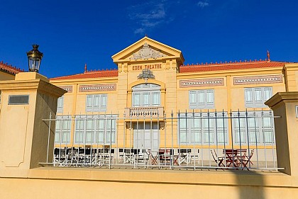
The Eden-Théâtre in La Ciotat, built in 1889, is recognised as the world’s oldest cinema still in operation. Linked to the history of the Lumière brothers, it held its first paid screening on 21 March 1899, establishing La Ciotat as a cradle of cinema. A true monument to La Ciotat’s cultural heritage, the Eden Théâtre holds a unique place in the global history of cinema. Built in 1889 as a performance venue, it originally hosted theatre performances, music-hall concerts and various popular events. A few years later, its destiny changed following a meeting between the Lumière family and the venue’s owners, making La Ciotat one of the birthplaces of cinema. At the end of the 19th century, the Lumière brothers stayed regularly in La Ciotat, where they shot several films that laid the foundations of cinema history. Captivated by the town and its landscapes, they experimented there with their revolutionary invention: the Cinématographe. After several private screenings organised in 1895, the Eden became the venue for a decisive stage in this adventure. On 21 March 1899, 250 spectators attended the first public, ticketed screening held in the theatre. This screening of Lumière films marked the Eden’s official entry into the history of cinema. As other cinemas from that era have disappeared or been radically transformed, the Eden Theatre is now recognised by Guinness World Records as the oldest cinema still in operation in the world. Fully restored in keeping with its original architecture, the Eden Théâtre continues its cultural mission today by offering a programme that combines cinema, heritage and artistic events. By honouring the memory of the pioneers of the silver screen whilst showcasing contemporary creativity, it offers visitors a unique experience in a venue steeped in history, where one can still feel the excitement of cinema’s early days. This must-see venue in La Ciotat is therefore a must-visit for all lovers of culture, history and cinema wishing to discover one of the most iconic sites of the world’s cinematic heritage. The screening room has a maximum capacity of 161 seats. An arthouse cinema with three labels (Heritage, Young Audiences and Short Films).

25 boulevard Georges Clemenceau 13600 La Ciotat
Book from 6 EURBook
Show

What to visit in HOTEL CASSITEL

See more suggestions
Shop in the boutiques of HOTEL CASSITEL.
See more suggestions
Bastide Marin
6.6 km

Bastide Marin

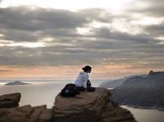
La Bastide Marin is a historic monument undergoing restoration. It is an interpretation centre for Mediterranean heritage. This concept symbolises the union between Mother Earth and the Mediterranean Sea, Mare Nostrum. Home to long-distance sailors, La Bastide Marin was at the heart of a large agricultural area where vineyards and olive groves provided significant harvests. Here you will discover architectural heritage dating back more than four centuries: a manor house and a farm. The natural setting, restored by members of the La Ciotat Il Était Une Fois association, is an eco-friendly site that houses an educational farm. It is also an LPO refuge consisting of several landscaped, secret and harmonious gardens. La Bastide Marin has been listed as a Historic Monument since 4 March 2013. Glorious long-distance sailors lived here for centuries. They braved storms, epidemics and pirates. Members of the Order of Malta, their bastide was hospitable. A summer resort, a place of care and refuge during maritime attacks, La Bastide Marin holds many secrets. A remarkable heritage site, it is the only remnant of the glorious days of maritime trade. The only surviving bastide in La Ciotat, Bastide Marin has a rich and fascinating history. Built around 1550, its owners were long-distance sailors and shipowners. Owned by the Marin family, bourgeoisie of the maritime city in the 17th century, the bastide would belong over the centuries to the Abeille, Portalis and Fabre families, before returning to the Marin family in the 19th century. Its owners lived off the riches of maritime trade and managed the city (several consuls over the centuries, coats of arms and a large heritage in La Ciotat and Marseille). Despite their desire to preserve the property, the heirs were forced to sell it to the municipality of La Ciotat on 9 July 1992 to settle inheritance costs. The Bastide and its lands then fell into disrepair, forgotten, squatted in and vandalised until 2004. Rescue of the Bastide Marin and restoration of the heritage Since 2004, the La Ciotat, Il Était Une Fois association has been working on a project to restore the Bastide Marin and its natural setting. With its 600 volunteers and extensive partnerships, its aim is to highlight periods of history by encouraging the active participation of all citizens. It contributes to the promotion and transmission of knowledge and skills by preserving and restoring natural and built heritage. A centre for interpreting Mediterranean matriarchal heritage. The concept of Mediterranean matriarchal heritage symbolises the union between Mother Earth and the Mediterranean Sea, Mare Nostrum. It also recalls the commitment of women throughout the centuries. Indeed, La Bastide Marin is a place where land and sea come together to form a single heritage. Home to long-distance sailors, it was also at the centre of a large agricultural area (10 hectares) where vineyards and olive trees provided significant harvests. Here and around the Mediterranean, the land and the sea are at the heart of ancestral traditions, knowledge and popular wisdom; they are matrimoine. This centre for interpreting Mediterranean matrimoine will aim to preserve and pass on ancient techniques and ancestral know-how to visitors and younger generations through spaces created and designed for educational purposes. Remarkable architecture Preserved by two hackberry trees, one of which is over three hundred years old, the façade of the residence is austere, faithful to the humility imposed by the hospitable order, but it has three rows of corbels, the first of which is inverted. Built with lime, a finely chiselled cobblestone pavement welcomes visitors. This presentation, which is by no means exhaustive, illustrates the rich architectural heritage of Bastide Marin. It holds many mysteries, and the association is still far from having uncovered all its secrets.

1943 Avenue Guillaume Dulac 13600 La Ciotat
Show
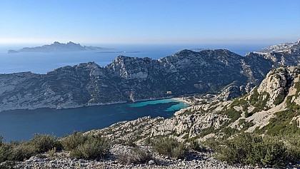
Plage Calanque de Sugiton
6.9 km

Plage Calanque de Sugiton

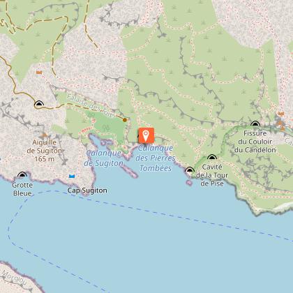
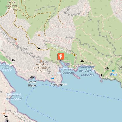
Small cove with varied relief, shaded, with sand, pebbles and rocks. The waters are fresh and crystal clear. A small, shaded cove with varied terrain, featuring sand, pebbles, and rocks. The water is cool and crystal-clear. Unsupervised area Caution: The access trail is quite long and steep. To reach Sugiton, you must first cross part of the Luminy estate and its beautiful pine forest, some of whose trees are over a century old. Hikers have two options for reaching the sea: the steep path carved through the rock, or the fire road built in the 1950s and 1960s. This is a chance to take in the surrounding vegetation and the agricultural and pastoral ruins that dot the route. At the bottom of the slope, the Sugiton calanque actually consists of two small, steep-sided coves, each with a tiny beach. The Sugiton and Pierres Tombées coves are suffering from severe erosion due to overuse. To protect the area, the National Park limits the number of visitors by requiring a free reservation for access during the peak season. In 2026, reservations are required on: June 20 and 21, every day from June 27 to August 30, September 5 and 6, and September 12 and 13, 2026. Reservations for Sugiton are open to everyone and can be made online. They are free and quick. troov.com/parc-national-des-calanques/rendez-vous Here is some practical information to know before booking: Anyone with a reservation must bring a form of ID Please adhere to the number of people specified in the reservation Reservation holders may arrive and depart at any time of day Children under 3 do not need a reservation In the event that the Bouches-du-Rhône Prefecture closes the forest areas due to fire risk, all reservations will be canceled and not rescheduled. Visitors will be notified by email the day before their visit, around 6:00 PM. Due to limited cell service in the Sugiton Calanque, your reservation must be downloaded or printed before arriving on-site. Safety Tips Recommended access by bus: Line B1 Castellane – Luminy Take responsibility for your own safety and come prepared: sturdy shoes, plenty of water, sun protection All use of fire is prohibited (cigarettes, hookahs, campfires, etc.) Camping and overnight stays are prohibited Please take your trash home and sort it there Stay on the trails and respect areas where vegetation is regenerating To preserve the peace and quiet of the area and respect other visitors, please be quiet. Playing music and using connected speakers are prohibited.

13009 Marseille
Show

Where to eat in HOTEL CASSITEL

See more suggestions
Restaurants in HOTEL CASSITEL offer a friendly atmosphere.
See more suggestions

Where to sleep in HOTEL CASSITEL

See more suggestions
Find a comfortable stay in HOTEL CASSITEL.
See more suggestions
Hôtel Calanque de Figuerolles
7 km

Hôtel Calanque de Figuerolles

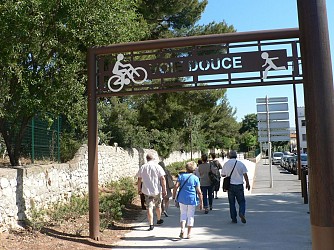
Rooms and studios nestled in a green oasis, 50m from the sea. No television in the accommodation, nature takes care of the show. Restaurant and snack bar on site. Far from the norm, but a magic that takes you away, the time of a stay. A hotel-restaurant with its feet in the water, 5 minutes from the old port of La Ciotat. Located on the beach of one of the most beautiful creeks of the coast, this atypical and unusual establishment is a haven of peace 5 minutes away from civilization. The establishment was created in 1956 by the Russian grandparents of the current owner and offers a restaurant listed in many guides and a hotel with 8 bungalows. Its panoramic view of the cliffs lit up at night, its many terraces on several levels and its luxuriant vegetation give the place the magic of a Provencal hamlet on the water's edge. This Independent Republic of Figuerolles, a humorous nod to a unique setting with an air of the end of the world, is also the awareness of living in a privileged environment. The association Les Amis de Figuerolles is committed to maintaining, protecting and embellishing the Calanque; while two of the rooms are deliberately kept at a historic rate to facilitate access to all. Terrace, garden, restaurant. Sea view, air conditioning, shower, bath, toilet, internet access, wifi access, safe. Animals accepted (extra charge of 12€ per day and per animal). Credit cards and holiday vouchers accepted.

Avenue de Figuerolles Calanque de Figuerolles 13600 La Ciotat
Show
Caution!
We have no information on the difficulty of this circuit. You may encounter some surprises along the way. Before you go, please feel free to inquire more and take all necessary precautions. Have a good trip! 🌳🥾