Tours
Activities
Places of interest
Where to eat
Where to sleep

Explore Fontenay-Trésigny with Hotel Restaurant Campanile

Are you the owner?
Welcome to Hotel Restaurant Campanile Fontenay-Trésigny, your ideal starting point for exploring the hidden treasures of Seine-et-Marne. Located in Île-de-France, Fontenay-Trésigny is brimming with activities and attractions that will delight both young and old.

Begin your visit at the majestic Château de Vaux-le-Vicomte, a masterpiece of Baroque architecture, where you can stroll through its Fr...
See more

Walking around HOTEL RESTAURANT CAMPANILE FONTENAY TRESIGNY

See more suggestions
Take a walk around HOTEL RESTAURANT CAMPANILE FONTENAY TRESIGNY.
See more suggestions
Forest Farm
5.2 km

Forest Farm

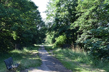
This route invites you to discover one of the many farms located on the Brie plateau: the Forest Farm. Enclosed on all sides, its sloping roofs frame a very curious dovecot porch. Certified by FFRandonnée. Description of the route : 1. With your back to the parking area, turn right, Rue Gallier. At the crossroads, go across the tree-lined avenue, turn right, cross the RD402 and turn right onto Rue du Cloître. Turn left onto Rue Couperin, then right to continue along Rue de l’Archelet and Rue de la Poterne. 2. Take Rue René-Quinton on the left for 60 m, then the path on the right. Go down the Thiou path on the right. Cross the Bréon stream at a ford and climb up through Forest to the farm. 3. Take the RD32 on the left for 150 m, then the forest track on the right. Cross the RD48 and go down straight ahead. Cross the Yerres and climb towards Maurevert. At the T-junction, follow the road to the left and, at the next crossroads, take the road to the right. It leads to Verneuil-l’Étang. Cross the RD402 and continue in the same direction. 4. At the crossroads, take the road on the right towards Verneuil-l’Étang station (SNCF access possible), then the street on the left and, after the junction (GR®1), again the street on the left. Continue along the path at the edge of the forest. At the next crossing, take the path on the right for 500 m. 5. Go down the path on the left through the woods and then along the edge. Cross the RD32, take the former railway line straight ahead, cross the Yerres by the viaduct, and continue straight back to the parking area. Municipalities crossed : Chaumes-en-Brie and Verneuil-l’Étang Distance : 11.1 km - Duration : 3h00 – Marked trail : Green - Difficulty : Average Access to the map : www.cirkwi.com/fr/circuit/282882-la-ferme-de-forest

3 h
11 km
Easy
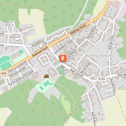
15 Parking coulée verte - au carrefour des rues Paul Doumer et Gallier 77390 Chaumes-en-Brie
Show
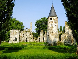
The Château du Vivier
5.2 km

The Château du Vivier

Le Vivier, with its ponds and the ruins of its castle, the Yerres valley dominated by the viaduct of the former railway line, and finally Chaumes-en-Brie, await you on this typically briard route. Certified by FFRandonnée. Description of the course : 1. With your back to the parking area, head right, Rue Gallier. At the crossroads, follow the tree-lined avenue straight ahead, turn right, cross the RD402 and turn right onto Rue du Cloître. In Rue Couperin, make a left-right turn to continue along Rue de l’Archelet, then Rue de la Poterne. 2. At the second junction, turn right onto Rue Pasteur (RD144). Pass the cemetery, go around it and follow the path behind. It runs along a wood. Take the paved path on the left. It crosses the Bréon at the Vieux Moulin (ponds and fish reserve). Continue on the path to the left and ignore the paths on the right. Then follow the RD144 to the right. 3. Opposite the stud farm, turn right. The road passes in front of the park of the ruined Château du Vivier, then runs between the ponds before entering the wood. It continues alongside the castle park, where the ruins are clearly visible, then turns left to pass between the ponds before climbing into the forest. 4. Turn right onto the path. At the RD402, make a right-left crossing and continue along the path beside the stream. Leave this path to the right for another path. After a right-angle bend, it leaves the wood, then makes another right-angle turn to run alongside the racecourse for 900 m. In the wood, turn left onto a path, leaving the pond and another path on your left. 5. Follow the road to the right for 30 m, then take the Chemin des Plantes on the left. Ignore the path on the left, cross the Fossé du Miroir and reach the Chemin Saint-Sébastien. 6. Take the road opposite the rue du Pignon Vert, before the bridge turn right to join the Allée Jehan Michel which leads back to the starting point. Municipalities crossed : Chaumes-en-Brie and Fontenay-Trésigny Distance : 10.2km - Duration : 2h30 – Marked trail : Magenta – Difficulty : Average Access to the map : www.cirkwi.com/fr/circuit/282883-le-chateau-du-vivier

3 h
10 km
Easy
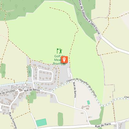
1 au carrefour des rues Paul Doumer et Gallier 77390 Chaumes-en-Brie
Show
Liverdy-en-Brie : The Fords of the Marsange
6.1 km

Liverdy-en-Brie : The Fords of the Marsange

Your steps will lead you across a series of fords. A verdant walk between woods and fields. Certified by FFRandonnée. Route description : 1. From the school parking area, behind the town hall, turn left into Rue Gustave Delage then onto the Route de Meaux. Pass by the town hall and the church. Turn right twice to follow Rue du Cèdre. Then turn left, Rue de la Forêt, and continue along the path of the same name. 2. Facing the copse, take the path on the right then the one on the left. Cross the Feneuse stream, ignore the path on the left, follow the edge of the wood and turn right. Cross the RD32 and follow the road through the hamlet of Retal (note the stone marker on the right). Take the path on the left. It sometimes follows the forest edge then enters the woods. 3. Climb the path on the left. It leads onto another path. Go down along it, exit the woods and cross the bridge over the Marsange. Climb the hillside and cross the railway line. 4. Turn right onto the road and right again on a 1km paved path parallel to the railway. Continue left for about 1 km, cross the road and turn right onto the next one. Enter Courquetaine, pass by the church, then reach the town hall via Rue de Villetour on the right. 5. Turn right into Rue du Bué then take the next one on the right. Cross the railway line. 6. Turn left onto the path. It descends through the woods, crosses a footbridge over the Marsange and climbs the hillside. Follow Rue des Fontaines to the left and enter Liverdy. After about 1,000 meters, turn right, Rue de la Briqueterie, then right again, Rue de la Croix de Retal, and finally left, Rue de Melun. Return to the starting point. Municipalities crossed : Liverdy-en-Brie, Courquetaine Distance : 14,3 km - Duration : 3h30 – Marked trail : Yellow - Difficulty : Average Access to the map : www.cirkwi.com/fr/point-interet/1934574-liverdy-en-brie-les-gues-de-la-marsange

4 h
14 km
Easy
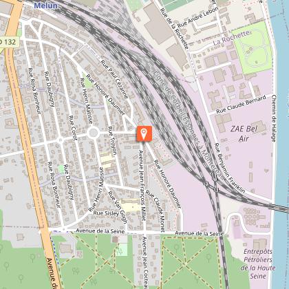
2 1 rue de Meaux - Parking de l'école 77220 Liverdy-en-Brie
Show
From Verneuil-l’Étang to Mormant (From the Yerres to the Avon stream)
7.8 km

From Verneuil-l’Étang to Mormant (From the Yerres to the Avon stream)

This course will allow you to discover the Yerres Valley and some Briard villages far from the modern bustle. Certified by FFRandonnée. Description of the route : 1. With your back to the train station, turn right onto Rue de la Gare, until you reach Rue Arthur Chaussy. Turn left and reach the crossroads with Rue Jean Jaurès, take a left at the decorated electrical substation. Walk along the forest and at the crossroads (100m from La Grange Saint-Père), turn right, after 500m enter the wood. Reach the RD32 and take the path opposite, cross the Yerres. 2. At the crossroads of Rue Nicolet, turn right onto Rue du Pignon Vert and continue straight along Chemin Vert. Cross the Fossé du Miroir and turn left onto Chemin des Plantes to reach Rue du Château. Go right for 100m and take the path on the right that leads to the Route de Courtomer, turn left towards Argentières. 3. Before the bridge, turn left and follow the river. Move away from it to go up along the edge of the woods, continue in the undergrowth. Turn left and climb through the woods. Near the road but without crossing it, immediately take the path on the right which goes down towards the Yerres, then turns left along the woods (Pierre Couvée, 50m on the right). The path leaves the edge with a right bend, then after a left bend reaches the RD32E2. Turn left and enter Courtomer. 4. Take Rue du Pont Neuf on the right. It crosses the Yerres and leads to the RD211. Continue along the path opposite. After a crossroads, turn right and enter the hamlet of Bonfruit. In Rue de l’Ormoy, turn left then right to follow Rue du Jour. Turn onto the path on the right, then 1,700m further on, onto the road on the right, walk along the cemetery and reach Aubepierre. Go around the hamlet on the left following the Grand Bois path. 5. Follow the RD32E3 on the left for 1 km and then take the path on the right. Pass the Ormesson farm. Immediately head into the path on the left, turn right, cross the Avon stream then the railway line to enter Mormant. Continue along Rue du Moulin, turn right onto Rue du Général-de-Gaulle and right onto Avenue de la Gare to reach Mormant station. Municipalities crossed : Argentières, Aubepierre-Ozouer-le-Repos, Chaumes-en-Brie, Courtomer, Mormant and Verneuil-l’Etang Distance : 18 km – Duration : 4h30 – Marked trail : Blue - Difficulty : Average Access to the map : www.cirkwi.com/fr/circuit/282888-de-verneuil-l-etang-a-mormant-de-l-yerres-au-ru-d-avron

5 h
18 km
Easy
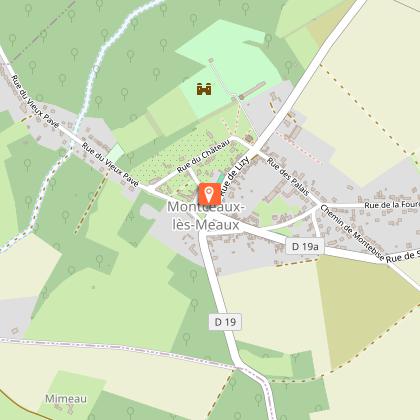
Gare de Verneuil-L'Étang 77390 Verneuil-l'Étang
Show
The Woods of Vitry
8.3 km

The Woods of Vitry

A pleasant short hike around a village nestled on a hillside above the Yerres river. After seeing fields and the village from different angles, you cross a wood where there are many traces of quarrying activities. Certified by FFRandonnée. Route description : 1. From the town hall square, head left. Go up Rue de la Mairie to Rue de la République (on the right, Saint-Martin church). Turn left. At the fork, of Croix Saint-Jean, turn right, then turn right twice onto a grassy path. Cross the RD48 and continue straight on the path slightly offset to the left, crossing fields. After the cemetery, turn right onto the road. 2. Take the road on the left for 1 km, then turn right and walk along the hamlet of Jamard. Near the level crossing, make a right-left turn and continue for 1 km along the railway line. 3. Take the RD48 on the right. Pass the place called La Cantine and turn left onto a dirt road. Cross the footbridge over the Yerres River and reach the edge of the forest, following it to the left. Walk along the Yerres for 800 m, then move away from it by going up the path on the right. Turn right twice, then turn left at the fork. Follow the main track on the right for 500 m. 4. Turn right, pass near old stone quarries, then turn left. Go down the main track until you exit the forest, cross the bridge over the Yerres, then climb Rue des Fontaines. After the washhouse, turn right then left and return to the town hall square. Municipality crossed : Ozouer-le-Voulgis Distance : 9.4 km - Duration : 2h30 – Marked trail : Blue - Difficulty : Easy Access to the map : www.cirkwi.com/fr/circuit/750485-les-bois-de-vitry

3 h
9.4 km
Very easy
19 Place de la Mairie 77390 Ozouer-le-Voulgis
Show
The Roses Path on foot
10 km

The Roses Path on foot

With a total length of 17 km, the roses path winds between the municipalities of Yèbles and Servon. It offers walkers, horse riders, and cyclists a space to walk along a railway track full of history. The route corresponds to the old railway line that connected Paris-Bastille to Verneuil-l'Étang. The path owes its name to the "train des roses" which transported to Paris flowers produced in the surrounding villages. As a major part of the local economy in the last century, it played a key role in the development of a regional specialty: rose cultivation. The old railway line, which has become a walking path, runs through mainly peri-urban and agricultural areas. Its interest lies above all in the quality of the landscape (the Yerres Valley and the Brie-Comte-Robert plateau), its accessibility for leisure activities (walking and cycling), and its important role as an ecological corridor (areas where living beings can move or spread in such a way as to be able to feed, and reproduce). Description of the route : 1. With your back to Yèbles cemetery, turn left. At the guard house, turn left and take the Chemin des Roses. 2. After just over 3 km, turn right, then left to cross the high-speed railway. Then continue left and right. 3. Cross the Yerres viaduct in Solers and enjoy the view. Built at the end of the 19th century and opened in 1892, this three-arch bridge is sadly known for a railway disaster that happened on August 10, 1918. 4. On your right, you will pass the old train station of Coubert-Soignolles, where cut roses from local growers were collected and sent by train to Les Halles de Paris. 5. At the old train station of Grisy, on your right, discover the Rose Museum, which brings to life the history of the 250 rose growers who helped make the region known as the “Land of Roses". 6. On your left, you will find the old train station of Brie-Comte-Robert, which now houses the headquarters of the Community of Communes of l'Orée de la Brie. 7. For about 1 km, the Roses Path becomes a cycle path in an urban area. Then continue your way towards Servon. Beyond the arrival point at Servon, it is possible, at least in part, to continue your hike in the Val-de-Marne Department by the green way known as "Végétale" greenway currently being developed : lavegetale.fr/ Municipalities crossed : Yèbles, Solers, Soignolles-en-Brie, Coubert, Grisy-Suisnes, Brie-Comte-Robert and Servon. Distance : 17,7 km Access to the map : www.cirkwi.com/fr/circuit/580250-le-chemin-des-roses

18 km
9 rue de Paris 77390 Yèbles
Show
The Roses Path for horse riding
10 km

The Roses Path for horse riding

With a total length of 17 km, the roses path winds between the municipalities of Yèbles and Servon. It offers walkers, horse riders, and cyclists a space to walk along a railway track full of history. The route corresponds to the old railway line that connected Paris-Bastille to Verneuil-l'Étang. The path owes its name to the "train des roses" which transported to Paris flowers produced in the surrounding villages. As a major part of the local economy in the last century, it played a key role in the development of a regional specialty: rose cultivation. The old railway line, which has become a walking path, runs through mainly peri-urban and agricultural areas. Its interest lies above all in the quality of the landscape (the Yerres Valley and the Brie-Comte-Robert plateau), its accessibility for leisure activities (walking and cycling), and its important role as an ecological corridor (areas where living beings can move or spread in such a way as to be able to feed, and reproduce). Description of the route : 1. With your back to Yèbles cemetery, turn left. At the guard house, turn left and take the Chemin des Roses. 2. After just over 3 km, turn right, then left to cross the high-speed railway. Then continue left and right. 3. Cross the Yerres viaduct in Solers and enjoy the view. Built at the end of the 19th century and opened in 1892, this three-arch bridge is sadly known for a railway disaster that happened on August 10, 1918. 4. On your right, you will pass the old train station of Coubert-Soignolles, where cut roses from local growers were collected and sent by train to Les Halles de Paris. 5. At the old train station of Grisy, on your right, discover the Rose Museum, which brings to life the history of the 250 rose growers who helped make the region known as the “Land of Roses". 6. On your left, you will find the old train station of Brie-Comte-Robert, which now houses the headquarters of the Community of Communes of l'Orée de la Brie. 7. For about 1 km, the Roses Path becomes a cycle path in an urban area. Then continue your way towards Servon. Beyond the arrival point at Servon, it is possible, at least in part, to continue your hike in the Val-de-Marne Department by the green way known as "Végétale" greenway currently being developed : lavegetale.fr/ Municipalities crossed : Yèbles, Solers, Soignolles-en-Brie, Coubert, Grisy-Suisnes, Brie-Comte-Robert and Servon. Distance : 17,7 km Access to the map : www.cirkwi.com/fr/circuit/580250-le-chemin-des-roses

18 km
rue de Paris 77390 Yèbles
Show

What to do in HOTEL RESTAURANT CAMPANILE FONTENAY TRESIGNY

See more suggestions
Book your activities in HOTEL RESTAURANT CAMPANILE FONTENAY TRESIGNY and experience memorable moments.
See more suggestions
Disneyland® Paris Multiday Tickets
19 km

Disneyland® Paris Multiday Tickets

ArrayWhy You Shouldn’t Miss This When in Paris, a trip to Disneyland® is an absolute must! Consisting of Disneyland® Park and Walt Disney Studios® Park, the 4800-acre park is also home to seven hotels, Disney® Village, a golf course, and a mall, among others. Disneyland® Paris has a number of thrilling rides, including the famous Rock 'n' Roller Coaster Starring Aerosmith, and your pass ensures that you don’t miss a single one! The Walt Disney Studios® Park takes you behind the scenes of your favourite Disney® movies. You can see the animation process that make the movies so brilliant. Come and see for yourself why Disneyland® Paris is the most-visited theme park in all of Europe. Your Experience When booking your tickets, you can choose the number of days you want to spend in Disneyland® Paris - 2, 3, or 4. Your skip-the-line ticket lets you bypass the long purchasing queues and head directly inside the park. At Disneyland® Paris, you can meet your favorite characters - the original Mickey Mouse and friends gang, the Disney® princesses, the Toy Story characters, the Jungle Book characters, among others. Your tickets also ensure that you have ample time to check out the numerous parades and shows going on during the day. Additionally, be sure to also check out how the beloved Disney® films are made at the Disney® Animation Studios, a must-visit for every Disney® fan! Some of the popular rides at Disneyland® Paris are: Big Thunder Mountain Buzz Lightyear Laser Blast Indiana Jones and the Temple of Peril Peter Pan’s Flight Pirates of the Caribbean Ratatouille: The Adventure Rock 'n' Roller Coaster Starring Aerosmith Star Wars Hyperspace Mountain Toy Soldiers Parachute Drop The Twilight Zone of Terror At the end of every day is a dazzling fireworks show at the Sleeping Beauty castle, which, by the way, also has a hidden lair, where a dragon lays asleep.

Disneyland Paris, 77777 Marne-la-Vallée, France 77420 Marne-la-Vallée
Book from 169 EURBook
Show

What to visit in HOTEL RESTAURANT CAMPANILE FONTENAY TRESIGNY

See more suggestions
Discover the nightlife of HOTEL RESTAURANT CAMPANILE FONTENAY TRESIGNY.
See more suggestions
German military cemetery
12 km

German military cemetery

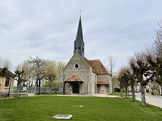
The german military cemetery in Solers where 2,228 soldiers rest, is now a place of pilgrimage for germanic families. In the middle of the Second World War, around August 25th, 1944, the Allies - British, Canadian and American - launched their offensive across the entire width of the front between Le Havre and Troyes, to the north-east. In these maneuvers, the 7th American Army Corps advanced towards Soissons, between Paris and Fontainebleau, fighting against the forces of the 1st American Army and the 5th German Armoured Army. It is in these battles that the German soldiers buried in Solers were killed. On August 30th, 1944, the 1st American Army began the creation of a temporary cemetery on a stretch of land located to the west of Solers, where it buried both the bodies of its own soldiers and those of the German army. To the left of the road leading to Soignolles-en-Brie, it buried approximately 2,000 of its dead and, to the right, a roughly equal number of German soldiers. After the cessation of hostilities, the bodies of the American soldiers were transferred to the military cemetery of Épinal, while the German plots passed under the administration of the French authorities and were enlarged following the addition of numerous graves from the surrounding region, but also from Troyes and Chartres. Within the framework of the Franco-German agreement of October 23rd, 1954, concerning military graves, the necropolis of Solers was chosen to become, after the necessary enlargement work, one of the definitive German military cemeteries in France. On July 28th, 1962, the cemetery was solemnly inaugurated in the presence of numerous relatives of the missing. Every year a ceremony in honour of German mourning takes place on the Sunday following November 11th in the presence of many dignitaries.

Grande rue 77111 Solers
Show
Sensitive Natural Area : Le Chemin Des Roses
14 km

Sensitive Natural Area : Le Chemin Des Roses

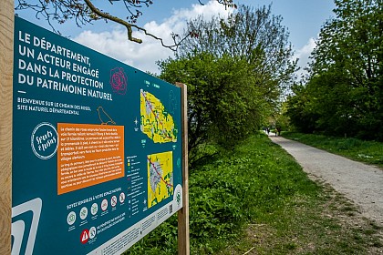
With a total length of 17 km, the Sensitive Natural Area the path of roses winds between the municipalities of Servon, Brie-Comte-Robert, Grisy-Suisnes, Coubert, Soignolles-en-Brie, Solers and Yèbles. It offers walkers, horse riders and cyclists a route to stroll along, steeped in history. The path follows the former railway line that connected Paris-Bastille to Verneuil-l'Étang. A major driver of the local economy of the last century, it was an essential element in the development of an activity specific to the region : rose growing. Built between 1859 and 1892 for military needs, the railway was closed to passenger traffic in 1953, and to the transport of goods, by successive sections, from the seventies until 1990. The disused line then lay fallow. In the early nineties, the section between Brie-Comte-Robert and Coubert was bought by the Chemin des Roses Intercommunal Union, created for the occasion, bringing together the municipalities of Brie-Comte-Robert, Grisy-Suisnes and Coubert. This union then carried out a development project for the railway right-of-way, to make walking, cycling and horse riding possible. The section, known as the « green path », was transferred, in 2003, to the Department of Seine-et-Marne which decided to classify the entire site as a sensitive natural area in order to preserve its landscape and ecological interest. Several years were necessary for the acquisition and development of additional land rights-of-way : at Servon (on the border with the department of Val-de-Marne) and between Coubert and Yèbles, at the other end. They were opened to walkers in 2010. The former line runs through mostly semi-urban and agricultural areas. The site's appeal lies mainly in its proximity in terms of leisure activities (walking, cycling) and the quality of the landscape. Indeed, it forms part of the wider ensemble constituted by the Yerres valley and the Brie plateau. The area's railway heritage is long-standing but the sector remains deeply marked by its history. The vestiges of the railway activity are identified by the linearity of the route, the presence of embankments or the sunken nature of the path, the presence of crossing structures and stations, some of which have been restored by the municipalities. The area covered by the Chemin des Roses is remarkable for the linear character of the path and the presence of grassy or wooded borders which give it a significant role as an ecological corridor (spaces where living beings can move or spread in order to feed or reproduce). Distance : 17 km Natural environments : woods, scrubland Points of interest : botany, landscape, history, ecological corridor Special features : former railway line, crossing of the Yerres by viaduct.

6 Rue de la Gare 77166 Grisy-Suisnes
Show
Collegiate Church of Saint Martin in Champeaux
15 km

Collegiate Church of Saint Martin in Champeaux

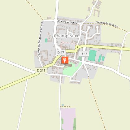
Regarded as one of the most remarkable religious buildings in the Brie region, the Collegiate Church of Saint-Martin in Champeaux remains the only witness of a college (community) of canons which welcomed a famous center of theological studies and chant. The Collegiate Church of Saint-Martin in Champeaux, listed as a Historic Monument in 1840, is a beautiful and large church built from the middle of the 12th century to the beginning of the 14th century. It was the church of a chapter of canons also called college from which it derives its name as a collegiate church. There was a singing school which trained choristers for the communities from all the region with its exceptional acoustics. The prosperity of the canons allowed the construction of a church with remarkable architectural qualities. It has a length of 69.55 m, a width of 24.20 m, a height in the nave of 15.30 m and its bell tower culminates at nearly 30 m. The oldest parts of the building, such as the transept, date back to the middle of the 12th century and the rest of the church illustrates the main stages of rayonnant gothic architecture. The whole, completed at the beginning of the 14th century, has come down almost intact, enriched during the Renaissance with a beautiful set of stained glass windows and very beautiful choir stalls and in the 18th century by a large carved wooden reredos. The architecture of the rather bare early Gothic style is however enriched with sculptures : a large number of carved capitals with plant motifs, figures and various monsters that dot the choir and the transept. There is within the Collegiate the most important set of 14th century tomb slabs in the region. In 1946, faced with the state of degradation into which the monument had fallen, the Association des Amis de la Collégiale was founded to help the municipality preserve and enhance this heritage. The Collegiate Church houses several objects protected as Historic Monuments : 16th century statues, a 17th century tabernacle, an 18th century eagle lectern, 19th century prie-dieux and a cantor's stool... The famous sculptor Rodin was passionate about this beautiful monument to which he often returned. He produced architectural drawings of the Collegiate Church, reproductions of which are displayed there. The Association Guillaume de Champeaux has been offering since 1983 concerts, exhibitions and guided tours of the Collegiate Church.

5 Place du Cloître 77720 Champeaux
Show
Aunoy Castle
16 km

Aunoy Castle

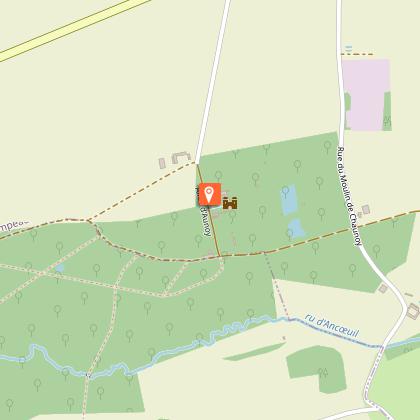
In Champeaux, not far from the collegiate church, the Aunoy domain has conserved its original architecture from the classical era. The castle and its jewel : an English-style park dating from the 18th century are listed in the inventory of Historical Monuments. The seigneury of Aunoy is attested as early as 1180 and at the beginning of the 18th century, a medieval castle flanked by towers is still visible. It was following a fire which occurred in 1750 that ravaged the old residence that the owner Jean-Baptiste Chabert, stockbroker, took the opportunity to completely remodel the domain, moving the dwelling further to the west, keeping only a few feudal features such as the dovecote and two small towers. The residence desired by Chabert is characteristic of the architecture of noble country houses. The Château d'Aunoy presents an important particularity ; it is devoid of ceiling and wooden framework. The roofing technique used is that of brick ceilings and attics. The castle barely completed, Chabert resold it in 1754, to his younger son. It then passed by marriage to the famous Parisian lawyer Pierre-Jean-Baptiste Gerbier, in 1761. Gerbier commissioned, from an English gardener whose name remains unknown, new gardens in the English style. The visits of the Prince de Conti and the Duchess of Chartres, themselves enthusiasts and patrons of English-style gardens, made this park a fashionable garden. It is regarded as one of the first English-style parks to be created in France. The castle park is today known for its majestic hybrid plane tree (Platanus x hispanica) of 30m high and 8m in circumference which extends over a span of more than 40m. About 200 years old, it is also classified as a "remarkable tree of Seine-et-Marne" (source CAUE77). In the 1960s, the property belonged to Emmanuel Motte, the style director of the mythical Maison Jansen, who undertook major restoration works both in the castle and in the park. He decorated the living rooms in the 18th century style, removed the roofs of the low wings and made many improvements in the park. Currently, property of Mr Tapiau, a former antique dealer and art collector, the castle's outbuildings are now fitted out to host seminars and receptions.

Château d'Aunoy 77720 Champeaux
Show
Notre-Dame de Roiblay Chapel
17 km

Notre-Dame de Roiblay Chapel

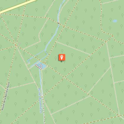
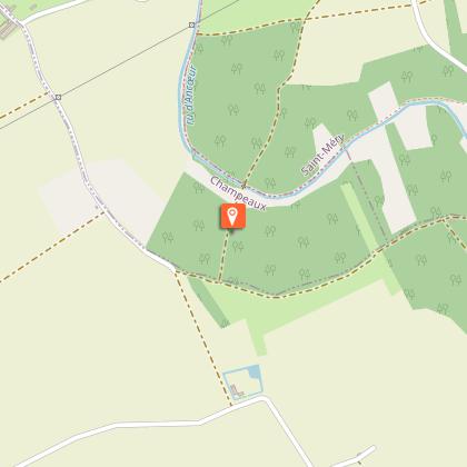
In the middle of a centuries-old wood in Champeaux, stands a little chapel (property of the municipality of Saint-Méry) implanted at the edge of the GR1. Here existed since the end of the 17th century, a priory with a chapel whose foundations still exist in part today. On the hillside which dominates the Ancœur stream valley, a listed site, stands a little chapel. Located on the municipality of Champeaux, but property of the municipality of Saint-Méry, by a decree of June 24th 1910, it is located at the edge of the long-distance hiking path, the GR1. On this location existed, since the end of the 17th century, a priory with a chapel whose foundations partially still exist today. Prosperous during the 13th and 14th centuries, it suffered the backlash of jurisdictional conflicts in the parish of Blandy and was only served by priests or hermits in the 16th century. The chapel continued, especially during the 16th and early 17th centuries, to be an important place of pilgrimage. In 1789, during the Revolution, community properties were seized and the chapel was sold in 1791 to Mr. Sarrazin de Maraize, Seigneur of Saint-Méry, for 200 livres. Named Mayor of Saint-Méry, Mr. de Maraize died there in 1794. The chapel was demolished during the Convention. The children of Mr. de Maraize had it rebuilt in 1803 and endowed it with a statue of the Virgin. It then served as a burial place for the family. Restored in 1859 by Mr. de Forestier, grandson of Mr. de Maraize through his mother, it remained in this family branch until 1867, then was offered to the municipality of Saint-Méry.

Rue du Moulin de Chaunoy 77720 Champeaux
Show
The Val d'Ancoeur : a protected site
17 km

The Val d'Ancoeur : a protected site

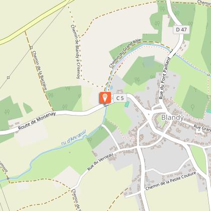
The history begins like a fairy tale : "Once upon a time the Val d'Ancoeur..." with its castles, its legends and the 3 names of this small stream, which has become a myth, that from Ancoeur becomes Ancoeuil to end as the Almont... before flowing into the Seine. (Extract from the website of the Departmental Archives) The Ancoeur stream is a watercourse that has its source in the municipality of Grandpuits-Bailly-Carrois at an altitude of 125 m. It then takes the name of "Ancoeuil" in the municipality of Moisenay and joins, after a journey of 25 km from its source, the Bassin de la Poële of the Vaux-le-Vicomte castle. At the exit of this basin, it flows into the "Almont" 5 km downstream into the Seine at Melun. It constitutes, with its tributaries, a catchment area of approximately 306 km². The Ancoeur stream flows through the municipalities of Grandpuits-Bailly-Carrois, La Chapelle-Gauthier, Bréau, Bombon, Saint-Méry, Blandy-les-Tours, Moisenay, Maincy and Melun. Classified as an "Exceptional Site" since October 14, 1985 by the Regional and Inter-Departmental Directorate for the Environment and Energy of Île-de-France, the Ancoeur stream offers enchanting landscapes. The classified site covers 1,861 hectares. Along the watercourses — the Almont, the Ancoeuil (or Ancueil) and then the Ancoeur — the Val d'Ancoeur unfolds its panoramas : villages, forests, castles (Vaux-le-Vicomte, Blandy-Les-Tours...) but also, at the confluence of the Seine, urbanised areas. "The Ancoeur is a very low-flow river, highly irregular and regularly at risk of running dry. The annual runoff depth within its catchment area is 96 millimeters annually, which is among the lowest in France, more than three times below the national average, and above all well below the average for the entire Seine basin (approximately 240 millimeters). The constant flow of the Ancoeur has, however, for centuries made it possible to operate the many mills. The large number of hydraulic structures, such as canals, basins and ponds, small reservoirs and mills, give the landscape a particular identity centred on water and its management. This is to be understood in relation to the wet character of the land." A place of life, production and creation, the Val d'Ancoeur brings together major heritage sites across the entire territory : churches and works of art dating back to the 12th century, castles, farms, mills, rural dwellings, small rural heritage... It has also become a subject of reflection and aesthetic admiration thanks to the artists who have captured its beauty and interpreted it in their own way. - The Ancueil ("Anqueil" in its 17th-century spelling) gave its name for example to a majestic statue in the park of Vaux-le-Vicomte, located to the left of all the grottos (1659–1662), facing the Tibre installed to the right in 1659. - The painter Paul Cézanne immortalised the bridge called Pont de Maincy in 1879 (now held at the Musée d'Orsay). - And the sculptor Auguste Rodin dedicated magnificent drawings to the collegiate church of Champeaux (1890–1917), as testimony to his admiration. For several years, the Communauté de Communes Brie des Rivières et Châteaux and the Communauté d'Agglomération Melun Val de Seine have joined forces to develop a Landscape Plan, revealing the assets of the Val d'Ancoeur. An opportunity for the protection and enhancement of the landscape heritage. The perimeter, which is based on the classified site, encompasses 11 municipalities across an area of approximately 56 km². It extends over a straight-line distance of nearly 17 km.

77115 Blandy
Show

Where to eat in HOTEL RESTAURANT CAMPANILE FONTENAY TRESIGNY

See more suggestions
Establishments in HOTEL RESTAURANT CAMPANILE FONTENAY TRESIGNY offer dishes for all tastes.
See more suggestions

Where to sleep in HOTEL RESTAURANT CAMPANILE FONTENAY TRESIGNY

See more suggestions
Stay in unique accommodations in HOTEL RESTAURANT CAMPANILE FONTENAY TRESIGNY.
See more suggestions
Centre International de Séjour Le Rocheton
27 km

Centre International de Séjour Le Rocheton

The centre is located in La Rochette, on the edge of the Fontainebleau forest and in the heart of a 10-hectare wooded park. Its green, peaceful setting and proximity to many sites of interest make Le Rocheton an ideal base for discovering the region. Whether you're on your own, with family, friends, an association, a school, a work group, a walker or a climber, whether you're coming as a neighbour or from another continent to relax or to work, the whole team at Le Rocheton is here to welcome you and to meet your needs. What's more, Le Rocheton is ideally located close to many sites of interest: exceptional residences, the Châteaux of Fontainebleau, Vaux le Vicomte and Blandy les Tours, the medieval town of Provins, museums, theme parks, etc. Activities : - A covered and fenced volleyball/tennis/archery pitch with a suitable synthetic surface - A city stadium (volleyball / mini football / badminton / handball / tennis / basketball) on an adapted synthetic surface - 4 squash courts are planned for 2017 in collaboration with the French Squash Federation. Services : - Tourist breaks (groups or individuals) - Educational breaks (with a tailor-made programme of activities) - Room hire for private events - Seminars and study days - BAFA training courses Whatever the nature of your project, the teams at Le Rocheton are here to help make it unforgettable. (Tourism & Handicap label since April 2019).

Rue de la Forêt 77000 La Rochette
Show
Campanile Melun-Dammarie-les-Lys
28 km

Campanile Melun-Dammarie-les-Lys

The Campanile Melun Sud - Dammarie-les-Lys hotel is located near Melun and Paris. Its relaxing setting makes it an ideal stopover during a stay in the Paris region. The hotel has 47 bright, spacious air-conditioned rooms, some of which are accessible for people with reduced mobility. Double, triple or family, we offer a wide choice of rooms to meet your needs. They all have a private bathroom, a writing desk, a telephone, an alarm clock, a free WIFI connection and a television with Canal + and Canal Satellite channels. You can also book a cot if required. A courtesy tray is available in your room so you can enjoy a tea or coffee break at any time of day. You will receive a warm welcome at the Campanile Melun Sud - Dammarie-les-Lys hotel from our bilingual French/English staff. To ensure your complete satisfaction, the hotel also has a free car park and a key dispenser allowing you free access to your room. A seminar room for up to 50 people can also be booked. Whether you're planning a business meeting, a banquet or a cocktail party, our space has all the facilities you need for a successful event. Take advantage of the restaurant for your meal breaks! A buffet breakfast is served every morning in the dining room or on the terrace. At lunchtime or dinnertime, don't miss out on our varied, well-balanced dishes, deliciously prepared with seasonal produce. To ensure your peace and quiet, meal trays can also be delivered to your room until 11pm.

346 Rue du Capitaine Bernard De Poret 77190 Dammarie-les-Lys
Show
Caution!
We have no information on the difficulty of this circuit. You may encounter some surprises along the way. Before you go, please feel free to inquire more and take all necessary precautions. Have a good trip! 🌳🥾