Alert
Alerts
The Woods of Vitry


Description
A pleasant short hike around a village nestled on a hillside above the Yerres river. After seeing fields and the village from different angles, you cross a wood where there are many traces of quarrying activities. Certified by FFRandonnée.
Route description :
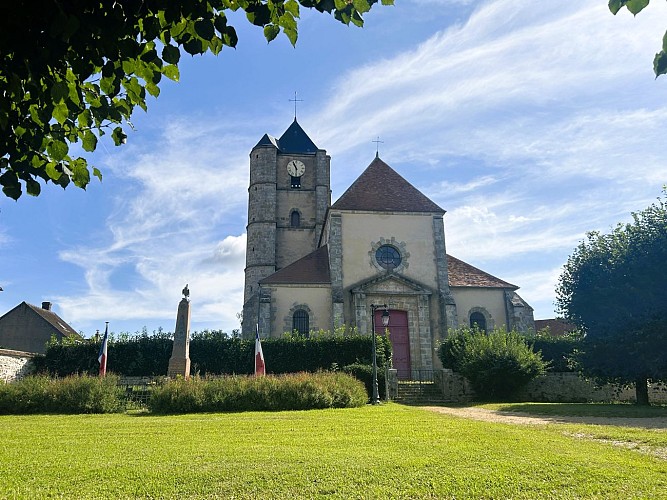
1. From the town hall square, head left. Go up Rue de la Mairie to Rue de la République (on the right, Saint-Martin church). Turn left. At the fork, of Croix Saint-Jean, turn right, then turn right twice onto a grassy path. Cross the RD48 and continue straight on the path slightly offset to the left, crossing fields. After the cemetery, turn right onto the road.
2. Take the road on the left for 1 km, then turn right and walk along the hamlet of Jamard. Near the level crossing, make a right-left turn and continue for 1 km along the railway line.
3. Take the RD48 on the right. Pass the place called La Cantine and turn left onto a dirt road. Cross the footbridge over the Yerres River and reach the edge of the forest, following it to the left. Walk along the Yerres for 800 m, then move away from it by going up the path on the right. Turn right twice, then turn left at the fork. Follow the main track on the right for 500 m.
4. Turn right, pass near old stone quarries, then turn left. Go down the main track until you exit the forest, cross the bridge over the Yerres, then climb Rue des Fontaines. After the washhouse, turn right then left and return to the town hall square.
Municipality crossed : Ozouer-le-Voulgis
Distance : 9.4 km - Duration : 2h30 – Marked trail : Blue - Difficulty : Easy
Access to the map : www.cirkwi.com/fr/circuit/750485-les-bois-de-vitry
Technical Information
Altimetric profile
Starting point
Points of interest


Additional information
Environments
In the country
Updated by
Communauté de Communes Brie des Rivières et Châteaux - 12/11/2026
www.briedesrivieresetchateaux.fr
Report a problem
Open period
All year round daily.
Contact
Email : seine-et-marne@ffrandonnee.fr
Website : http://www.randonnee-77.com/
