Tours
Activities
Places of interest
Where to eat
Where to sleep

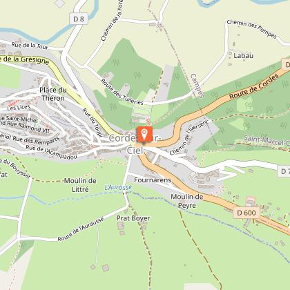
Discover Cordes-sur-ciel from Domaine du Garissou

Are you the owner?
Located in the heart of Tarn, the charming town of Cordes-sur-ciel and its surroundings provide a multitude of activities to enrich your stay at Domaine du Garissou. Start your exploration with a stroll through the medieval streets of Cordes, renowned for its Gothic architecture and panoramic valley views. Meet local artisans and admire their craft in pottery, jewelry making, and more. Nature enth...See more

Walking around DOMAINE DU GARISSOU

See more suggestions
Explore the walking circuits of DOMAINE DU GARISSOU.
See more suggestions
Cordes heritage trail
941 m

Cordes heritage trail

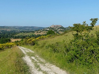
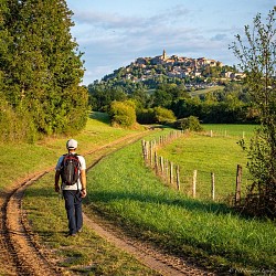
It is said that the village of Cordes-sur-Ciel is as breathtaking from within as it is from outside the ramparts! The beauty of its Gothic buildings rivals the panoramic views of the town from the surrounding hills. The profile of Cordes changes with every angle and time of day.So, don’t miss the pleasure of discovering the medieval town from every angle and combining history, heritage, landscape, and nature.This loop can be completed in two parts by cutting between point 3 and point 9. Follow the GR®36 from Place Jeanne Ramel-Cals: climb up Grand’Rue de l’Horloge. Pass through the Porte du Vainqueur and then the Porte du Portail-Peint. Emerge onto Grand’Rue Raymond VII. Continue to Place de la Halle. Descend to Porte des Ormeaux. Go through it and immediately turn right, then leave the town through Porte de la Jane, continuing to follow the GR®36 (be careful at the Redoulets: stairs can be very slippery when wet). Cross the D600 (beware!). Continue towards "Tanneries-Collège". Follow Rue des Tanneries to Place Saint-Félix des Cabannes. Head right on the D30. Cross the Cérou bridge. Walk for 250 meters. Turn left onto the embankment and take the GR® de Pays. Continue for 500 meters on the Voie Verte. Pass the wooden barrier. Turn right onto the dirt path. At the Nauze, continue straight towards the woods. Do not take the GR® de Pays that climbs to the right but go straight to the D7. Turn right along the Cérou. Pass the Moulin de la Bogne. Walk 100 meters on the road. Take the old bridge to the left, known as the "Pont des Ânes". After 100 meters, turn right onto the dirt path (beware of flooding; climb the embankment if necessary). Continue for 1 km to Vindrac. Follow the church and then turn right along the cemetery to circle the village by the mill and its pond. Stay on the left and turn right onto the tree-lined road to reach the D600. Cross the road (be careful!) to reach the road sign for Péteulé. Continue 2 km on the road that ascends to the hamlet of Les Fargues. At Les Fargues, admire the cross. Go back and take the dirt path. Continue straight to the junction with the GR® de Liaison (red and white markers). Continue left to the farm shed. Turn right towards Piton and follow the ravined path bordered by stone walls. Go to the road. Take the road to the right for 120 meters. At the intersection, turn left towards La Devèze. Cross the Aurosse. Climb straight up the path. Turn right, under the convent, and follow the small path towards Bouysset. Descend the road for 500 meters. Cross the Aurosse again. Ignore La Bouriette to the right. Arrive at a crossroads. Continue straight along the path lined with plum trees. Leave the path to admire the Saint-Jean Chapel. Resume the path (please respect the private property you are passing). After the tennis court and an old washhouse, climb left up the path. Stay on the path to the left for 700 meters. Emerge at a fork. Take the left path (PR Sentier du Causse) for 1.5 km towards Cordes and admire the silhouette of Cordes one last time. Climb up Rue de Litou to return to the starting point

4 h
15 km
Easy
Show
Lacapelle Sainte-Lucie circuit
2.4 km

Lacapelle Sainte-Lucie circuit

From the hills of Mouzieys-Panens, the northern profile of Cordes commands attention: the medieval city stretches out like a sleeping dragon above the Cérou Valley, imprinting its presence on the walker who eagerly awaits the moment when the city's silhouette will reappear around a bend. Departure from Place Saint-Félix. Take Rue des Tanneries towards the Théâtre du Colombier and the bioclimatic primary school. After about 250 meters, join the old railway track on your left. When you reach the road, turn right towards Mas de Tulle. You will now follow the GR® 36 (white and red) for 2 km. At the fork, leave the GR® 36 and take a path on your left that will lead you to a small paved road. Turn left and join the D30 road. Pass the Cantarrane-Le-Haut lake and the bridge, then follow the path that ascends to Mouzieys-Panens. Cross the village, and at the Calvary, turn left towards "La Védillerie." Continue on the road until you reach the hamlet of Lacapelle-Sainte-Lucie. At the crossroads, continue left along a path that leads to the old Sainte-Lucie Chapel (private property). Go back up the road to the right. Behind the Camp de Besset house, turn left. Follow the path through the woods until you reach the road. Turn left (the route is shared with the GRP® Cordes-Penne). At the "La Védillerie" sign, turn right and then left. After the last house, take a right onto a steep, somewhat hidden path under the trees (slippery when wet). In the valley, go left onto a wide grassy track, pass the Nauze, then reach the old railway track (viewpoint of Cordes-sur-Ciel). At the end, turn right and cross the Cérou bridge to return to your starting point

4 h
12 km
Easy
Show
Téroundel path (Sentier du Téroundel)
4.5 km

Téroundel path (Sentier du Téroundel)

A peaceful walk along the hillside with a beautiful viewpoint opening up to the Cérou valley and the city of Cordes. The oaks lining the path provide light and pleasant shade. The walk starts in front of the castle entrance, heading into the countryside along the beautiful tree-lined avenue recently named "Lice des créneaux." You will see several dovecotes, including the one on the right at the large farm "La Peyrière." Continue straight on the path through the fields. At the end of the path, before turning right onto the Chemin des Plaideurs, move towards the left to discover a beautiful white stone cross hidden in the embankment. Descend the Chemin des Plaideurs and take the small hillside path to the right, which overlooks a private agricultural path. A bit further on, follow this agricultural path for 40 meters. Then, turn left onto the small path that descends to the bottom of the hill. Along your route, you will pass an olive grove and catch glimpses of the striking profile of Cordes-sur-Ciel through the trees. This relatively flat and shaded area offers you the chance to take a break before starting the return journey to the village. Follow the small path that climbs halfway up the slope. You will come across numerous installations for olive cultivation. In the distance, you will see the Château de Mouzieys and the arched bridge. This rather unique bridge was built 150 years ago to support the new road between Cordes-sur-Ciel and Mouzieys-Panens. When you reach the road, if you wish to finish your circuit directly, continue straight and then turn left at the intersection to return to your starting point in front of the castle. Discovery detour: from point 4, turn right to take the road towards Térondel, then the small path to admire the magnificent panorama of Cordes and the Cérou valley at the southern end of the plateau (about 1 km - 15 min round trip). Returning on your steps, continue a few meters towards the village, then turn left to arrive below the castle. There you will find the Thouron washhouse. Its three clear water basins will allow you to refresh yourself before returning to the starting point via the stony path that runs along the castle

2 h
2.6 km
Very easy
Show
Sentier des dunes de Maraval aux Touardes
7.4 km

Sentier des dunes de Maraval aux Touardes

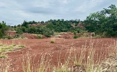
An itinerary combining geology, nature and heritage In front of the starting sign, near the car park, take the path that leads into the woods. You are now entering the clay dunes of the Rougier de Maraval. Please note: you are now entering a Sensitive Natural Area (ENS): stay strictly on the marked path; on either side you are on private property. Turn left towards La Vernière. Pass by the foot of the hamlet and join the D91 departmental road. At this point, there is a shorter 5.34 km option (1 hour 45 minutes) by taking the path on the right. Cross the departmental road and continue straight ahead until you reach the small road. Take it on the right, pass in front of the Mouline and continue for another 400 m. Turn onto the path on the right. Shortly before reaching the road, turn right, go up the path along the edge of the field and join a farm track. Turn left towards Tonnac. At the road, turn left, cross the D33 and follow the path up to the village church. Go around the church on the left, cross the village to the cemetery.  If you are starting from Tonnac: the loop begins here. After the cemetery, turn right and go down to the D33. Turn left onto it for 130m and turn right to go up towards the D91. Cross the main road and take the path through the fields. At the track, turn right. At the next intersection, ignore the path on the right (arrival of the alternative route) and take the path opposite which descends through the woods to the entrance of the Maraval estate. Take the road on the right and return to the starting point.

3 h
8.6 km
Easy
Show
Sentier des coteaux
8.8 km

Sentier des coteaux

During this loop, starting from the village of Cestayrols, a great variety of landscapes consisting of vineyard hills, valleys, and sunflower fields will unfold before your eyes.During the tour, you will also discover the very picturesque and charming rural heritage, including dovecotes and washhouses that bear witness to the activities of our ancestors. At the starting sign, on the village square, go straight up a small street, then turn right. Take a path winding through oaks and boxwood. Cross the D3 and continue straight on a stony path. About 1 km further, at a path intersection, climb right onto a grassy path and reach a fork. Go right and continue straight. Arrive at a crossroads. Turn left onto a grassy path passing through fields. Cross the D3 again and take the road opposite. Leave the Théron road on your right and reach a bend. Take the path on the right; it leads to an intersection. Go left until a fork. Continue straight towards Lincarque. The path leads to the D1. Turn left towards Lincarque. -> Opportunity to visit the church Take the road to the right until the Mas de Caussé (farmhouse). At the Mas, hairpin left and continue straight on a path along the edge of fields to reach La Couliche. At the hamlet's exit, go left and descend along a field to the road, which you follow straight for about 200 meters. Turn right to climb under bushes. Emerge onto the D1, which you cross to climb straight up a grassy path. At the crossroads, turn left. Follow the grassy path straight. Pass a dovecote. At the road, turn left towards Théron. Before a large house at the end of the road, take a path to the left. Pass a washhouse and return to Cestayrols.

3 h
9.7 km
Very easy
Show
Chemin de la Vère au Saint-Hussou
9.7 km

Chemin de la Vère au Saint-Hussou

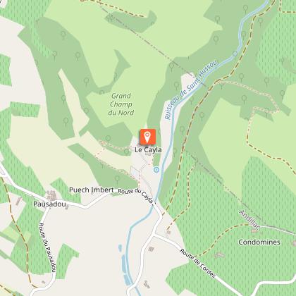
A very pleasant hike that will take you through centuries of history and typical Gaillac landscapes (vineyards, hillsides, valleys, riversides). Make a stop at the departmental Château du Cayla museum to enjoy the romantic atmosphere of the place. At the square of Cahuzac-sur-Vère, take the D 922 to the right, towards Gaillac, for about 20 meters, then turn right into a small street; reach a fork. Descend on the road to the right and continue straight on a gravel path. It passes in front of a sewage treatment plant, then follows the river before making a right-angle turn to the left and becoming grassy. At the road, climb straight ahead on the grassy path to reach an intersection of paths. Turn right and, just before the place called Sept-Viols, descend to the right on a path along the vineyards. At Comberouzal, turn left onto the road until a crossroads; go straight on a path. At the Moulin de la Tour, go left. At the D 26, turn right, cross a bridge then, via the D 1, reach Vieux. -> To see the menhir Ste Carissime (Peyra Levada): from the village of Vieux, follow the D1. At the first crossroads, turn left (signposted menhir), cross the Vère (bridge). The menhir is located in the middle of the field on the right (signposted). Before the left turn, climb straight ahead on a grassy path. At the end, turn right. Arriving at a dovecote, descend by stairs. Pass under a medieval gate. Cross the washhouse then pass to the left of the church. After the cemetery, climb to the right onto the road. Descend to the right onto a path that then climbs towards Andillac. At the road at the entrance to the village, turn right and cross Andillac. At the exit, continue straight towards the Château du Cayla until an intersection. Turn left towards Pausadou. Pass in front of a dovecote. About 150 meters later, go on a grassy path. At the road, turn right. At a crossroads, in Pausadou, descend to the left. Reach an intersection. Turn left onto a path. Walk for about 20 meters and climb to the left onto the Cayla path. Cross a small footbridge and climb into the woods. Pass in front of the château, then descend onto the road. At the bottom of the château, descend on a grassy path (note: in winter, go right onto the road, the path is impassable). Pass in front of a washhouse. Cross a stream by a ford and continue straight to an intersection of paths. Turn right. At the road, turn left. At a crossroads, climb to the left. Pass the place called La Combe, then next to a water tower. At Cinq-Peyres, go right. Continue to the right on a path (viewpoint on Cahuzac-sur-Vère). In the village, cross a stone bridge and reach the square.

4 h
14 km
Easy
Show
Sentier des lavoirs
9.7 km

Sentier des lavoirs

Cahuzac sur Vère is a charming little village nestled on the banks of the Vère. The trail will allow you to discover the local heritage and the beautiful rolling landscapes of the Gaillacois hills. From Place du Mercadial, turn left onto the Bélautié road towards Salettes. Continue straight. At the exit of Cahuzac, turn left towards Fontanes and continue straight for 1.5 km. To see: fortified village church and frescoes by Nicolaï Greschny. At the road junction, turn left. Ignore a path on the right and take the next one. Cross the main road (with caution!) and continue straight ahead on the path. Pass over the railway line. At the tarmac, make a left/right turn. At the fork, turn left onto the gravel path. At the path intersection, go left. 50 meters further, at the four-way junction, turn left. The path follows the ridge. At the main road (with caution!), turn left and immediately right towards La Réveillé. At the fork, go left. Leave the grassy path on the left. Climb towards the place called La Réveillé. Facing the calvary, turn left and take the path. At the path intersection, turn left. The path descends along the woods. At the end, facing the Lafargue dovecote, turn left. Cross the Vère via the small bridge. At the fork, climb to the left. Ignore a path on the right. At the road, go straight on the dirt path through the undergrowth and then through the boxwood. At the exit, continue straight on the grassy path (view of Donnazac). At the road, go left. At the fork, take the path to the left. Continue straight. Pass the train bridge. Turn right onto the dirt path (left shortcut towards Cahuzac-sur-Vère). At the road, turn right. Leave a path on the left. At the intersection, turn left. After 250 meters, go left on the path. Go around the grove on the left. Take the grassy path on the left. At the next intersection, go right to the road. Turn left. At the calvary, turn right onto the path along the railway line. After 200 meters, pass under the bridge. At the road, turn right. After 50 meters, turn left. In Arzac, at the first intersection, turn right. At the exit of the hamlet, descend to the right. Ignore the path on the right. At the road junction, turn left. Cross the Vère bridge to reach the main road. Go straight (with caution!). Ignore a path on the left. Pass under the viaduct arch and climb straight on the path. At the road (former station on the left), descend straight onto the grassy path. Facing the main road, turn left towards Mas Brunet. Follow a water reservoir on the right. At the intersection, ignore the train bridge and go right on the gravel path. It passes near a washhouse. 10 meters further, at the fork, turn right onto the grassy path. Follow the fence. At the road, continue straight towards Salettes and Château de Mauriac. Follow the cemetery and continue straight. After 50 meters, descend to the right on the path. Pass near the washhouse to reach the road. Descend to the right (common route with the Vineyard and Châteaux trail - yellow mark) to return to Cahuzac-sur-Vère. At the stop sign, turn left and take the first street on the left to return to the starting point.

4 h
17 km
Easy
Show
Vignoble et châteaux
10 km

Vignoble et châteaux

The trail winds through the hills of Gaillacois, where the vineyard, prominent in the landscape, is marked by its undulating rows. The hiker will discover a noble heritage (castles) and a viticultural one (vine huts, dovecotes, farm cellars). On the square, take the road towards Gaillac for 100 meters. Turn right into the small street (follow GR 46, marked with white and red signs). At the intersection of roads, go left (ignore the white and red markings). Walk for 300 meters. At the fork, turn right and then left onto the dirt road. At D26, continue straight. At the fork, take the grassy path to the right. Walk for 800 meters then turn left onto the grassy path. Continue straight on the gravel path. At D115a, turn right and then descend left along the vineyard path. Continue straight. At the intersection, turn right onto the road. At this junction, turn left onto the stone path and continue straight to Broze. In the village, pass the town hall, descend the stairs, then turn left onto the road along the vineyards. At the first crossroads, turn left and walk for 150 meters. At the second crossroads, take the road to the right and continue straight. At the intersection, turn left towards Mas de Mazières. At the calvary, turn right. Cross Mas d'Ousty and continue straight. At the crossroads, descend to the right towards La Garriguette. Descend on the grassy path. Cross the road and pass by the cemetery to reach Boissel. In the village, turn right onto the road and then left towards the square. Cross D922. Continue straight for 50 meters then turn left and right onto the grassy path. At the intersection of paths, turn right and continue straight. At Les Carbonnières, descend on the path through the fields to Barastou. At the road, turn right and continue straight up to the village of Mauriac. Pass by the castle and continue straight. At the crossroads, turn right. Walk for 150 meters. Turn right onto the path along the fields to Salettes. Turn left and then, at the crossroads, turn right along the cemetery. At the fork, go right onto the road. Walk for 200 meters, then turn left. Walk another 300 meters and then turn right onto the path. At the road, turn left. Continue on the stone path. Reach Cahuzac-sur-Vère.

5 h
17 km
Easy
Show
From the Cérou to the Aveyron
10 km

From the Cérou to the Aveyron

From the Plateaux du Combal and des Graves, the path opens up to the beautiful views of the Cérou and Aveyron valleys.The rather dry highlands contrast, especially in summer, with the freshness in the valleys provided by the two rivers.Heritage also makes an appearance along the path with the small Saint-Projet Church in Larroque (12th-15th centuries), which features a simple and rustic beauty. From in front of the Town Hall, take the small road to the right for 250 meters. Then cross the Cérou River via the metal footbridge and turn right. Continue along the river towards La Borie. Cross the railway tracks, turn right, and take the path that climbs straight ahead towards the hill. You can pause to enjoy the beautiful viewpoint over the Cérou Valley. Then resume on the path. Pass by the mobile home and, 250 meters later, turn left to take the small trail winding through the woods. Follow this trail to emerge above the "castle" of Ratayrens, an old fortified house with original restoration. Turn left and follow the zigzagging road through the hamlet. Then turn left again and follow the Aveyron River. Pass by the Saint-Projet Church in Larroque (be sure to take a look inside) until reaching Saulieu-Haut. Turn left into the hamlet of Saulieu-Haut and ascend to the ridge that overlooks the two valleys (great viewpoint). Turn right and descend the Chemin de Caudecoste to return to La Borie. Enjoy the view of the Milhars Castle. Head back towards Milhars along the road that follows the railway tracks. At Prunelle, cross the railway line to find the road and the metal footbridge taken on the way out. Continue until you reach your starting point, Place de la Mairie (Town Hall).

3 h
10 km
Easy
Show
Oenorando® Vallon de la Caude
11 km

Oenorando® Vallon de la Caude

An almost 3-hour oenorando® in the hills of Cestayrols, with rolling landscapes covered in vineyards and meadows. From the car park, take the path between the cypress trees to the departmental road. When you reach the road, turn left onto the path along the vineyard and descend to the bottom of the valley. Cross the Caude stream, then the Castanet road and join the other small road. Turn left and, 200m further on, go back up towards Plancas. Cross the hamlet and take the ridge path, which offers a lovely view over the valley and the hamlet of Lincarque. Ignore the various junctions and continue to the Domaine des Vignals. At the entrance to the Domaine, head down to the left through the vineyards and rejoin the Castanet road. Turn right. Here, there is the option of a short variant (5.50 km). Turn left, cross the bridge over the Caude stream and go back up through the vineyards to the Lacroux estate. Continue along the Castanet road until you reach the RD n°1. Take it carefully to the left, cross the bridge over the stream and then turn right towards Moussens. Cross the hamlet. On leaving, turn right onto the path running alongside the vineyard. At the road, take the path leading to Le Pouget via a right/left turn. On leaving the hamlet, turn left at the crossroads and continue straight ahead along the path until you reach the RD n°1, at the entrance to Lincarque. Cross the road, take the end of the path and then turn left until you reach the roundabout. Cross it and take the path opposite, which runs along the old wall. After about 300 metres, turn right and go up through the vineyards to return to the starting point.

3 h
9.6 km
Very easy
Show

What to do in DOMAINE DU GARISSOU

See more suggestions
Discover surprising activities in DOMAINE DU GARISSOU and book the ones you like.
See more suggestions
Camping Huttopia Pays de Cordes sur Ciel
3.6 km

Camping Huttopia Pays de Cordes sur Ciel

Stay just a stone's throw from Albi, in a lush green setting with views of the hills and the medieval town of Cordes, voted 'France's favourite village', right in the heart of the Gaillac vineyards and the Cordais region. Just a few kilometres from Albi, Huttopia Pays de Cordes-sur-Ciel opens the doors to a timeless getaway, where unspoilt nature meets the fascinating history of the Tarn. Imagine waking up each morning to birdsong, with breathtaking views over the rolling green hills and the medieval town of Cordes-sur-Ciel, voted 'France's favourite village'. Here, everyone finds their own happiness : traditional camping enthusiasts settle on spacious, shaded pitches, while those looking for something unique can choose a cosy chalet, a Toile & Bois tent, a Cahutte or a Wooden Trailer, for a total immersion in nature without ever giving up comfort. Everything is designed so that young and old alike enjoy an unforgettable holiday : take a dip in the heated pool, let the children have fun in the playground, challenge your loved ones to pétanque, table tennis or on the multisport field. In summer, share convivial moments during the activities, then meet up at the Café-Comptoir to enjoy a crêpe for a snack, an aperitif at sunset or a homemade pizza on the terrace, lulled by the gentle Occitan evenings. Set off to discover the treasures of the region: stroll through the cobbled streets of Cordes-sur-Ciel, a UNESCO World Heritage site, explore the Gaillac vineyards or set off on hiking trails, on foot or by electric bike, available for hire on site.

910 route de Cordes sur Ciel 81170 Vindrac-Alayrac
Book from 0 €Book
Show
Cap Canoë Aveyron
20 km

Cap Canoë Aveyron

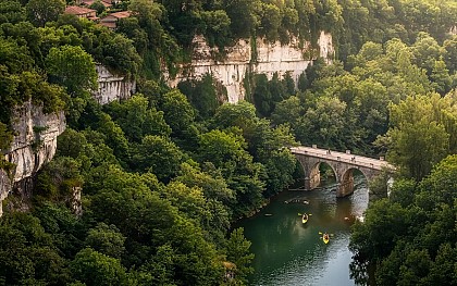
Canoë Kayak rental in Saint Antonin Noble Val in the Gorges de l'Aveyron. The opening of the rental base is scheduled for May 29. Welcome to all for an exceptional adventure punctuated by water, nature, and the sun! Céline and Pierre welcome you to Saint-Antonin-Noble-Val, 1:15 from Toulouse, to discover the river in the heart of the Gorges de l'Aveyron in canoe-kayak. Take advantage of a warm welcome we take the time to answer your questions and are at your service for a descent of the gorges in canoe-kayak safely. You will be able to fully enjoy the landscapes and limestone cliffs of exceptional beauty, while being rocked over the water. With family, friends or in groups, prices are adapted to all types of budget and among the cheapest. Promotions are offered throughout the season. Accessible to all the descent of the Gorges de l'Aveyron (located in the Tarn and Garonne region Occitanie) in canoeing is fun. The numerous beaches developed along the courses from 7 km to 30 km are ideal places for a picnic or swimming. We are open every day from May to September from 9:30 a.m. to 8 p.m. for the rental of Canoe Kayak in the Gorges de l'Aveyron in Saint Antonin Noble Val. From September the departure is from 9:30 a.m. to 2 p.m. only. We are members of the National Professional Professional Federation of Canoë-Kayak fnplck.fr which involves rigor and professionalism in our profession. We do not take a bank card on site. Reserve in all serenity, all rentals are 100% refundable without costs and without conditions until 4 hours before the start of the activity.

Pont de Saint-Antonin-Noble-Val   82140 Saint-Antonin-Noble-Val
Book from 17 EURBook
Show
Chambre d'hôtes Lou Papagai
20 km

Chambre d'hôtes Lou Papagai

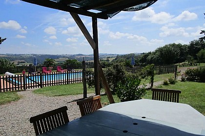
Beautiful, fully renovated stone house with, on the ground floor, an entrance hall giving access to a living room with sitting area (2 3-seater sofas on either side of a wood-burning stove, 4 armchairs, coffee table, TV, DVD player, Satellite TV), kitchen area (fitted units LV, MO, fridge, 1 additional fridge, 1 freezer), dining area. 1 ground-floor toilet with hand-washer and heated towel rail. 2 bedrooms accessible to people with reduced mobility (1 double bed each with en-suite shower room and toilet). Storage space under the stairs. Large terrace in front of the property with shade arbour. Enclosed swimming pool (secure gate) 10 x 4 with steps and paddling pool area. Pretty lawned grounds surrounding the gîte. Parking spaces in front of the building and electric charging point. Wifi in bedrooms and USB and RJ45 sockets in all rooms (ideal for teleworking). In the old sheepfold, additional capacity with: a kitchen (MO, LV fridge, freezer, washing machine), a dining room. Direct access from the terrace to a ground-floor bedroom (Colibri) with 2 single beds (0.80cm), 1 shower room with toilet. Upstairs, 1 bedroom (1 double bed), 1 bedroom (2 single beds 0.90cm, 2 bunk beds), 1 shared shower room with toilet. Large terrace with pizza oven and barbecue, table and chairs. Numerous activities on site (yoga, drawing classes, ayurvedic massages, yoga walks) by prior arrangement.

169 Chemin de Mazèdes 82140 Saint-Antonin-Noble-Val
Book from 0 €Book
Show

What to visit in DOMAINE DU GARISSOU

See more suggestions
Stroll through the historic districts of DOMAINE DU GARISSOU.
See more suggestions
Puech Mignon Church
12 km

Puech Mignon Church

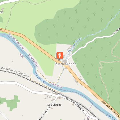
Puech Mignon, founded in 972, was destroyed and rebuilt several times between the 14th and 16th centuries. After suffering severe fire damage in 1821, the church has been undergoing restoration since 1999, including the renovation of its altarpiece. Listed as a Historic Monument, it is open to visitors by appointment. Puech Mignon's time The High Middle Ages Puech Mignon made its first appearance around 972, in the will of a high personality of the southern nobility, Garsinde, widow of Raymond, dit Pons, count of Toulouse. This controversial text clearly reflects, however, the existence of a dense and ancient parish and monastic fabric in this portion of the Aveyron valley. The Benedictine monks of Varen, beneficiaries of this pious donation and themselves dependent on the abbey of Saint-Géraud d'Aurillac, founded a rural priory there which depended on their deanery until its secularization in 1561. The time of wars and reconstructions The Hundred Years War and the Wars of Religion hold their share of destruction ... and reconstruction. The decade 1380 ends with the capture of Laguépie by the men in arms in the service of the English and the repurchase of Puech Mignon (1382), that is to say the payment of a real war tax, to dislodge them . The visitors sent in 1419 on behalf of the bishop of Rodez could collect only from the dean of Varen two books for Puech Mignon.The lords of the place, Lautrec well established in the surroundings from the twelfth century and Puech Mignon in the fourteenth, rebuild the castle and perhaps the church after 1460. From this time probably dates the north side chapel, traditionally designated as stately chapel. Despite this, the bishop estimated in 1495 that reconstruction was necessary. In 1561, new havoc. Cardinal d'Ossat, dean of the Varen chapter, in 1603 allocated a sum of 60 pounds to repair the vaults of the nave. With the resurgence of plague epidemics, Saint Roch experienced an increase in devotion. A chapel, that of Lautrec, has been dedicated to it at least since 1635. From the 18th to the 21st century In the 18th century, the work had to be taken over by the parish priest. However, the serious fire of February 19, 1821 necessitated a complete redevelopment. Overshadowed by its parochial title, the church of Puech Mignon, from the early 1870s, lost even its liturgical furnishings, which the locals strived to reconstruct.In the meantime, it had acquired the superb tabernacle which constitutes its most prestigious ornament. Listed in the inventory of Historic Monuments in 1997, it has been the subject of a restoration campaign since 1999. Many rich and exceptional decorations compose it. The restoration of the altar and the altarpiece was done by Françoise Vorms, established in Mas-Grenier. she is a restorer of golden and polychrome woods, graduated from the Boule school in Paris. The altarpiece was in very poor condition, it stayed a year and a half in her workshop, and after a lot of worries, she did a magnificent job by repairing the joinery and restoring the altarpiece and gold leaf. 'altar. The church can be visited by asking for the keys in the vicinity or by prior appointment.

Eglise Puech Mignon 82250 Laguépie
Show
Château de Mayragues, Monument Historique
13 km

Château de Mayragues, Monument Historique

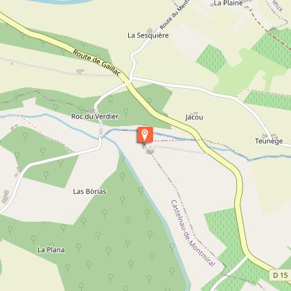
The Château de Mayragues (12th - 17th century) and its pigeon loft built on 4 columns, both listed as Historic Buildings, surrounded by its bio-dynamic vineyard, sit proudly in the midst of the magnificent rolling countryside of the Bastides Albigeoises. The Château de Mayragues is one of the few remaining examples of the regional fortified architecture with a half-timbered, overhanging gallery surrounding the top of the château built of the light-coloured local limestone. The splendid pigeon loft sitting on 4 stone columns, typical of the Languedoc region, the formal box parterre, the vineyard ( cultivated in bio-dynamics since 1999), the surrounding woods and fields of sunflowers and corn, make an ideal setting for the summer concerts which have been performed in front of the château for the last 20 years. The château and the pigeon loft have undergone an extensive 35 year restoration programme using traditional meterials of stone, wood, lime and sand, and in 1998, during the course of the restoration, were awarded the Grand Prix of the Vieilles Maisons Françaises. The half-timbered gallery provides a unique setting for the guest B&B bedrooms and an extensive view over the garden and the surrounding countryside. Visiting the winery, tasting the bio-dynamic wines of the domain, or simply relaxing in the garden are the ideal complement to discovering the treasures of the Bastides Albigeoises.

SCEA Château de Mayragues 332 Chemin de Mayragues 81140 Castelnau-de-Montmiral
Show
Castelnau-de-Montmiral
16 km

Castelnau-de-Montmiral

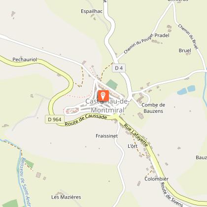
Overlooking the rolling hills of the Gaillac vineyards, Castelnau-de-Montmiral is centred around its arcaded main square. Founded in the 13th century, it combines architectural harmony with gentle landscapes. Founded in the 13th century by Raymond VII, Count of Toulouse, Castelnau-de-Montmiral is a castelnau, a seigneurial settlement organised around local authority. Although its layout is structured, it does not strictly follow the bastide model, reflecting instead a different approach to medieval territorial organisation. The village is centred around its remarkable arcaded square, which has been the heart of local life since its foundation. Lined with houses combining stone, brick and timber framing, it remains a lively focal point for markets and daily life. From this central space, streets extend towards different parts of the village, leading in particular to the Church of Notre-Dame-de-l’Assomption, home to a rich heritage including a remarkable 14th-century reliquary cross. Listed among the “Most Beautiful Villages of France”, Castelnau-de-Montmiral is appreciated for its balance between architecture and landscape. From its elevated position, it offers wide views over the Gaillac vineyards and the surrounding countryside. To explore the village in a different way, the EnQuête(s) free app provides a self-guided tour with interactive and immersive content revealing the site’s history and hidden details. The app is also available in English.

81140 Castelnau-de-Montmiral
Show

Where to eat in DOMAINE DU GARISSOU

See more suggestions
The cuisine of DOMAINE DU GARISSOU is a must-try.
See more suggestions

Where to sleep in DOMAINE DU GARISSOU

See more suggestions
Stay at one of the many hotels in DOMAINE DU GARISSOU.
See more suggestions
Camping Huttopia Pays de Cordes sur Ciel
3.6 km

Camping Huttopia Pays de Cordes sur Ciel

Stay just a stone's throw from Albi, in a lush green setting with views of the hills and the medieval town of Cordes, voted 'France's favourite village', right in the heart of the Gaillac vineyards and the Cordais region. Just a few kilometres from Albi, Huttopia Pays de Cordes-sur-Ciel opens the doors to a timeless getaway, where unspoilt nature meets the fascinating history of the Tarn. Imagine waking up each morning to birdsong, with breathtaking views over the rolling green hills and the medieval town of Cordes-sur-Ciel, voted 'France's favourite village'. Here, everyone finds their own happiness : traditional camping enthusiasts settle on spacious, shaded pitches, while those looking for something unique can choose a cosy chalet, a Toile & Bois tent, a Cahutte or a Wooden Trailer, for a total immersion in nature without ever giving up comfort. Everything is designed so that young and old alike enjoy an unforgettable holiday : take a dip in the heated pool, let the children have fun in the playground, challenge your loved ones to pétanque, table tennis or on the multisport field. In summer, share convivial moments during the activities, then meet up at the Café-Comptoir to enjoy a crêpe for a snack, an aperitif at sunset or a homemade pizza on the terrace, lulled by the gentle Occitan evenings. Set off to discover the treasures of the region: stroll through the cobbled streets of Cordes-sur-Ciel, a UNESCO World Heritage site, explore the Gaillac vineyards or set off on hiking trails, on foot or by electric bike, available for hire on site.

910 route de Cordes sur Ciel 81170 Vindrac-Alayrac
Book from 0 €Book
Show
Caution!
We have no information on the difficulty of this circuit. You may encounter some surprises along the way. Before you go, please feel free to inquire more and take all necessary precautions. Have a good trip! 🌳🥾