Tours
Activities
Places of interest
Where to eat
Where to sleep

Uncover Tournan-en-brie’s gems at Fredland campground

Are you the owner?
Nestled in the heart of Seine-et-Marne, Île-de-France, Tournan-en-Brie offers a wealth of attractions for nature and history enthusiasts alike. From Fredland campground, you are perfectly positioned to explore the local treasures. Just steps from your campsite, venture into the Regional Natural Park of Gâtinais Français, ideal for hiking or cycling through breathtaking landscapes. History buffs wi...See more

Walking around FREDLAND

See more suggestions
Explore the natural surroundings of FREDLAND.
See more suggestions
Liverdy-en-Brie : The Fords of the Marsange
4.4 km

Liverdy-en-Brie : The Fords of the Marsange

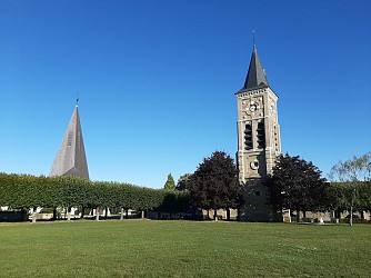
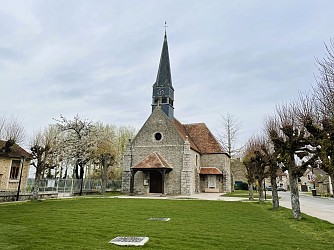
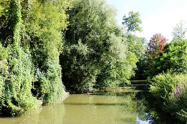
Your steps will lead you across a series of fords. A verdant walk between woods and fields. Certified by FFRandonnée. Route description : 1. From the school parking area, behind the town hall, turn left into Rue Gustave Delage then onto the Route de Meaux. Pass by the town hall and the church. Turn right twice to follow Rue du Cèdre. Then turn left, Rue de la Forêt, and continue along the path of the same name. 2. Facing the copse, take the path on the right then the one on the left. Cross the Feneuse stream, ignore the path on the left, follow the edge of the wood and turn right. Cross the RD32 and follow the road through the hamlet of Retal (note the stone marker on the right). Take the path on the left. It sometimes follows the forest edge then enters the woods. 3. Climb the path on the left. It leads onto another path. Go down along it, exit the woods and cross the bridge over the Marsange. Climb the hillside and cross the railway line. 4. Turn right onto the road and right again on a 1km paved path parallel to the railway. Continue left for about 1 km, cross the road and turn right onto the next one. Enter Courquetaine, pass by the church, then reach the town hall via Rue de Villetour on the right. 5. Turn right into Rue du Bué then take the next one on the right. Cross the railway line. 6. Turn left onto the path. It descends through the woods, crosses a footbridge over the Marsange and climbs the hillside. Follow Rue des Fontaines to the left and enter Liverdy. After about 1,000 meters, turn right, Rue de la Briqueterie, then right again, Rue de la Croix de Retal, and finally left, Rue de Melun. Return to the starting point. Municipalities crossed : Liverdy-en-Brie, Courquetaine Distance : 14,3 km - Duration : 3h30 – Marked trail : Yellow - Difficulty : Average Access to the map : www.cirkwi.com/fr/point-interet/1934574-liverdy-en-brie-les-gues-de-la-marsange

4 h
14 km
Easy
2 1 rue de Meaux - Parking de l'école 77220 Liverdy-en-Brie
Show
The Woods of Vitry
8.8 km

The Woods of Vitry

A pleasant short hike around a village nestled on a hillside above the Yerres river. After seeing fields and the village from different angles, you cross a wood where there are many traces of quarrying activities. Certified by FFRandonnée. Route description : 1. From the town hall square, head left. Go up Rue de la Mairie to Rue de la République (on the right, Saint-Martin church). Turn left. At the fork, of Croix Saint-Jean, turn right, then turn right twice onto a grassy path. Cross the RD48 and continue straight on the path slightly offset to the left, crossing fields. After the cemetery, turn right onto the road. 2. Take the road on the left for 1 km, then turn right and walk along the hamlet of Jamard. Near the level crossing, make a right-left turn and continue for 1 km along the railway line. 3. Take the RD48 on the right. Pass the place called La Cantine and turn left onto a dirt road. Cross the footbridge over the Yerres River and reach the edge of the forest, following it to the left. Walk along the Yerres for 800 m, then move away from it by going up the path on the right. Turn right twice, then turn left at the fork. Follow the main track on the right for 500 m. 4. Turn right, pass near old stone quarries, then turn left. Go down the main track until you exit the forest, cross the bridge over the Yerres, then climb Rue des Fontaines. After the washhouse, turn right then left and return to the town hall square. Municipality crossed : Ozouer-le-Voulgis Distance : 9.4 km - Duration : 2h30 – Marked trail : Blue - Difficulty : Easy Access to the map : www.cirkwi.com/fr/circuit/750485-les-bois-de-vitry

3 h
9.4 km
Very easy
19 Place de la Mairie 77390 Ozouer-le-Voulgis
Show
Walk in Grisy-Suisnes
8.8 km

Walk in Grisy-Suisnes

This walk will take you through the narrow streets of the village of Grisy-Suisnes and allow you to discover remarkable heritage features such as the Belfry, the protected natural site “Le Chemin des Roses”, the Fontaine Houdart washhouse, the Ferme de l’Ormeau, and the Church of Notre-Dame des Roses. The walk, step by step… 1. The walk begins in front of the town hall of Grisy-Suisnes. Head towards Rue Paul Doumer, keeping the town hall on your right and the belfry on your left. Continue straight along Rue de Verdun. 2. At the end of the street, turn left into Rue de Villemain, then immediately right into the narrow Fontaine Houdart lane. The Fontaine Houdart washhouse is located in front of you at the end of the lane. 3. Retrace your steps and turn right onto Rue de Villemain, then immediately left into Sentier Guérin between the houses. Continue to the junction with Rue Madame Hegot. 4. Turn immediately right into Chemin de la Folie. You can make a detour by turning right onto Chemin des Guigniers to visit the Villemain greenhouses, which produce flowers and perennial plants. Continuing along the path, you will rejoin Rue de Villemain, which you follow to admire Villemain Castle below the road after crossing the Barbançonne bridge. 5. Retrace your steps and continue straight along Chemin des Guigners, which leads you back to Rue Jean Nicot. Immediately turn right onto Rue du Maréchal Gallieni. 6. Continue straight along Rue du Maréchal Gallieni and turn left into the Chemin des Roses. At the junction with Avenue du Maréchal Joffre, turn left, then right into Rue de la Gare. You are now in front of the Museum of the Rose and its magnificent rose garden. Take the opportunity to visit the ecomuseum. 7. Leaving the Museum of the Rose, continue straight along Rue de Saint Médard. At the crossroads, turn left into Rue de la Libération, then immediately right into Rue de la Justice. 8. Continue along Rue de la Justice. Take the Chemin de Corbeil à Lagny on your left. 9. At the junction with Rue des Bois, continue along Chemin de Corbeil à Lagny, which becomes a footpath. The footpath becomes a wider track again at the junction with Chemin de l’Ormeau. 10. At the end of the path, on your left, you will discover the Ferme de l’Ormeau, which produces potatoes. Retrace your steps. 11. Turn right onto Chemin de l’Ormeau. Continue straight and turn left onto Rue Sadi Carnot. In the farm buildings of the Ferme de Solaire, located on your right, you will find the automatic vending machine for potatoes and farm products from the Ferme de l’Ormeau. 12. Turn right into Rue des Fleurs, continue along the street to the left, which opens onto Place Pasteur. 13. Take Rue Paul Doumer on the right and turn left onto the town hall square. End the walk by observing the belfry and the Church of Notre-Dame des Roses located behind the square. At the corner of Rue Paul Doumer and Rue de Verdun, you can also see one of the oldest farms in Grisy: the so-called “Écossais Farm”. Municipality crossed : Grisy-Suisnes Distance : 7.2 km - Duration : 2h30 – Unmarked trail Access to the map : www.cirkwi.com/fr/circuit/293721-balade-a-grisy-suisnes

3 h
7.2 km
Very easy
4 Bis Place de la mairie 77166 Grisy-Suisnes
Show
The Fords on the Yerres
10 km

The Fords on the Yerres

The Yerres is certainly one of the few rivers in France that can still be crossed with a ford. A surprising experience to try. Do you prefer the bridge or walking—slightly—through the water ? Certified by FFRandonnée. Course description : 1. From the square, reach Rue de Corbeil, turn left, and walk along the church and the town hall. Turn right onto Rue du Port then left onto Impasse des Écoles. At the end, go left, take the footbridge to cross the river, and follow the Chemin du Cornouiller to the left. Reach the road junction on the left. 2. Head toward Coubert by taking the road on the right for 25 m, then go up the narrow Rue de la Burelle on the right. Turn right, then left, and cross the bridge over the former railway line. 3. Take Chemin des Rougettes on the right for 200 m, go down the stairs on the right, and take Chemin des Roses on the left (former railway line). Pass under the road bridge. 4. Before the bridge over the Yerres, turn left. The path runs below properties, climbs, then continues along the edge of the woods up to Solers. 5. At the junction, go down the path on the right towards the Yerres river, cross the Bossu bridge, continue straight ahead for 80 m, then turn left. Continue until the intersection. 6. Take the path on the right. After 800 m, pass under the former railway line and continue. Go up the road on the left and enter Barneau. At the Croix de la Trinité (menhir), turn right, then left. In front of the castle gate, take the street on the right. 7. At the end of the castle wall, climb the path on the left and continue along the trail for 1.5 km. By the road, pass the cemetery, take Rue de Champeaux on the left, turn left onto Rue du Plaidoyer, then right. Go left to reach the parking area on the right. Municipalities crossed : Soignolles-en-Brie and Solers Distance : 8,2 km - Duration : 2h30 – Marked trail : Yellow - Difficulty : Easy Access to the map : www.cirkwi.com/fr/circuit/267904-les-gues-sur-l-yerres

3 h
7.6 km
Very easy
18 Place Mathilde Vivot 77111 Soignolles-en-Brie
Show
Forest Farm
10 km

Forest Farm

This route invites you to discover one of the many farms located on the Brie plateau: the Forest Farm. Enclosed on all sides, its sloping roofs frame a very curious dovecot porch. Certified by FFRandonnée. Description of the route : 1. With your back to the parking area, turn right, Rue Gallier. At the crossroads, go across the tree-lined avenue, turn right, cross the RD402 and turn right onto Rue du Cloître. Turn left onto Rue Couperin, then right to continue along Rue de l’Archelet and Rue de la Poterne. 2. Take Rue René-Quinton on the left for 60 m, then the path on the right. Go down the Thiou path on the right. Cross the Bréon stream at a ford and climb up through Forest to the farm. 3. Take the RD32 on the left for 150 m, then the forest track on the right. Cross the RD48 and go down straight ahead. Cross the Yerres and climb towards Maurevert. At the T-junction, follow the road to the left and, at the next crossroads, take the road to the right. It leads to Verneuil-l’Étang. Cross the RD402 and continue in the same direction. 4. At the crossroads, take the road on the right towards Verneuil-l’Étang station (SNCF access possible), then the street on the left and, after the junction (GR®1), again the street on the left. Continue along the path at the edge of the forest. At the next crossing, take the path on the right for 500 m. 5. Go down the path on the left through the woods and then along the edge. Cross the RD32, take the former railway line straight ahead, cross the Yerres by the viaduct, and continue straight back to the parking area. Municipalities crossed : Chaumes-en-Brie and Verneuil-l’Étang Distance : 11.1 km - Duration : 3h00 – Marked trail : Green - Difficulty : Average Access to the map : www.cirkwi.com/fr/circuit/282882-la-ferme-de-forest

3 h
11 km
Easy
15 Parking coulée verte - au carrefour des rues Paul Doumer et Gallier 77390 Chaumes-en-Brie
Show
The Château du Vivier
10 km

The Château du Vivier

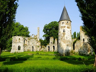
Le Vivier, with its ponds and the ruins of its castle, the Yerres valley dominated by the viaduct of the former railway line, and finally Chaumes-en-Brie, await you on this typically briard route. Certified by FFRandonnée. Description of the course : 1. With your back to the parking area, head right, Rue Gallier. At the crossroads, follow the tree-lined avenue straight ahead, turn right, cross the RD402 and turn right onto Rue du Cloître. In Rue Couperin, make a left-right turn to continue along Rue de l’Archelet, then Rue de la Poterne. 2. At the second junction, turn right onto Rue Pasteur (RD144). Pass the cemetery, go around it and follow the path behind. It runs along a wood. Take the paved path on the left. It crosses the Bréon at the Vieux Moulin (ponds and fish reserve). Continue on the path to the left and ignore the paths on the right. Then follow the RD144 to the right. 3. Opposite the stud farm, turn right. The road passes in front of the park of the ruined Château du Vivier, then runs between the ponds before entering the wood. It continues alongside the castle park, where the ruins are clearly visible, then turns left to pass between the ponds before climbing into the forest. 4. Turn right onto the path. At the RD402, make a right-left crossing and continue along the path beside the stream. Leave this path to the right for another path. After a right-angle bend, it leaves the wood, then makes another right-angle turn to run alongside the racecourse for 900 m. In the wood, turn left onto a path, leaving the pond and another path on your left. 5. Follow the road to the right for 30 m, then take the Chemin des Plantes on the left. Ignore the path on the left, cross the Fossé du Miroir and reach the Chemin Saint-Sébastien. 6. Take the road opposite the rue du Pignon Vert, before the bridge turn right to join the Allée Jehan Michel which leads back to the starting point. Municipalities crossed : Chaumes-en-Brie and Fontenay-Trésigny Distance : 10.2km - Duration : 2h30 – Marked trail : Magenta – Difficulty : Average Access to the map : www.cirkwi.com/fr/circuit/282883-le-chateau-du-vivier

3 h
10 km
Easy
1 au carrefour des rues Paul Doumer et Gallier 77390 Chaumes-en-Brie
Show
The Roses Path by bike
11 km

The Roses Path by bike

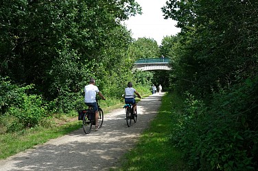
With a total length of 17 km, the roses path winds between the municipalities of Yèbles and Servon. It offers walkers, horse riders, and cyclists a space to walk along a railway track full of history. The route corresponds to the old railway line that connected Paris-Bastille to Verneuil-l'Étang. The path owes its name to the "train des roses" which transported to Paris flowers produced in the surrounding villages. As a major part of the local economy in the last century, it played a key role in the development of a regional specialty: rose cultivation. The old railway line, which has become a walking path, runs through mainly peri-urban and agricultural areas. Its interest lies above all in the quality of the landscape (the Yerres Valley and the Brie-Comte-Robert plateau), its accessibility for leisure activities (walking and cycling), and its important role as an ecological corridor (areas where living beings can move or spread in such a way as to be able to feed, and reproduce). Description of the route : 1. With your back to Yèbles cemetery, turn left. At the guard house, turn left and take the Chemin des Roses. 2. After just over 3 km, turn right, then left to cross the high-speed railway. Then continue left and right. 3. Cross the Yerres viaduct in Solers and enjoy the view. Built at the end of the 19th century and opened in 1892, this three-arch bridge is sadly known for a railway disaster that happened on August 10, 1918. 4. On your right, you will pass the old train station of Coubert-Soignolles, where cut roses from local growers were collected and sent by train to Les Halles de Paris. 5. At the old train station of Grisy, on your right, discover the Rose Museum, which brings to life the history of the 250 rose growers who helped make the region known as the “Land of Roses". 6. On your left, you will find the old train station of Brie-Comte-Robert, which now houses the headquarters of the Community of Communes of l'Orée de la Brie. 7. For about 1 km, the Roses Path becomes a cycle path in an urban area. Then continue your way towards Servon. Beyond the arrival point at Servon, it is possible, at least in part, to continue your hike in the Val-de-Marne Department by the green way known as "Végétale" greenway currently being developed : lavegetale.fr/ Municipalities crossed : Yèbles, Solers, Soignolles-en-Brie, Coubert, Grisy-Suisnes, Brie-Comte-Robert and Servon. Distance : 17,7 km Access to the map : www.cirkwi.com/fr/circuit/580250-le-chemin-des-roses

18 km
9 rue de Paris 77390 Yèbles
Show
The Roses Path on foot
11 km

The Roses Path on foot

With a total length of 17 km, the roses path winds between the municipalities of Yèbles and Servon. It offers walkers, horse riders, and cyclists a space to walk along a railway track full of history. The route corresponds to the old railway line that connected Paris-Bastille to Verneuil-l'Étang. The path owes its name to the "train des roses" which transported to Paris flowers produced in the surrounding villages. As a major part of the local economy in the last century, it played a key role in the development of a regional specialty: rose cultivation. The old railway line, which has become a walking path, runs through mainly peri-urban and agricultural areas. Its interest lies above all in the quality of the landscape (the Yerres Valley and the Brie-Comte-Robert plateau), its accessibility for leisure activities (walking and cycling), and its important role as an ecological corridor (areas where living beings can move or spread in such a way as to be able to feed, and reproduce). Description of the route : 1. With your back to Yèbles cemetery, turn left. At the guard house, turn left and take the Chemin des Roses. 2. After just over 3 km, turn right, then left to cross the high-speed railway. Then continue left and right. 3. Cross the Yerres viaduct in Solers and enjoy the view. Built at the end of the 19th century and opened in 1892, this three-arch bridge is sadly known for a railway disaster that happened on August 10, 1918. 4. On your right, you will pass the old train station of Coubert-Soignolles, where cut roses from local growers were collected and sent by train to Les Halles de Paris. 5. At the old train station of Grisy, on your right, discover the Rose Museum, which brings to life the history of the 250 rose growers who helped make the region known as the “Land of Roses". 6. On your left, you will find the old train station of Brie-Comte-Robert, which now houses the headquarters of the Community of Communes of l'Orée de la Brie. 7. For about 1 km, the Roses Path becomes a cycle path in an urban area. Then continue your way towards Servon. Beyond the arrival point at Servon, it is possible, at least in part, to continue your hike in the Val-de-Marne Department by the green way known as "Végétale" greenway currently being developed : lavegetale.fr/ Municipalities crossed : Yèbles, Solers, Soignolles-en-Brie, Coubert, Grisy-Suisnes, Brie-Comte-Robert and Servon. Distance : 17,7 km Access to the map : www.cirkwi.com/fr/circuit/580250-le-chemin-des-roses

18 km
9 rue de Paris 77390 Yèbles
Show

What to do in FREDLAND

See more suggestions
Find the best activities in FREDLAND and book easily online.
See more suggestions
Disneyland® Paris Multiday Tickets
15 km

Disneyland® Paris Multiday Tickets

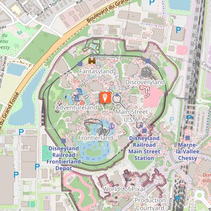
ArrayWhy You Shouldn’t Miss This When in Paris, a trip to Disneyland® is an absolute must! Consisting of Disneyland® Park and Walt Disney Studios® Park, the 4800-acre park is also home to seven hotels, Disney® Village, a golf course, and a mall, among others. Disneyland® Paris has a number of thrilling rides, including the famous Rock 'n' Roller Coaster Starring Aerosmith, and your pass ensures that you don’t miss a single one! The Walt Disney Studios® Park takes you behind the scenes of your favourite Disney® movies. You can see the animation process that make the movies so brilliant. Come and see for yourself why Disneyland® Paris is the most-visited theme park in all of Europe. Your Experience When booking your tickets, you can choose the number of days you want to spend in Disneyland® Paris - 2, 3, or 4. Your skip-the-line ticket lets you bypass the long purchasing queues and head directly inside the park. At Disneyland® Paris, you can meet your favorite characters - the original Mickey Mouse and friends gang, the Disney® princesses, the Toy Story characters, the Jungle Book characters, among others. Your tickets also ensure that you have ample time to check out the numerous parades and shows going on during the day. Additionally, be sure to also check out how the beloved Disney® films are made at the Disney® Animation Studios, a must-visit for every Disney® fan! Some of the popular rides at Disneyland® Paris are: Big Thunder Mountain Buzz Lightyear Laser Blast Indiana Jones and the Temple of Peril Peter Pan’s Flight Pirates of the Caribbean Ratatouille: The Adventure Rock 'n' Roller Coaster Starring Aerosmith Star Wars Hyperspace Mountain Toy Soldiers Parachute Drop The Twilight Zone of Terror At the end of every day is a dazzling fireworks show at the Sleeping Beauty castle, which, by the way, also has a hidden lair, where a dragon lays asleep.

Disneyland Paris, 77777 Marne-la-Vallée, France 77420 Marne-la-Vallée
Book from 169 EURBook
Show
Caillebotte's House
20 km

Caillebotte's House

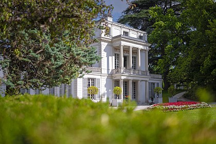
Satisfy your curiosity and follow the footsteps of Gustave Caillebotte himself, since it is here, in the family resort, that the painter planted his easel in open air and painted nearly 90 paintings in the summers of the 1870s. The Caillebotte property is a public garden located in the city center. It is now open to public and is as much a resting place as an invitation to discover a rich historical heritage: the famous "ornamental factories" that dot this beautiful park have almost all been restored. The Caillebotte house can also be visited. In the 1830s, the Caillebotte Property layout followed the principles in vogue: a site chosen for its undulating valleys, its vegetable wealth. The sinuous alleys lead the visitor to the "ornamentation factories", small constructions of varied architectures. The river skirting the domain traces the northen limit. The property Caillebotte is harmoniously integrated into the countryside landscape that once characterized the small village of Yerres. Rich owners, from Borrel to Caillebotte, gave a beautiful look to this sublime English garden. Today, the public garden offers to the visitor an exceptional geographical situation, its preserved views, beautiful trees and all curiosities that history patiently composed. The Yerres river banks kept their charm. The pictorial presence of Gustave Caillebotte, still identifiable, brings a higher dimension to this place of heritage, which bears the name of an artist and exceptional man. The Caillebotte's House is located at the geographical center of the municipality of Yerres. Typical of the 19th century, it was built in the 1830's, in the "English" style with an irregular layout.

8 rue de Concy 91330 Yerres
Book from 0 €Book
Show

What to visit in FREDLAND

See more suggestions
Relax in the parks of FREDLAND.
See more suggestions
Sensitive Natural Area : Le Chemin Des Roses
9.3 km

Sensitive Natural Area : Le Chemin Des Roses

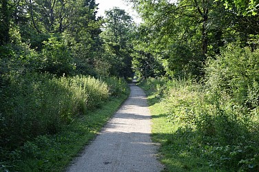
With a total length of 17 km, the Sensitive Natural Area the path of roses winds between the municipalities of Servon, Brie-Comte-Robert, Grisy-Suisnes, Coubert, Soignolles-en-Brie, Solers and Yèbles. It offers walkers, horse riders and cyclists a route to stroll along, steeped in history. The path follows the former railway line that connected Paris-Bastille to Verneuil-l'Étang. A major driver of the local economy of the last century, it was an essential element in the development of an activity specific to the region : rose growing. Built between 1859 and 1892 for military needs, the railway was closed to passenger traffic in 1953, and to the transport of goods, by successive sections, from the seventies until 1990. The disused line then lay fallow. In the early nineties, the section between Brie-Comte-Robert and Coubert was bought by the Chemin des Roses Intercommunal Union, created for the occasion, bringing together the municipalities of Brie-Comte-Robert, Grisy-Suisnes and Coubert. This union then carried out a development project for the railway right-of-way, to make walking, cycling and horse riding possible. The section, known as the « green path », was transferred, in 2003, to the Department of Seine-et-Marne which decided to classify the entire site as a sensitive natural area in order to preserve its landscape and ecological interest. Several years were necessary for the acquisition and development of additional land rights-of-way : at Servon (on the border with the department of Val-de-Marne) and between Coubert and Yèbles, at the other end. They were opened to walkers in 2010. The former line runs through mostly semi-urban and agricultural areas. The site's appeal lies mainly in its proximity in terms of leisure activities (walking, cycling) and the quality of the landscape. Indeed, it forms part of the wider ensemble constituted by the Yerres valley and the Brie plateau. The area's railway heritage is long-standing but the sector remains deeply marked by its history. The vestiges of the railway activity are identified by the linearity of the route, the presence of embankments or the sunken nature of the path, the presence of crossing structures and stations, some of which have been restored by the municipalities. The area covered by the Chemin des Roses is remarkable for the linear character of the path and the presence of grassy or wooded borders which give it a significant role as an ecological corridor (spaces where living beings can move or spread in order to feed or reproduce). Distance : 17 km Natural environments : woods, scrubland Points of interest : botany, landscape, history, ecological corridor Special features : former railway line, crossing of the Yerres by viaduct.

6 Rue de la Gare 77166 Grisy-Suisnes
Show
German military cemetery
9.5 km

German military cemetery

The german military cemetery in Solers where 2,228 soldiers rest, is now a place of pilgrimage for germanic families. In the middle of the Second World War, around August 25th, 1944, the Allies - British, Canadian and American - launched their offensive across the entire width of the front between Le Havre and Troyes, to the north-east. In these maneuvers, the 7th American Army Corps advanced towards Soissons, between Paris and Fontainebleau, fighting against the forces of the 1st American Army and the 5th German Armoured Army. It is in these battles that the German soldiers buried in Solers were killed. On August 30th, 1944, the 1st American Army began the creation of a temporary cemetery on a stretch of land located to the west of Solers, where it buried both the bodies of its own soldiers and those of the German army. To the left of the road leading to Soignolles-en-Brie, it buried approximately 2,000 of its dead and, to the right, a roughly equal number of German soldiers. After the cessation of hostilities, the bodies of the American soldiers were transferred to the military cemetery of Épinal, while the German plots passed under the administration of the French authorities and were enlarged following the addition of numerous graves from the surrounding region, but also from Troyes and Chartres. Within the framework of the Franco-German agreement of October 23rd, 1954, concerning military graves, the necropolis of Solers was chosen to become, after the necessary enlargement work, one of the definitive German military cemeteries in France. On July 28th, 1962, the cemetery was solemnly inaugurated in the presence of numerous relatives of the missing. Every year a ceremony in honour of German mourning takes place on the Sunday following November 11th in the presence of many dignitaries.

Grande rue 77111 Solers
Show
Old Menier chocolate factory
16 km

Old Menier chocolate factory

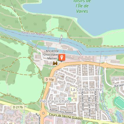
In 1825, Jean-Antoine-Brutus Menier acquired the Noisiel mill and three hectares of land. This site is at the origin of the creation of a factory for the industrial production of chocolate. The manufacturing site has undergone several phases of transformation since the arrival of the Meniers in 1825 and the presence of a mill designed to grind pharmaceutical substances. From the 1860s, the business became a real industrial complex where the organisation of the manufacturing space was completely redesigned. The buildings were then arranged in accordance with the manufacturing process. The design of the mill by Jules Saulnier (1878-1881) is a successful collaboration between "Art Nouveau" architecture from the end of the 19th century and industrial functionality. The industrial complex was completed from 1874 with the construction of a workers' city. Up to 1924, the reconstructions and new buildings, made necessary by the expansion of production, perfectly integrated the technical progress of the 19th century, as well as an exceptional architectural aesthetic. After the departure of the Menier family in 1960, the lands of the complex were sold to several successive groups. The old Menier chocolate factory was converted into a head office by the Nestlé-France SAS group in 1996. This conversion, carried out by the architects Reichen and Robert, is based on "the dialogue between contemporary and ancient architecture". The buildings of the first Menier factories now belong to the French industrial heritage and have been listed as historic monuments since 1986.

7 boulevard Pierre-Carle 77186 Noisiel
Show

Where to eat in FREDLAND

See more suggestions
Discover the local flavors of FREDLAND.
See more suggestions
Where to sleep in FREDLAND

See more suggestions
Discover the best lodging options in FREDLAND.
See more suggestions
Caution!
We have no information on the difficulty of this circuit. You may encounter some surprises along the way. Before you go, please feel free to inquire more and take all necessary precautions. Have a good trip! 🌳🥾