Tours
Activities
Places of interest
Where to eat
Where to sleep

Discover Camping Municipal d'Arsine in Villar-d'arene

Are you the owner?
Camping Municipal d'Arsine is nestled in the charming village of Villar-d'arene, in the Hautes-Alpes of Provence-Alpes-Côte d'Azur. Surrounded by breathtaking landscapes, this campsite is an ideal starting point for nature lovers and adventure enthusiasts. Explore the Ecrins National Park, famed for its stunning hiking trails and panoramic views. Mountain climbing aficionados can conquer the peaks...See more

Walking around CAMPING MUNICIPAL D'ARSINE

See more suggestions
Explore the natural surroundings of CAMPING MUNICIPAL D'ARSINE.
See more suggestions

What to do in CAMPING MUNICIPAL D'ARSINE

See more suggestions
Enjoy unforgettable moments in CAMPING MUNICIPAL D'ARSINE by booking activities for everyone.
See more suggestions
County of La Meije's Nordic Area
211 m

County of La Meije's Nordic Area

At the foot of the Lautaret Mountain pass, under the summits and glaciers, the Pays de la Meije Nordic Area is a magic spot surrounded by majestic and wild beauty. In this haven of peace the groves of trees give shelter to many wild animals. The site is at the gates of the Ecrins National Park, in a beautiful corner of the Hautes Alpes region. You will evolve in an unspoilt environment that encourages contemplation, under the watchful eye of chamois, deer and snow hares. The area is ideal for nordic sking and snowshoeing. The trails are relatively flat, going through the woods and the valley bottom, except for the ones that cross the Arsine hamlet. Cross-country skiing: 10 km of trails, three loops with with diverse but fairly easy profiles. Nordic Walking: Villar d'Arène - La Gravière (8 km) Snowshoeing: Tour of the hamlets of Villar d'Arène (11 km) Sledging: one hill at Arsine and one at the Jouvencelles, opposite Villar d'Arène Natural ice skating rink: free access, ice skate rental posssible at the gîte le Pas de l'Ane. Ski hockey: hockey equipment (bring your skis) at your disposal at the Nordic Chalet every weekend and Wednesday outside school holidays and all mornings during the french school holidays. Relaxation area: deck chairs and a spyglass enables you to enjoy the sun and observe the wildlife from a terrace next to the Nordic Chalet. The sun skimming the peaks at the heart of the winter, the site has good snow conditions throughout the winter season. Reminder: walkers and hikers with snowshoes,please follow the dedicated trails. The ski trails are strictly reserved for skiers (municipal decree of 11/01/1986 )

Chalet du pisteur Arsine 05480 Villar-d'Arêne
Book from 0 €Book
Show
Alpe de Villar d'Arène Mountain hut (FFCAM)
4.4 km

Alpe de Villar d'Arène Mountain hut (FFCAM)

Located in the heart of the alpine pastures, the Alpe refuge welcomes young and old alike, for a day hike, a first night in a refuge, a stopover on the GR54 or on the way to another refuge. For mountaineering and ski touring: it's THE spot par excellence! With a superb view of the summit of Les Agneaux, access is by a very easy family hike; despite a few steep sections, it takes you back to the source of the Romanche and allows you to enjoy a very pleasant break on the banks of this pretty torrent. "A small stream, a few boulders, grassy slopes and the whole space to run and laugh at life. Not far away, the chickens peck at grass and insects, and a few yards away, from his pen, the pack donkey observes the scene with his gentle eyes, here it's a bit of Paradise", the janitors tell us. Children can run, climb, roll in the grass... Freedom is theirs! It's also the starting point for mountain hikes to various summits (Agneaux, Neige Cordier, Chamoissière, la Pyramide...). From the refuge: Main hikes : - Arsine glacier lake (2400m - 2h) - Romanche springs (2150m - 1h) - a small summit: la bosse de Chamoissière - Stage on the Tour de l'Oisans (GR54) Mountaineering : - Les Agneaux (3646m - AD) - Pointe de Chamoissière (3215m) - Pic de Neige Cordier (3613m) Ski touring : - Stage on the Tour de la Meije and the Tour des Ecrins - North corridor of Roche Faurio - La Grande Ruine - Col des Chamois, Col du Fauteuil, Col des Agneaux / les Agneaux... There's plenty to choose from! NB: Adapted tourism: The refuge, via the Crevasses trail, is accessible by joëlette with assistance. (Can be borrowed from the La Grave tourist office, on reservation and against deposit: 04 76 79 90 05).

Arsine 05480 Villar-d'Arêne
Book from 0 €Book
Show
Chalet refuge de Chamoissière
4.5 km

Chalet refuge de Chamoissière

Sylvie and Sebastian welcome you to their chalet refuge of Chamoissiere; old sheepfold fully restored with ecological and traditional materials ; located in the heart of the Alpine of Villar d'Arene, in a beautiful setting, away from the hustle and bustle. Located on the Alpe plan at 2106m, at the foot of the glaciers and at the gateway to the Ecrins National Park, this superb chalet-refuge will open its doors to you for a stay in the heart of nature; a beautiful escape in the heart of the mountains, to recharge your batteries and recharge your batteries as a family. Clean sheets required. This comfortable, small-capacity refuge welcomes you for a night or more, for a sporting or contemplative stay (or both) in a magnificent, peaceful setting, far from the wifi, stress and hassle of life down below! Accommodation in small rooms. The refuge has room for 20 people, a bathroom with 2 washbasins and 2 hot showers, and a large living/dining room with wood-burning stove. 220V electricity. Outdoor solar shower. Allow approx. 1h30 to 2h for the ascent along the path from Arsine (Villar d'Arène) and 1h30 along the Crevasses path from Col du Lautaret (halfway along this path, there is a somewhat vertiginous passage lasting 50m, but with a handrail on the path along the wall). A number of easy hikes can be discovered from the refuge, including - Sources de la Romanche - Lac de l'Etoile - Lac d'Arsine Refuge marked "Refuges ALPES".

L'alp de Villar D'arène 05480 Villar-d'Arêne
Book from 0 €Book
Show
Fishing
4.6 km

Fishing

In La Meije country, in a sumptuous setting, fishing is a real pleasure! Come and enjoy the peace and quiet during your vacation, alone or with family and friends, close to the glaciers, where the trout have a field day! A river, La Romanche, and fish-filled high altitude lakes such as Lac du Pontet and Lac Noir, as well as a turquoise-colored lake, are sure to please. When you buy a fishing card from a dealer, you automatically become a member of the Association Agréée de Pêche et de Protection des Milieux Aquatiques (Association for Fishing and Protection of Aquatic Environments) on which the dealer depends. The price of a fishing pass enables the Associations to carry out their missions: monitoring fishing, negotiating and exploiting fishing rights for the benefit of a large number of anglers, fish management and restocking, and protecting species and aquatic environments. The Romanche : A steep river, the Romanche rises beneath the La Plate des Agneaux glacier (in the northern part of the Ecrins National Park) and flows into the Drac south of Grenoble. A superb river. The upper Alpine limit of the Romanche stops below the village of La Grave. On this upstream section, from the source, you can fish for fario trout and brook salmon in a fabulous setting with the Col du Lautaret and the emblematic peaks of the Écrins as a backdrop. Below the village of Villar d'Arène, the Romanche quickly becomes powerful. Positions and counter-currents are well marked. The fishing here is very fast, and you need to be quick on your feet and very attentive, otherwise you'll miss a lot of fish that often go unnoticed. Access is easy from the D1091, and there are several bridges. Arsine lake: A small lake is located near Villar d'Arène at the Arsine bridge: the Arsine lake. Here, we fish for fario trout and rainbow trout in accordance with 1st category watercourse regulations. Nearby high-altitude lakes: Several high-altitude lakes surround the canton of La Grave and Villar d'Arène. Some are renowned for their fishing, such as Lac Le Noir, Lac de Puy Vachier, Lac du Goléon and Lac du Pontet. "You can get there after a few hours' hiking. Loaded down with all your gear, you sometimes have to get yourself motivated to get over the last climb. Nothing too terrible, but all the same, with shortness of breath and "heavy" legs, the appearance of the lake is a reward... these lakes have to be earned. Then fishing takes on a whole new meaning: the silence, the taste of the air, the color of the sky, the stones, the grass and the water, the whisper of the drag on the reel, or the quick splash of a gobble. Nothing but the simplest things. All to be enjoyed. Time stands still. You're fine, you're fishing. Hautes Alpes Fishing Federation / "Guisane-Romanche" AAPPMA

D 1091 La Grave 05320 La Grave
Book from 0 €Book
Show
Trail de la Meije
5 km

Trail de la Meije

Come and visit La Grave and Villar d'Arène while running. In the upper Romanche valley, you will have the chance to reach for the sky and have the chance to see breathtaking landscapes. Between mountain landscapes with a view of the Écrins massif and an assured conviviality, passionate runners will be able to tread the trails of the Pays de la Meije while setting themselves a sporting challenge! Trail running is an outdoor activity on hilly and sometimes steep trails. But the most important thing to remember is that it's a sport that's sure to give you a thrill, and allow you to contemplate the peaks while simply enjoying nature! Trail de la Meije adapts to everyone's desires, offering 3 routes on Sunday and a vertical kilometer on Saturday. These routes will take runners around La Grave, Villar d'Arène and their hamlets, along some of the most legendary trails in the Hautes-Alpes. Indeed, there's something for everyone, from Kv+ to Marathon, 26km or 15km, not forgetting a children's race and a course suitable for joëlettes. So don't wait any longer, come and discover the warm and welcoming atmosphere of high-altitude villages! THE DIFFERENT ROUTES : THE FRÉAUX VERTICAL KILOMETER Distance: 4.8 km & 1200 D+ (vertical kilometer) To warm up for Sunday's races, a vertical kilometer is proposed on Saturday, with the participation of Les Téléphériques des Glaciers de la Meije. The program includes 4.8km and 1200m D+, starting at Les Fréaux and climbing steeply to the Puy Vachier lake and the Chancel refuge. At the top, a refreshment station awaits you and you can enjoy the view, before reaching the station at 2400m and taking the gondola back down to La Grave. LA BOUCLE DE L'AIGUILLON 16 km & 750 D+ This route takes in the Haute Romanche valley in a dream landscape, facing the Meije. It's a pretty loop that will take you on a quick tour of the canton's mythical sites. Starting at the village hall in La Grave, you'll pass through this authentic mountain village, then climb up to the banks of the Romanche in a larch forest, where the river refreshes you before entering the village of Villar d'Arène. The first refreshment station awaits you on the square in front of St Martin's church. Afterwards, the climb up to Lac du Pontet gives you a chance to get some height and look down on the valley from above. After a short, fairly rolling balcony traverse, you'll find yourself at the Col de l'Aiguillon. All that remains is to descend to the village and return to La Grave via the river in the Ecrins National Park. THE MEIJE TROPHY 27 km & 1634 D+ This route takes in a multitude of mountain landscapes. Starting on a small single in a larch forest, runners then cross terraced mountain pastures before arriving at a high-altitude lake. The race then reaches its highest point at 2707m, with an obligatory stop at the Goléon refuge. The second part of the route features a beautiful panorama of the Meije and a descent along a ridge line overlooking the canton. Competitors on the 42km will then switch to the vallon de la Buffe, where you'll reach the hamlet of Le Chazelet, before a final descent through the slate to the village of La Grave. THE MEIJE MARATHON 45 km & 2,500 D+ (altitude gain) This marathon trail takes you deeper into the remote corners of Meije country, starting in La Grave. It's a rolling but demanding course, with an average altitude of over 1,600 meters and a high point of 2,707 meters. From the highest point, the view of the Goléon refuge and its lake is one of the finest in the canton. After the Col du Cruq, a bit of well-marked "off-trail" awaits you to reach the Signal de La Grave and a beautiful panoramic descent over the ridge. Next, head for the Pic du Mas de la Grave refuge, before tackling the final climb to the famous Plateau d'Emparis. In September, this mountain plateau bears a striking resemblance to the famous South American altiplano. A loop on this plateau takes you to two mountain lakes with views of the Écrins massif. Finally, a long descent takes you back to the village of La Grave.

Route des Grands cols 05320 La Grave
Book from 0 €Book
Show
Goleon Mountain Hut
5.4 km

Goleon Mountain Hut

The accessible refuge du Goléon awaits you summer and winter alike, in an exceptional setting between lake and Meije. The wardens warmly welcome you to spend the night or grab a bite to eat in this little refuge of character. The hut keepers, Myrtille and Lucile, welcome you, with a big smile, to the hut located near Goléon Lake, facing La Meije. Nestled in the Goléon valley, near the lake (200 meters) and facing La Meije, the Goléon hut welcomes you in an exceptional setting. Made of stone and wood, this building, built in 2009 by its owner will seduce you with its rustic beauty. In summer the place is ideal to spend a night with family or friends in a warm and authentic mountain hut. In winter, the valley lends itself perfectly to ski touring. Don't hesitate to stay several nights to explore the hidden corners of this beautiful valley. Drinks and lunch à la carte, half-board or dinner, breakfast only (booking in advance is required). They cook as much as possible with local, seasonal and organic products. Fishing (in authorized period) : in the lake of Goléon is possible. The lake is stocked with brook & brown trouts by the fishing federation. The lake is classified 1st category. Fishing will be open from the 3rd Saturday of June to the 2nd Sunday of October. Mountaineering courses from the hut : make sure to have the right gear ! Aiguille du Goléon (3472m) : Easy route - 3h30 Aiguille Méridionale d'Arve (3514m) : Course D - 4 to 5 h Hikes from the refuge : Glacier du Goléon (3000m) : 4h30 (return) Lombard pass (3092m) : 5h (return) Crux des Aiguilles (2589m) : 1h15 (return) Col du Goléon (2973m) : 2h30 (return) If you decide to camp around the mountain hut, you are welcome to join for a drink, dinner and breakfast.

Refuge du Goléon Les Hières 05320 La Grave
Book from 0 €Book
Show
Lac du Pave alpine hut (FFCAM)
5.8 km

Lac du Pave alpine hut (FFCAM)

At the heart of a mountain cirque, between Le Pavé, Roche Méane and Pic Gaspard, on the shores of a glacial lake, this small mountain refuge offers a trip having an Himalayan air in one of the most secret and wild valleys from the massif des Ecrins. The ascent route is 4 hours starting from Arsine and has 1150m height difference Climbing up to Lac du Pavé is first and foremost a magnificent hike, then a close-up view of the high mountains. Set in the heart of a majestic cirque, the new refuge du Pavé is part of a breathtaking scenery.... High mountains in their purest form. Recently renovated, and manned for the first time this summer, the new Pavé refuge will welcome mountaineers, climbers, experienced hikers and all nature lovers. You'll discover a refuge whose design was dictated by the surrounding environment, combining comfort and sobriety. Pauline, the janitor, will do her utmost to ensure that you have a great time in the mountains! Conviviality and good humor are the order of the day! The refuge offers quick access to a wide range of mountaineering and climbing routes, from the easiest to the most challenging. The most popular summit is the Pic nord des Cavales: one of the most beautiful easy mountaineering routes in the Ecrins massif, on excellent granite. Pointe Emma, which has the same characteristics, is also covered by numerous rope parties. These two summits offer numerous routes of varying difficulty, and both offer remarkable views over the Etançons valley and the south face of the Meije. Pointe des Chamois, next to Pointe Emma, is perfect for a quick introductory run. Fans of the great races of the wild Oisans will turn to the Pic Gaspard and its south-southeast ridge: the famous Devies-Gervasuti. Vertical enthusiasts should head for the foot of the south face of Le Pavé. Here you'll find three routes, including one of the most difficult climbs in the massif, with a 7b pitch at 3500 m! Long-distance climbers will enjoy the beautiful and demanding Pavé - Meije orientale traverse. A must in this sector. For snow climbers, the Col du Pavé is the ideal out-and-back route. From the col, you can also reach the Promontoire refuge or vice versa (serious route: steep, crevassed glacial terrain). Finally, don't forget the Grande Ruine and the famous Col du Diable. Due to global warming, this great couloir is no longer widely used, and you have to look for good snow conditions very early in the season.

05480 Villar-d'Arêne
Book from 0 €Book
Show

IGN cards

3435ETR - VALLOIRE RESISTANTE AIGUILLES D'ARVES COL DU GALIBIER
Editor : IGN
Collection : TOP 25 RÉSISTANTE
Scale : 1:25 000
17.20€
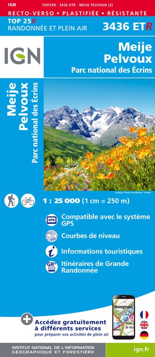
3436ETR - MEIJE PELVOUX RESISTANTE PARC NATIONAL DES ÉCRINS
Editor : IGN
Collection : TOP 25 RÉSISTANTE
Scale : 1:25 000
17.20€
3436ET - MEIJE PELVOUX PARC NATIONAL DES ÉCRINS
Editor : IGN
Collection : TOP 25 ET SÉRIE BLEUE
Scale : 1:25 000
13.90€
3435ET - VALLOIRE AIGUILLES D'ARVES COL DU GALIBIER
Editor : IGN
Collection : TOP 25 ET SÉRIE BLEUE
Scale : 1:25 000
13.90€
TOP75006 - MASSIF DES ECRINS OISANS CHAMPSAUR
Editor : IGN
Collection : TOP 75
Scale : 1:75 000
9.80€
TOP75005 - BRIANCONNAIS QUEYRAS
Editor : IGN
Collection : TOP 75
Scale : 1:75 000
9.80€
TOP100D38 - ISÈRE GRENOBLE VIENNE PARC NATIONAL DES ÉCRINS PARC NATUREL RÉGIONAL DU VERCORS
Editor : IGN
Collection : TOP 100
Scale : 1:100 000
8.40€
TOP100D73 - SAVOIE CHAMBÉRY ALBERTVILLE PARC NATIONAL DE LA VANOISE PNR DU MASSIF DES BAUGES
Editor : IGN
Collection : TOP 100
Scale : 1:100 000
8.40€
202 JURA ALPES DU NORD
Editor : IGN
Collection : TOP 200
Scale : 1:200 000
6.80€
D04-05 ALPES-DE-HAUTE-PROVENCE HAUTES-ALPES
Editor : IGN
Collection : CARTES DÉPARTEMENTALES IGN
Scale : 1:150 000
5.90€
D38 ISÈRE
Editor : IGN
Collection : CARTES DÉPARTEMENTALES IGN
Scale : 1:150 000
5.90€
NR14 AUVERGNE-RHÔNE-ALPES RECTO/VERSO MASSIF CENTRAL
Editor : IGN
Collection : CARTES RÉGIONALES IGN
Scale : 1:250 000
6.80€
NR15 AUVERGNE-RHÔNE-ALPES RECTO/VERSO MASSIF ALPIN
Editor : IGN
Collection : CARTES RÉGIONALES IGN
Scale : 1:250 000
6.80€
NR16 PROVENCE-ALPES-CÔTE D'AZUR
Editor : IGN
Collection : CARTES RÉGIONALES IGN
Scale : 1:250 000
6.80€
EUROPE
Editor : IGN
Collection : DÉCOUVERTE DES PAYS DU MONDE IGN
Scale : 1:2 500 000
7.00€

What to visit in CAMPING MUNICIPAL D'ARSINE

See more suggestions
Attend shows and concerts in CAMPING MUNICIPAL D'ARSINE.
See more suggestions

Where to eat in CAMPING MUNICIPAL D'ARSINE

See more suggestions
The flavors of CAMPING MUNICIPAL D'ARSINE await you.
See more suggestions

Where to sleep in CAMPING MUNICIPAL D'ARSINE

See more suggestions
Discover the best lodging options in CAMPING MUNICIPAL D'ARSINE.
See more suggestions
Alpe de Villar d'Arène Mountain hut (FFCAM)
4.4 km

Alpe de Villar d'Arène Mountain hut (FFCAM)

Located in the heart of the alpine pastures, the Alpe refuge welcomes young and old alike, for a day hike, a first night in a refuge, a stopover on the GR54 or on the way to another refuge. For mountaineering and ski touring: it's THE spot par excellence! With a superb view of the summit of Les Agneaux, access is by a very easy family hike; despite a few steep sections, it takes you back to the source of the Romanche and allows you to enjoy a very pleasant break on the banks of this pretty torrent. "A small stream, a few boulders, grassy slopes and the whole space to run and laugh at life. Not far away, the chickens peck at grass and insects, and a few yards away, from his pen, the pack donkey observes the scene with his gentle eyes, here it's a bit of Paradise", the janitors tell us. Children can run, climb, roll in the grass... Freedom is theirs! It's also the starting point for mountain hikes to various summits (Agneaux, Neige Cordier, Chamoissière, la Pyramide...). From the refuge: Main hikes : - Arsine glacier lake (2400m - 2h) - Romanche springs (2150m - 1h) - a small summit: la bosse de Chamoissière - Stage on the Tour de l'Oisans (GR54) Mountaineering : - Les Agneaux (3646m - AD) - Pointe de Chamoissière (3215m) - Pic de Neige Cordier (3613m) Ski touring : - Stage on the Tour de la Meije and the Tour des Ecrins - North corridor of Roche Faurio - La Grande Ruine - Col des Chamois, Col du Fauteuil, Col des Agneaux / les Agneaux... There's plenty to choose from! NB: Adapted tourism: The refuge, via the Crevasses trail, is accessible by joëlette with assistance. (Can be borrowed from the La Grave tourist office, on reservation and against deposit: 04 76 79 90 05).

Arsine 05480 Villar-d'Arêne
Book from 0 €Book
Show
Chalet refuge de Chamoissière
4.5 km

Chalet refuge de Chamoissière

Sylvie and Sebastian welcome you to their chalet refuge of Chamoissiere; old sheepfold fully restored with ecological and traditional materials ; located in the heart of the Alpine of Villar d'Arene, in a beautiful setting, away from the hustle and bustle. Located on the Alpe plan at 2106m, at the foot of the glaciers and at the gateway to the Ecrins National Park, this superb chalet-refuge will open its doors to you for a stay in the heart of nature; a beautiful escape in the heart of the mountains, to recharge your batteries and recharge your batteries as a family. Clean sheets required. This comfortable, small-capacity refuge welcomes you for a night or more, for a sporting or contemplative stay (or both) in a magnificent, peaceful setting, far from the wifi, stress and hassle of life down below! Accommodation in small rooms. The refuge has room for 20 people, a bathroom with 2 washbasins and 2 hot showers, and a large living/dining room with wood-burning stove. 220V electricity. Outdoor solar shower. Allow approx. 1h30 to 2h for the ascent along the path from Arsine (Villar d'Arène) and 1h30 along the Crevasses path from Col du Lautaret (halfway along this path, there is a somewhat vertiginous passage lasting 50m, but with a handrail on the path along the wall). A number of easy hikes can be discovered from the refuge, including - Sources de la Romanche - Lac de l'Etoile - Lac d'Arsine Refuge marked "Refuges ALPES".

L'alp de Villar D'arène 05480 Villar-d'Arêne
Book from 0 €Book
Show
Goleon Mountain Hut
5.4 km

Goleon Mountain Hut

The accessible refuge du Goléon awaits you summer and winter alike, in an exceptional setting between lake and Meije. The wardens warmly welcome you to spend the night or grab a bite to eat in this little refuge of character. The hut keepers, Myrtille and Lucile, welcome you, with a big smile, to the hut located near Goléon Lake, facing La Meije. Nestled in the Goléon valley, near the lake (200 meters) and facing La Meije, the Goléon hut welcomes you in an exceptional setting. Made of stone and wood, this building, built in 2009 by its owner will seduce you with its rustic beauty. In summer the place is ideal to spend a night with family or friends in a warm and authentic mountain hut. In winter, the valley lends itself perfectly to ski touring. Don't hesitate to stay several nights to explore the hidden corners of this beautiful valley. Drinks and lunch à la carte, half-board or dinner, breakfast only (booking in advance is required). They cook as much as possible with local, seasonal and organic products. Fishing (in authorized period) : in the lake of Goléon is possible. The lake is stocked with brook & brown trouts by the fishing federation. The lake is classified 1st category. Fishing will be open from the 3rd Saturday of June to the 2nd Sunday of October. Mountaineering courses from the hut : make sure to have the right gear ! Aiguille du Goléon (3472m) : Easy route - 3h30 Aiguille Méridionale d'Arve (3514m) : Course D - 4 to 5 h Hikes from the refuge : Glacier du Goléon (3000m) : 4h30 (return) Lombard pass (3092m) : 5h (return) Crux des Aiguilles (2589m) : 1h15 (return) Col du Goléon (2973m) : 2h30 (return) If you decide to camp around the mountain hut, you are welcome to join for a drink, dinner and breakfast.

Refuge du Goléon Les Hières 05320 La Grave
Book from 0 €Book
Show
Lac du Pave alpine hut (FFCAM)
5.8 km

Lac du Pave alpine hut (FFCAM)

At the heart of a mountain cirque, between Le Pavé, Roche Méane and Pic Gaspard, on the shores of a glacial lake, this small mountain refuge offers a trip having an Himalayan air in one of the most secret and wild valleys from the massif des Ecrins. The ascent route is 4 hours starting from Arsine and has 1150m height difference Climbing up to Lac du Pavé is first and foremost a magnificent hike, then a close-up view of the high mountains. Set in the heart of a majestic cirque, the new refuge du Pavé is part of a breathtaking scenery.... High mountains in their purest form. Recently renovated, and manned for the first time this summer, the new Pavé refuge will welcome mountaineers, climbers, experienced hikers and all nature lovers. You'll discover a refuge whose design was dictated by the surrounding environment, combining comfort and sobriety. Pauline, the janitor, will do her utmost to ensure that you have a great time in the mountains! Conviviality and good humor are the order of the day! The refuge offers quick access to a wide range of mountaineering and climbing routes, from the easiest to the most challenging. The most popular summit is the Pic nord des Cavales: one of the most beautiful easy mountaineering routes in the Ecrins massif, on excellent granite. Pointe Emma, which has the same characteristics, is also covered by numerous rope parties. These two summits offer numerous routes of varying difficulty, and both offer remarkable views over the Etançons valley and the south face of the Meije. Pointe des Chamois, next to Pointe Emma, is perfect for a quick introductory run. Fans of the great races of the wild Oisans will turn to the Pic Gaspard and its south-southeast ridge: the famous Devies-Gervasuti. Vertical enthusiasts should head for the foot of the south face of Le Pavé. Here you'll find three routes, including one of the most difficult climbs in the massif, with a 7b pitch at 3500 m! Long-distance climbers will enjoy the beautiful and demanding Pavé - Meije orientale traverse. A must in this sector. For snow climbers, the Col du Pavé is the ideal out-and-back route. From the col, you can also reach the Promontoire refuge or vice versa (serious route: steep, crevassed glacial terrain). Finally, don't forget the Grande Ruine and the famous Col du Diable. Due to global warming, this great couloir is no longer widely used, and you have to look for good snow conditions very early in the season.

05480 Villar-d'Arêne
Book from 0 €Book
Show
Caution!
We have no information on the difficulty of this circuit. You may encounter some surprises along the way. Before you go, please feel free to inquire more and take all necessary precautions. Have a good trip! 🌳🥾