Tours
Activities
Places of interest
Where to eat
Where to sleep
Discover LOGIS HOTEL L'ENCLOS DES LAURIERS ROSES in Cabrieres
Are you the owner?Nestled in the heart of the charming village of Cabrieres, in the Gard region of Languedoc-Roussillon, LOGIS HOTEL L'ENCLOS DES LAURIERS ROSES is the perfect starting point to explore an area brimming with natural and cultural treasures. Begin your adventure by exploring the majestic gorges of the Gardon River, ideal for canoeing, hiking, or simply enjoying the wild beauty. Just a few kilometers a...See more
Walking around LOGIS HOTEL L'ENCLOS DES LAURIERS ROSES REST L
See more suggestionsStroll through the walking routes of LOGIS HOTEL L'ENCLOS DES LAURIERS ROSES REST L.
See more suggestions


What to do in LOGIS HOTEL L'ENCLOS DES LAURIERS ROSES REST L
See more suggestionsRelax and have fun with the available activities in LOGIS HOTEL L'ENCLOS DES LAURIERS ROSES REST L.
See more suggestions


IGN cards
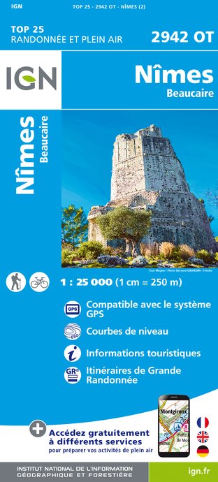
2942OT - NÎMES BEAUCAIRE
Editor : IGN
Collection : TOP 25 ET SÉRIE BLEUE
Scale : 1:25 000
13.90€

2941OT - UZES REMOULINS PONT DU GARD
Editor : IGN
Collection : TOP 25 ET SÉRIE BLEUE
Scale : 1:25 000
13.90€

VEL03 - LE VAUCLUSE A VÉLO
Editor : IGN
Collection : DECOUVERTE A VELO
Scale : 1:100 000
9.10€

TOP100D13 - BOUCHES-DU-RHÔNE MARSEILLE AIX-EN-PROVENCE PARC NATIONAL DES CALANQUES PNR DES ALPILLES ET DE CAMARGUE
Editor : IGN
Collection : TOP 100
Scale : 1:100 000
8.40€

TOP100D84 - VAUCLUSE AVIGNON CARPENTRAS PARCS NATURELS RÉGIONAUX DU LUBERON ET DU MONT-VENTOUX
Editor : IGN
Collection : TOP 100
Scale : 1:100 000
8.40€

D13-84 BOUCHES-DU-RHÔNE VAUCLUSE
Editor : IGN
Collection : CARTES DÉPARTEMENTALES IGN
Scale : 1:150 000
5.90€

D30-34 GARD HÉRAULT
Editor : IGN
Collection : CARTES DÉPARTEMENTALES IGN
Scale : 1:150 000
5.90€

NR16 PROVENCE-ALPES-CÔTE D'AZUR
Editor : IGN
Collection : CARTES RÉGIONALES IGN
Scale : 1:250 000
6.80€

NR14 AUVERGNE-RHÔNE-ALPES RECTO/VERSO MASSIF CENTRAL
Editor : IGN
Collection : CARTES RÉGIONALES IGN
Scale : 1:250 000
6.80€

NR15 AUVERGNE-RHÔNE-ALPES RECTO/VERSO MASSIF ALPIN
Editor : IGN
Collection : CARTES RÉGIONALES IGN
Scale : 1:250 000
6.80€

EUROPE
Editor : IGN
Collection : DÉCOUVERTE DES PAYS DU MONDE IGN
Scale : 1:2 500 000
7.00€
What to visit in LOGIS HOTEL L'ENCLOS DES LAURIERS ROSES REST L
See more suggestionsLearn the history of LOGIS HOTEL L'ENCLOS DES LAURIERS ROSES REST L through its museums.
See more suggestions


Where to eat in LOGIS HOTEL L'ENCLOS DES LAURIERS ROSES REST L
See more suggestionsThe restaurants of LOGIS HOTEL L'ENCLOS DES LAURIERS ROSES REST L await you.
See more suggestions


Where to sleep in LOGIS HOTEL L'ENCLOS DES LAURIERS ROSES REST L
See more suggestionsExplore lodging possibilities in LOGIS HOTEL L'ENCLOS DES LAURIERS ROSES REST L.
See more suggestions


