Tours
Activities
Places of interest
Where to eat
Where to sleep

Discover the treasures of Ambilly near Ibis Annemasse

Are you the owner?
Nestled in the picturesque Haute-Savoie region, Ambilly offers delightful discoveries. Rich in cultural and natural attractions, this beautiful commune invites you to explore its hidden gems. Start your visit with a walk in Parc La Fantasia, perfect for a relaxing outdoor getaway. Continue with a visit to Château Bleu for its diverse cultural exhibits. If you love nature, don't miss Mont Salève, i...See more

Walking around IBIS ANNEMASSE

See more suggestions
Explore the natural surroundings of IBIS ANNEMASSE.
See more suggestions
Cycling loop: Circuit de la Vallée Verte
1.1 km

Cycling loop: Circuit de la Vallée Verte

A moderately difficult route, with the ascent of the Col de Cou (1,117 m) rewarded with an uninterrupted descent of the Vallée Verte. If you set off from Thonon-les-Bains, you'll make the ascent of the Col de Terramont (1,090 m) and the Col de Saxel (943 m). A medium-difficulty circuit with the ascent of the Col de Cou (1,117 m), rewarded by a complete descent of the Vallée Verte. If you leave from Thonon-les-Bains, you'll climb the Col de Terramont (1,090 m) and the Col de Saxel (943 m). Departure point / TER: Annemasse or Thonon-les-Bains, parking de Crête Length: 69 km or 66 km Difficulty: red Total ascent: 700 m or 840 m Direction: clockwise Landmarks and connections from Annemasse : Ville-la-Grand (joint start with Balcons d'Annemasse #26, Tour des Voirons #27 and Annemasse / Thonon-les-Bains link #23); Machilly (separation from Balcons d'Annemasse #26) ; Brens (separation from Annemasse / Thonon-les-Bains route no. 23); Bons-en-Chablais (separation from Tour des Voirons route no. 27); Boëge (joint return with Tour des Voirons route no. 27); Pont Morand (not-to-be-missed exit from départementale 20). From Thonon: Armoy (separation from Circuit de Planbois n°50); Vailly / Sous-la-Côte (separation from Tour du Roc d'Enfer n°37); Habère-Poche (separation from Tour du mont d'Hermone n°29); Boëge; Draillant TER stations: Machilly, Bons-en-Chablais If the Vallée Verte is defined as the Menoge valley, then this itinerary from Annemasse will take you all the way from top to bottom in its second part. To reach the top of this magnificent landscape slide, you'll need to climb to the top of the Col de Cou, which isn't all that formidable. In fact, the average gradient from Draillant is less than 5% over the 10 km ascent. After the "crazy descent of the Vallée Verte", make sure you leave the D20 at the Pont Morand (right-turn sign) to finish in peace. From Thonon, take the D26 and D22 up to the Col de Terramont. After Boëge and the Col de Saxel, don't forget to turn right at the third hairpin on the descent, to join the D35 and Cervens, then Draillant.

66 km
Medium
74100 Annemasse
Show
Cycling loop: Tour des Voirons
1.1 km

Cycling loop: Tour des Voirons

Perfect for a first experience of a "red level" circuit. You'll especially enjoy the little Col de Saxel (943 m), which is ideally positioned at the half-way point and has all the right characteristics for an introduction mountain cycle touring ! Direction of travel: clockwise Landmarks and connections: Ville-la-Grand (shared departure with Balcons d'Annemasse no. 26, Circuit de la Vallée Verte no. 28 and the Annemasse / Thônes link route no. 23); Machilly (leave Balcons d'Annemasse no. 26); Brens (leave the Annemasse / Thonon-les-Bains link route no. 23); Bons-en-Chablais (leave Circuit de la Vallée Verte no. 28); Boëge (return route shared with Circuit de la Vallée Verte no. 28); bridge at Morand (leave the RD20 main road, don't miss the turn-off) Regional rail network stations: Machilly, Bons-en-Chablais Description: To complete the circuit of this modest cluster of mountains in the foothills of the Alps, which is completely covered in forests (summit 1,480 metres), you must ascend the Col de Saxel. But there's no need to worry: the gradient is very steady and never exceeds 5% over a distance of 8 km. Added to that, it's well shaded and faces north-east, so the sun is never overpowering; you could say that this is a "mountain pass training school" for learner mountain-bikers! The route itself is not difficult to follow, nor is it particularly dangerous. One way and another, this route has a lot to recommend it. But make sure you don't miss the turn-off from the RD20 main road when you reach the bridge at Morand, at the bottom of the descent from the valley. The mini balcony route that is suggested to get back to La Bergue and then Cranves-Sales keeps you off busy main roads until you reach the outskirts of Annemasse.

49 km
Medium
74100 Annemasse
Show
Cycling loop:  Annemasse's Balcony
1.1 km

Cycling loop: Annemasse's Balcony

A swift excursion to the north of the town of Annemasse, on the Swiss border. As you go past, have a look at the little dolmen of La Cave-aux-Fées which stands in a middle of a field in the village of Saint-Cergues. Direction of travel: clockwise Landmarks and connections: Ville-la-Grand (shared departure with Tour des Voirons no. 27, Circuit de la Vallée Verte no. 28 and the Annemasse / Thonon-les-Bains link route no. 23); Machilly (leave all these routes); bridge at La Bergue on the RD903 main road (return route shared with Tour des Voirons no. 27 and Circuit de la Vallée Verte no. 28) Regional rail network stations: Machilly Description: The first four kilometres of this route follow the Swiss border closely, often within a few metres, from border post 113 to border post 136. On the French side, you are overlooking the Foron valley up to the point where you cross the mountain stream, at Machilly, to return through the impressive forests of the Voirons mountains. Here, if you look out very carefully, you'll see the neolithic dolmen of La Cave-aux-Fées, which it has to be said is not as impressive as the dolmen of La Pierre-aux-Fées! But keep some pedal-power in reserve because you'll have to drop into second gear for the ascent up to Lossy, which, although not steep, is nonetheless 2 km long. Your last uphill section, at Cranves-Sales, will be shorter. Finally, take care on the last 3 kilometres, where you go along the RD907 main road after Bas-Monhoux.

26 km
Easy
74100 Annemasse
Show
Cycling loop: Circuit du Salève
1.1 km

Cycling loop: Circuit du Salève

Crossing Le Salève this way, you won't encounter any gradients over 6%. This allows you to admire the famous panoramic view of Lake Geneva! When you set off from Annecy you go across (on foot) the impressive Caille bridge. Direction of travel: clockwise Landmarks and connections: From Annemasse: common route along the north Plateau des Bornes, 1 km from the river Avre crossing to the RD2/RD15 junction. ; Cruseilles (meets the Plateau des Bornes south route n°21). Train station TER: Annemasse - Annecy information: inhabited for more than 12,000 years, the Salève mountain has been a tourist attraction for more than a century. Since 1893 it was served by the world’s first funicular railway, which has since been replaced by a cable car used often by the people of the Genevois region. The French term “varappe” (meaning rock-climbing) comes from Salève, being the name of a rocky cave found in the cliffs overlooking Geneva. Departing from Annemasse, the RD15 will take you along the mountainside to reach Salève from the south. The direct ascent through Monnetier-Mornex contains a section with a gradient in excess of 17%, and is not advised. Instead, a short and interesting alternative would be to make the ascent directly at the Croisette from Muraz (RD15). From Cruseilles the RD41 will take you to the summit of Salève with many interesting viewpoints along the way. On the recommended route, you will find yourself a stone’s throw away from Grand Piton (1379 metres) which is the summit of Salève. You will then make a short descent onto the Croisette where you will find a panoramic viewpoint. After another short climb, the route ends with a descent down Monnetier-Mornex (very steep!) before arriving back at Annemasse.

56 km
Medium
74100 Annemasse
Show
Cycling loop: Plateau des Bornes Nord
1.1 km

Cycling loop: Plateau des Bornes Nord

A long continuous climb up to La Chapelle-Rambaud, the highest peak of the Bornes mountain range, gives you a chance to you explore the forest trails from the plateau that bring you to the foot of Le Salève, which you then follow, finishing with a downhill section. Departure point / TER: Annemasse Length: 55 km Difficulty: red Total ascent: 600 m Direction: clockwise Landmarks and connections: Etrembières (joint start with Circuit du Salève no. 20 to Viaison); Régnier (reverse junction with Circuit de la Pierre-aux-Fées no. 24); Etaux (reverse junction with Plateau des Bornes sud no. 21); les Petits Pierres (D27); chez Fauraz (D15) Half uphill and half downhill: that's the general, logical profile of this circuit, which climbs to and from the plateau. Don't start out too strong! You'll appreciate it all the more when you reach the high point, where the slope gradually steepens. But from Chapelle-Rambaud onwards, you'll be on a permanent descent. A few key points not to miss at the start: after the Etrembières bridge, turn left onto the D2, which is heavily trafficked. But you'll leave it 3.5km further on, at a place called Viaison. From then on, you'll be on a quiet road, except after Reignier, where you'll follow the D2 again for 1.5km before turning off towards Jussy. The last point where you'll need to be vigilant: after passing through the charming village of Etaux and crossing the A41, you'll have to cross the N203 before continuing your ascent towards Chapelle-Rambaud.

53 km
Medium
74100 Annemasse
Show

What to do in IBIS ANNEMASSE

See more suggestions
Explore the bookable activity options in IBIS ANNEMASSE for all tastes and ages.
See more suggestions

IGN cards

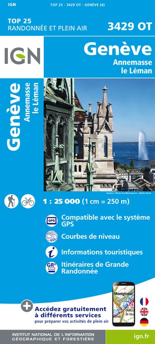
3429OT - GENÈVE ANNEMASSE LE LÉMAN
Editor : IGN
Collection : TOP 25 ET SÉRIE BLEUE
Scale : 1:25 000
13.90€
3430OT - MONT SALÈVE SAINT-JULIEN-EN-GENEVOIS - ANNEMASSE
Editor : IGN
Collection : TOP 25 ET SÉRIE BLEUE
Scale : 1:25 000
13.90€
TOP100D01 - AIN BOURG-EN-BRESSE AMBÉRIEU-EN-BUGEY PAYS DE GEX
Editor : IGN
Collection : TOP 100
Scale : 1:100 000
8.40€
TOP100D39 - JURA PAYS DE DOLE ET VAL D'AMOUR CHAMPAGNOLE LES ROUSSES PNR DU HAUT-JURA
Editor : IGN
Collection : TOP 100
Scale : 1:100 000
8.40€
TOP100D74 - HAUTE-SAVOIE ANNECY THONON-LES-BAINS MASSIF DU MONT BLANC CHAÎNE DES ARAVIS
Editor : IGN
Collection : TOP 100
Scale : 1:100 000
8.40€
202 JURA ALPES DU NORD
Editor : IGN
Collection : TOP 200
Scale : 1:200 000
6.80€
89026 - GRANDES TRAVERSÉES DU JURA - GTJ
Editor : IGN
Collection : DECOUVERTE DES CHEMINS
Scale : 1:105 000
9.10€
D25-39 DOUBS JURA
Editor : IGN
Collection : CARTES DÉPARTEMENTALES IGN
Scale : 1:150 000
5.90€
D01-69 AIN RHÔNE
Editor : IGN
Collection : CARTES DÉPARTEMENTALES IGN
Scale : 1:150 000
5.90€
NR09 BOURGOGNE FRANCHE-COMTÉ
Editor : IGN
Collection : CARTES RÉGIONALES IGN
Scale : 1:250 000
6.80€
NR15 AUVERGNE-RHÔNE-ALPES RECTO/VERSO MASSIF ALPIN
Editor : IGN
Collection : CARTES RÉGIONALES IGN
Scale : 1:250 000
6.80€
NR14 AUVERGNE-RHÔNE-ALPES RECTO/VERSO MASSIF CENTRAL
Editor : IGN
Collection : CARTES RÉGIONALES IGN
Scale : 1:250 000
6.80€
EUROPE
Editor : IGN
Collection : DÉCOUVERTE DES PAYS DU MONDE IGN
Scale : 1:2 500 000
7.00€
SUISSE
Editor : IGN
Collection : DÉCOUVERTE DES PAYS DU MONDE IGN
Scale : 1:303 000
7.00€

What to visit in IBIS ANNEMASSE

See more suggestions
Relax in the parks of IBIS ANNEMASSE.
See more suggestions

Where to eat in IBIS ANNEMASSE

See more suggestions
The flavors of IBIS ANNEMASSE await you.
See more suggestions

Where to sleep in IBIS ANNEMASSE

See more suggestions
Book a quality accommodation in IBIS ANNEMASSE.
See more suggestions
Caution!
We have no information on the difficulty of this circuit. You may encounter some surprises along the way. Before you go, please feel free to inquire more and take all necessary precautions. Have a good trip! 🌳🥾