Tours
Activities
Places of interest
Where to eat
Where to sleep

Barbaira, Aude, Languedoc-Roussillon

Are you in charge of the destination?
Nestled in the stunning region of Aude in Languedoc-Roussillon, Barbaira is a charming town that invites you to explore the natural beauty and cultural heritage of southern France. This small town is surrounded by renowned vineyards producing quality wines, picturesque hiking trails, and breathtaking landscapes. History enthusiasts will appreciate the proximity to the famous medieval site of Carca...See more

Walking around Barbaira

See more suggestions
Walks and hikes around Barbaira.
See more suggestions
Around Miramont
109 m

Around Miramont

From the top of this headland, the view embraces a magnificent landscape formed by the Aude valley, the reliefs of the Minervois up to the borders of the Montagne Noire. Signs: Yellow markings topped by a circle of the same colour From the “Place du 14 Juillet” square take the rue de la Mairie, pass under the railway line and take the Côte à Cailloux (steep pebble path), a medieval track. Place de l'Eglise, take the rue du Carrayrat then turn left on rue de la Faichette. Turn right on rue de Miramont and follow the chemin de la Tuilerie to leave the village. Pass under the highway and turn right for about 200m/656ft. Turn left, then right, on a slightly steep path lined with low walls. Follow the Chemin du four à Chaux up to the parking lot of the plant nursery. Cross the D8008 and follow the path to the plant nursery for 200m/656ft. Turn right onto the Pas de Roland path, then a few dozen meters further on, this will take you to a viewpoint overlooking the Aude valley, the Minervois relief as far as the edge of the Montagne Noire. Carry on along  the path up to the "departmental" road. At this point, turn left for about 600m/1970ft. At the track intersection, turn left and go down the path on 200m/656ft. You are on the site of the remains of the Miramont castle. Then carry on going down by the same route towards the plant nursery, turn right to reach the village by taking the departmental road D8008 through the farmstead "metairie" towards the village.

3 h
7.4 km
Easy
Show
The wall walk - Le Chemin de ronde
3.8 km

The wall walk - Le Chemin de ronde

The vineyard was settled in Languedoc by the Romans. For centuries, it rubbed shoulders with the olive tree plantation and was under the strong domination of cereals. Only a few ruins of windmills remain from the cereal-farming era, on the promontories near the villages. This loop allows you to observe the “couloir Audois” (Aude Corridor) criss-crossed by communication routes, the settlement of the villages and to recall the evolution of southern agriculture. Signs: Yellow markings topped by a square of the same colour The departure is in the heart of the village of Capendu, “place de la Mairie”, in front of the sign.  Pass in front of the post office and take the direction of Montlaur-Val de Dagne. Be careful when passing through the level crossing ! Continue under the highway bridge. First right-angle turn to the left, take the path going outwards below. It winds through the vineyards to the D 57. Turn right again, continue for about 600m/1970ft, just after a safety rail on the right-hand side of the road, inside the bend, take the uphill path. Small slope, in the shade of holm oaks and white oaks, very pleasant in hot weather. Turn right and as you progress, take the time to observe the "couloir audois" (Aude corridor) criss-crossed by communication routes, the villages and in the background the Montagne Noire (Black Mountain). Through the scree, the descent begins and then take the path that leads through the pines. Once at the bottom, cross the vineyard and turn right onto the path, first paved then tarred, which leads to the hamlet of "Font de Roque".

3 h
8.2 km
Very easy
Show
Geological Trail – Great Loop
4.6 km

Geological Trail – Great Loop

A trail for experienced hikers, featuring challenging climbs and stunning views. With ridgelines, steep ascents, and sections through the woods, this challenging route is sure to surprise you!  Trail Markings: yellow  Start at the welcome sign located in the parking lot across from the community center, walk behind it. At the end, turn right and head up the old Capendu trail.  When you reach a junction, turn right and continue straight for about one kilometer.  At a grassy pass, you can shorten the trail by about 2.6 km by taking the “Variante” trail to the right, which descends. Otherwise, tackle the steep climb straight ahead (130 m elevation gain).  Reach the ridge line and head right, following the route shared with the GR 36 (marked with red and white) as well as another trail (marked with a yellow cross). A little further on your left, a short round-trip path will take you to a superb viewpoint.  Return to the original path, then continue through the woods—a very pleasant walk in the summer.  Once again, a directional sign pointing to the right will lead you down a slope for about 1 km toward the Roquenégade farm; you are now on your way back. At the very bottom, you’ll pass through olive groves and vineyards.  At the trail, turn right and stay on it for about 1.3 km. Another sign will direct you to turn right into a field and head to the top of it. It’s a short climb, but you’ll enjoy the view, the vegetation, and the stroll along a path that will lead you into a small valley toward the village, where you’ll return to the parking lot.  Tips: Don’t forget your water bottle and a hat. We do not recommend hiking the entire trail in the summer, as the ascent is very sunny. 

4 h
9.1 km
Easy
Show
Nature and Heritage in Alaric
5.3 km

Nature and Heritage in Alaric

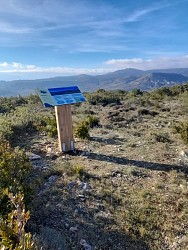
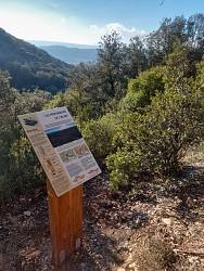
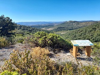
Keep your eyes peeled, along this botanical trail, several breathtaking views await you. Admire the unique panoramic views to the south and north of the Pyrenees and the Montagne Noire, and enjoy the themed interpretive signs dotted along the way.  Trail Markings: Yellow Rectangle Start from the parking lot at the Col du Fer à Cheval between Capendu and Montlaur.  Leave the parking lot by taking the trail that climbs, heading due west. At the top right, you’ll see the trail welcome sign (taking a photo of it will help you orient yourself as you proceed, relative to the locations of the various themed signs).  You are in the heart of the “Corbières Occidentales” Natura 2000 site; be sure to stay on the marked trail and carefully follow the yellow rectangular markers.  Continue along the winding trail for one kilometer, then at the intersection, turn right onto a gentle uphill section. Enjoy the remarkable views to the south and north, overlooking the Pyrenees and the Montagne Noire.  In the wooded area, the southern part of the Capendu communal forest managed by the ONF (National Forest Office), at the small clearing where you’ll find a themed sign, turn left. This small pass was once a route to Montlaur. Shortly after, at the busy Y-shaped intersection, you’ll find yourself at a crossroads. Pay close attention to the yellow rectangular markers. Turn left.  You’re already on your way back. About 200 m further on, on your right, is the last interpretive sign. Enjoy the extraordinary view of part of the Pyrenees. 

2 h
3.7 km
Very easy
Show
The “Capitelles” - Trail of Rancoule
9.5 km

The “Capitelles” - Trail of Rancoule

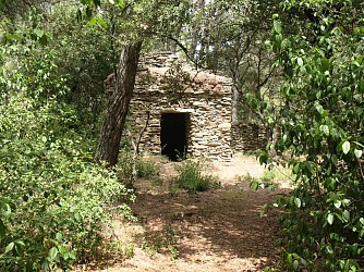
The wide territory of Laure Minervois, the “capitelles” - dry-stone shelters - are the witness of Minervois’ history and rural life.   Trail Markings: Yellow Starting Point: With your back to City Hall. Turn left, then at the intersection, take Rue des Oliviers—this is where the trail markers begin. At the top of the housing area, turn right and head up toward the scrubland, where the first sign on the left points to the path leading to a small “capitelle”; above it, a larger one with a shelter leans against the fence wall. Pass through a grove of holm oaks and giant broom, turn left onto the cart path, then right to reach an old raised garden with a restored "capitelle" near a small chasm.  Climb about ten stone steps and return to the scrubland. Turn right and follow the wall to the north. At the water tower, rejoin the old cart track and continue along the La Guinette municipal trail.  Enter a pine forest heading toward Pech Majou Sud. As you climb, enjoy a beautiful view of the Romanesque bell tower of Saint Jacques d’Albas and the Château de Villarlong (pre-Romanesque chapel and Visigothic ruins).  Cross a remarkable cypress grove (20-meter-tall trees, to the right and left of a deep ravine). Above a small stream, climb about thirty steep steps to reach a flat area.  Head north, following the wall of standing stones (capitelle) bordering a vast pasture (carpeting with rockroses). To the east, there’s a beautiful view of the village, the Crapam, and the Alaric. Descend toward Pech Majou Nord (a small, restored "capitelle" with a doorway on the north side).  Reach a large square "capitelle" (vaulted dome, splayed openings to the north and east) via a flight of twelve steps. On either side, a sloping wall has been built, with stones overlapping in a scale-like pattern. Take the “Carretal” (cart path) westward (a beautiful, straight 100-meter path lined with well-restored low walls). Turn right, follow the wall, and enjoy the panoramic view of Figuères.  At the junction of the trail and the small paved road, turn right onto “Retour 3.” At the very bottom, just before the Calvary of the Cross of Saint Peter, take the small descending trail to the right. Walk past the olive groves and then a hedge of cypress trees.  At the road, turn right to return to the village center. 

3 h
7 km
Very easy
Show
The “Capitelles” - Trail of Fontanilles
9.5 km

The “Capitelles” - Trail of Fontanilles

Across the vast territory of Laure-Minervois, the "capitelles" - dry-stone cabins - stand as testaments to the history and labor of rural life.  Trail Markings: yellow  Starting Point: With your back to City Hall. Turn left, then at the intersection, take Rue des Oliviers—this is where the trail markers begin. At the top of the housing development, turn right and head up toward the scrubland, where the first sign on the left points to the path leading to a small capitelle; above it, a larger one with a shelter leans against the fence. Pass through a grove of holm oaks and giant broom, turn left onto the cart path, then right to reach an old raised garden with a restored capitelle near a small chasm. Climb about ten stone steps and return to the scrubland. Turn right and follow the wall to the north. At the water tower, rejoin the old cart track and continue along the La Guinette municipal path.  Enter a pine forest heading toward Pech Majou Sud. As you climb, enjoy a beautiful view of the Romanesque bell tower of Saint Jacques d’Albas and the Château de Villarlong (pre-Romanesque chapel and Visigothic ruins).  Cross a remarkable cypress forest (20-meter-tall trees, to the right and left of a deep ravine). Above a small stream, climb about thirty steep steps to reach a flat area.  Head north, following the wall of upright stones (capitelle) bordering a vast pasture (carpeting with rockroses). To the east, there’s a beautiful view of the village, the Crapam, and the Alaric. Descend toward Pech Majou Nord (a small, restored "capitelle" with a door on the north side).  Reach a large square “capitelle” (arched with a dome, with splayed openings to the north and east) via a flight of twelve steps. On either side, a sloping wall has been built, with stones overlapping in a scale-like pattern. Take the “Carretal” (cart path) westward (a beautiful, straight 100-meter path lined with well-restored low walls). Turn right, follow the wall, and enjoy the panoramic view of Figuères. Go down toward Figuères, crossing a large pine forest toward Métairie Neuve.  You’ll reach a path; turn right toward Les Fontanilles, then descend to the stream and cross it. Pass through a grove of magnificent Aleppo pines and cade junipers to reach Rancoule (look for a square capitelle in a vineyard, near a sunken path). Follow the path that runs alongside the vineyards. There is a massive square capitelle on the left. You’ll reach the “enclos” of Pont de Canet (a wall of vertical or slanted stones). A square "capitelle" leans against the wall.  At the very bottom, just before the Calvary of the Cross of Saint Peter, take the small descending trail to the right. Walk alongside the olive groves and then a hedge of cypress trees. 

4 h
8.7 km
Very easy
Show
The “Capitelles” - Arques Road
9.5 km

The “Capitelles” - Arques Road

Across the vast territory of Laure-Minervois, the "capitelles" - dry-stone shelters - stand as testaments to the history and labor of rural life.  Trail Markings: Yellow Starting Point: With your back to City Hall. Head left, then at the intersection, take Avenue des Oliviers, this is where the trail markers begin. At the top of the housing development, turn right and “head up” toward the scrubland, where the first sign on the left points to the path leading to a small capitelle; above it, a larger one with a shelter leans against the boundary wall. Pass through a grove of holm oaks and giant broom, turn left onto the cart path, then right to reach an old raised garden with a restored "capitelle" near a small chasm.  Climb about ten stone steps and return to the scrubland. Turn right and follow the wall to the north. At the water tower, rejoin the old cart track and continue along the La Guinette municipal trail.  Enter a pine forest heading toward Pech Majou Sud. As you climb, enjoy a beautiful view of the Romanesque bell tower of Saint Jacques d’Albas and the Château de Villarlong (pre-Romanesque chapel and Visigothic ruins).  Walk through a remarkable cypress grove (20-meter-tall trees, on both sides of a deep ravine). Above a small stream, climb about thirty steep steps to reach a flat area.  Continue north, following the vertical stone wall (capitelle) bordering a vast enclosure (carpet of rockroses). To the east, enjoy a beautiful view of the village, the Crapam, and the Alaric. Descend toward Pech Majou Nord (a small, restored capitelle with a door on the north side).  Once you reach the trail, turn right onto “Retour 2” toward the village to return to the starting point. 

2 h
5.6 km
Very easy
Show

What to do in Barbaira

See more suggestions
Book your activities in Barbaira now and get ready for adventure.
See more suggestions
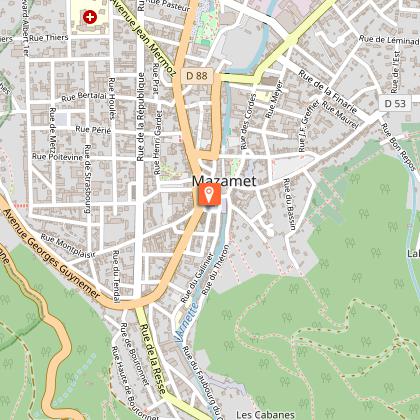
Via Ferrata in Mazamet
34 km

Via Ferrata in Mazamet

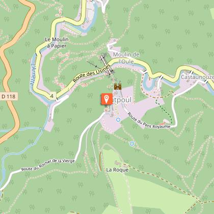
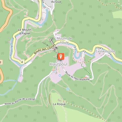
Looking for big thrills? Desire to surpass yourself? The via ferrata of Mazamet is for you! In the the Arnette gorges, in Mazame, via ferrata and giant zip line, under the footbridge. Acrobats and adventurers will enjoy this safe activity which completes, since 2022 the current tourist offer. This land is located in a protected natural site carried by an outstanding historic heritage (Cormouls-Houlès remarkabe gardens, St-Sauveur ruins, classified archeological site), and a rich and diverse wildlife. Nearby, after crossing the Mazamet's Hymalayan footbridge at 70 meters high over the Arnette river, you will find the medieval village of Hautpoul and its gardens, as well as, on the GR7, the House of Wood and Toy, its arboretum and its orchard. A nice wander along the 'Art Net' to picnic in th the shadows of chestnut trees. - Via Ferrata with ziplines : . Access: 20 mn . Drop : 90 m . Length: 880 ml . Difficulty: AD à D+ . Duration: 2 h 30 . Way back: 20 mn - Via Ferrata without zipline . Access: 30 mn . Drop: 110 m . Length: 370 ml . Difficulty: AD à D+ . Duration: 1 h 30 . Way back: 20 mn - Via Ferrata (upper part of Hautpoul) . Access: 20 mn . Drop: 60 m . Length: 130 ml . Difficulty: PD . Duration: 45 mn . Way back: 25 mn Minimum gear required: . Helmet . Harness . Closed shoes . Rest Karabiner & short lanyard . 2 wide aperture autoblock gate karabiners . Karabiner aerolink specifically for continuous safe line . Lanyard aeroline Ferrata . Double lanyard with shock absorber . Gloves General recommendations: Access to the Via Ferrata of Mazamet is prohibited: - to children measuring less than 1,35m and minors who are not accompanied by un experienced adult ; - outside opening hours and over night ; - in adverse weather conditions and especially when the route is slipppery and affected by snow, ice and stormy conditions. You agree to undertake this activity at your own risk. If you have little or no experience in this type of activity, please contact the services of a guide. Equipment rental: Mazamet Tourist Office Online booking: www.tourisme-castresmazamet.com/billetterie Rates: 18€/pers. Groups more than 5 persons: 16,50€/pers. Groups more than 10 persons : 15€/pers. Deposit: 400€ (on the day of the rental, chèque ou Crédit card) For beginners or persons needing a guide, you can contact: - Aude Escapades - Laurence Combes 06 03 50 00 85 - Axecime - Yannick Saulnier 06 08 42 27 13

95 rue de la Resse 81200 Mazamet
Book from 0 €Book
Show
Le Mouscaillou
42 km

Le Mouscaillou

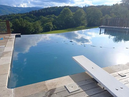
Towering majestically over you, the Montagne Noire Our large Guest House, authentic, spacious, very comfortable, surrounded of 5ha of prairies and oak woods invite to well-being. Need for tranquillity, contemplation: a panorama of exception, a large swimming pool with salt, beautiful beach wood vegetation, with on-site botanical trail. Here in the Parc Naturel Regional du Haut-Languedoc is planned to make you discover a rich and preserved nature. The Panda label is attested. For more physical activity: discovery of the mountain, the waterfall of the Mouscaillou, walk or bike the trails. Possibility to put in place of hiking tours with picnic. Maps and guidebooks available. Opportunity also to try our all-terrain scooters: initiation on-site warranties sensations. More than cultural: rich local heritage: Albi, Castres, Cordes, Carcassonne, Sorèze, Lautrec. After l aperitif offered on the moment of sharing and conviviality terrace, you can enjoy in our The large ground floor room opened by its three windowpanes on the shaded terrace and its remarkable panorama, fully reserved you. Wood, stone, green plants create a soft and warm atmosphere. You will take your meals and enjoy relaxing lounge chairs, his television, his library enriched with many works nature and tourism and its corner bar with fridge. Also on the ground floor, you have two toilets and a washing machine. L floor the rooms, with their wooden floors, colors in the milk of lime, custom decorations, beautiful openings of the mountains or the plain of Castres, offer you comfort and privacy. Three rooms with private wc and shower room; a fourth is added if necessary to one of them to form the family that will accommodate up to five people. You certainly understand that we need to take the time to have fun, which is why we you propo

112 chemin du Mouscaillou La B 81290 Escoussens
Book from 0 €Book
Show
The Great Paths
42 km

The Great Paths

Towering majestically above you: the Montagne Noire. Here in the Haut-Languedoc Regional Nature Park, everything is designed to help you discover a rich and unspoiled natural environment. The Panda label attests to this. This authentic, spacious, and very comfortable home, surrounded by five hectares of meadows and oak forests, invites you to relax and unwind. Looking for peace and quiet, or a chance to reflect? Enjoy an exceptional panoramic view, a large saltwater pool (shared), a beautiful wooden deck surrounded by greenery, and an on-site botanical trail. For more physical activities: explore the mountains and the Mouscaillou waterfall on foot or by bike along marked trails. Maps and guidebooks are available. Be sure to try our all-terrain scooters as well—get an on-site introduction; thrills guaranteed. For cultural experiences: rich local heritage, Albi, Castres, Mazamet, Cordes, Sorèze, the springs, lakes, and waterways of the Canal du Midi, and Carcassonne. ** THE COTTAGE ** You enter on the ground floor into a large open room with floor-to-ceiling windows opening onto the terrace, which offers a pleasant mix of sun and shade, the lawn, and its remarkable panoramic view. Wood, stone, and houseplants create a soft and warm atmosphere. You can relax in the living room’s armchairs, watch TV, browse the library—which is well-stocked with books on nature and tourism—or enjoy the bar area with a fridge; there’s also a separate living room. You’ll also find another living room and a very large, professionally equipped kitchen: a large refrigerator with a separate freezer compartment, a professional-grade gas stove, a gas oven and an electric oven, a microwave, a sink, and a dishwasher. Upstairs, the four bedrooms—with their hardwood floors, lime-washed walls, personalized decor, and beautiful views of the mountains or the Castres plain—offer comfort and privacy thanks to enhanced insulation. There are three bathrooms and three separate toilets. Your stay is all-inclusive: sheets, towels, and linens are provided; beds are made upon your arrival; and end-of-stay cleaning is included.

112 chemin du Mouscaillou La B 81290 Escoussens
Book from 884 EURBook
Show

What to visit in Barbaira

See more suggestions
Savor the local cuisine of Barbaira.
See more suggestions
Where to eat in Barbaira

See more suggestions
The restaurants of Barbaira await you.
See more suggestions

Where to sleep in Barbaira

See more suggestions
Discover popular accommodations in Barbaira.
See more suggestions
Caution!
We have no information on the difficulty of this circuit. You may encounter some surprises along the way. Before you go, please feel free to inquire more and take all necessary precautions. Have a good trip! 🌳🥾