Tours
Activities
Places of interest
Where to eat
Where to sleep
Camping Le Gallo Romain: Discover Barbieres' Charm
Are you the owner?Welcome to Camping Le Gallo Romain, your ideal starting point for exploring the wonders of Barbieres, Drôme, Rhône-Alpes. Nestled between mountains and valleys, this campsite is perfect for nature lovers and history enthusiasts alike. Discover numerous hiking trails that wind through picturesque landscapes, including the famous Huguenot Trail that offers breathtaking panoramas.
Cyclists will find...See more
Cyclists will find...See more
Walking around CAMPING LE GALLO ROMAIN
See more suggestionsExplore the hiking trails around CAMPING LE GALLO ROMAIN.
See more suggestions")


What to do in CAMPING LE GALLO ROMAIN
See more suggestionsBook your activities in CAMPING LE GALLO ROMAIN and experience memorable moments.
See more suggestions


")


IGN cards
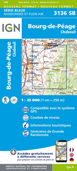
3136SB - BOURG-DE-PÉAGE CHABEUIL
Editor : IGN
Collection : TOP 25 ET SÉRIE BLEUE
Scale : 1:25 000
13.90€

3136ET - COMBE LAVAL
Editor : IGN
Collection : TOP 25 ET SÉRIE BLEUE
Scale : 1:25 000
13.90€

TOP75001 - MASSIF DU VERCORS
Editor : IGN
Collection : TOP 75
Scale : 1:75 000
9.80€

VEL01 - LA DRÔME A VELO
Editor : IGN
Collection : DECOUVERTE A VELO
Scale : 1:105 000
9.10€

TOP100D26 - DRÔME VALENCE MONTÉLIMAR DIE PNR DES BARONNIES PROVENÇALES PNR DU VERCORS
Editor : IGN
Collection : TOP 100
Scale : 1:100 000
8.40€

202 JURA ALPES DU NORD
Editor : IGN
Collection : TOP 200
Scale : 1:200 000
6.80€

D38 ISÈRE
Editor : IGN
Collection : CARTES DÉPARTEMENTALES IGN
Scale : 1:150 000
5.90€

D07-26 ARDÈCHE DRÔME
Editor : IGN
Collection : CARTES DÉPARTEMENTALES IGN
Scale : 1:150 000
5.90€

NR15 AUVERGNE-RHÔNE-ALPES RECTO/VERSO MASSIF ALPIN
Editor : IGN
Collection : CARTES RÉGIONALES IGN
Scale : 1:250 000
6.80€

NR16 PROVENCE-ALPES-CÔTE D'AZUR
Editor : IGN
Collection : CARTES RÉGIONALES IGN
Scale : 1:250 000
6.80€

NR14 AUVERGNE-RHÔNE-ALPES RECTO/VERSO MASSIF CENTRAL
Editor : IGN
Collection : CARTES RÉGIONALES IGN
Scale : 1:250 000
6.80€

EUROPE
Editor : IGN
Collection : DÉCOUVERTE DES PAYS DU MONDE IGN
Scale : 1:2 500 000
7.00€
What to visit in CAMPING LE GALLO ROMAIN
See more suggestionsExplore the cultural heritage of CAMPING LE GALLO ROMAIN.
See more suggestions


Where to eat in CAMPING LE GALLO ROMAIN
See more suggestionsEnjoy delicious dishes at CAMPING LE GALLO ROMAIN's restaurants.
See more suggestions


Where to sleep in CAMPING LE GALLO ROMAIN
See more suggestionsFind lodging to suit your needs in CAMPING LE GALLO ROMAIN.
See more suggestions


