Alert
Alerts
The Echo pass
Description
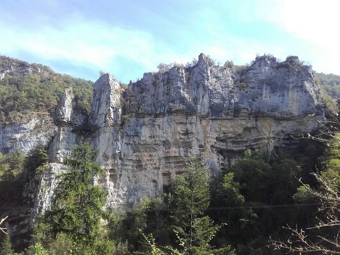
Join the Pas de l'Echo, partly in the footsteps of an ancient Roman road that was once the only link between Oriol and the village of Leoncel in the south.
Departure from Oriol-en-Royans (parking exit south of the village), direction Léoncel and Pas de l'Echo 5. Leave the main road to go up on the right by a small path along a wall (follow the yellow and green markings). The route joins a road to the hamlets of Grippats and La Bourrelière, the walk continues through a path through woods and meadows that leads to the place called Les Merles 1. Cross the departmental road (pay attention to the cars), always following the direction of the Pas de l'Echo, climb to the hamlet of Tamée 2 and then take 200 meters on the departmental road. At the crossroads of Gagnas 3, take on the left the itinerary which gradually descends into undergrowth. Once again, cross the local road (the place called Le Bedaud 4) and a little further along a small road following the yellow and green signs towards the Pas de l'Echo. GR 9, the return to Oriol-en-Royans is done by passing successively by La Passerelle 6 then L'Usine de la Plaine 7, Les Rats and la Freydière 8 Monne and les Clefs 9 La Rousse 10, Tallard 11 and Tognon 12.
Technical Information
Altimetric profile
Starting point
Additional information
Public transport
By train :Valence train stationsOùRA multimodal route planner : www.oura.com/by bus :From Valence : Line D05 to Vassieux-en-Vercors and stop at Saint-Jean-en-Royans. Then, reach the start hitchiking or by car pooling.By hitch hiking : You can get there / get back by hitching a lift with the Rezo Pouce network from Autrans-Méaudre, Lans-en-Vercors, Grenoble and Royans-Vercors (you can find all the stops in the Vercors on www.rezopouce.fr).carpooling :Offer your services or book your carpooling on the regional Mov'Ici platform.
Advice
Beware in rainy weather, some technical passages can be delicate and slippery! Use the passageways to cross the fences, close the gates and barriers.Stay on the marked paths is also respect private property.
Advised parking
Parking exit south of the village or parking near the town hall
Access
From Saint-Nazaire-en-Royans follow the D 209 towards Saint-Jean-en-Royans, then the D 629 and the D 70 towards Oriol-en-Royans.
Arrival
Oriol-en-Royans (parking exit south of the village)
Ambiance
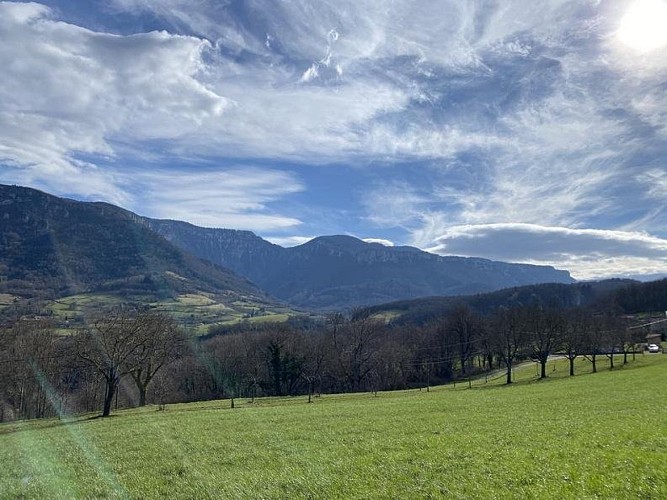
This stroll with diversified landscapes makes you discover the historical and natural heritage of Oriol-en-Royans, between agricultural spaces, under wood, canyon and unusual passages.
Departure
Oriol-en-Royans (parking exit south of the village)
