Tours
Activities
Places of interest
Where to eat
Where to sleep

Explore Alpuech, Aveyron: a gem in Midi-Pyrénées

Are you in charge of the destination?
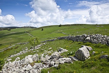
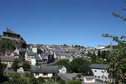
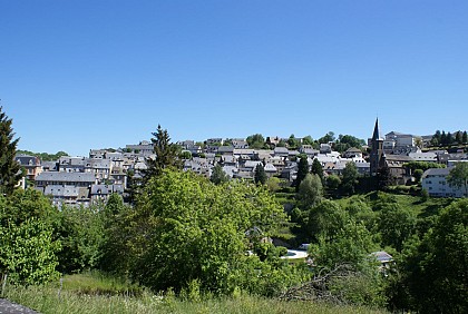
Nestled between lush valleys and majestic plateaus, Alpuech, Aveyron, Midi-Pyrénées is a small town that enchants with its unrivaled natural and cultural attractions. Visitors can start their visit with a stroll through the picturesque village, admiring the traditional stone architecture of the centuries-old houses.

Outdoor enthusiasts will be delighted by the hiking trails available in the area....
See more

Walking around Alpuech

See more suggestions
Explore the natural surroundings of Alpuech.
See more suggestions
Hike "Roc des Pas"
9.5 km

Hike "Roc des Pas"

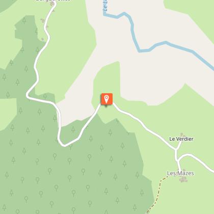
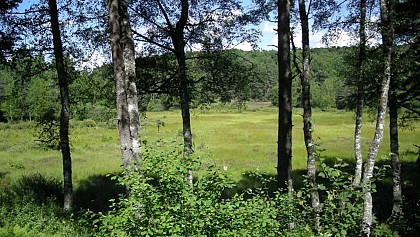
A long hike with a long descent and long steep climb. Recommended only for expererienced hikers. Beautiful view on the Truyère valley and the volcano massif. The "Roc des Pas" is a big rock which shows curious traces which seems to be foot-and handprints. Their origin is not known. D - Depart Lieutadès in front of the former hotel. Take the road to LA SAUVETAT until VAISSIERES HAUTES (or make the first part of the hike "La Sauvetat". 1 - Cross the village. After the village take a path at left which follows the hedges. After 700 m take the path to the right. 2 - In LA SAUVETAT follow an asphalt road at left, cross the village and take the path which passes in front of the last house. Follow the fence and the large path between two ash hedges. 3 - At the intersection go straight on until a flat site where you follow the fence into the wood. Then follow the path and exceed the fence. The path leads you along an embankment to the "Roc des Pas". At point 3 follow a path at right into the valley which joins another path. Take the second path and go until POUJET. 4 -Cross the D 65 and take the path at right of a house to reach the D 11. Follow the road for 500 m. Take the path to ESTOURNIES and cross the village. The path joins a second time the D 11. Turn at right. 5 - Follow the asphalt road, cross the bridge and take at the next turn a steep path into the wood. Follow it until LA BORIE. 6 - Cross LA BORIE and take at the end of the village a path to your right which follows a stone wall. Take it and go back to LIEUTADES.

4 h
12 km
Medium
Vaissières Hautes 15110 Lieutadès
Show
Road trip "Aubrac Cantalien"
16 km

Road trip "Aubrac Cantalien"

Magic landscapes, changeable light at any time ... An atmosphere and Unique feelings! Forests, pastures and burons, typical shelters of Shepherds, are divided the space on the tray of Aubrac. Of a height average of 1000 meters, this site appreciates summer and winter alike. Since Chaudes-Aigues and his hot waters in 82°C, borrow the road of Laguiole. Just a step from the village, you can admire the Castle of Couffour Sheltering the restaurant of the famous leader double studed Serge Vieira. The famous guide is worth seeing as would say! Take then the direction of Deux-Verges, the name of which comes from the meeting Of two brooks. You are from now on on a site "Space out Sensitive Nature" Of Cantal: the Volcanic hill of the Tile. The landscape is exceptional (table Of orientation). This site shelters an important biodiversity of which a peat bog with A named rare plant "lycopode". Not to miss, the bell tower with comb of The church of the village which shelters one of the most former bells of the canton. Direction Saint Rémy de Chaudes-Aigues at the moment. The landscape opens, the plateau begins to offer his area. Since Saint Rémy de Chaudes-Aigues, in particular in front of the Romanesque church in the bell tower with comb in four arches, admire meadows crossed by the sinuous river of Bès, paradise of the fishermen. By continuing your road, a passage by the Rock of the Virgin in Roche-Canilhac will offer you another surprising panorama. The next stage of this périble leads you to Saint-Urcize, village raised on a basaltic rock dominating the valleys of the Miserable wretch and the Bès. The old houses, the narrow alleys, the places decorated with fountains, the vestiges of fortifications and the ruins of the former fort give to the city a medieval character and give evidence of its very former origin. The magnificent Romanic church Saint-Peter/Saint Michel du XIIème century, one of the most beautiful of Haute-Auvergne, invites you in the pondering: limp in comb and bell of 1583 (one of the most former of France), ambulatory bent in quarter circle, frescoes of time, incredible stained-glass windows, chalice ... An inescapable building. To note the very beautiful panorama on the tray of Aubrac (we see three departments there!) and on the village since the Rock of the Virgin. After a coffee decorated with Fred's crunchy anecdotes, boss emblêmatique of the restaurant to Discount, let us take the direction of Trinitat. It is In this a little isolated village and in the singular church that was sounded, as it is said, the first angelus near 1350. The last step is the village of Jabrun, which, contrary to what one might think, is a famous village. It was first a high place of the Resistance during the Second World War. In another book, a few years ago, the director Jean-Pierre Marchand shot the film «La Dictée» at the village school premises. Not far from this is the Romanesque-style church, which deserves attention... The time of return to Chaudes-Aigues is near and on the road in clear weather, you can see, not so far away, the Cantal Mountains, synonymous with a next ride...

3 h
55 km
Very easy
2 3 place du Gravier 15110 Chaudes-Aigues
Show
Hike The Old Roman Road - Chabridet Wood
18 km

Hike The Old Roman Road - Chabridet Wood

This easy family hike on good paths passes in the Chabridet wood and offers beautiful view points. Gourdièges is an interesting little village with an old church dating partly from the 16th century (visit outside only). D - From the Tourist Office in Pierrefort, take the D990 until the ancien post office. Turn right in the direction of SAINT- GERVAIS. 1 - At the sports field leave the Roman way and take the parallel path at right towards “PRE-CLAU”. 2 - At the end of the path to the left follow right towards CHABRIDET woods. 3 - Hug the woods to the right until the Roman way 4 - Follow to the right in the direction of GOURDlEGES. Beautiful view to the Aubrac plateau. 5 - At the end of the path follow the road to the left. 6 -Before the sign GOURDIEGES take the road to the right. Go towards the old bread oven called “Four Banal” (note the original archway and lauze roof). 7 - Continue straight on until the church and observe the old comb bell tower, the stone cross and a "trifront" next the entrance. Keep left until the exit to the village. View of the Plomb du Cantal and Puy de Rocher to the right. 8 - Take the path opposite until the D990. 9 - Follow the D990 to the left for 200m. 10 - Leave the road and take the way to the left. Re- enter the wood to the right until the Roman way then right and descend until Pierrefort. Mountainbike: Easy level. Count 1 hour. Marked green signed = .

3 h
9.3 km
Easy
Place de l'église 15230 Pierrefort
Show
Hike Puy d'Assac and Montrozier Wood
18 km

Hike Puy d'Assac and Montrozier Wood

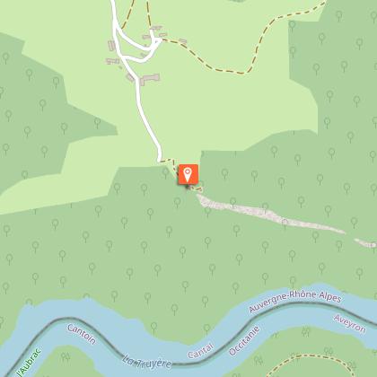
A long but easy hike without any difficulties. Ideal piste for mountain bikers. From the plateau beautiful view to the montains. D - DEPART: From the Tourist Office, take the D990 for 200 m, direction SAlNT- FLOUR until the ancien Post Office, then to the right direction SAlNT- GERVAIS. 1 - At the sports field follow the left track direction of Bois de Chabridet. 2 - Cross CHABRIDET WOOD. 3 - In the middle of the forest turn at left and follow the sandy path to the D990. 4 - Follow the D990 to the right for 200 m then to the left. Bypass the PUY d’ASSAC. 5 - Arriving at the D34 follow it to the right for 300 m then take the path to the left towards TRENAC. 6 - In TRENAC take the first path on the left between the houses. 7 - The path borders the lake of Montzorier, fishing area. Views of the Puy de Bane, Puy de la Cede, Plomb de Cantal and the Puy de Rocher. 8 - Turn left towards MONTROZIER WOOD and cross it. 9 - Arriving on the D265 (note the path leads out of a bend). Continue for 200m then go right until the view point on the “CROlX d’ lSERGUES.” View of the BREZONS VALLEY. Return to the D265, cross it in direction of the wood. At the junction follow to the right to Pierrefort. Mountainbike: Easy level. Time: 1 hour 45 minutes. Between 4 and 5 ruts hidden by vegetation. At 9: Attention, dangerous turn. Marked as foot path in green = and special bike signs triangle/points.

4 h
14 km
Medium
Place de l'église 15230 Pierrefort
Show
Scenic car tour "Around the Valley of Brezons"
18 km

Scenic car tour "Around the Valley of Brezons"

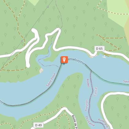
3 hours car trip (64 km) around one of the most beautiful glacial valley of Europe Circuit by car " Around the Valley of Brezons ". Duration 3h - 64 km Located between the Plomb du Cantal and the Truyère Gorges, in the southern part of the Auvergne Volcanoes Regional Natural Park, Pierrefort welcomes you for an active and greedy stage. The birthplace of Jean Todt will seduce you with its picturesque streets lined with houses arranged in an amphitheater. You will then take the small bucolic road towards the Prat-de-Bouc pass. Discover the village of Cézens with its gothic church topped by a combed bell tower. Possibility of a return trip to the belvedere of Vidèche : beautiful view on the valley of Brezons (narrow road!). To continue this escapade by crossing the plateaus of estives and to take well on the left the direction of the Valley of Brezons. There, in these great spaces, enjoy the sounds, the smells, the colors so particular to these mountain plateaus. At the level of the Col de la Griffoul, you can walk to the Cirque de Grandval and back, where you can admire the view of the Vallée de Brezons or enjoy a gourmet break at the Buron de la Combe de la Saure from mid-May to the end of October (tel. 06 19 06 29 54, reservation recommended, buron accessible by car) Then you will plunge into this glacial valley in trough. While descending, pay attention to the Boyle rock on your left, and your imagination will allow you to discover a lion's head. After a sharp bend, before the village of Bourguet, a round trip will lead you to the will lead you to the marked paths of the Site de la Haute Vallée. Attention motor homes: this road is not accessible by motor homes because it is very narrow. You can park in Bourguet on a parking lot on the right. A signposted path leads to the start of the Haute-Vallée site (about 45 minutes walk). In Brezons, stop to visit the church (nice modillions...), then go up to Vigouroux, a small mountain village. 1 km after Vigouroux, before a big bend on the right, you have the possibility to visit the Chaussée de Vigouroux, a remaining vestige of the old road linking Saint-Flour and Aurillac in the 18th century. Continue straight ahead and then turn right towards Malbo to discover the Rocaillade site, a basaltic organ landslide (after the water catchment, a signpost for a walk on the left). Continue towards Malbo with the visit of the archeological site of Rissergues, vestiges of a village of the year 1000 (follow the signs, 2.5 km from the village). Continue in the direction of Lacapelle-Barrès, then reach Pont-la-Vieille, bathed by the cool waters of the Siniq. Stay on the D 990 in the direction of Pierrefort and take, after 1.5 km, the D 54 in the direction of Narnhac (interesting church with a very old bell). After Narnhac, continue on the D 354 to Saint-Martin-sous-Vigouroux and visit the 14th century church with its beautiful murals. Return to Pierrefort on the D 990. Translated with www.deepl.com/translator (free version)

3 h
64 km
Medium
29, Avenue de Georges Pompidou 15230 Pierrefort
Show

What to do in Alpuech

See more suggestions
Explore Alpuech through its many bookable activities.
See more suggestions
Le grenier à grains de Juzelles
25 km

Le grenier à grains de Juzelles

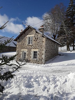
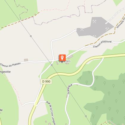
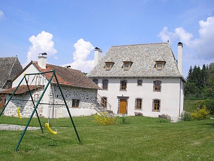
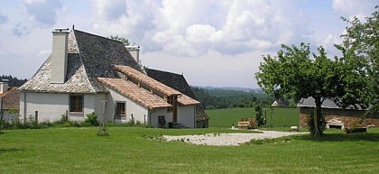
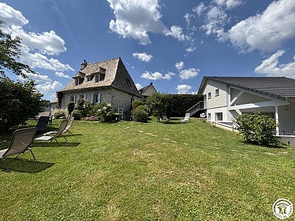
Independent house of character with panoramic views in the heart of the Carlads. Private outdoor spa for 4 persons arranged all year round. Located in the heart of the Carlads, near Aurillac, this former agricultural estate was completely renovated in 2021. Enjoy breathtaking views of the Aubrac and the Goul valley. This characterful detached house is located in the heart of the owners' farm on a basalt plateau overlooking the valleys of the Rasthène and the Embène. You can take advantage of the unobstructed views of the Aubrac and also the Cantal mountains. Numerous activities are available: hiking, golf in Vézac, visiting the site of the Carlat rock (climbing and virtual visit of the old fortress), exploring the Ronesque rock site, the Château de Messilhac, the Petite Cité de Caractère of Raulhac, water activities and swimming at the Laussac peninsula or at the Lake of Saint-Etienne Cantallès, cross-country skiing, snowshoeing, and the Super-Lioran resort. You have a non-fenced plot of 600 m², a south-facing terrace at the front with garden furniture and a barbecue, and a covered terrace on the side with a spa for 4 people and an outdoor shower. On the ground floor, there is a spacious living room with a flat-screen TV and a kitchen area, a utility room, and a separate toilet. Upstairs, there is 1 bedroom with a 160 cm bed, 1 bedroom with a double bed and a single bed, and a shower room with a toilet. Internet access via Wi-Fi. Beds made upon arrival and towels provided. Heating by heat pump included. Rates include all charges. Shops are 10 km away in Vézac, 14 km in Arpajon-sur-Cère, 16 km in Vic-sur-Cère, and 17 km in Aurillac.

Juzelles 15130 Carlat
Book from 0 €Book
Show

What to visit in Alpuech

See more suggestions
Stroll through the historic districts of Alpuech.
See more suggestions
Aubrac : a high plateau with a unique character
14 km

Aubrac : a high plateau with a unique character

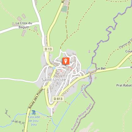
A high open plateau, corrugated, punctuated with granite blocks and herds, lakes lined with walls... A place where the eyes get lost and the walker pleases. A millennial place of passage on the way to St-Jacques de Compostela. Situated in the borders of 2 regions: Auvergne-Rhône Alpes and Occitanie, the plateau of Aubrac extends over 3 departments: Lozère, Cantal and Aveyron. Of small surface, 40 km on 20 km, it is limited to the North by the gorges of Truyère and to the South by the valley of the Lot. With an average height of 1000 meters, Aubrac peaks in 1469 meters in the signal of Mailhebiau and 1440 meters in the Truc of Aubrac. Forests and immense pastures are divided the space. This entity to part, to the very strong identity became in 2018 the regional Natural reserve of Aubrac. An essential foundation for the future of this territory so particular. To discover it: - Walking map of Aubrac and organised trip by car to ask the Tourist Office of Chaudes-Aigues - Villages to be visited: Saint-Urcize (Petite Cité de Caractère), Aubrac and the House of Aubrac - The Sensitive Natural Space of the Volcanic hill of the Tuile and its panorama in 360° - The waterfall of Déroc and the road of Lakes - The thermal city of Chaudes-Aigues where hot waters spring in 82 °C, - Gorges of Bès - The village of Laguiole, its bull, its knives, its cheese maker cooperative Jeune Montagne - The numerous hiking trails. For the walkers the Path of Santiago de Compostela or the route on several days " Aubrac au Coeur " - The activities of open air " Aubrac 4 Saisons "

15110 Saint-Urcize
Show

Where to eat in Alpuech

See more suggestions
Restaurants in Alpuech offer a friendly atmosphere.
See more suggestions
Where to sleep in Alpuech

See more suggestions
Find lodging to suit your needs in Alpuech.
See more suggestions
Le grenier à grains de Juzelles
25 km

Le grenier à grains de Juzelles

Independent house of character with panoramic views in the heart of the Carlads. Private outdoor spa for 4 persons arranged all year round. Located in the heart of the Carlads, near Aurillac, this former agricultural estate was completely renovated in 2021. Enjoy breathtaking views of the Aubrac and the Goul valley. This characterful detached house is located in the heart of the owners' farm on a basalt plateau overlooking the valleys of the Rasthène and the Embène. You can take advantage of the unobstructed views of the Aubrac and also the Cantal mountains. Numerous activities are available: hiking, golf in Vézac, visiting the site of the Carlat rock (climbing and virtual visit of the old fortress), exploring the Ronesque rock site, the Château de Messilhac, the Petite Cité de Caractère of Raulhac, water activities and swimming at the Laussac peninsula or at the Lake of Saint-Etienne Cantallès, cross-country skiing, snowshoeing, and the Super-Lioran resort. You have a non-fenced plot of 600 m², a south-facing terrace at the front with garden furniture and a barbecue, and a covered terrace on the side with a spa for 4 people and an outdoor shower. On the ground floor, there is a spacious living room with a flat-screen TV and a kitchen area, a utility room, and a separate toilet. Upstairs, there is 1 bedroom with a 160 cm bed, 1 bedroom with a double bed and a single bed, and a shower room with a toilet. Internet access via Wi-Fi. Beds made upon arrival and towels provided. Heating by heat pump included. Rates include all charges. Shops are 10 km away in Vézac, 14 km in Arpajon-sur-Cère, 16 km in Vic-sur-Cère, and 17 km in Aurillac.

Juzelles 15130 Carlat
Book from 0 €Book
Show
Caution!
We have no information on the difficulty of this circuit. You may encounter some surprises along the way. Before you go, please feel free to inquire more and take all necessary precautions. Have a good trip! 🌳🥾