Tours
Activities
Places of interest
Where to eat
Where to sleep

Discover Vitrolles-en-luberon in Vaucluse

Are you in charge of the destination?
Nestled in the heart of Provence-Alpes-Côte d'Azur, Vitrolles-en-luberon is a true gem for lovers of nature and culture. Visitors can explore the Luberon Regional Natural Park, a protected area where biodiversity flourishes. The hiking trails offer panoramic views of hills and forests, perfect for walking or biking adventures.
For history and architecture enthusiasts, visiting the nearby village...
See more

Walking around Vitrolles-en-luberon

See more suggestions
Walk through the natural landscapes of Vitrolles-en-luberon.
See more suggestions
The short circuit of Grambois
5.5 km

The short circuit of Grambois

Discovering the heritage and biodiversity of this small village of the Southern Luberon, which attracted the filmmaker Yves Robert. Head towards the bottom of the car park and take the gravel road to the left about twenty meters. Go into the driveway to the right and reach the fifth dovecote. 1- Take a left and head up the olive tree paths and reach the road (D122). Cross it and climb the Chemin de Fontsausse. Pass a curve around the spring at the foot of the rock and continue. Descend to the right the Rue de Ribas for 100m and climb the steep paved path to the left of Chemin des Pasquiers. On top of the hill, continue straight to the fountain with the three barrels. 2- Turn left, taking the stairs and come out on the Place des Remparts. Cross it then continue left to the town hall square. After the square, turn right and go down the paved street of Rue du Château. Continue to the right and cross the winding descent and pass the Porte de Fontvérane. Go up to the right the Rue de la Ferrage. 3- Before the calvary (cross) exit left the main street. 100m lower, hurtle down to the left the little staircase and then go left under a remarkable oak. Continue the path, go down a final series of steps and lead right to the Fontvérane source. Go down the wide path to the left. Leave behind the right trail (marked in green) and continue straight on the slope (GR markings) on about 200m. 4- In a right turn, take a left along a path overhanging the left bank of the Eze. Further down, go along an old meadow and climb slightly to the left (4 steps). Then continue into the undergrowth. Cross the road (D122) to regain the car park of the starting point

1 h
1.9 km
Very easy
Show
Le Mourre Nègre, southern side
8.4 km

Le Mourre Nègre, southern side

Ascension is athletic but quite rewarding once on the ridges.! From up there, you will see why the Luberon is 'Big'... From the town hall, go up the street on the right, then take a left at the fountain. Turn right until the crossroads "Cime de Vière". Take the track to the massif along the farmlands. 350m after a left turn, reach a collar and continue straight onto the track. 1 - At the crossroads"The Couleron" (point 586), leave the geological trail on the right and climb the left track (GR.). After a series of winding paths, you finally reach the highest ridges. 2 - At the crossroads "La Basse de Cabrières", take a left and reach the antenna, the highest point of the Grand Luberon. At the top of the Mourre Nègre (1 125m), turn around and return to point 2. From here, continue straight on the ridges and cross five hills. 3 - At the crossroads "Gros Collet", leave the GR and switch right on the trail (RP). 450m down, continue straight and hurtle down the slope under the forest cover until the Draille de Roche (point 609). 4 - Turn right, move forward 10m and turn left just after the tank.  Down the trail, go back on the track and continue down to reach an asphalt road. Continue straight for 1.5km leaving the geological trail half-way, on the right. 5 - 20m before the crossroads "Les Vaucèdes", turn right and go down the trail to the creek. Follow the riverbed to the right for 100m and climb the steep path on the left. Go around the field and continue right up the track. Get to the road and continue straight, then head right back down to the left, at the starting point.

6 h
16 km
Hard
Show
On the trail of the Waldensians (Disciples of the Christian movement founded by Peter Waldo)
10 km

On the trail of the Waldensians (Disciples of the Christian movement founded by Peter Waldo)

Through landscapes and repopulated villages in the valley of Aigues, discover the marks of the disciples of Waldo. With your back to the castle entrance, turn right in the Boulevard de la République (D956). 180m away, go left on a pedestrian crossing (cycling sign). Pass the middle school then at the roundabout take the 2nd right (Chemin du Piedmont). Further down, reach the D120 and take a right for 200m. 1- At the intersection, turn right towards Saint-Martin-de-la-Brasque (D165). At the Y, stay on the left. At the entrance of the village, turn right and go through the large car park. At the corner of the town hall, turn left and proceed straight until the D27. 2- Turn right and take the Route de Grambois (D27). 1.5km further, turn left towards Tourrache and take a quick left onto the paved road of the Grandes Terres. Come out on the D42. 3- Turn right on the D42 until Peypin-d'Aigues. Then come back to point 3. Continue straight on 350m and turn left towards Fontjoyeuse (D42a). Take the 2nd intersection to the right, Rue de la Bergerie. Turn right and then left twice. Take the Rue de Vignes to the right. Follow the D42 to the left. After 300m, turn right on the Chemin des Baysses. Continue on the Chemin des Micouliets. Turn left towards Belle Etoile, then follow the Chemin de Langresse. Take the D27 to the right to Motte-d'Aigues. Go through the village and go until the stadium. 4 - Turn right and head towards Cabrières-d'Aigues (D120). 200m after a big left turn, turn right on the Chemin des Grès. At the Y, turn left, go down the Rue des Jourdans, then turn right onto the Rue des Jardins. 100m further, turn left (at the bridge) anc continue to the left. Before the church, go to the right. At the fountain, climb left, then continue to the right on the Rue des Vaudois. 5- At the crossroads, continue across on the Chemin des Palons. At the next intersection, continue straight on the Chemin de Roubian. Further down, stay to the right. After the hamlet of Lataud, take the Chemin des Mascarades to the left. At the Y, turn left and 200m further, turn left on the Chemin d'Entraigues. Before the roundabout (garbage bins), turn left on the Chemin de la Palonne. Come out the D27 and follow it to the left. 6- At the roundabout, continue straight and follow the Etang de la Bonde (D27). At the 1st crossing, turn right on the D37 towards La Tour-d'Aigues. 2.5km further, take the Chemin des Huguenots to the right. Cross the D135 and continue across. Continue straight to the next crossing. 7- At the intersection "l'Archibaude" (sign-post), turn left towards the Tour-d'Aigues. Take the Chemin de Septem and then the Chemin Le Plan. Come out on the D956, turn left on Rue Antoine de Très. After the church, turn right and return to the castle of La Tour d'Aigues.

3 h
34 km
Medium
Show
The vines at the mercy of the bike riding season
10 km

The vines at the mercy of the bike riding season

By bike, browse the vineyard landscapes of the Luberon and learn more about the vineyards and winemaking. With your back to the castle and the tourist office, turn right on the Boulevard de la République (D956). 180m away, go left on a pedestrian crossing (cycling sign). Pass the middle school then at the roundabout take the 2nd right (Chemin du Piedmont). Further down, reach the D120 and take a right for 800 m. 1 - Turn left on Chemin des Escabots. At the intersection, turn right on the D37. Come out the D27 and follow it to the left going along the pond. At the roundabout, turn left (D9) over 400m then turn right (D37). Reach Ansouis by the D37. 2- At the roundabout, take a left onto the Boulevard des Platanes. Continue straight up until the Place des Hôtes and go down the Rue du Vieux Moulin. At the stop sign, turn left on the D37 for 300m. After the curve, go right up the paved track. Continue straight for 2km and come out on the D182. Follow it to the left then follow the Route d'Ansouis (D37) to Villelaure. 300m after the village entry sign, turn left on the Cours du Luberon. At the next intersection, continue for 70m and turn left on the Rue de Séguret. At the end of the road, turn right. 3 - At the stop sign, go straight across on the Avenue Jean Moulin. At the roundabout, follow across the marking "Le pays d'Aigues à vélo" (bike arrows with red dots) to Pertuis. 4- Leaving the VC15 of Eze, turn right over the bridge and up the boulevard Jules Ferry (D973). At the roundabout, continue to the right on the Boulevard Victor Hugo and continue straight for 600m on the D973 (marking "Le pays d'Aigues à vélo"). Turn right on Rue Léon Arnoux over 1.5km. At the exit sign of the village, turn left onto the VC12 of Condamines and reach La Bastidonne. 5- Take the Rue des Ferrages to the right. Climb left onto Rue du Pasquier and turn right. At the Y, go left for 600m on the Chemin des Paroites then go left on the Chemin de Pouspeire. At the give-way, reach the D165 to the right. Come out on the D135 and head left to the Tour-d'Aigues. Cross the Eze river and switch to the right onto Rue Sous le Château. Work your way up the ramparts, turn right twice on Rue des Remparts and under the porch to reach the Place Jean Jaurès and the castle.

3 h
39 km
Medium
Show
On the country of Aigues by bike (East)
10 km

On the country of Aigues by bike (East)

Large loop of the south Luberon, on the eastern part of the road "Le pays d'Aigues à vélo"; a joy between vineyards and villages! With your back to the castle and the tourist office, turn right on the Boulevard de la République (D956). 180m later, turn left into a protected passage (bike sign "Liaison La-Tour-d'Aigues-Saint-Martin-de-la-Brasque"). Go past the college. At the next roundabout, turn right into Chemin du Piedmont. Further down, reach the D120 and take a right for 200m. 1- At the intersection, turn right towards Saint-Martin-de-La Brasque (D165). At the Y, stay on the left. At the entrance of the village, turn right and go through the large car park. At the corner of the town hall, turn left and proceed straight until the D27. 2- Turn right, leave on the left the bike route "Autour du Luberon", and continue the D27 until the foot of the village of Grambois. Before the stop, turn left (signposted "Pays d'Aiguesà vélo"), take the D856 then turn right at the roundabout (D122). Cross the bridge over the Eze, climb the winding path and reach the top of Grambois. At the roundabout, turn right towards Beaumont-de-Pertuis. At the Y continue on the left the D122) for 4km. 3- Turn right towards Beaumont-de-Pertuis (stretch of D42 common with the cycle route "Autour du Luberon"). 4- At the intersection, leave on the left the cycle route "Autour du Luberon" and continue right towards the center of Beaumont-de-Pertuis (D42). Facing the town hall, turn right. Follow the road to Mirabeau (D198). Go past ND de Beauvoir, turn, and continue until Mirabeau. 5- At the foot of Mirabeau, just after the tennis courts, turn right twice and follow the road to La Tour-d'Aigues (D135). Farther, turn twice to the left and once to the right, then slip to La Tour-d'Aigues (D135). 6- At the height of ND de Ferrage, leave the road "Le Pays d'Aigues à vélo" which goes left towards La Bastidonne, continue right. Just after the bridge over the Eze, turn right. Cross the street on the left, climb the rue des Remparts and go right to the castle.

3 h
39 km
Medium
Show
Le Mourre Nègre, northern side
11 km

Le Mourre Nègre, northern side

A classic, as sporty as bucolic! The height differences can be felt but the climb is unreal and the panoramas of the ridges are mindblowing Leave the car park and climb right on the paved road (PR). Pass a house and continue climbing on a rocky path. Pass the edge and at the 1st crossing (point 685), turn left (PR). Take the nice balcony path and pass the edges by a succession of uphills and downhills. Continue left in the third valley (PR) and do not go right to the valley of the Trois Eves. 1- At the crossroads "Marauvière", turn right, pass two hairpin bends and continue the ascent. Reaching a vague pass, continue straight and follow the road on the hillside. Exit the forest and lead to the track on the ridges. Turn left and go down 200m. 2- At the "Basse de Cabrière" climb the bump to the right (GR® marking barely visible). Switch, reach the DFCI track and go across to reach the foot of the top bump. 3- At the tank, climb the path that climbs on the north side of the summit and reach the Mourre Nègre. Go around the top (panorama) leaving the antennas on your right hand. Pass under the power line, and head northwest on the path through the summit field. Dive into the undergrowth and reach the DFCI track below. 4- At the track, do not dive in front into the Font Jean de Martin valley (steep and rocky), but turn left and take an immediate parallel path to the right. Rise slightly, pass the small sheepfold of the Jas de Brémond and a few meters below (sign-post), turn right. Start heading down following the edge, then dive to the left into the valley of Roumi (PR). Cut three times the forest track and follow the very craggy trail in certain places (cairns). Falling a fourth time on the track, follow it to the right. 5- At the exit of the first curve, turn right on the trail (PR). Go down, pass three curves and finish with a long cobblestone path section. Turn right to reach the car park.

4 h
9.1 km
Hard
Show
Landscapes of Ansouis
13 km

Landscapes of Ansouis

Ascend the wooded hill of Pâtis, offering beautiful views of the Pays d'Aigues, the Grand Luberon and one of the most beautiful villages in France. From the car park of the Tourist Office, turn left under the porch and follow the road towards the village. At the roundabout, turn right onto the Boulevard des Platanes. Pass the Place Saint-Elzéar and continue straight until the Place des Hôtes. 1- Turn left, take the crossing of the Colombier. Below, at the exit of the curve (big cactus), take the stony trail to the left. At the bottom, follow the road to the left, then turn right and cross the stream Le Marderic. At the sign "Juillère", take the path on the left direction Le Gavède. Go under a house, cross a barrier, and climb a steep path. Cross a second barrier, then continue climbing up the ridge trail. 2- At the top, turn right and follow the forest trail. At the height of the power line, leave a path on the right and continue straight ahead. 3- At the intersection "Coulet Blanc", continue straight in the direction of Villelaure, Vieux Moulin. Pass in front of a house, leave a path to the left, then, 100m further, turn to the right. Go straight ahead, cross a barrier, and then a second leading to the hamlet of Font-Blanche. Continue twice to the right, cross the small bridge over Le Marderic and reach the Route de Pertuis (D37). 4- Take the right for 300m and after the turn, turn right on the paved road of the Vieux Moulin. Go back to the village, go back to point 1 and reach the Place des Hôtes. Go further and turn left into the Rue du Petit Portail. 30m later, climb the stairs to the right. Go left in the Rue du Grand Four, then go up to the Place du Château. 5- Go back, go down to the first intersection, and turn right onto Grande Rue. Continue right on Rue de France and return to Place de la Vieille Fontaine and the Tourist Office.

2 h
6.6 km
Easy
Show

What to do in Vitrolles-en-luberon

See more suggestions
Organize your days in Vitrolles-en-luberon with bookable activities for the whole family.
See more suggestions
La Maguette
31 km

La Maguette

Facing the Ventoux, Catherine and Pierre welcome you in the calm of their family lavender farm. The authentic and warm welcome will allow you to enjoy the place and discover the region. Whether you are cyclists, hikers, fans of nature, culture or outdoor activities, La Maguette will be the ideal setting for your holiday! To preserve the calm of the place and the relation with the guests, we propose you only 2 comfortable rooms on the same level (one of them is a family room). Decorated with care, they each have a bathroom with Italian shower, WC and 140 cm beds. Each room is equipped with fine linen and a hair dryer. Breakfast and table d'hôtes meals are served in the warm, communal living room; on sunny days, you can enjoy them outside facing the Mont Ventoux. The table d'hôtes is available on reservation and will allow you to taste a tasty cuisine made with local and garden products! Tourist information is available on site, and of course we can also advise you on what to see and do. Outside, the garden, the shaded terrace and its lounge are at your disposal as well as the petanque ground or the swings for your children. If you wish, we can show you the animals of the farm and the different crops. A shop selling the farm's products is open on site. Bikes and motorbikes can be parked in the shelter when you come! Shops at 7 km - Farm inn on the spot (500m) on reservation only at lunchtime. Baby facilities on request. Attached to our territory and eager to make you discover it, we will reveal you the richness of it. For hikers and cyclists, La Maguette is part of the "Compagnon de route" and "Accueil vélo" network. We speak english - Parliamo italiano Find more information and a reservation module on the website of the establishment.

2075, Route de Javon LA MAGUETTE 84390 Sault
Book from 0 €Book
Show

IGN cards

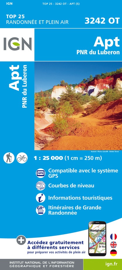
3242OT - APT PNR DU LUBERON
Editor : IGN
Collection : TOP 25 ET SÉRIE BLEUE
Scale : 1:25 000
13.90€
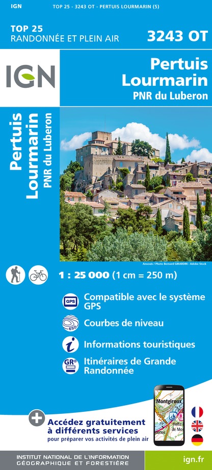
3243OT - PERTUIS LOURMARIN PNR DU LUBERON
Editor : IGN
Collection : TOP 25 ET SÉRIE BLEUE
Scale : 1:25 000
13.90€
TOP75034 - LUBERON MONT VENTOUX
Editor : IGN
Collection : TOP 75
Scale : 1:75 000
9.80€
VEL03 - LE VAUCLUSE A VÉLO
Editor : IGN
Collection : DECOUVERTE A VELO
Scale : 1:100 000
9.10€
VEL06 - LE VAR A VELO
Editor : IGN
Collection : DECOUVERTE A VELO
Scale : 1:110 000
9.10€
TOP100D83 - VAR TOULON FRÉJUS MASSIFS DES MAURES ET DE L'ESTEREL PARC NATUREL RÉGIONAL DU VERDON
Editor : IGN
Collection : TOP 100
Scale : 1:100 000
8.40€
TOP100D13 - BOUCHES-DU-RHÔNE MARSEILLE AIX-EN-PROVENCE PARC NATIONAL DES CALANQUES PNR DES ALPILLES ET DE CAMARGUE
Editor : IGN
Collection : TOP 100
Scale : 1:100 000
8.40€
TOP100D84 - VAUCLUSE AVIGNON CARPENTRAS PARCS NATURELS RÉGIONAUX DU LUBERON ET DU MONT-VENTOUX
Editor : IGN
Collection : TOP 100
Scale : 1:100 000
8.40€
TOP100D04 - ALPES-DE-HAUTE-PROVENCE DIGNE MANOSQUE PNR DU VERDON LAC DE SERRE-PONÇON
Editor : IGN
Collection : TOP 100
Scale : 1:100 000
8.40€
D13-84 BOUCHES-DU-RHÔNE VAUCLUSE
Editor : IGN
Collection : CARTES DÉPARTEMENTALES IGN
Scale : 1:150 000
5.90€
D83 VAR
Editor : IGN
Collection : CARTES DÉPARTEMENTALES IGN
Scale : 1:150 000
5.90€
D04-05 ALPES-DE-HAUTE-PROVENCE HAUTES-ALPES
Editor : IGN
Collection : CARTES DÉPARTEMENTALES IGN
Scale : 1:150 000
5.90€
NR16 PROVENCE-ALPES-CÔTE D'AZUR
Editor : IGN
Collection : CARTES RÉGIONALES IGN
Scale : 1:250 000
6.80€
EUROPE
Editor : IGN
Collection : DÉCOUVERTE DES PAYS DU MONDE IGN
Scale : 1:2 500 000
7.00€

What to visit in Vitrolles-en-luberon

See more suggestions
Admire the unique architecture of Vitrolles-en-luberon.
See more suggestions

Where to eat in Vitrolles-en-luberon

See more suggestions
Restaurants in Vitrolles-en-luberon are ready to welcome you.
See more suggestions

Where to sleep in Vitrolles-en-luberon

See more suggestions
Stay in unique accommodations in Vitrolles-en-luberon.
See more suggestions
Terres de France - Résidence Côté Provence
25 km

Terres de France - Résidence Côté Provence

Stay in Gréoux-les-Bains, Between Provence and Verdon: Accommodation & Must-See Attractions Gréoux-les-Bains, a charming spa town nestled between the Verdon Natural Park and the Luberon, is the perfect destination for a getaway combining relaxation, wellness, and exploration. With its renowned thermal baths, stunning Provençal landscapes, and picturesque villages, Gréoux-les-Bains offers a truly unique experience in the heart of Provence. Accommodation in Gréoux-les-Bains – Résidence Côté Provence The Résidence Côté Provence – Terres de France welcomes you to a warm and elegant setting, just a short walk from the thermal baths and town center. Its fully equipped and comfortable apartments are ideal for spa retreats, Provence getaways, or family vacations. Enjoy a residence featuring a swimming pool, wellness area, and all the amenities for a relaxing stay. Places of Interest The Gréoux-les-Bains Thermal Baths: Experience the therapeutic benefits of these renowned healing waters. The Verdon Gorges: Explore Europe’s largest canyon, perfect for rafting, hiking, and paddleboarding. The Valensole Plateau: Marvel at the famous lavender fields in full bloom between June and July. The Templar Castle: A historic landmark overlooking the town, offering a glimpse into medieval history. Esparron Lake: A beautiful setting for swimming, canoeing, and nature walks. Book your stay at Gréoux and immerse yourself in the charm of Gréoux-les-Bains and Provence!

11 Avenue des Thermes 04800 Gréoux-les-Bains
Show
La Maguette
31 km

La Maguette

Facing the Ventoux, Catherine and Pierre welcome you in the calm of their family lavender farm. The authentic and warm welcome will allow you to enjoy the place and discover the region. Whether you are cyclists, hikers, fans of nature, culture or outdoor activities, La Maguette will be the ideal setting for your holiday! To preserve the calm of the place and the relation with the guests, we propose you only 2 comfortable rooms on the same level (one of them is a family room). Decorated with care, they each have a bathroom with Italian shower, WC and 140 cm beds. Each room is equipped with fine linen and a hair dryer. Breakfast and table d'hôtes meals are served in the warm, communal living room; on sunny days, you can enjoy them outside facing the Mont Ventoux. The table d'hôtes is available on reservation and will allow you to taste a tasty cuisine made with local and garden products! Tourist information is available on site, and of course we can also advise you on what to see and do. Outside, the garden, the shaded terrace and its lounge are at your disposal as well as the petanque ground or the swings for your children. If you wish, we can show you the animals of the farm and the different crops. A shop selling the farm's products is open on site. Bikes and motorbikes can be parked in the shelter when you come! Shops at 7 km - Farm inn on the spot (500m) on reservation only at lunchtime. Baby facilities on request. Attached to our territory and eager to make you discover it, we will reveal you the richness of it. For hikers and cyclists, La Maguette is part of the "Compagnon de route" and "Accueil vélo" network. We speak english - Parliamo italiano Find more information and a reservation module on the website of the establishment.

2075, Route de Javon LA MAGUETTE 84390 Sault
Book from 0 €Book
Show
Caution!
We have no information on the difficulty of this circuit. You may encounter some surprises along the way. Before you go, please feel free to inquire more and take all necessary precautions. Have a good trip! 🌳🥾