Tours
Activities
Places of interest
Where to eat
Where to sleep

Discover Leyvaux, Cantal, Auvergne's attractions

Are you in charge of the destination?
Nestled in the heart of Cantal, Auvergne, the charming village of Leyvaux offers a plethora of activities and discoveries for visitors seeking authenticity and nature. Embark on hiking trails that wind through the lush landscapes of the region, offering breathtaking panoramic views.

Nature lovers should not miss visiting the Monts du Cantal, a natural beauty marvel with its rugged peaks and deep ...
See more

Walking around Leyvaux

See more suggestions
Stroll through the walking routes of Leyvaux.
See more suggestions
The gorges of Leyvaux and Apcher
2 km

The gorges of Leyvaux and Apcher

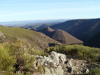
From Blesle, we walk through the gorges of the Apcher stream, in settings that inspire the world’s end, immersing the walker in a preserved environment with intact fauna and flora. In the village of Leyvaux, time seems to have stopped. Starting point - Take a wide track opposite when looking at the starting sign. Leave a path on the right and continue down to the edge of the cliff (view of Montfouat, Monts du Livradois, du Devès, vallée de Leyvaux, plateau d'Anliac, Margeride, in the foreground the vallée des Trois Sauts). 1 - Turn right to continue the descent in bends on a balcony path up to the lowest point of the valley. The path crosses the Saroil stream and goes up for about sixty meters before descending to the village of Leyvaux (church with combed bell tower and porch). 2 - Leave the church on the left, take a wide path on the right and continue up the hill in front in the undergrowth. At a fork in the locality "Les Gorges d'Apcher" take the right track, direction Saroil. Go along the steep slopes of the Apcher gorges to the footbridge. 3 - Leave a path on the left (alternative in case of high water) and take a path on the right along the stream (former antimony mines). Cross a second footbridge and start a steep climb up to Sagnes (view of the Livradois, Devès and Margeride mountains). Immediately after the last house, turn right into a path between dry stone walls. Continue until you reach Saroil. 4 - In the village take a path on the left after an old transformer (old gabled houses with stepped gables, stone roofs). Leave the village. At the next crossing turn right (view of Anzat-le-Luguet and signal of Luguet). Continue straight ahead until you reach the start.

4 h
12 km
Medium
Lieu-dit "Combaliboeuf" - Parking sur terre-plein 63420 Anzat-le-Luguet
Show
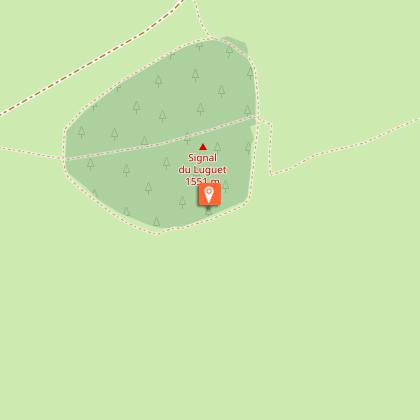
The Signal of the Luguet
7.3 km

The Signal of the Luguet

The high plateaus of the Cézallier massif seduce lovers of the great wild spaces with pastures, valleys, streams and peatlands. The path opens the horizon to the volcanoes of the Puys chain, the Sancy and Cantal massifs. Starting point – Below the starting sign, take the road to Le Buffier. At the farm, go down and follow the path on the left. At the crow's feet, stay on the left until you reach an intersection. Turn right (PV1- view of the Forez, Devès and Margeride mountains). The path goes around the Rocher d'Aulhat, then down to the Artoux glacial cirque (PV2). After crossing a stream, the trail reaches the bottom of the circus. At the intersection, turn right and, 30 m later, go down on the left. After the stream, go up to the road (off course, right on the road, AR 200 m, information sign). 1 - Cross it and go up on the right leaving the GR and the direction of Luguet. At the first constructions encountered, turn right into a path. Go past all the houses, go straight up. At a fork, turn right. Before a small solid shelter near the woods, turn right for about 500 metres. 2 - Leave the path to climb a step ladder on the right. Through the pastures, follow on your right the fence overlooking the circus (PV3). Cross a new step ladder and immediately turn left following the fence. After a third step ladder, go straight ahead until you reach the edge of the woods. Follow it on the left, for about 750 m (PV4: panorama on the Cantal mountains, Sancy and the Dome range). At an intersection, turn left following a fence to reach a wide road. 3 - Take it to the right, pass between the woods of Cézalier and the Croix des Champs and the Signal du Luguet. Go down and take the road on the left for 100 m. Turn right into a summer trail, follow the fence until you reach the finish line.

5 h
14 km
Medium
Parking du foyer de ski de fond à Parrot 63420 Anzat-le-Luguet
Show

What to do in Leyvaux

See more suggestions
Choose from a variety of activities in Leyvaux and book your favorites.
See more suggestions

What to visit in Leyvaux

See more suggestions
Shop in the boutiques of Leyvaux.
See more suggestions
Ardes-sur-Couze
11 km

Ardes-sur-Couze

This charming village is located on a basaltic headland and has kept several testimonies of its medieval past. The part at the bottom of the city, crossed by the Couze of Ardes, doubled up religious and handmade functions. The upper part of the village was created in the 13th century. Its History is linked to the one of the powerful family of Mercoeur. Ardes-sur-Couze is famous for the bottling and commercialization of the gaseous natural and mineral water Ardesy by the Company of waters of Cezallier. The “hill” and “cherry tree” springs, located in Augnat near Ardes-sur-Couze, belong to the same category of springs that the Chabetout one. They are known for their richness in lithium, and are used since 1995. The deepest spring is used to supply the bottling factory, and the other one is kept in reserve. A discovery path of the springs has been developed by the Arvie Company and by the Protective association of the Areas and Landscapes of Auvergne. The Couze of Ardes has its origins in the Cezallier mounts, and ends up in the Allier River, near the city of Breuil-sur-Couze. It is long of 39,5 km and well-known for trout fishing, that is regulated. Enjoy a walk along the Couze Pavin, near the “Robert Dupré’s stadium”. The Chabetout spring is collected in Ardes-sur-Couze. This natural mineral gaseous water is bottled and commercialized by the Waters of the Cezallier Company. Discovered in the Gallo-Roman period, it was first known under the name of Chabetout in the 19th century, and then under Arvie from 1995 to 2008, to end under the name of Ardésy since 2012. In 1858, a channelling and bottling building was established, and a thermal centre with 2 pools and 15 baths were constructed. Further to the lack of interest of the visitors taking the waters there, and to the First World War, the establishments closed. We have to wait until 1988 to see other drillings, and the 1990’s to observe the new commercialization of this water under the name of Arvie. Nowadays, the production, known as Ardésy, is mainly designed to the exportation towards Asian countries, but you can find it in supermarkets in Auvergne.

6 Place de l'Église 63420 Ardes
Show

Where to eat in Leyvaux

See more suggestions
Establishments in Leyvaux offer dishes for all tastes.
See more suggestions

Where to sleep in Leyvaux

See more suggestions
Enjoy your stay with accommodations in Leyvaux.
See more suggestions
Caution!
We have no information on the difficulty of this circuit. You may encounter some surprises along the way. Before you go, please feel free to inquire more and take all necessary precautions. Have a good trip! 🌳🥾