Tours
Activities
Places of interest
Where to eat
Where to sleep

Discover the Tarn and Midi-Pyrénées with Les Lodges d Adelaide

Are you the owner?
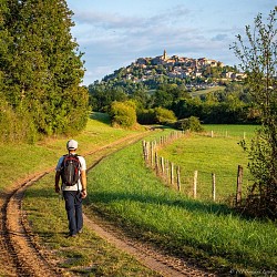
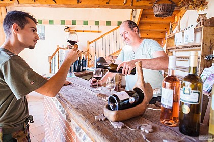
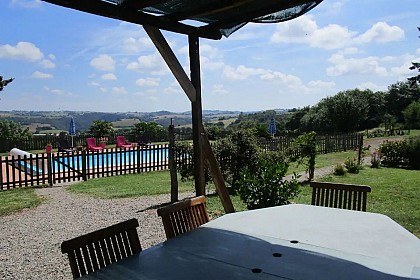
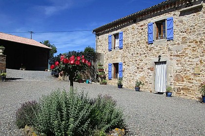
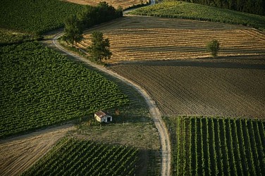
Welcome to Cahuzac-sur-vere, a charming village in the heart of Tarn, Midi-Pyrénées, perfectly located to explore the cultural and natural treasures of this stunning region. During your stay at Les Lodges d Adelaide, start your journey with a visit to the magnificent Château de Mauriac, a prime example of medieval architecture. Wine enthusiasts will love exploring the Gaillac vineyards, where you ...See more

Walking around LES LODGES D ADELAIDE

See more suggestions
Discover the walking paths of LES LODGES D ADELAIDE.
See more suggestions
Chemin de la Vère au Saint-Hussou
2.5 km

Chemin de la Vère au Saint-Hussou

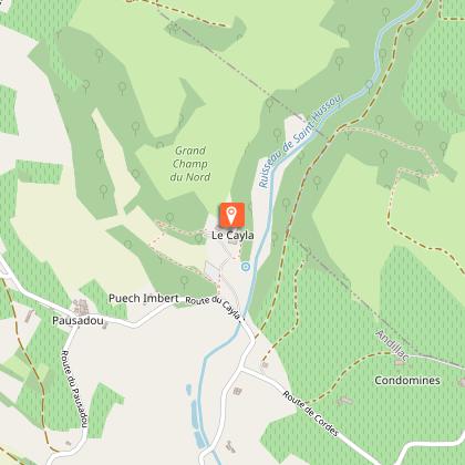
A very pleasant hike that will take you through centuries of history and typical Gaillac landscapes (vineyards, hillsides, valleys, riversides). Make a stop at the departmental Château du Cayla museum to enjoy the romantic atmosphere of the place. At the square of Cahuzac-sur-Vère, take the D 922 to the right, towards Gaillac, for about 20 meters, then turn right into a small street; reach a fork. Descend on the road to the right and continue straight on a gravel path. It passes in front of a sewage treatment plant, then follows the river before making a right-angle turn to the left and becoming grassy. At the road, climb straight ahead on the grassy path to reach an intersection of paths. Turn right and, just before the place called Sept-Viols, descend to the right on a path along the vineyards. At Comberouzal, turn left onto the road until a crossroads; go straight on a path. At the Moulin de la Tour, go left. At the D 26, turn right, cross a bridge then, via the D 1, reach Vieux. -> To see the menhir Ste Carissime (Peyra Levada): from the village of Vieux, follow the D1. At the first crossroads, turn left (signposted menhir), cross the Vère (bridge). The menhir is located in the middle of the field on the right (signposted). Before the left turn, climb straight ahead on a grassy path. At the end, turn right. Arriving at a dovecote, descend by stairs. Pass under a medieval gate. Cross the washhouse then pass to the left of the church. After the cemetery, climb to the right onto the road. Descend to the right onto a path that then climbs towards Andillac. At the road at the entrance to the village, turn right and cross Andillac. At the exit, continue straight towards the Château du Cayla until an intersection. Turn left towards Pausadou. Pass in front of a dovecote. About 150 meters later, go on a grassy path. At the road, turn right. At a crossroads, in Pausadou, descend to the left. Reach an intersection. Turn left onto a path. Walk for about 20 meters and climb to the left onto the Cayla path. Cross a small footbridge and climb into the woods. Pass in front of the château, then descend onto the road. At the bottom of the château, descend on a grassy path (note: in winter, go right onto the road, the path is impassable). Pass in front of a washhouse. Cross a stream by a ford and continue straight to an intersection of paths. Turn right. At the road, turn left. At a crossroads, climb to the left. Pass the place called La Combe, then next to a water tower. At Cinq-Peyres, go right. Continue to the right on a path (viewpoint on Cahuzac-sur-Vère). In the village, cross a stone bridge and reach the square.

4 h
14 km
Easy
Show
Sentier des lavoirs
2.6 km

Sentier des lavoirs

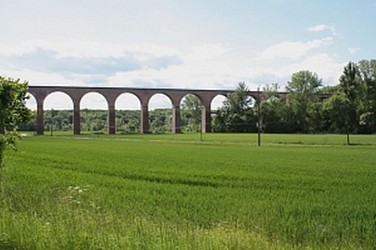
Cahuzac sur Vère is a charming little village nestled on the banks of the Vère. The trail will allow you to discover the local heritage and the beautiful rolling landscapes of the Gaillacois hills. From Place du Mercadial, turn left onto the Bélautié road towards Salettes. Continue straight. At the exit of Cahuzac, turn left towards Fontanes and continue straight for 1.5 km. To see: fortified village church and frescoes by Nicolaï Greschny. At the road junction, turn left. Ignore a path on the right and take the next one. Cross the main road (with caution!) and continue straight ahead on the path. Pass over the railway line. At the tarmac, make a left/right turn. At the fork, turn left onto the gravel path. At the path intersection, go left. 50 meters further, at the four-way junction, turn left. The path follows the ridge. At the main road (with caution!), turn left and immediately right towards La Réveillé. At the fork, go left. Leave the grassy path on the left. Climb towards the place called La Réveillé. Facing the calvary, turn left and take the path. At the path intersection, turn left. The path descends along the woods. At the end, facing the Lafargue dovecote, turn left. Cross the Vère via the small bridge. At the fork, climb to the left. Ignore a path on the right. At the road, go straight on the dirt path through the undergrowth and then through the boxwood. At the exit, continue straight on the grassy path (view of Donnazac). At the road, go left. At the fork, take the path to the left. Continue straight. Pass the train bridge. Turn right onto the dirt path (left shortcut towards Cahuzac-sur-Vère). At the road, turn right. Leave a path on the left. At the intersection, turn left. After 250 meters, go left on the path. Go around the grove on the left. Take the grassy path on the left. At the next intersection, go right to the road. Turn left. At the calvary, turn right onto the path along the railway line. After 200 meters, pass under the bridge. At the road, turn right. After 50 meters, turn left. In Arzac, at the first intersection, turn right. At the exit of the hamlet, descend to the right. Ignore the path on the right. At the road junction, turn left. Cross the Vère bridge to reach the main road. Go straight (with caution!). Ignore a path on the left. Pass under the viaduct arch and climb straight on the path. At the road (former station on the left), descend straight onto the grassy path. Facing the main road, turn left towards Mas Brunet. Follow a water reservoir on the right. At the intersection, ignore the train bridge and go right on the gravel path. It passes near a washhouse. 10 meters further, at the fork, turn right onto the grassy path. Follow the fence. At the road, continue straight towards Salettes and Château de Mauriac. Follow the cemetery and continue straight. After 50 meters, descend to the right on the path. Pass near the washhouse to reach the road. Descend to the right (common route with the Vineyard and Châteaux trail - yellow mark) to return to Cahuzac-sur-Vère. At the stop sign, turn left and take the first street on the left to return to the starting point.

4 h
17 km
Easy
Show
Vignoble et châteaux
2.7 km

Vignoble et châteaux

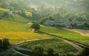
The trail winds through the hills of Gaillacois, where the vineyard, prominent in the landscape, is marked by its undulating rows. The hiker will discover a noble heritage (castles) and a viticultural one (vine huts, dovecotes, farm cellars). On the square, take the road towards Gaillac for 100 meters. Turn right into the small street (follow GR 46, marked with white and red signs). At the intersection of roads, go left (ignore the white and red markings). Walk for 300 meters. At the fork, turn right and then left onto the dirt road. At D26, continue straight. At the fork, take the grassy path to the right. Walk for 800 meters then turn left onto the grassy path. Continue straight on the gravel path. At D115a, turn right and then descend left along the vineyard path. Continue straight. At the intersection, turn right onto the road. At this junction, turn left onto the stone path and continue straight to Broze. In the village, pass the town hall, descend the stairs, then turn left onto the road along the vineyards. At the first crossroads, turn left and walk for 150 meters. At the second crossroads, take the road to the right and continue straight. At the intersection, turn left towards Mas de Mazières. At the calvary, turn right. Cross Mas d'Ousty and continue straight. At the crossroads, descend to the right towards La Garriguette. Descend on the grassy path. Cross the road and pass by the cemetery to reach Boissel. In the village, turn right onto the road and then left towards the square. Cross D922. Continue straight for 50 meters then turn left and right onto the grassy path. At the intersection of paths, turn right and continue straight. At Les Carbonnières, descend on the path through the fields to Barastou. At the road, turn right and continue straight up to the village of Mauriac. Pass by the castle and continue straight. At the crossroads, turn right. Walk for 150 meters. Turn right onto the path along the fields to Salettes. Turn left and then, at the crossroads, turn right along the cemetery. At the fork, go right onto the road. Walk for 200 meters, then turn left. Walk another 300 meters and then turn right onto the path. At the road, turn left. Continue on the stone path. Reach Cahuzac-sur-Vère.

5 h
17 km
Easy
Show
Sentier des coteaux
4.2 km

Sentier des coteaux

During this loop, starting from the village of Cestayrols, a great variety of landscapes consisting of vineyard hills, valleys, and sunflower fields will unfold before your eyes.During the tour, you will also discover the very picturesque and charming rural heritage, including dovecotes and washhouses that bear witness to the activities of our ancestors. At the starting sign, on the village square, go straight up a small street, then turn right. Take a path winding through oaks and boxwood. Cross the D3 and continue straight on a stony path. About 1 km further, at a path intersection, climb right onto a grassy path and reach a fork. Go right and continue straight. Arrive at a crossroads. Turn left onto a grassy path passing through fields. Cross the D3 again and take the road opposite. Leave the Théron road on your right and reach a bend. Take the path on the right; it leads to an intersection. Go left until a fork. Continue straight towards Lincarque. The path leads to the D1. Turn left towards Lincarque. -> Opportunity to visit the church Take the road to the right until the Mas de Caussé (farmhouse). At the Mas, hairpin left and continue straight on a path along the edge of fields to reach La Couliche. At the hamlet's exit, go left and descend along a field to the road, which you follow straight for about 200 meters. Turn right to climb under bushes. Emerge onto the D1, which you cross to climb straight up a grassy path. At the crossroads, turn left. Follow the grassy path straight. Pass a dovecote. At the road, turn left towards Théron. Before a large house at the end of the road, take a path to the left. Pass a washhouse and return to Cestayrols.

3 h
9.7 km
Very easy
Show
Oenorando® Vallon de la Caude
5.8 km

Oenorando® Vallon de la Caude

An almost 3-hour oenorando® in the hills of Cestayrols, with rolling landscapes covered in vineyards and meadows. From the car park, take the path between the cypress trees to the departmental road. When you reach the road, turn left onto the path along the vineyard and descend to the bottom of the valley. Cross the Caude stream, then the Castanet road and join the other small road. Turn left and, 200m further on, go back up towards Plancas. Cross the hamlet and take the ridge path, which offers a lovely view over the valley and the hamlet of Lincarque. Ignore the various junctions and continue to the Domaine des Vignals. At the entrance to the Domaine, head down to the left through the vineyards and rejoin the Castanet road. Turn right. Here, there is the option of a short variant (5.50 km). Turn left, cross the bridge over the Caude stream and go back up through the vineyards to the Lacroux estate. Continue along the Castanet road until you reach the RD n°1. Take it carefully to the left, cross the bridge over the stream and then turn right towards Moussens. Cross the hamlet. On leaving, turn right onto the path running alongside the vineyard. At the road, take the path leading to Le Pouget via a right/left turn. On leaving the hamlet, turn left at the crossroads and continue straight ahead along the path until you reach the RD n°1, at the entrance to Lincarque. Cross the road, take the end of the path and then turn left until you reach the roundabout. Cross it and take the path opposite, which runs along the old wall. After about 300 metres, turn right and go up through the vineyards to return to the starting point.

3 h
9.6 km
Very easy
Show
Sentier des quatre châteaux
6.1 km

Sentier des quatre châteaux

The Four Castles Trail allows you to explore the village of Sénouillac and its surroundings, passing by several private castles. Along the route, you will also discover the vineyards-covered hills that have contributed to the wealth and reputation of this region. From the town hall, turn left onto Avenue des Vignes. Pass by the church and turn left onto Rue de la Caminade. At the end of the street, go straight ahead. Walk for 250 meters. At the calvary, turn left onto a path. At the end, turn right to reach Devezié. In the hamlet, take the second stony path on the left, which becomes grassy. At the intersection of grassy paths, continue straight ahead, then after 50 meters, at the edge of the thicket, turn right. Go around it on your left side. On the grassy path, continue straight ahead. At the crossing of four grassy paths, go straight. At the road, turn left. Ignore a path on the left. At Figayrade, at the corner of a house, turn right onto a path along the vineyards. Continue straight. At the crossing, go straight on the grassy path under the canopy. At RD, turn left. Pass the Fayssac square and then take the first street on the right. Follow the school and descend straight on the grassy path. At the crossroads, turn left. In Le Pouget, at the corner of the first house, turn left. Cross the hamlet. At the calvary, turn right. Cross the RD (be cautious!) and continue straight. After a few meters, the stony path turns sharply left and continues through the vineyards. At the tarmacked path, turn right. Walk for 250 meters, then turn left onto the path. At the crossroads, descend to the left. Continue straight on the stony path. At RD, go straight (be cautious!) towards Gatens. At the fork, turn right then take the left bend. Continue straight. The tarmacked path becomes a grassy path alongside the vineyards. At the first intersection of grassy paths, go straight. At the second intersection, turn sharply right. At the road, go straight towards Maurénié. Facing the hamlet, turn left onto the stony path passing through the woods. Cross the railway. Leave the road to the left and immediately take the fork to the left onto the path that climbs. Continue straight. The path runs alongside the vineyards, enters the woods, follows an embankment, then an agricultural building. At Mauriac, at the road intersection, turn right towards the church and castle (shared path with PR de Vignoble et Châteaux). Continue straight. Pass by the castle. A few meters later, turn left onto the path (rest area on the right). At the crossroads, turn left (leaving Vignoble et Châteaux which goes right). The path emerges onto a road. Continue straight. Ignore a path climbing to the right. At the next intersection (interpretation tablet "Le Gaillac des châteaux"), turn left then immediately right under the SNCF bridge (Vignoble et Châteaux continues left). Continue straight. Pass near a lake. Cross the RD (be cautious!) and climb straight on Rue des Pavillons. Follow alongside the school to return to the starting point.

4 h
14 km
Easy
Show
Cordes heritage trail
7.5 km

Cordes heritage trail

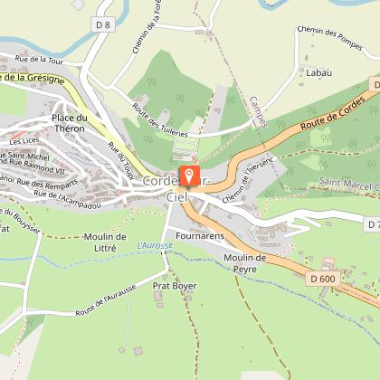
It is said that the village of Cordes-sur-Ciel is as breathtaking from within as it is from outside the ramparts! The beauty of its Gothic buildings rivals the panoramic views of the town from the surrounding hills. The profile of Cordes changes with every angle and time of day.So, don’t miss the pleasure of discovering the medieval town from every angle and combining history, heritage, landscape, and nature.This loop can be completed in two parts by cutting between point 3 and point 9. Follow the GR®36 from Place Jeanne Ramel-Cals: climb up Grand’Rue de l’Horloge. Pass through the Porte du Vainqueur and then the Porte du Portail-Peint. Emerge onto Grand’Rue Raymond VII. Continue to Place de la Halle. Descend to Porte des Ormeaux. Go through it and immediately turn right, then leave the town through Porte de la Jane, continuing to follow the GR®36 (be careful at the Redoulets: stairs can be very slippery when wet). Cross the D600 (beware!). Continue towards "Tanneries-Collège". Follow Rue des Tanneries to Place Saint-Félix des Cabannes. Head right on the D30. Cross the Cérou bridge. Walk for 250 meters. Turn left onto the embankment and take the GR® de Pays. Continue for 500 meters on the Voie Verte. Pass the wooden barrier. Turn right onto the dirt path. At the Nauze, continue straight towards the woods. Do not take the GR® de Pays that climbs to the right but go straight to the D7. Turn right along the Cérou. Pass the Moulin de la Bogne. Walk 100 meters on the road. Take the old bridge to the left, known as the "Pont des Ânes". After 100 meters, turn right onto the dirt path (beware of flooding; climb the embankment if necessary). Continue for 1 km to Vindrac. Follow the church and then turn right along the cemetery to circle the village by the mill and its pond. Stay on the left and turn right onto the tree-lined road to reach the D600. Cross the road (be careful!) to reach the road sign for Péteulé. Continue 2 km on the road that ascends to the hamlet of Les Fargues. At Les Fargues, admire the cross. Go back and take the dirt path. Continue straight to the junction with the GR® de Liaison (red and white markers). Continue left to the farm shed. Turn right towards Piton and follow the ravined path bordered by stone walls. Go to the road. Take the road to the right for 120 meters. At the intersection, turn left towards La Devèze. Cross the Aurosse. Climb straight up the path. Turn right, under the convent, and follow the small path towards Bouysset. Descend the road for 500 meters. Cross the Aurosse again. Ignore La Bouriette to the right. Arrive at a crossroads. Continue straight along the path lined with plum trees. Leave the path to admire the Saint-Jean Chapel. Resume the path (please respect the private property you are passing). After the tennis court and an old washhouse, climb left up the path. Stay on the path to the left for 700 meters. Emerge at a fork. Take the left path (PR Sentier du Causse) for 1.5 km towards Cordes and admire the silhouette of Cordes one last time. Climb up Rue de Litou to return to the starting point

4 h
15 km
Easy
Show
Oenorando® La ronde des vignerons
7.8 km

Oenorando® La ronde des vignerons

At the gates of Gaillac, this very pleasant hike takes you through a rolling landscape structured by the undulating lines of vineyards. The unexpected beauty of the panorama from the heights adds an extra charm to the route.Discover the nearby wineries along the trail:Domaine du Moulin, Domaine Barreau, Domaine Laubarel, Domaine René Rieux, Mas des Combe. From the parking lot, follow the small vineyard that descends towards the entrance gate of the estate. Turn left before reaching the gate to carefully cross the road. Ascend through the vineyards and turn left towards the large oak tree. Pass in front of the oak tree and continue to the next intersection. Enjoy the beautiful view of the Rhodes Castel and the Church of Notre Dame de Boissel. Turn right and follow this path to reach the D922 at the entrance to Boissel. At the road, turn left and take the small street below the main road. In the center of the hamlet, turn right, cross the road, go around the wine cellars on the left, and follow the path that is shared with the "Vineyards and Castles" circuit. Ignore all right or left paths until the designated point. Ignore the "Vineyards and Castles" route that continues to the right and instead, ascend the path to the left. This path runs along a ridge and offers a beautiful view of the vineyard. Continue straight, pass under the ruins of a farmhouse, and after approximately 350 meters, turn left and descend along the hedge to the D922. Cross the road and continue on the path to "Mas d’Oustry". Here, the path rejoins the "Vineyards and Castles" circuit. In the hamlet, turn left and descend to La Gariguette. Cross the small road and take the path leading to Rhodes. At the intersection with the road, in front of the cemetery, turn right, pass by the wine cellars, cross the small bridge over the stream, and after approximately 250 meters, turn left. At the intersection, take the right path that you followed earlier to return to the starting point

2 h
7.9 km
Very easy
Show
Lacapelle Sainte-Lucie circuit
7.9 km

Lacapelle Sainte-Lucie circuit

From the hills of Mouzieys-Panens, the northern profile of Cordes commands attention: the medieval city stretches out like a sleeping dragon above the Cérou Valley, imprinting its presence on the walker who eagerly awaits the moment when the city's silhouette will reappear around a bend. Departure from Place Saint-Félix. Take Rue des Tanneries towards the Théâtre du Colombier and the bioclimatic primary school. After about 250 meters, join the old railway track on your left. When you reach the road, turn right towards Mas de Tulle. You will now follow the GR® 36 (white and red) for 2 km. At the fork, leave the GR® 36 and take a path on your left that will lead you to a small paved road. Turn left and join the D30 road. Pass the Cantarrane-Le-Haut lake and the bridge, then follow the path that ascends to Mouzieys-Panens. Cross the village, and at the Calvary, turn left towards "La Védillerie." Continue on the road until you reach the hamlet of Lacapelle-Sainte-Lucie. At the crossroads, continue left along a path that leads to the old Sainte-Lucie Chapel (private property). Go back up the road to the right. Behind the Camp de Besset house, turn left. Follow the path through the woods until you reach the road. Turn left (the route is shared with the GRP® Cordes-Penne). At the "La Védillerie" sign, turn right and then left. After the last house, take a right onto a steep, somewhat hidden path under the trees (slippery when wet). In the valley, go left onto a wide grassy track, pass the Nauze, then reach the old railway track (viewpoint of Cordes-sur-Ciel). At the end, turn right and cross the Cérou bridge to return to your starting point

4 h
12 km
Easy
Show
Sentier du château de Lagarde
10 km

Sentier du château de Lagarde

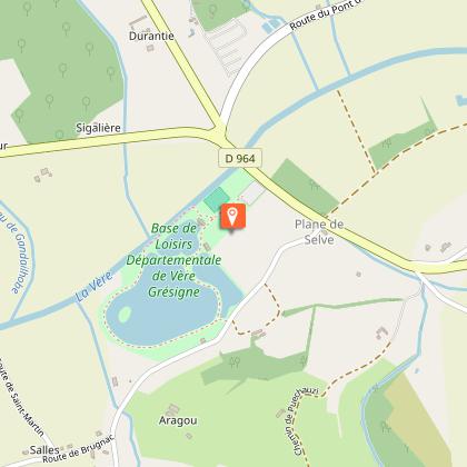
Following rivers, fields, and meadows, and crossing streams, the route will lead hikers from the village of Castelnau-de-Montmiral to the Vère-Grésigne leisure center. At Pradel Parking, behind the community hall, follow the ramparts for 200m then descend left on a path. Cross the D964 (caution!) then turn left. Walk for 50m, then take the path on the right. Continue straight to a road intersection. Go left (view of Castelnau-de-Montmiral on the left). Take the forest path on the right that climbs through an oak undergrowth. At the junctions, first with paths, then with a road, continue straight. At the D5, turn right and reach an intersection. Go right towards Magarié, La Vernière, then immediately left on a path. Pass by agricultural buildings on the left. At a path intersection, turn right. At a fork, go right. In front of a house gate in Lagarde, descend right on the path marked by a white road sign with a red border (close the electric fence carefully) (viewpoint over the Vère valley). Walk along the edge of meadows. At the trail intersection, leave GR® 46 (red and white marks) which goes left and take the right path. Follow the fences, then descend right in a hairpin turn. Ignore the first path on the left. Hairpin on the second path to the left. The trail becomes a path through a mixed forest of deciduous and coniferous trees. At the road, turn left. At the intersection, turn right. Pass by Trifyl. Go past it and immediately turn left into the meadow. Enter the leisure center by a path that leads to the lake. Turn right, follow it along. Ignore a path to the left between the lakes. Continue straight along the second lake to reach a chicane. Exit, turn left on the road. Cross the D964 (caution!) and continue straight on a path. At the road, turn left then immediately right on a path. At the next road, turn left again and immediately right on a path. At Lapeyre, follow a path to the left that becomes a road; arrive at an intersection. Turn right (GR® 46). At the intersection with the D4, climb straight ahead on a grassy path, then turn right to return to Castelnau-de-Montmiral.

4 h
13 km
Easy
Show

What to do in LES LODGES D ADELAIDE

See more suggestions
Book your activities in LES LODGES D ADELAIDE and experience memorable moments.
See more suggestions
Parc Résidentiel de Loisirs Les Chalets De Fiolles
14 km

Parc Résidentiel de Loisirs Les Chalets De Fiolles

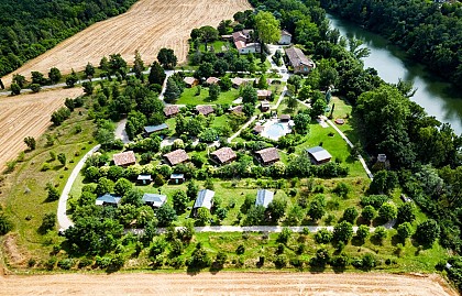
Gite village located between Albi and Toulouse, 3 minutes from Gaillac. 14 chalets, 2 lodges on stilts and 2 bungalows spread over 3 hectares. A place of escape and charm, both warm, friendly and family. River access and heated swimming pool. QUALITÉ TOURISME and QUALITÉ TOURISME OCCITANIE label A 4**** Residential Leisure Park (PRL), you will find 14 wooden chalets, 2 lodges on stilts for the unusual and 2 wooden bungalows. All our accommodation is air-conditioned, equipped for 4/5 people, has a terrace and a charcoal barbecue and is located on large, tree-lined pitches with no screws. It is a place of escape and charm, both warm and friendly, which will offer you a change of scenery, relaxation and discovery. A quiet, family environment on a human scale, an ideal place to spend a family holiday or a weekend with friends. You will find a heated swimming pool, spa, games for children (2 trampolines, swings...), games and entertainment room, table tennis, pétanque, football, volleyball. The river Tarn flows below, you can go for a walk, fish or go canoeing (on loan in July and August). Activities for young and old in July and August. Ideal starting point to discover all the treasures of the Tarn: the various perched villages and bastides such as Cordes sur Ciel at 30 min, Puycelsi at 20 min, Albi and its cathedral (registered with the world heritage of UNESCO) at 15 min. In the heart of the Gaillac vineyards, you will have a wide choice of wine cellars to visit. You can go hiking or biking, or go for a walk in the forest of Grésigne or Sivens. The pink city, Toulouse, is 40 minutes away. You can rent by the night or by the week. Our 150 m2 room can accommodate groups of up to 40 people: sportsmen, families, seminars... Groups welcome : contact us Children's activities from 04/07 to 29/08 Adult entertainment from 04/07 to 29/08 Swimming pool from 01/05 to 30/09 Heated swimming pool depending on weather conditions Bar from 01/05 to 30/09 Snck from 01/05 to 30/09

2634 Rte de Lavaur 81600 Brens
Book from 0 €Book
Show
The Toulouse-Lautrec museum
18 km

The Toulouse-Lautrec museum

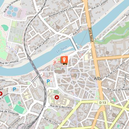
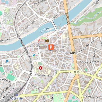
The Toulouse-Lautrec museum is located in one of the most beautiful corners of Albi: the Berbie Palace. The Palace is one of the Episcopal City’s major sites with World Heritage status. The museum is recognised internationally for the works of this artist from Albi. TOULOUSE-LAUTREC, A UNIQUE COLLECTION IN THE WORLD The world’s most important public collection of the works of Henri de Toulouse-Lautrec, including 31 posters by the lithograph painter, is to be found in Albi. There are also no fewer than 219 paintings, 563 drawings and 183 lithographs displayed in the museum. Early works, major portraits, paintings of brothels, prints from the world of entertainment, advertisements and later works are presented there, giving this museum an exceptional collection. Each stage of the production is represented, highlighting his gift for observation, his talent as a draughtsman and his quality for capturing significant detail. The route around the museum is enriched with information panels. To visit the museum is to meet the man, this native of Albi, of whom this city is so proud. The first rooms are devoted to his early works representing his family, his friends and his favourite theme: animals. Gradually the visitor is taken into the Parisian world: the brothels, especially the world of entertainment and the circus. Room after room, we follow the evolution of this unusual artist.

Palais de la Berbie Place Sainte Cecile 81000 Albi
Book from 5 EURBook
Show

What to visit in LES LODGES D ADELAIDE

See more suggestions
Learn the history of LES LODGES D ADELAIDE through its museums.
See more suggestions
Château de Mayragues, Monument Historique
7.2 km

Château de Mayragues, Monument Historique

The Château de Mayragues (12th - 17th century) and its pigeon loft built on 4 columns, both listed as Historic Buildings, surrounded by its bio-dynamic vineyard, sit proudly in the midst of the magnificent rolling countryside of the Bastides Albigeoises. The Château de Mayragues is one of the few remaining examples of the regional fortified architecture with a half-timbered, overhanging gallery surrounding the top of the château built of the light-coloured local limestone. The splendid pigeon loft sitting on 4 stone columns, typical of the Languedoc region, the formal box parterre, the vineyard ( cultivated in bio-dynamics since 1999), the surrounding woods and fields of sunflowers and corn, make an ideal setting for the summer concerts which have been performed in front of the château for the last 20 years. The château and the pigeon loft have undergone an extensive 35 year restoration programme using traditional meterials of stone, wood, lime and sand, and in 1998, during the course of the restoration, were awarded the Grand Prix of the Vieilles Maisons Françaises. The half-timbered gallery provides a unique setting for the guest B&B bedrooms and an extensive view over the garden and the surrounding countryside. Visiting the winery, tasting the bio-dynamic wines of the domain, or simply relaxing in the garden are the ideal complement to discovering the treasures of the Bastides Albigeoises.

SCEA Château de Mayragues 332 Chemin de Mayragues 81140 Castelnau-de-Montmiral
Show
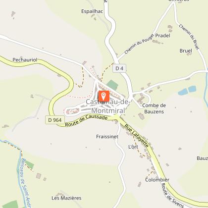
Castelnau-de-Montmiral
9.9 km

Castelnau-de-Montmiral

Overlooking the rolling hills of the Gaillac vineyards, Castelnau-de-Montmiral is centred around its arcaded main square. Founded in the 13th century, it combines architectural harmony with gentle landscapes. Founded in the 13th century by Raymond VII, Count of Toulouse, Castelnau-de-Montmiral is a castelnau, a seigneurial settlement organised around local authority. Although its layout is structured, it does not strictly follow the bastide model, reflecting instead a different approach to medieval territorial organisation. The village is centred around its remarkable arcaded square, which has been the heart of local life since its foundation. Lined with houses combining stone, brick and timber framing, it remains a lively focal point for markets and daily life. From this central space, streets extend towards different parts of the village, leading in particular to the Church of Notre-Dame-de-l’Assomption, home to a rich heritage including a remarkable 14th-century reliquary cross. Listed among the “Most Beautiful Villages of France”, Castelnau-de-Montmiral is appreciated for its balance between architecture and landscape. From its elevated position, it offers wide views over the Gaillac vineyards and the surrounding countryside. To explore the village in a different way, the EnQuête(s) free app provides a self-guided tour with interactive and immersive content revealing the site’s history and hidden details. The app is also available in English.

81140 Castelnau-de-Montmiral
Show

Where to eat in LES LODGES D ADELAIDE

See more suggestions
Explore the best dining spots in LES LODGES D ADELAIDE.
See more suggestions
Where to sleep in LES LODGES D ADELAIDE

See more suggestions
Discover popular accommodations in LES LODGES D ADELAIDE.
See more suggestions
Parc Résidentiel de Loisirs Les Chalets De Fiolles
14 km

Parc Résidentiel de Loisirs Les Chalets De Fiolles

Gite village located between Albi and Toulouse, 3 minutes from Gaillac. 14 chalets, 2 lodges on stilts and 2 bungalows spread over 3 hectares. A place of escape and charm, both warm, friendly and family. River access and heated swimming pool. QUALITÉ TOURISME and QUALITÉ TOURISME OCCITANIE label A 4**** Residential Leisure Park (PRL), you will find 14 wooden chalets, 2 lodges on stilts for the unusual and 2 wooden bungalows. All our accommodation is air-conditioned, equipped for 4/5 people, has a terrace and a charcoal barbecue and is located on large, tree-lined pitches with no screws. It is a place of escape and charm, both warm and friendly, which will offer you a change of scenery, relaxation and discovery. A quiet, family environment on a human scale, an ideal place to spend a family holiday or a weekend with friends. You will find a heated swimming pool, spa, games for children (2 trampolines, swings...), games and entertainment room, table tennis, pétanque, football, volleyball. The river Tarn flows below, you can go for a walk, fish or go canoeing (on loan in July and August). Activities for young and old in July and August. Ideal starting point to discover all the treasures of the Tarn: the various perched villages and bastides such as Cordes sur Ciel at 30 min, Puycelsi at 20 min, Albi and its cathedral (registered with the world heritage of UNESCO) at 15 min. In the heart of the Gaillac vineyards, you will have a wide choice of wine cellars to visit. You can go hiking or biking, or go for a walk in the forest of Grésigne or Sivens. The pink city, Toulouse, is 40 minutes away. You can rent by the night or by the week. Our 150 m2 room can accommodate groups of up to 40 people: sportsmen, families, seminars... Groups welcome : contact us Children's activities from 04/07 to 29/08 Adult entertainment from 04/07 to 29/08 Swimming pool from 01/05 to 30/09 Heated swimming pool depending on weather conditions Bar from 01/05 to 30/09 Snck from 01/05 to 30/09

2634 Rte de Lavaur 81600 Brens
Book from 0 €Book
Show
Caution!
We have no information on the difficulty of this circuit. You may encounter some surprises along the way. Before you go, please feel free to inquire more and take all necessary precautions. Have a good trip! 🌳🥾