Tours
Activities
Places of interest
Where to eat
Where to sleep

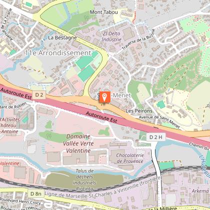
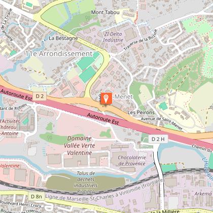
Discover Aubagne with Le Mas de l'Etoile

Are you the owner?
Welcome to Aubagne, at the heart of Provence-Alpes-Côte d'Azur, where natural beauty and Provençal culture await you. Just steps away from Le Mas de l'Etoile, uncover the hidden treasures of this enchanting region.

Start with a visit to the Maison Natale de Marcel Pagnol, a must-see for lovers of French literature. This museum immerses you in the world of the writer and filmmaker, with captivati...
See more

Walking around LE MAS DE L'ETOILE

See more suggestions
Walks and discoveries in LE MAS DE L'ETOILE.
See more suggestions
The Garlaban
4.4 km

The Garlaban

This hike leads to the summit of Garlaban, where you can discover the Douard engravings. The Garlaban, which rises to 714 metres, is easily distinguished when you're in the south-eastern part of the Bouches-du-Rhône département. Whether arriving from Toulon or from the sea, it dominates the landscape. Its shape is so distinctive that it served as a landmark for sailors navigating the Marseilles roadstead. Some even describe it as the crown that sits atop a hill so dear to Aubagne-born writer Marcel Pagnol. The Garlaban and its surroundings, whether in Marseille or Aubagne, were Marcel Pagnol's favorite playground as a child. He later made it a central element in his work. Let's recall the opening lines of his first novel, "La Gloire de mon père": "I was born in the town of Aubagne, under the goat-crowned Garlaban, at the time of the last goatherds. Garlaban is an enormous tower of blue rock, planted on the edge of the Plan de l'Aigle, the immense rocky plateau overlooking the green Huveaune valley. The tower is a little wider than it is tall: but as it rises out of the rock at an altitude of six hundred meters, it towers high into the Provencal sky, and sometimes a white July cloud comes to rest there for a moment. So it's not a mountain, but it's no longer a hill: it's Garlaban." The starting point for the hike is at the "Gastaude" bus stop, where there is also a parking lot. Join the Chemin du Ruissatel and follow the brown signposted path "Font de Mai, sentier Marcel Pagnol". Enter the Font de Mai park and pass in front of the large bastide. After the bastide, fork left to join the Font de Mai road, which you can follow along a path that runs between oak and pine trees. You'll pass an excellent gourmet restaurant, l'Auberge la Ferme. At the crossroads with Chemin du Ruissatel, continue straight ahead on Chemin de la Font de Mai, which winds its way up to Col d'Aubignane. From here, follow the yellow markings to the Garlaban. Shortly afterwards, there's a narrower path on your right. Follow it until you reach a sign suggesting a 100-metre detour to the Manon cave. Then return to the gently ascending corbelled path. Pass the Col Salis and continue on to the Pas Garrigue, a small steep slope, as we like them in Provence, to reach the Col du Garlaban. From here, it's just a short climb to the summit of Garlaban. The path zigzags through the garrigue. Yes, it's tough! But the panoramic view from the summit is your reward. It's sublime! An orientation table helps you decipher the landscape at your feet. You are the kings of Provence. Return to the Col and turn left onto the wide path leading down to the plain. On either side of the path, you'll discover engraved stones. The path overlooks the Draioulet valley, whose name comes from "petite draille", a reminder that it was once a transhumance route used by shepherds. A shortcut takes you straight downhill for 250 metres, avoiding 4 bends, before reaching an intersection where you must turn left to reach the park and the Font de Mai bastide more directly. After a 950-meter walk, you reach the edge of a hill. 4 circular cement shapes (remnants of an old high-voltage line support?) are the markers for turning left onto a path that zigzags downhill. Another landmark you'll pass: the ruins of a sheepfold. You then come to a wide DFCI track which you must take to the right, rounding a hill dominated by a rocky peak. Keep to the path along the rocky ridge. The Font de Mai estate can also be reached via an alternative route at the bottom of the valley, but the view is less unobstructed. Finish the hike by following the same section back to the parking lot or bus stop.

4 h
12 km
Medium
Parking de la Font de Mai route d'Eoures d44 13400 Aubagne
Show
PLAN D’AUPS SAINTE-BAUME - Saint-Pilon Chapel
13 km

PLAN D’AUPS SAINTE-BAUME - Saint-Pilon Chapel

A must-see in Sainte-Baume! A genuine trove of natural, cultural and landscaped treasures. With your back to the Sainte-Baume Tourist & Discovery Area, cross the road to the corner of the “Parking de l'Hostellerie Est” (information sign), on your left. 1- Facing the Sainte-Baume mountains, take GR9® (red and white markings) going due south, via the trail leading to the forest. After the wooden bridge, take Allée Royale on your right.2- At the junction with the Compagnons du Devoir obelisk, start climbing Chemin du Canapé, to your left. At the intersection with Chemin de Giniez (pole), turn left in the direction of Grotte de Sainte Marie-Madeleine (Mary Magdalene's cave) and go past a first oratory. 3- At the “Oratoire” junction (pole), continue the climb on your right until you reach the stairs and then Mary Magdalene's cave. Taking the same route, descend to the Carrefour de l'Oratoire junction. Then start the climb on your right (GR®9). Go past the Chapelle des Parisiens chapel and continue to the Col du Saint-Pilon pass (952 m). 4- Take GR98® on your right and stay on the trail amidst the limestone pavements until you reach the Chapelle du Saint-Pilon chapel. Then take the same route back to the Carrefour de l'Oratoire junction (point 3). 3- Turn right and continue the descent via Chemin des Roys, following the yellow markings. Pass by the Source de Nans spring and stay on the main path. 5- At the Placette des Trois Chênes plot, with your back to the sign, take Allée Royale on the far left to the wooden bridge you took earlier and head back to the starting point. VARIANT: After visiting the sanctuary of Mary Magdalene's cave, go back down to the Carrefour de l'Oratoire junction (point 3) and continue the descent via Chemin des Roys until you reach the Placette des Trois Chênes plot (point 5) and directly return to the starting point.

3 h
6.3 km
Medium
Show
Hike to En-Vau Calanque passing by Port-Pin Calanque
13 km

Hike to En-Vau Calanque passing by Port-Pin Calanque

Hike to the popular Calanque d'En-Vau. Departure from the Bestouan peninsula in Cassis. The itinerary is difficult, requiring the use of the Portalet passage, redesigned in 2022. The route is considerably shorter than that from Le Logisson. The starting point is the "Balli de Suffren" bus stop. When you get off the bus, turn around and go back a few meters to take Avenue des Calanques on your left. At the next intersection, turn left again to follow the avenue down to the bottom of the Port-Miou Calanque. "Port-Miou" is Provençal for "good harbor", and this deep inlet offers excellent shelter for boats on windy days and in rough seas (1). On your left, you'll see large signs for the Parc National des Calanques marking the start of the path. At the start, it's a wide track that runs for 1 kilometer through a former industrial site, the Solvay stone quarry. Cassis stone is a shell limestone of marine rather than lacustrine origin, highly resistant and therefore highly appreciated as a building material in Provence, before the advent of concrete. The site was in operation until 1982. Along the way, you'll see the Cassis "château" on your left (2). At the crossroads, follow the GR signs (red/white or green). You pass close to the trou du souffleur (3). The path descends through the pines towards the Calanque de Port-Pin (4). [Then two options: 1/ The option chosen for this itinerary is to follow the GR to continue the route to reach the Portalet passage, which leads down to the bottom of the Calanque d'En-Vau (5). 2/ Take a detour (not marked on this itinerary) to explore the En-Vau plateau, discover the former Piolet refuge and enjoy several vertiginous viewpoints overlooking the Calanque d'En-Vau. In this case, follow the blue markers which also lead down to the Portalet descent]. Leave the Calanque de Port-Pin, continuing to follow the GR markers. It climbs until you reach the passage du Portalet. Here, in order to limit the gradual degradation of the path and natural habitats, channel visitor flows and reinforce hiker safety, the National Park authorities have undertaken work to redesign the path. Crossing the Portalet passage is a tricky business. It is therefore important not to deviate from the itinerary and to follow the signs. Once you've reached the bottom of the valley, follow the red markers to reach the coastal part of the Calanque d'En-Vau. Hikers, please don't leave any garbage behind. Don't follow the bad examples that are still recurrent. There are no maintenance workers to collect abandoned garbage. Sooner or later, it will end up in the sea. For the return journey, it's the same route in the opposite direction: follow the red markings up to the Portalet rise. Then green and white/red markings guide you to Port-Miou. One last climb and you're back on the Avenue des Calanques and at the bus stop to return to your car. We would like to thank the ©Parc national des Calanques for permission to use its gpx trail.

4 h
7.5 km
Medium
2 Avenue Notre-Dame 13260 Cassis
Show
A walk along the Little Prince trail
14 km

A walk along the Little Prince trail

On the Bestouan peninsula, the Little Prince trail pays tribute to Antoine de Saint-Exupéry's book, the second best-selling and most translated book in the world after the Bible. This is a family-friendly tour. Good to know about access: During the tourist season (between Easter and All Saints' Day), we recommend parking your car at the Gorguettes parking lot at the entrance to Cassis, then taking the shuttle bus to the Calanques, stop: "Presqu'île". Information on timetables is available at: https://www.cassis.fr/vie-pratique/les-transports/les-transports-urbains/les-navettes-parking-relais-des-gorguettes/ The tour is easy on the eyes, even if it does include a few steps cut into the rock. Welcome to the Presqu'île de Port-Miou (1), which runs alongside the calanque of the same name (2). The walk starts at the junction of Avenue Notre-Dame and Avenue de la Plage Bleue, where the Parc National des Calanques welcome sign is located. Just follow the enamelled plaques, which provide information on the history of the area and the Calanques (3), (4). Walk along, keeping the bottom of the Port-Miou calanque on your right. At some point, you'll reach a fork in the road (5). Keep to the right to complete a small loop which will bring you back to this point and take you around Bestouan (6). Continue on your right towards a chapel (7). Continue past the tennis courts to reach the esplanade with its panoramic view of Cap Canaille (8). Lean over the wall to catch a glimpse of the large rocky slabs of Plage Bleue (9). Take time to admire the beauty of the glistening Mediterranean Sea, and let the words of the Little Prince resonate within you: "You can only see well with your heart; what is essential is invisible to the eye". (10) Complete your loop by passing under the tall pines of the presqu'île parking lot. Continue straight ahead to reach the junction of Avenue de la Plage Bleue and Avenue Jean-Jacques Garcin. Turn left to return to the starting point.

1 h
1.8 km
Very easy
39 Avenue Notre-Dame Au croisement de l’avenue Notre-Dame et de l’avenue de la Plage Bleue 13260 Cassis
Show
Stroll through the Saint-Pierre district
16 km

Stroll through the Saint-Pierre district

This walk takes you through the peaceful Saint-Pierre district, in the heart of the city of Marseille. It's best known for its cemetery, established in the mid-19th century. Today, families love the area, which boasts schools, numerous shops, a village atmosphere and good transport links (tramway, metro, bus and main roads). The starting point for this exploration of the neighborhood is the "Sainte-Thérèse" streetcar stop, on the T1 line towards "les Caillols". Follow Boulevard Sainte-Thérèse until you reach the rear of the Saint-Pierre church (1). Join the church square and admire the Art Deco facade on your right. At the corner of the square, turn right into rue Pascal Ruinat, which leads to the Louis Loucheur housing complex (2). After crossing the housing estate, whose facades are painted in a monochrome of orange, follow the railroad tracks to reach boulevard Daumas. At the end, turn right under the arch. You're now on the chemin de Saint-Jean du Désert. When you reach the traffic circle, turn left onto boulevard Jeanne d'Arc and walk back towards the railroad (3). You'll pass the Cristal Limiñana company (4) and the cabaret l'étoile bleue (5). Continue straight ahead on boulevard Jeanne d'Arc (6) until you come to the church of Saint-Pierre, then turn right. Rue Ruinat (7) leads to Rue Saint-Pierre (8). If you're observant, you'll notice that the Saint-Pierre district is home to many small buildings with tiled roofs, representative of traditional Marseille architecture. Turn left into rue Saint-Pierre and drive 300 meters to the main entrance to the cemetery (9). It's like entering a hemicycle extended by a vast magnolia-lined avenue. On either side of the alley are the tombs of the Marseilles bourgeoisie, who made Marseilles famous from 1850 onwards (10). Walk straight ahead to reach a little-known site: a military crypt (11). Continue straight ahead until you reach the 4th intersection (12), then turn left until you reach the depository. Turn right and climb the stairs. On the way, you'll come across several remarkable graves (13) and (14). Go straight on until you reach a staircase, then turn left to reach a secondary gate which takes you out of the cemetery. Go left down rue Saint-Pierre until you reach the remains of an aqueduct on your right (15). Continue straight ahead, skirting the streetcar tracks (16) and (17). The walk ends at the "Saint-Pierre" stop on tramway T1, which takes you back to the city center.

2 h
2.9 km
1 rue Moreau Point de départ : en sortant du Tramway T1, arrêt Sainte-Thérèse 13005 Marseille
Show
Hiking from Luminy to the Sugiton belvedere
16 km

Hiking from Luminy to the Sugiton belvedere

An easy stroll to the Sugiton belvedere, from where you can see most of the Calanques. Suitable for an all-terrain stroller. Ideal for walkers who don't like big differences in altitude, or who don't have much time, but still want to discover the Calanques on foot. Whichever means of transport you use (bus, bike or car), the hike starts in front of a gate that gives access to the Luminy estate. Have you brought enough water? No ? Then take advantage of the fountain a few meters behind you, under the trees, to fill your water bottle. The hike starts in the heart of the Luminy campus. At the end of the Second World War, the Luminy estate came under state ownership. While preserving the natural character of the site, the 1960s saw the development of a campus at its center, while the outlying areas were handed over to the City of Marseille in 1963 for leisure and recreation facilities. Designed by René Egger, the city's official architect, the campus was inspired by Anglo-Saxon models and adapted to the constraints of the site, between natural heritage and relative isolation. The École d'art et d'architecture, with its patios, galleries, calades and pilings, was recognized as a twentieth-century heritage site in 2007. In September 2023, the École Nationale Supérieure d'Architecture (ENSA) left its historic site, inaugurated in 1968. The 7,000m² available are now looking for a new vocation. Today, the entire facility is home to some 10,000 people, including students, professors, researchers and contractors. At the start of the walk, you pass through a beautiful wooded area with century-old trees. In the past, Luminy and Sugiton were part of the same forestry and agropastoral estate. The slightly uphill path culminates at the Col de Sugiton. Then fork right and the trail (1) takes you to the foot of the belvedere, where it ends. The reward is a 360° panoramic view (2) of the Calanques, Cap Canaille, the fishing hamlet of Morgiou (3), the Riou archipelago jutting out over the ridges, Mont Puget, the cliff of the roofs (4) and the infinite beauty of the Mediterranean Sea. During the Calanque de Sugiton quota period, this itinerary remains accessible and is not affected by the access reservation. To return, simply follow the same itinerary in the opposite direction.

5 km
Very easy
5 171 avenue de Luminy 13009 Marseille
Show
Urban stroll: a veritable green corridor between the Saint-Giniez, Bonneveine and Mazargues districts
17 km

Urban stroll: a veritable green corridor between the Saint-Giniez, Bonneveine and Mazargues districts

This tour, which can be done on foot or by bike, takes in some of Marseille's neighborhoods, which are home to a number of sites well worth a visit. The route is particularly pleasant in hot weather, as it is shaded. The starting point is a bridge at the beginning of impasse René Magnac (1). You'll walk alongside the sports complex named after the former president of the ASPTT club, who did a great deal for its development. You enter the Avenue de Mazargues and continue along a greener stretch of road, until you reach the back of the building housing the Ballet National de Marseille (2) and the Parc Henri Fabre (3). Continue along the original Huveaune riverbed to reach the main entrance to Parc Borély (4). Admire the view of the château (5). Pass through the gates and continue left to reach the rose garden. Pass under the imposing, majestic plane tree to reach the island of the former "Pavillon du Lac" establishment. Leave the island and head for the entrance to the botanical garden (6). If you've taken the necessary steps to reserve your entrance (it's free, but must be reserved in advance), you'll be in for a complete change of scenery. After this detour, walk past the Bird Man fountain to reach the children's play area. A gate leads from Parc Borély to Avenue Clot-Bey. Cross the avenue and continue along the narrow traverse Paul, which zigzags between properties. Fence walls protect some beautiful homes from view. You finally come to Rue Albert Dubout and, at the end, turn right down Avenue d'Haïfa. You'll come to the [mac ]musée d'art contemporain (7) and the Pouce de César (8). Via avenue de Hambourq, you'll reach the central Bonneveine park (9), where you'll also find some monumental works of contemporary art. Continue through the park to skirt the grounds of the Horticultural Society and Parc Bortoli (10). You've reached the end of the route. You now have several options: Continue the tour to discover the Mazargues district, take the 22/22S buses back to the rond-point-du-Prado, or take the 45 bus that brings you closer to the seaside, the Pointe-Rouge district and the Pastré countryside.

2 h
4.6 km
Very easy
88 Boulevard Michelet Au début de l’impasse René Magnac 13008 Marseille
Show

What to do in LE MAS DE L'ETOILE

See more suggestions
Book your activities in LE MAS DE L'ETOILE and experience memorable moments.
See more suggestions
Château Pradeaux
16 km

Château Pradeaux

A winery and a family in harmony. The wind soothes vineyards and olive trees, A bastide anchored in Les Lecques, All of this under a burning sun. Château Pradeaux entered in the PORTALIS family in 1752, thanks to an heritage that received Jean-Etienne-Marie PORTALIS, Napoléon’s Minister, co-writer of the civil code 1804 and writer of the Concordat. This property is the most representative of Bandol traditions: a vineyard of Mourvèdre perfectly maintained first by Countess Arlette Portalis who passed down her heritage to Cyrille Portalis in order to carry on what she began. The Countess's vine-growing adventure and Château Pradeaux's fate started in 1940 in this winery of 26 hectares. Living in Paris, the Countess and her mother isolate themselves in their holiday home when the war began. This holiday house was Château Pradeaux. After the occupation troops destroyed the vineyards, the Countess started to produce a rich red wine with more than 80% of Mourvèdre: Château Pradeaux became Mourvèdre’s kingdom. Since 1983, her nephew and adopted son, Cyrille, and his wife, Magali, took over and continue the work of this great woman. Indeed, after winegrowing studies in the Lycée Viticole in Beaune (Burgundy), Cyrille is “crazy” about wine and he is determined to carry on the tradition of Château Pradeaux from generation to generation. This is the reason why Cyrille is the only person in charge of winemaking and wines maturing. Few times before she passed down her heritage, this is what the Countess said about him: “He is my saviour, a real vine-grower and an excellent cellarman”.

676 chemin des Pradeaux 83270 Saint-Cyr-sur-Mer
Book from 0 €Book
Show
Retro Cab - Charming car hire
16 km

Retro Cab - Charming car hire

Starting from Saint-Cyr-sur-Mer, between land and sea, we offer you a double journey with our charming cars... First of all, to take the time to discover the magnificent landscapes of the Provencal coastline.... From warm sandy beaches to perched villages, from breathtaking viewpoints to renowned wine estates, we take you on a journey out of time, by car, on an escapade with a guide or in total freedom. Whether you want to go on an adventure alone or let us guide you on one of our escapades, for a company seminar, a gift to someone you love, a trip with your lover or friends or an original wedding, whether our cars are alone or in a procession, whether you are at the wheel or as a passenger, we offer you a nostalgia bath with our seventies icons... In the heart of the prestigious landscapes of the Provencal coast, you will find a past time, that of our memories, that of our parents, of a film which marked us or simply that of a meeting with those which marked the history of the car .... From Brigitte, the inescapable 2CV to Jane, the sporty MGB, from Luigi, our tiny Fiat 500 to Janis, the iconic Beetle Convertible, passing by the Italian charm of Claudia, the Fiat 124 Spider, they are all available for this trip between two centuries, between land and sea. Whatever your choice, don't worry, with our 300 days of sunshine a year, there is always "a time for her", to drive around in a convertible, with your horses and your hair blowing in the wind, for a moment out of time...

Notre Show Room se situe au milieu des vignes, au 653 Chemin du Jas de David 83270 Saint-Cyr-sur-Mer
Book from 0 €Book
Show

What to visit in LE MAS DE L'ETOILE

See more suggestions
Relax in the parks of LE MAS DE L'ETOILE.
See more suggestions

Where to eat in LE MAS DE L'ETOILE

See more suggestions
Food enthusiasts will love LE MAS DE L'ETOILE's restaurants.
See more suggestions

Where to sleep in LE MAS DE L'ETOILE

See more suggestions
Book a pleasant stay in LE MAS DE L'ETOILE.
See more suggestions
Caution!
We have no information on the difficulty of this circuit. You may encounter some surprises along the way. Before you go, please feel free to inquire more and take all necessary precautions. Have a good trip! 🌳🥾