Tours
Activities
Places of interest
Where to eat
Where to sleep
Camping municipal Bourg: Discover Giat, Puy-de-Dôme, Auvergne
Are you the owner?Welcome to Camping municipal Bourg in Giat, located in the beautiful Puy-de-Dôme department of Auvergne. Enhance your stay by exploring the local wonders. Start with the scenic hiking trails in the Regional Natural Park of the Auvergne Volcanoes, where unspoiled nature will amaze you at every turn. History enthusiasts will enjoy a visit to the 12th-century Saint-Pierre church. Take a leisurely str...See more
Walking around CAMPING MUNICIPAL BOURG
See more suggestionsEmbark on a hike in CAMPING MUNICIPAL BOURG.
See more suggestions


What to do in CAMPING MUNICIPAL BOURG
See more suggestionsOrganize your days in CAMPING MUNICIPAL BOURG with bookable activities for the whole family.
See more suggestions


IGN cards
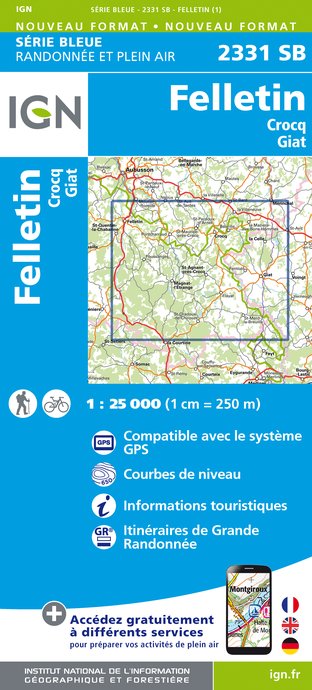
2331SB - FELLETIN CROCQ GIAT
Editor : IGN
Collection : TOP 25 ET SÉRIE BLEUE
Scale : 1:25 000
13.90€

148 CLERMONT FERRAND SALERS PNR DES VOLCANS D'AUVERGNE
Editor : IGN
Collection : TOP 100
Scale : 1:100 000
8.40€

D23-87 CREUSE HAUTE-VIENNE
Editor : IGN
Collection : CARTES DÉPARTEMENTALES IGN
Scale : 1:150 000
5.90€

D15-19 CANTAL CORREZE
Editor : IGN
Collection : CARTES DÉPARTEMENTALES IGN
Scale : 1:150 000
5.90€

D03-63 ALLIER PUY-DE-DÔME
Editor : IGN
Collection : CARTES DÉPARTEMENTALES IGN
Scale : 1:150 000
5.90€

EUROPE
Editor : IGN
Collection : DÉCOUVERTE DES PAYS DU MONDE IGN
Scale : 1:2 500 000
7.00€
What to visit in CAMPING MUNICIPAL BOURG
See more suggestionsVisit the museums and galleries of CAMPING MUNICIPAL BOURG.
See more suggestions


Where to eat in CAMPING MUNICIPAL BOURG
See more suggestionsRestaurants in CAMPING MUNICIPAL BOURG will captivate you.
See more suggestions


Where to sleep in CAMPING MUNICIPAL BOURG
See more suggestionsStay in unique accommodations in CAMPING MUNICIPAL BOURG.
See more suggestions


