Tours
Activities
Places of interest
Where to eat
Where to sleep

Nature adventures at camping sur narlay, Le frasnois, Jura

Are you the owner?
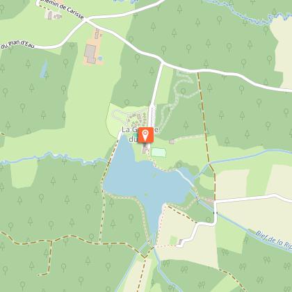
Immerse yourself in the heart of the Jura by staying at camping sur narlay, located in Le frasnois, Franche-Comté. This region is a true treasure trove of natural beauty and culture, waiting to be explored by outdoor enthusiasts and history buffs alike. Just a stone's throw from the campsite, you can venture to Lake Narlay, a stunning glacial lake with crystal-clear waters perfect for swimming, fi...See more

Walking around CAMPING SUR NARLAY

See more suggestions
Explore the parks and paths of CAMPING SUR NARLAY.
See more suggestions
A trip around the four lakes
1.2 km

A trip around the four lakes

Petit Maclu and Grand Maclu, Ilay and Narlay: these are four emblematic lakes of the riparian Jura landscape often called “Little Scotland”. Families with young children should choose the trip around the three lakes, which is shorter and only includes one road crossing. From the parking lot, carefully cross the D 75 (yellow waymarking) and head to the Monts des Ifs intersection. Follow the path to the left below the road and reach the top of the LAC DU PETIT MACLU (Petit Maclu Lake). Take the good stony path along the lakes, heading past the Petit Maclu and the Grand Maclu, and after a small forest section, arrive at the edge of the Lac d’Ilay before joining up with the Chemin des lacs.  Continue on the path to your right (white and red waymarking) until you reach Lac d’Ilay. (If you would like to shorten this circuit and only take the trip around the three lakes, branch off to the right and take the Chemin des Bornes, followed by the Mont des Ifs.)From the Lac d’Ilay intersection, carefully cross the D 75 and follow a tree-lined path towards the hamlet of LA FROMAGERIE.Turn right (yellow waymarking) onto a long wooded path bordered by hedges, which heads to Le Raffour and then right to the village LE FRASNOIS.Turn left. Chemin de la Vierge heads along the back of the village and meets up with the D 75 to the right. Take the road to your left, head past the church and the town hall and take the road towards Lac de Narlay.At the Vers Narlay intersection, continue on the road to your left, and head towards the houses at the bottom of the hamlet. Follow the stony path that heads up and along the left of the lake. The path will take you up to the Monts des Ifs parking lot.

3 h
11 km
Show
Pic de l'Aigle (Eagle Peak)
3.6 km

Pic de l'Aigle (Eagle Peak)

During this wooded and riparian walk, the rocky barrier that marks the transition from the lake region to the Grandvaux plateau gives way to the Pic de l'Aigle (Eagle Peak) and the Belvedere of the Four Lakes. From the PEAK PARKING LOT, the rocky trail ascends (yellow waymarking) to the north until it reaches the Foot of the peak across a healthy dry lawn. After climbing a steep slope (white and red waymarking) for 200 m, you will reach the PIC DE L’AIGLE. The walk continues to the northeast winding along the wooded ridge. It nears a forest road twice and leads to the Belvedere of the Three Lakes, Ilay, Great Maclu and Little Maclu. Staying on the edge of the ridge, a stony trail will lead you to the BELVEDERE OF THE FOUR LAKES (interpretive sign) surrounded by fir trees. The trail ascends to the right towards the Belvedere Parking Lot, below the Ban forest road. The path to the left - an extension of another trail - follows along the ridge marked by a set of cliffs without ever approaching it. After a quick winding descent, which can be slippery during humid weather, the trail meets the edge of the D 75 at the Côte du Maclu. Using the cycling lane to the left of the roadside (yellow waymarking), head to the LITTLE MACLU LAKE (parking lot). The path then follows along the Little Maclu and Grand Maclu lakes towards Ilay. From the Chemin des Lacs, the road to the left opens onto les Rousselets and its chapel, nestled between two trees. Follow the road to the left (white and red waymarking) and take a trail that crosses the D39 twice. The well-delineated path (former tramline) gradually ascends towards "Chemin du Château". The trail then becomes steep until it reaches the Foot of the peak. From here, you can head back to your starting point (yellow waymarking).

3 h
9.3 km
Very easy
Show
Between Lemme and Saine
5 km

Between Lemme and Saine

A succession of ascents and descents, paths, trails and little roads to reach the Morillon cliffs, the Langouette gorges and the belvedere of Les Prés Grillet. From CHAUX-DES-CROTENAY, head down the tarmac road (red MTB waymarking no. 69) towards Le Gros Tilleul. Turn right to reach La Fontaine Neuve and La Chaux Church. Branch off to the left on the tarmac road towards La Loye. Take the stony path that enters the forest to your right, towards La Côte Coulon and the Morillon cliffs in LE CERNOIS.Continue on the stony path that soon turns to tarmac and that runs along the cliffs and heads up to Le Rachet. Take the tarmac road to your right through the open combe of Entre-deux-Monts to reach the hamlet of Les Merets. Turn onto the road to your right and quickly turn left to take the stony path down towards the forest and up to the Étang des Drillettes (Drillettes lake). Continue on the muddy path that heads right up to Les Drillettes, and then take the long forest road along the Quenot rivulet to the road in Sous Grateloup. Carefully cross the départemental road and take the road opposite you that will lead you to the LAVOIR (washhouse) - LES PLANCHES-EN-MONTAGNE via La Fontenette and Le Girod. Continue on the main village road towards Bas du Village. Head down the road to your left and cross a bridge over the La Langouette gorges. Continue on the road, past LE MARTINET and reach Montliboz. Branch off to the right on a stony path that then heads up into the forest, towards Derrière la Montagne Ronde (“behind the round mountain”). Take the muddy path that follows along the right of the D 16 until you reach Chez Tatet, and then take the tarmac road down to La Feuillée au Loup. Turn left onto a small forest path towards La Voie Sacrée. Follow the white path to your right for 200 metres, and then turn left into an area with railings and a building. Follow a long and narrow trail through the forest. Exit onto a tarmac road, turn left and follow the trail to LES PRÉS GRILLETS. After the short out-and-back to the belvedere of Les Prés Grillets, continue on the tarmac road towards La Grande Cheminée. Descend to your left on the stony forest path and take the winding trail to your right to reach Les Messageries. Turn left on the tarmac road and reach the hamlet of Cornu. Continue left onto the road to the hamlet and then turn right just before the last farm. Head up the stony path through the pastures to reach Les Champs Montants. Turn right and return to your point of departure in CHAUX-DES-CROTENAY via a little stony path.

5 h
26 km
Easy
Show

What to do in CAMPING SUR NARLAY

See more suggestions
Make your stay in CAMPING SUR NARLAY special by booking activities.
See more suggestions

What to visit in CAMPING SUR NARLAY

See more suggestions
Visit the museums and galleries of CAMPING SUR NARLAY.
See more suggestions

Where to eat in CAMPING SUR NARLAY

See more suggestions
The flavors of CAMPING SUR NARLAY await you.
See more suggestions
Voyages des Sens
55 km

Voyages des Sens

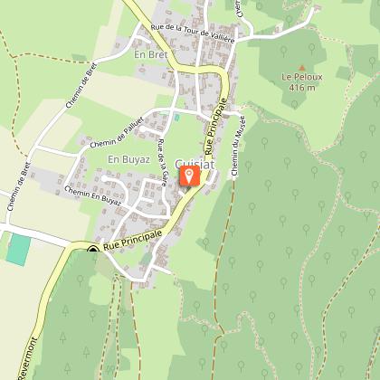
A mixed cuisine with flavors from here and elsewhere, surprising recipes between local and modern. Our restaurant is distinguished by a bib gourmand in the Michelin guide. The fruit of the imagination of Julie Morelle in the dining room and chef Nicolas Morelle, the Voyages des sens restaurant offers inventive cuisine, full of flavors and authenticity. Discover our specialties with local accents, our dishes revisited with raw and delicate flavors at the same time. Take advantage of your stay in the region to enjoy a gourmet getaway where fresh and seasonal products are available in the vicinity of the restaurant. The restaurant is located in a small village of Revermont in Treffort-Cuisiat, this beautiful Bresse house, carved in the stone will seduce you by its charm, its authenticity, its quiet environment and its breathtaking view on the surrounding countryside. Our restaurant is now distinguished by a bib gourmand in the Michelin guide A unique place in Treffort-Cuisiat to meet and share a moment of pleasure and discovery In the heart of the Bresse region, Treffort-Cuisiat is located at the foot of many hills and is part of the natural region of Revermont. Its stone winegrower's houses, attest to its past of vineyard cultivation and the presence of numerous stone quarries. Gastronomy has always been closely linked to the Bresse region. In front of the fireplace in winter or on the flowered terrace in summer, let yourself be guided on a journey where audacity mixes with tradition to highlight the finesse of the products of our region.

33 rue principale Village de Cuisiat 01370 Val-Revermont
Book from 0 €Book
Show

Where to sleep in CAMPING SUR NARLAY

See more suggestions
Stay at one of the many hotels in CAMPING SUR NARLAY.
See more suggestions
Caution!
We have no information on the difficulty of this circuit. You may encounter some surprises along the way. Before you go, please feel free to inquire more and take all necessary precautions. Have a good trip! 🌳🥾