Tours
Activities
Places of interest
Where to eat
Where to sleep

Discover the charm of Le Bourg-d'Oisans from Restaurant La Terrasse

Are you the owner?
Nestled in the heart of the beautiful Isère region in Rhône-Alpes, Le Bourg-d'Oisans is a must-visit destination for nature lovers and outdoor sports enthusiasts. Starting from Restaurant La Terrasse, you'll find a plethora of exciting activities to engage in. Begin by exploring the famous cycling routes, particularly those known from the Tour de France, and be mesmerized by the breathtaking panor...See more

Walking around RESTAURANT LA TERRASSE

See more suggestions
Explore the hiking trails around RESTAURANT LA TERRASSE.
See more suggestions
Car-free hiking - Prégentil from Bourg d'Oisans
950 m

Car-free hiking - Prégentil from Bourg d'Oisans

A beautiful route between forests and meadows surrounded by the peaks of the Ecrins. Itinerary with public transport proposed by Alpes Là. Start: Bourg d'Oisans - Gare Routière (718 m) - 10 min (0.7 km, D+ 20 m) From the bus station, walk 100m towards Bourg d'Oisans town center on the main road (D1091b) to take rue Jean-Baptiste Gauthier (right) and pass the Maison du Parc. At the crossroads, follow signs for Villard-Reymond, turning right into rue St Antoine, then left into rue "Au-dessus du Bourg" to reach the Merlon. 1) Le Merlon (745 m) - 3 h 10 (4.8 km, D+ 930 m) After the Salle des Associations, follow a path along the torrent (right bank) without crossing it. Descend a flight of tire steps to cross a merlon (large artificial ditch designed to stop rock falls), then climb into the forest on the hairpin path. Pass the forest hut (alt. 1360 m, simple unenclosed shelter). Follow the signs and arrows (black on yellow). yellow background). After a meadow, take a wide path to the Col du Solude. 2) Col du Solude (1680 m) - 1 h (2.1 km, D+ 246 m) [Return trip possible (5 min) to Villard-Reymond]. After enjoying a fine view, take the north-western path leading to the Col de St Jean, just below the north-eastern slope of Prégentil. Climb to its summit (100 m D+ Orange points). 3) Prégentil (1938 m) - 1 h 45 (4.7 km, D+ 32 m, D- 918 m) Descend to Col de St Jean, then take the north-west path to cross the Tête des Fromentières meadow. Continue in the direction of Bourg d'Oisans: switch to the forest (heading northeast) and descend via a number of hairpins, first on the west-facing side of the ridge (with an easy cabled passage), then on the east-facing side. The descent continues through the forest on a path that crosses a track at 1270 m, before arriving at the clearing and ruins of Le Puy. 4) Le Puy (1040 m) - 35 min (1.7 km, D- 292 m) Descend to the point on the south path (right): once you've descended to the Alberts torrent, ford it (go up 5m). 5) Le Merlon (745 m) - 10 min (0.7 km, D- 30 m) Return to the bus station via the Maison du Parc. Return to Bourg d'Oisans - Gare Routière (718 m)

7 h
15 km
Medium
Gare 38520 Le Bourg-d'Oisans
Show
Tour of Oisans and Ecrins
1.1 km

Tour of Oisans and Ecrins

Two weeks of active hiking, taking us to the foot of the highest summits in the southern Alps.From Le Bourg d'Oisans, the Tour of Oisans and Ecrins footpath begins its grand tour with the help of handrails to reach the small villages perched on the mountainside. It descends towards the Sarenne mountain stream and then goes up to the mountain pass, with a panorama over the Monts de Lans. We then go down towards Clavans and the Ferrand valley, before a fine climb as far as Besse-en-Oisans, at the edge of the vast Emparis plateau. Above, Col de Souchet offers a five-star view over the Meije. A descent of almost 1000 metres leads to La Grave. You then walk along the River Romanche as far as its source on the mountain pastures of Villar d'Arène. When you arrive at Col d'Arsine, the spectacle is astonishing. The mountainous setting is an invitation to visit the Arsine glacier lake before beginning our long descent along the Petit Tabuc mountain stream as far as the Guisane valley and Monêtier-les-Bains. Our destination is Vallouise via Col de l'Eychauda and the peaceful chalets of Chambran. 8 km of road along the Onde mountain stream bring us to the Jas Lacroix alpine pastures. Crossing Col de l'Aup Martin, the highest point in all the tour, is always rich in adventure, and the descent towards the Pré de la Chaumette is equally exciting. To reach Lake Vallonpierre and Valgaudemar, you have to take care crossing no less than three mountain passes carved out in the schist. Along the Séveraisse, the footpath joins La Chapelle-en-Valgaudemar and then rises through Villar Loubière as far as the Souffles refuge and the impressive Col de la Vaurze. Equally impressive is the descent towards the unspoilt Valjouffrey. The rich green Col de Côte Belle contrasts with the schist landscapes we have seen until now. Valsenestre, in the Béranger valley, comes as a well-earned break before we set off for the last few twists and turns. We arrive at the vertical Col de la Muzelle, leading to the Vénéon. One last mountain pass takes us to the biggest lake in L’Oisans, the Lauvitel, and we are back in Le Bourg d'Oisans. We have come full circle!You can follow the GR® 54 footpath either from Le Bourg d'Oisans, L'Argentière, La Grave or from any other village along the way.

312 h
194 km
Hard
Show
Lac de Buclet -Walking
1.1 km

Lac de Buclet -Walking

Start from the Bourg-d'Oisans tourist office, follow the greenway itinerary with a tarred and wooded section, pass alongside Lac Bleu, continue to Lac de Buclet, then back along the Romanche. TECHNICAL INFORMATION Departure point: Bourg d'Oisans Tourist Office or Parking du Vénéon (730m) Height difference: 50m Loop time: 2h06m to complete the loop Loop distance: 9.3 km Level: very easy (stroll) MAP AND TOPO IGN Top map 3335ET Topo map OBP n°1(Oisans au Bout des Pieds), trails 657 then 272 then I1 to end with trail 271 ITINERARY I set off from the Bourg-d'Oisans tourist office, following the voie verte in the direction of Venosc, past the Théâtre de Verdure with its superb view of the Prégentil cliffs, then along the Bourg-d'Oisans church to continue along the voie verte to the hamlet of Vert, This is followed by a straight stretch to Lac Bleu (natural color), where you can admire the fish basking under the rocks. With its mini waterfalls, picnic tables, little wooden bridges and large green space, it's a bucolic place for the whole family. I then followed the asphalt road towards the Aiguille de Venosc with two short climbs, then skirted the Source de la Rive before arriving at the Lac de Buclet parking lot. I decided to walk around the lake, which has a superb mirror effect for photos, then skirted the parking lot along the high dirt track. The path then runs alongside the Romanche river, with a beautiful view of the route des travers d'Auris, Alpe d'Huez and the Belledonne massif in the background. At the end of the path, a new parking lot comes into view. Cross it, then turn left along Avenue Aristide Briand to return to the starting point. THINGS TO SEE ALONG THE WAY The Théatre de Verdure, Bourg-d'Oisans church, Lac Bleu, Lac de Buclet, La Romanche river, Prégentil cliffs, Belledonne massif, Rive spring, Aiguille de Venosc. NEARBY ATTRACTIONS Lac Bleu, Lac de Buclet, Cascade de la Pisse NOTES - Lac Bleu is not open to fishing, as it is a fish farm reserve. The cascade de la Pisse is a 20-minute walk from Lac de Buclet along the voie verte. -The trail is suitable for all-terrain baby carriages. -The trail can be explored by bike or on horseback.

2 h
9.2 km
Very easy
31 quai dr Girard 38520 Le Bourg-d'Oisans
Show
La balade de la Cascade de la Pisse
1.1 km

La balade de la Cascade de la Pisse

Most of this ride is fluid, allowing you explore the hidden side of the Bourg-d'Oisans plane. The return along the left bank is a more technical and physical cross-country ride. Itinerary from the "VTT en Oisans" guide (Oisans Tourisme) Start/finish (loop) : Bourg d'Oisans 720 m Duration : 2 h Distance: 14 km Highest point: 792 m Lowest point: 720 m Ascent: 140 m Negative ascent: -140 m Technique: 1/4 Endurance: 1/4 Map: Top 25 Les 2 Alpes - Olan - Muzelle 3336 ET. ITINERARY > Start in front of the Bourg-d'Oisans tourist office, head towards the post office and turn left after it, following the signs for Villard-Notre-Dame. > At the foot of the climb to Villard-Notre-Dame, take the small road on the left. Follow the GR 50-54 towards Le Vert. Continue straight ahead until you reach the dike. Once on the dike, to avoid the voie verte (tarmac), take the small path on the right which goes into the undergrowth. At the end of the path, you'll find the voie verte again. Follow the GR 50-54 to the right as far as the cascade de la Pisse... Take a break to admire it. > Continue over the small footbridge. Follow the path back to the voie verte. Turn left towards Bourg-d'Oisans. You'll come to a ford. Depending on the season, this ford is more or less submerged by small streams. These can be crossed by bike or on foot... it's an adventure! > Continue straight on to Lac de Buclet, the second attraction on this trail. Go around the lake to the right, and at the end, turn left into the forest, following the signs [XC 2] in the wrong direction. > As you approach the dike, which you can make out through the trees, watch out for a path on the right which takes you directly up to the dike, avoiding the 4x4 track. Once on the dike, turn right, then straight on for 1.5 km. > At the end, a track on the left leads down from the dike. Take the path that goes into the forest on the right. Turn right onto the road leading to Bourg-d'Oisans. On this small road, more frequented by walkers than cars, you'll pass several paddocks for ponies, donkeys and horses... a delight for children. GOOD TO KNOW : > Don't set off too late for this itinerary. On the outward journey, the route skirts the cliffs behind Bourg-d'Oisans very closely and quickly moves into the shade. For your information, the cascade de la Pisse begins to be in the shade from 3pm in mid-July.

2 h
14 km
Very easy
38520 Le Bourg-d'Oisans
Show

What to do in RESTAURANT LA TERRASSE

See more suggestions
Find bookable activities in RESTAURANT LA TERRASSE for an unforgettable experience.
See more suggestions
Cross-Country Ski Domain in Auris en Oisans
3.3 km

Cross-Country Ski Domain in Auris en Oisans

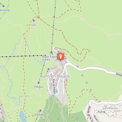
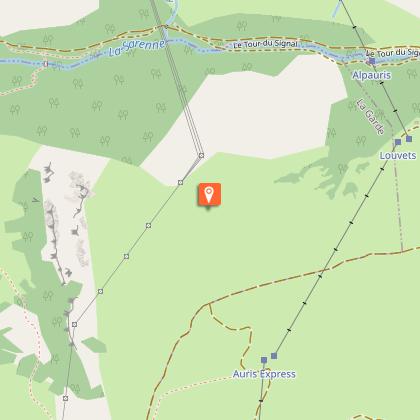
The Auris Nordic domain is 2 sectors for 2 wild atmospheres! With a total of 8 km, the Rochette loop is one of the Alpe d'Huez cross-country skiing itineraries. As for walking and snowshoeing, there are 3 groomed and secure pedestrian trails. SKI DE FOND Concerning the access to this loop of the Rochette, from the resort the most sporty will warm up by climbing the 200 meters of difference in altitude to the pass. For those who prefer to go "easy", the Auris express chairlift will do the job (pedestrian rate). Once at the pass, the cross-country skiers will join the Rochette loop after 2 short kilometres, then they will set off on the 2 km route which winds over a plateau in the hills opposite the Alpe d'Huez resort. Along the loop, pedestrians of all kinds (snowshoes, Nordic walking, walkers) are welcome but must give priority to cross-country skiers who must keep up the pace! The vast snow-covered expanses on the road to the Rochette plateau open up first to the peaks of the Écrins. Here, a little piece of Alaska has been invited into the Alps... You forget about the ski resort and the ski lifts until the view opens up onto Alpe d'Huez and the summits of the Grandes Rousses... And here again the magic happens! PEDESTRIAN PATHS With or without snowshoes, walkers will oxygenate themselves on one of the 3 groomed pedestrian trails of Auris: the "Col de Maronne", the "Piégut" forest and the "La Rochette" loop. The Auris Nordic domain is made up of 2 sectors for 2 wild atmospheres typical of the Oisans and its high mountain spirit. → Piégut sector On the Piégut forest side, the pedestrian route is a must in Auris as it goes into one of the highest spruce forests in Europe. The play of sunlight with the snow-laden branches, the animal tracks and the peaks that reveal themselves as you walk will transport you to Canada... As if you didn't need to go so far, Auris has enough to give you a change of scene. → Maronne / Rochette sector From the resort a route climbs 100m up to the Col de Maronne. This very accessible itinerary is exactly what you need for a short family outing. There are vast expanses of snow all the way up to the plateau and breathtaking views. Here, a little piece of Alaska has been invited into the Alps... The more athletic will only warm up, before continuing for another 2km. From then on, the whole Rochette plateau opens up to you for a wild moment of face-to-face contact with the summits. On the other hand, to reach the latter, those who prefer to go "easy", the Auris express chairlift will do the job! The 2 km loop in itself winds along a plateau in front of the Alpe d'Huez resort. Along the latter, pedestrians are welcome but must give way to cross-country skiers who must keep up the pace! In all, it's an 8 km journey through the fascinating winter landscapes... 8 km that clears the head, lengthens the holidays and makes memories!

38142 Auris-en-Oisans
Book from 0 €Book
Show
Sophie Dode Artiste Peintre
9.3 km

Sophie Dode Artiste Peintre

Painter on canvas, paper and various media. The mountain landscape, its magic, its energy ... Sophie Dode works from her studio a few minutes from Les 2 Alpes. Somewhere between landscape and abstraction, her creativity is nourished by the landscapes that surround us, the mountains, their lights and nature through the seasons. Landscape’ then becomes a springboard from which this artist springs towards form, colour and movement .... At the frontiers of the mountain landscape, Sophie Dode magnificently translates our multiple emotions in the face of Mother Nature. Sophie lovingly produces her own paints, based on acrylics and pigments, and as often as possible on plant resins, taking care to decant the water used in her practice, while respecting the beauty of her small high-mountain village. EXHIBITIONS AND DATES 2024 : -As every year, you can find Sophie's paintings on permanent display on the beautiful walls of the restaurant ‘La Porte d'à Coté’. 70 avenue de La Muzelle. 38860 Les 2 Alpes. -A selected work is also exhibited all year round at the La Muzelle Estate Agency. 2 rue du Grand Plan, Les 2 Alpes. - A few works are also exhibited each winter at the beautiful Hôtel Les Mélèzes in Les 2 Alpes. 17 rue des Viking. 38860 Les 2 Alpes. - Visit your home to try out paintings in situ. Tel: 06 11 39 80 38. -Visits to the studio by appointment. -Exhibitions in preparation for All Saints' Day and Christmas. -Every April, the beautiful CHALET MOUNIER **** devotes 3 days to our mountain artist (dates coming soon). -Summer exhibition (dates to come). Click on ‘Reserve’ below to view the paintings for sale online. Don't hesitate to contact Sophie Dode for further information: 06 11 39 80 38. or : contact.sophiedode@gmail.com

Place de Venosc 38860 Les Deux Alpes
Book from 0 €Book
Show

What to visit in RESTAURANT LA TERRASSE

See more suggestions
Taste the culinary specialties of RESTAURANT LA TERRASSE.
See more suggestions
The former Lac Saint-Laurent
707 m

The former Lac Saint-Laurent

The Bourg d'Oisans plain was hollowed out over the centuries by glaciers, before being filled by sediment from rivers that formed a lake, called the Lac St-Laurent. On several occasions over a very long period, this wide valley has been a lake. The Bourg d'Oisans basin is characteristic of the erosion and accumulation that occurred at the end of the tertiary and quaternary eras due to the glacial waters that dissected the mountainous mass, reducing it to a network of crests. The successive lakes and deposits of rivers filled the valley with sediment, but the glacial rock bar was backed up by another rock bar formed by two alluvial cones from mountain streams opposite the current Pont de la Véna bridge (just outside Livet on the way to Grenoble). Upstream, the Romananche river formed a lake, the Lac St-Laurent, which was regularly emptied. Bourg d'Oisans was then called Saint-Laurent du Lac. Prior to 1091, it is difficult to pinpoint an exact date as to when the lake was formed, although mentions of it have been found in documents dated 1058. In 1191, the Infernet was the scene of a terrible drama, when a substantial rock fall and landslide completrly blocked the flow of the Romanche, creating an insurmountable barrier. This caused the lake to spread to over 18 km in length, submerging the plain under 10 m of water. St Laurent du bord du Lac completely disappeared under the water and all the local inhabitants had to flee their homes, seeking safety on higher ground. According to some documents, the water rose to a level of 741 m above sea level. 28 years later, on 14 September 1219, the dam suddenly burst, creating a catastrophic flood that reached as far as Grenoble (known as the "Flood of Grenoble") killing some 5,000 people. The natural dam had given way under the sheer weight of the water and an enormous volume of water rushed into the gorge with the violence of a hurricane, sweeping away everything in its path, whether trees, fields or whole villages... Although smaller in size, the lake continue to exist for another three centuries, sometimes increasing in volume, as on 4 August 1465 after a terrible summer storm. In 1429, it was recorded that the lake had dried up, only to return at a later date. In 1540, reduced to a "puddle", it finally disappeared... Over the following centuries, the Romanche wended its way through the plain, causing regular floods. In the 18th century, dykes were built to contain the river and the plane was drained using the grid system that now makes for an original landscape. Once the plain had been restored, plans were made to clean it up and grow crops. Back in the 13th century, just after the 1219 catastrophe, the village of St Laurent became the centre of interest for all the local population and villages. The tantrums of the Romanche were only contained once and for all in 1935, with the construction of the Chambon Dam. Website: bourgdoisans.com / freneydoisans.com

38520 Le Bourg-d'Oisans
Show
Bourg-d'Oisans village
1.2 km

Bourg-d'Oisans village

Here you are in Bourg-d'Oisans at an altitude of 700m: all around you are mountains and underfoot is the plain. This landscape has been shaped over thousands of years at the same time as the Alps were being created. The mountains you see, and the plain you walk on, are the consequences of shifting continents, the major ice ages and the subsequent warming. Humans have also helped shape this landscape over the last few centuries, adapting to and taking advantage of natural and geological constraints. The dammed rivers and the network of drainage canals, for example, have allowed the habitat to expand and agriculture to develop in the plain, creating a mountain "bocage" with fields and hedges. However, these actions have never eradicated certain natural hazards, such as avalanches and rockfalls. Half-wild and half-tamed, this landscape and its features are home to a multitude of animal and plant species, some of which are protected. Lake St Laurent: when the Vénéon-Romanche glacier retreated, it stagnated in the lower valley and a lake of more than 5,000 hectares then occupied the entire valley from Bourg-d'Oisans to Allemond. The alluvium deposited by the Romanche and the Vénéon gradually plugged up the lake and filled in the plain to a depth of 500m. In fact, if it weren't for the lake, which gradually filled in, the village would only be at an altitude of 200m! Bourg-d'Oisans is now a delightful little town of international renown where mountain lovers come, both in summer and winter, to stay and enjoy the many activities on offer!

38520 Le Bourg-d'Oisans
Show

Where to eat in RESTAURANT LA TERRASSE

See more suggestions
Restaurants in RESTAURANT LA TERRASSE will captivate you.
See more suggestions

Where to sleep in RESTAURANT LA TERRASSE

See more suggestions
Discover available accommodations around RESTAURANT LA TERRASSE.
See more suggestions
Le Chamois - Gîte auberge
8.3 km

Le Chamois - Gîte auberge

Located at the top of a pass at 1371m above sea level, natural border between Oisans and Matheysine, surrounded by massifs renowned for their wild and majestic character, this large chalet in wood cladding will offer you all the comfort for an unforgettable stay . Inside, its 7 bedrooms and 6 shower rooms can comfortably accommodate up to 25 people. The living room with typical mountain decoration and its large bays which open onto nature, the wood stove, the large professional kitchen offer you the ideal conditions for good moments of conviviality. Outside, a large "high" terrace facing west on the imposing Pic de l'Armet and a south-facing garden terrace on the Ecrins massif where you can enjoy the calm and surrounding beauty, bright colors of the seasons , on a lounge chair in the sun or on the ball field, or even at the table with your loved ones for an XXL barbecue… And everything is ready to facilitate relaxation and the practice of your favorite sports: A boiler room for your shoes on return from hikes, a secure ski room, a shed for motorcycles, a garage for bikes. Leave your vehicle in the private car park and experience your vacation…. Benefit without supplement: Indoor games, library, table football Petanque ground in the garden Orientation course (maps offered at the chalet) Departures for hikes of all levels (on foot, on horseback or by bicycle) Water sports And in winter, ski touring, cross-country skiing or downhill skiing. Marked snowshoe trail.
6810 route du Grand Armet Col d'Ornon 38740 Chantelouve
Show
Caution!
We have no information on the difficulty of this circuit. You may encounter some surprises along the way. Before you go, please feel free to inquire more and take all necessary precautions. Have a good trip! 🌳🥾