To see around
See more
Open
Close
Show
Show
Show
Show
Show
Show
Show
Show
Show
Show
Show

Oups... It would appear that Cirkwi does not have permission to use your location.

Description
Map
Points of interest
Ratings and reviews
See around

A ride in the Bourg d'Oisans plain

A ride in the Bourg d'Oisans plain

Description

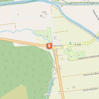
This is a lovely circular ride, ideal for families, around the Bourg d'Oisans plain. In Rochetaillée, the remains of a Roman road, carved high up out of the rock, are a reminder that a lake, the Saint-Laurent, covered this plain 800 years ago.

Route in "MTB in Oisans" guide (Oisans Tourisme)

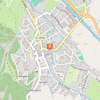
Departure/Arrival (loop): Bourg d'Oisans 720 m
Length: 3 hours
Distance: 18 km
Highest point: 749 m
Lowest point: 711 m
Total height gain: +148 m
Total height loss: -148 m
Technique: 0/4
Endurance: 1/4

Map: Top 25 Bourg d'Oisans and l'Alpe d'Huez 3335 ET

ROUTE
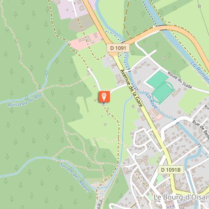
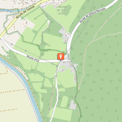
Set off from the Bourg-d’Oisans tourist office, following signs for Grenoble. Ride past the bus station and after a further 400 m, turn left following signs for the «Four Cross». Turn right at La Molière and follow signs for Rochetaillée.
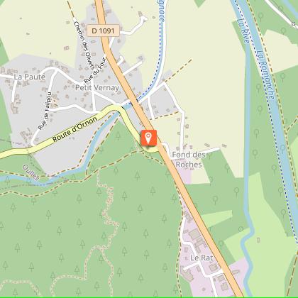
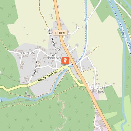
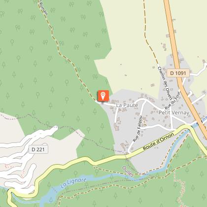
Cross through the hamlet of La Paute. The road then turns into a track, the «Chemin Romain», until Rochetaillée.
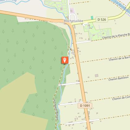
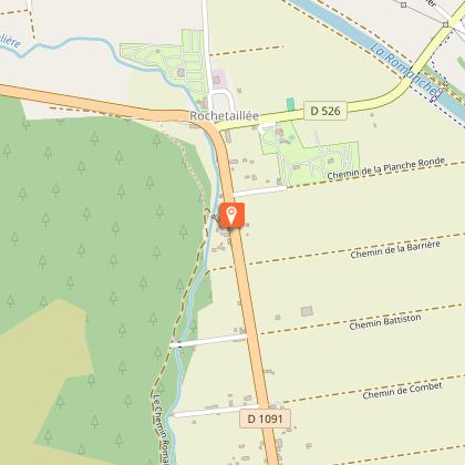
Once in Rochetaillée, look at the rock on the left for the surprising remains of the Roman road, built higher up due to the lake that filled the plain at this time. Several sections are still visible over a 300 m stretch. The well dug-out rock forms a 2.2 meter wide arch. Regularly spaced grooves show where a series of beams were positioned to support a wooden deck used to widen the road. This considerable construction work bears witness to the strategic importance of the Oisans road in Roman times, as it was the road that linked Gaul to Italy.
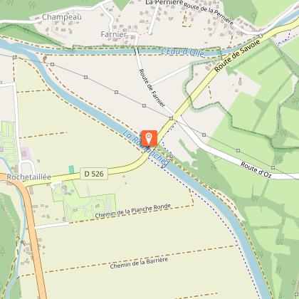
In Rochetaillée, turn left onto the D1091 for just a few dozen metres, before turning right onto the «Chemin de Planche Ronde» to the «Pont Rouge».
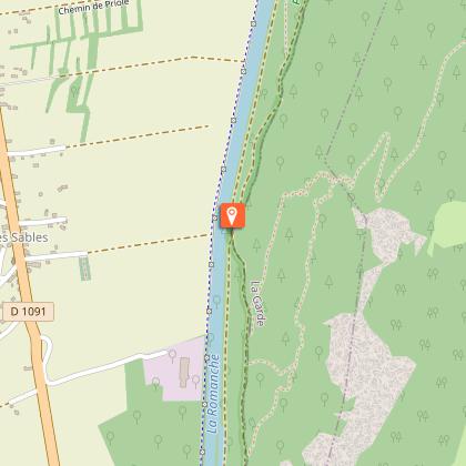
Cross over the bridge and carry on up to the junction, where you turn right towards Villard Reculas as far as Le Raffour (at the bottom of the hill). Turn right in Le Raffour and carry straight on to the dyke.
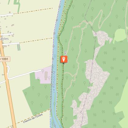
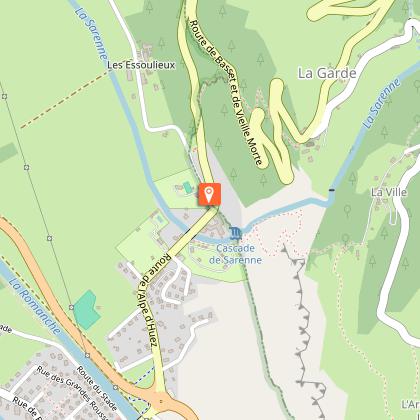
Just after reaching the dyke, take a path to the left towards the Ruines de Vieille Morte. This somewhat sinister name refers to the «dead» arm of one of the many meanders of the Romanche River. In the last century, around 50 people lived in Vieille Morte and an inn provided a stopover for the inhabitants of the Olle Valley travelling to the Bourg-d’Oisans fairs and markets.
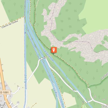
Carry straight on to the «3 Ponts», followed by the hamlet of Basset, where you join up with the road. Follow it up to the junction with the road leading up to Alpe d’Huez. Take special care here as cars can come down quickly and visibility is not particularly good.
Turn right back to Bourg-d’Oisans.

Technical informations

This circuit was updated on: 13/04/2024
18 km
3 h
max. 758 m
min. 709 m
148 m
148 m

Accessibility

Public : Suitable for beginners

Altimetric profile

Starting point

25 Avenue Docteur Louis Fauré , 38520 Le Bourg-d'Oisans
Lat : 45.054957Lng : 6.031237

Points of interest

image du object

La voie de Rochetaillée

Rochetaillée lierally means "cut rock" in French and looking up at the road carved out of the cliff face, it is clear how the village got its name. However, the exact origin of this road appears lost in the folds of history.Is this road, as many people believe, the remains of a Roman road, the indelible mark of an unstoppable sovereign population? Or, as Doctor Roussillon suggests in his Traveller's guide to Oisans, is it "the still visible trace of a path created during the existence of the lake, along the bottom of the neighbouring mountain and behind the small hamlet of Rochetaillée, from which it draws its name. Such were the circumstances in which this path was built." An observor at the end of the 19th century reported certain similarities beween the Porte des Bons and the Rochetaillée road, suggesting a close correlation between the two. Marks and tracks on the ground were reported to be similar and of exact equal width. Unfortunately, no trace of these marks has been found since and the campaign to clear and clean the site carried out by in 2004 by "Customs and Traditions of Oisans" also failed to uncover any evidence. To better understand this, it needs to be remembered that in the last century, the plain through which the road passes was like a desert without any vegetation. Both the cliff and the plain were completely bare, meaning that it was no doubt easy at the time for witnesses to observe and note the smallest details. These days, the road is virtually covered by vegetation and in some places, you can almost walk past without noticing it. But why carve the road out of the rock? If we go along with Docteur Roussillon's theory, the creation of Saint-Laurent lake would be the only tangible reason for this project, which must have involved considerable manpower and resources. The other theory, if we consider this to be a Roman road, suggests that any rapid progress towards the high mountain passes was hindered by the neighbouring plain. Perhaps it was a swamp or a lake that was liable to flooding due to the unpredictable behaviour of the Romanche river? The size of the project to build the road would also prove the importance of the "Oisans way" in the eyes of the Romans. Along the entire length of the platform, rectangular markings are carved out of the stone at regular intervals. These suggest that a structure consisting of beams and a wooden floor covered the road, widening it from 2 metres to 3 or 4 metres and making for easier progression. At suitable points, wider platforms were installed, known as "garages" that served as passing places for animals and carts. To this day, the track linking Rochetaillée to Bourg d'Oisans, via the hamlets of La Paute and Les Sables, is known as the "Chemin Romain". Source: Freneyd'Oisans.com/Mr Albertino

- Oisans Tourisme -
Consulter
image du object

The former Lac Saint-Laurent

The Bourg d'Oisans plain was hollowed out over the centuries by glaciers, before being filled by sediment from rivers that formed a lake, called the Lac St-Laurent. On several occasions over a very long period, this wide valley has been a lake.The Bourg d'Oisans basin is characteristic of the erosion and accumulation that occurred at the end of the tertiary and quaternary eras due to the glacial waters that dissected the mountainous mass, reducing it to a network of crests. The successive lakes and deposits of rivers filled the valley with sediment, but the glacial rock bar was backed up by another rock bar formed by two alluvial cones from mountain streams opposite the current Pont de la Véna bridge (just outside Livet on the way to Grenoble). Upstream, the Romananche river formed a lake, the Lac St-Laurent, which was regularly emptied. Bourg d'Oisans was then called Saint-Laurent du Lac. Prior to 1091, it is difficult to pinpoint an exact date as to when the lake was formed, although mentions of it have been found in documents dated 1058. In 1191, the Infernet was the scene of a terrible drama, when a substantial rock fall and landslide completrly blocked the flow of the Romanche, creating an insurmountable barrier. This caused the lake to spread to over 18 km in length, submerging the plain under 10 m of water. St Laurent du bord du Lac completely disappeared under the water and all the local inhabitants had to flee their homes, seeking safety on higher ground. According to some documents, the water rose to a level of 741 m above sea level. 28 years later, on 14 September 1219, the dam suddenly burst, creating a catastrophic flood that reached as far as Grenoble (known as the "Flood of Grenoble") killing some 5,000 people. The natural dam had given way under the sheer weight of the water and an enormous volume of water rushed into the gorge with the violence of a hurricane, sweeping away everything in its path, whether trees, fields or whole villages... Although smaller in size, the lake continue to exist for another three centuries, sometimes increasing in volume, as on 4 August 1465 after a terrible summer storm. In 1429, it was recorded that the lake had dried up, only to return at a later date. In 1540, reduced to a "puddle", it finally disappeared... Over the following centuries, the Romanche wended its way through the plain, causing regular floods. In the 18th century, dykes were built to contain the river and the plane was drained using the grid system that now makes for an original landscape. Once the plain had been restored, plans were made to clean it up and grow crops. Back in the 13th century, just after the 1219 catastrophe, the village of St Laurent became the centre of interest for all the local population and villages. The tantrums of the Romanche were only contained once and for all in 1935, with the construction of the Chambon Dam. Website: bourgdoisans.com / freneydoisans.com

- Oisans Tourisme -
Consulter

Date and time

  • From 01/05/2024 to 31/10/2024
  • From 01/05/2025 to 31/10/2025

Additional information

Environments

Riverside
Forest location
Mountain view

Updated by

Oisans Tourisme - 08/04/2024
www.oisans.com
Report a problem

Open period

From 01/05 to 31/10.

Subject to favorable snow and weather conditions.

Contact

Phone : 04 76 80 03 25

Email : info@oisans.com

Website : www.bike-oisans.com

Location complements

Leave your car in one of the free car parks in Bourg d’Oisans - the ride will bring you back to the same place.

Data author

Image Oisans Tourisme
proposed by Oisans Tourisme
1 bis rue Humbert 38520 Le Bourg d'Oisans France

Ratings and reviews

To see around
See more
Open
Close
Show
Show
Show
Show
Show
Show
Show
Show
Show
Show
Show