Tours
Activities
Places of interest
Where to eat
Where to sleep
Municipal camping Les Bruyères at La chapelle-en-vercors
Are you the owner?Immerse yourself in the undeniable charm of the La chapelle-en-vercors area in Drôme, Rhône-Alpes, by staying at the municipal camping Les Bruyères. Begin your exploration with the Vercors Regional Natural Park, a true natural wonder teeming with hiking trails and stunning vistas. The Combe Laval circus, with its dizzying cliffs, offers breathtaking views worthy of any postcard. Caving enthusiasts...See more
Walking around CAMPING MUNICIPAL LES BRUYERES
See more suggestionsExplore the parks and paths of CAMPING MUNICIPAL LES BRUYERES.
See more suggestions
")


What to do in CAMPING MUNICIPAL LES BRUYERES
See more suggestionsExplore the many bookable activities in CAMPING MUNICIPAL LES BRUYERES and make the most of every moment.
See more suggestions


IGN cards
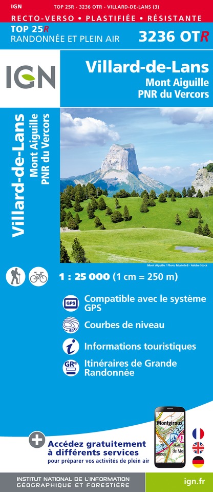
3236OTR - VILLARD-DE-LANS RESISTANTE MONT AIGUILLE PNR DU VERCORS
Editor : IGN
Collection : TOP 25 RÉSISTANTE
Scale : 1:25 000
17.20€

3136ET - COMBE LAVAL
Editor : IGN
Collection : TOP 25 ET SÉRIE BLEUE
Scale : 1:25 000
13.90€

3236OT - VILLARD-DE-LANS MONT AIGUILLE PNR DU VERCORS
Editor : IGN
Collection : TOP 25 ET SÉRIE BLEUE
Scale : 1:25 000
13.90€

TOP75001 - MASSIF DU VERCORS
Editor : IGN
Collection : TOP 75
Scale : 1:75 000
9.80€

VEL01 - LA DRÔME A VELO
Editor : IGN
Collection : DECOUVERTE A VELO
Scale : 1:105 000
9.10€

TOP100D26 - DRÔME VALENCE MONTÉLIMAR DIE PNR DES BARONNIES PROVENÇALES PNR DU VERCORS
Editor : IGN
Collection : TOP 100
Scale : 1:100 000
8.40€

202 JURA ALPES DU NORD
Editor : IGN
Collection : TOP 200
Scale : 1:200 000
6.80€

D38 ISÈRE
Editor : IGN
Collection : CARTES DÉPARTEMENTALES IGN
Scale : 1:150 000
5.90€

D04-05 ALPES-DE-HAUTE-PROVENCE HAUTES-ALPES
Editor : IGN
Collection : CARTES DÉPARTEMENTALES IGN
Scale : 1:150 000
5.90€

D07-26 ARDÈCHE DRÔME
Editor : IGN
Collection : CARTES DÉPARTEMENTALES IGN
Scale : 1:150 000
5.90€

NR14 AUVERGNE-RHÔNE-ALPES RECTO/VERSO MASSIF CENTRAL
Editor : IGN
Collection : CARTES RÉGIONALES IGN
Scale : 1:250 000
6.80€

NR16 PROVENCE-ALPES-CÔTE D'AZUR
Editor : IGN
Collection : CARTES RÉGIONALES IGN
Scale : 1:250 000
6.80€

NR15 AUVERGNE-RHÔNE-ALPES RECTO/VERSO MASSIF ALPIN
Editor : IGN
Collection : CARTES RÉGIONALES IGN
Scale : 1:250 000
6.80€

EUROPE
Editor : IGN
Collection : DÉCOUVERTE DES PAYS DU MONDE IGN
Scale : 1:2 500 000
7.00€
What to visit in CAMPING MUNICIPAL LES BRUYERES
See more suggestionsStroll through the historic districts of CAMPING MUNICIPAL LES BRUYERES.
See more suggestions


Where to eat in CAMPING MUNICIPAL LES BRUYERES
See more suggestionsA wide selection of restaurants awaits you in CAMPING MUNICIPAL LES BRUYERES.
See more suggestions


Where to sleep in CAMPING MUNICIPAL LES BRUYERES
See more suggestionsFind lodging to suit your needs in CAMPING MUNICIPAL LES BRUYERES.
See more suggestions


