Tours
Activities
Places of interest
Where to eat
Where to sleep

Activities and Discoveries Near Indigo XXIX in Die, Drôme

Are you the owner?
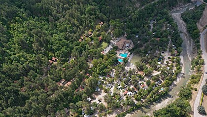
Nestled in the heart of the Drôme region, Die is an ideal destination for nature lovers and cultural explorers. From Indigo XXIX, set off on numerous hiking and biking trails, like the famed Glandasse climb with its breathtaking panoramic views. Dive into local history at the Museum of Die and Diois, where the Gallo-Roman past of the region comes to life.

Wine enthusiasts will delight in the Drôm...
See more

Walking around INDIGO XXIX

See more suggestions
Walks and hikes around INDIGO XXIX.
See more suggestions
The Pison - Chabrinel pass
9 km

The Pison - Chabrinel pass

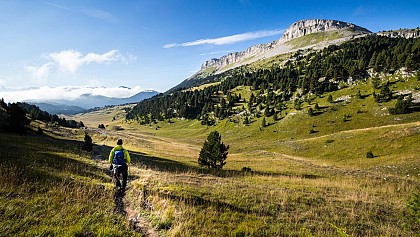
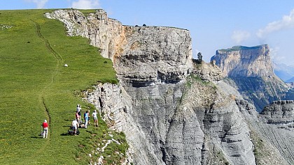
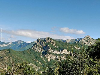
Discover the northern plateau of the Glandasse mountain, an unforgettable getaway in the Hauts-Plateaux du Vercors Nature Reserve. 1.">Departure from Fournaire (parking), take the forest road to join Les Drayes 1. 2, atteindre par un joli sentier en forêt le Pas de Pillouse 3, poursuivre jusqu'au Col de Vire Sac.">Then take the direction of the Col de Vire Sac 2, reach by a nice path in the forest the Pas de Pillouse 3, continue until Col de Vire Sac. 4.">From there, follow the itinerary that goes towards the North, to pass near the characteristic rock of the Dent de Die, before arriving at the crossroads of Lentillière 4. 5, pour déboucher un peu plus haut à Pison 6 sur le plateau (attention vous pénétrez dès lors dans la Réserve naturelle des">Continue on the trail in the balcony (always yellow-green markings), passage to the shelter of the Pison 5, to unbuckle a little higher to Pison 6 on the plateau (attention you penetrate then in the Natural reserve of the High plateaux of the Vercors, with a specific regulation to know and respect!). 7.">Now take the route of GR 91 and 93 (white-red markings), running north to Pré Peyret 7. At Pré Peyret, take the GR 93 direction of the Col du Rousset until the Pré Peyret shelter. From here, take the path leading to the Pas de Chabrinel to the south, before gradually starting the descent, towards Romeyer (pay attention to certain passages in the scree, especially in rainy weather). 8, Serre Reynier 9 et Les Echaliers 10 , un chemin puis une piste forestière permet de terminer cette grande randonnée par Le Château">Follow the yellow-green markup to the parking of Fournaire, passing at the crossroads Les Gravelles 8, Serre Reynier 9 and Les Echaliers 10, a path then a forest trail allows to finish this great hike by Le Château 11 et Les Drayes.">11 and Les Drayes.

6 h
15 km
Hard
Show
The Grand Veymont from the Beure plateau
10 km

The Grand Veymont from the Beure plateau

Go and conquer the Grand Veymont, the main and emblematic summit of the Vercors with its 2,341 meters. This unforgettable walk offers you some of the most beautiful landscapes of the Vercors. The departure of this magnificent hike takes place at the Parking de Beure. 1, où une magnifique vue sur le massif vous attend.">Climb towards the Belvedere 1, where a magnificent view of the massif is waiting for you. 3 par le GR 93, en passant par le Pas des Econdus 2.">From there, follow Pre Peyret 3 by the GR 93, passing by the Pas des Econdus 2. Be careful, you will enter the Hauts-Plateaux du Vercors Nature Reserve. Open to all, this space of freedom requires to be protected, respected and placed under the benevolence of each visitor. Voluntarily low development and restricted mark-up require some commitment on the ground. From Pre Peyret, the path is no longer marked, but is well marked, continue east-northeast, you will gradually climb to reach the vast plain of Queyrie. Continue on your way to the northeast (well-marked path), Mont-Aiguille will then offer you to the east, after a short descent join the foot of the Grand Veymont (towards the north) which stands in front you. 4 à 2341 m.">The path goes up in laces, then in a more rectilinear way to reach the summit 4 at 2341 m. 5 présente quelques passages délicats.">The descent towards the Pas de la Ville 5 presents some delicate passages. 6 et le GR91, suivre le GR vers le sud pour une longue traversée des Haut-plateaux (8 km) et rejoindre Pré Peyret.">From the Pas de la Ville, take the direction of the west, to join La Chau 6 and the GR91, follow the GR towards the south for a long crossing of Haut-plateaux (8 km) and join Pré Peyret. From there, the return journey takes place on the same route as on the way.

11 h
31 km
Hard
Show
Archeotrail : the craftsmen of Prehistory
11 km

Archeotrail : the craftsmen of Prehistory

From the Museum of Prehistory, you will walk up to the ridges of Vassieux where you will have a wide panorama on the Diois and the high plateaux of the Vercors.From the But Saint-Genix to the Vassieux pass and from west to east, you can gaze at the vast lawns of Font d'Urle and Ambel where Mesolithic (9,500-5,500 BC) and Neolithic archaeological sites (5 500-2 500 BC) were uncovered.Circuit developed in partnership with Departure from the Museum of Prehistory, direction Col de Vassieux 8. Take the road to Espeline 1, a strategic crossroads where the GR 93 and the Grandes Traversées du Vercors (GTV) intersect. From there, continue south and pass through Fontaine du Lauset 2 then Les Taillis 3. Leave the forest road to enter the forest and climb gradually to Coras 4, temporarily take the forest road again and reach the Fontaine du Plainet 5 and the Plainet crossroads 6. Take the itinerary on the right which leads to the shelter of the pass of Vassieux (unguarded hut open to the public) after about ten minutes. Still a few steps and the directional panel Entrecols 7 is in sight, with a breathtaking panorama over part of the Diois valley in particular. Here, clearly a pause is needed!The hike continues along the ridge to reach the Col de la Chau 8, then Champ Rolland 9 before reaching the Saint-Genix Butte 1,643 meters 10, the highest point of this circuit And breathtaking views of the valley of Quint below. The path then leaves full north to reach, two kilometers away, the Pas Bouillanain 11 and continues its route towards the Crest of the Clots 12 passing by Pas de l'Ours.At this junction, start the return to the Museum of Prehistory on the descent, taking the GR 93 on the right. Pass through Piarrou 13 and then at Espeline 14 take on the left, the last straight to the Museum .Find more information in the guide Vercors, land of prehistory, available in bookshop and in the shop of the Park

4 h
13 km
Medium
Show
The vineyard path
12 km

The vineyard path

This short pleasant walk takes you through the many vineyards that make up the charming vineyard of Châtillon en Diois. Departure from the Cabanon du Maupas (parking in front of the cellar), take the direction of Châtillon-en-Diois. Always follow the yellow and green markings between the directional signs, take the road for a hundred meters before turning right, between vineyards and crops, then reach a crossroads where a directional panel invites you to continue the walk.1 et le Serre du Poêt 2, ici une halte s'impose. ">The route goes to the right, to reach the Cabanon du Poet 1 and the Serre du Poêt 2, here a stop is required.3 et le Ruisseau du Pibou 4, avant de prendre la direction du Cabanon du Poêt pour rejoindre Beylière 5 et Les Cerisiers 6.">This discovery of the vineyard of Châtillon and its characteristic huts continues through Barsac 3 and the Ruisseau du Pibou 4 before heading towards the Cabanon du Poêt to join Beylière 5 and Les Cerisiers 6. 7 puis le Cabanon du Poêt, le Cabanon du Maupas, le point de départ de la promenade n'est alors plus très loin. ">To finish the discovery of this vineyard through Les Quatre Chemins 7 then the Cabanon du Poêt, the Cabanon of the Maupas, the starting point of the walk is no longer very far.This itinerary is flexible to your convenience. There are several paths in the vineyards that can be borrowed, it is up to you to compose your itinerary in the middle of the vineyards and the numerous sheds.

2 h
4.1 km
Easy
Show

What to do in INDIGO XXIX

See more suggestions
Find the best activities in INDIGO XXIX and book easily online.
See more suggestions
Vercors, gentle family adventures
1.2 km

Vercors, gentle family adventures

An immersion in the vastness of the Vercors' High-Plateaus which will delights parents as kids! At the program: hikes with donkeys, hikes on the earth, underground, in water and in the air… The program: D1/ Accrobranche in Die Meet at 2pm at Die station. Playful aerial treetop adventure in the Parc du Martouret, then transfer to the hamlet of Archiane, a timeless village set in an exceptional natural cirque. In recent years, griffon vultures have taken up residence here thanks to ideal aerological and nesting conditions. This reintroduction has been a great success, with 4 different species now inhabiting the cliffs of the cirque, including the bone-crushing lammergeier. We have plenty of opportunities to observe the vultures soaring in the cliffs above the village. We also enjoy the waterfalls, pools and slides of the Aubaise, a cool river that rises in the upper valley and joins the Archiane a little downstream from its resurgence. Overnight at the "Le refuge d'Archiane" B&B in shared rooms. D2/ Escapade at Tour de Borne Departing from the remote village of Borne, we discover a local geological curiosity: "Les Sucettes", slender stone spires that shape an astonishing landscape. Our escapade continues to discover La Tour de Borne, an associative alpine gîte ideally situated in a grandiose mountain setting, facing the Jocou peaks (2050m). After a picnic lunch, we visit the medieval village of Châtillon-en-Diois, classified as one of France's most beautiful villages, and return to the Archiane cirque to explore the resurgences with flashlights and enjoy the coolness of the mossy rocks. 2 to 3 h walk Overnight at the "Le refuge d'Archiane" B&B in shared rooms. D3/ Treasure hunt and water trail This morning's "treasure hunt" takes us through meadows, lavender fields, pine forests and ruins close to the village to discover - in the footsteps of Ulysses - the life of yesteryear. The afternoon is devoted to a fun-filled aquatic activity with the discovery of the Comane canyon (beginner's level - bring old sneakers to walk in the water): slides, small jumps, swimming, walking in a wild river and a fun zip-line! For the little ones, or those who don't want to take part in the aquatic activity, a walk will be proposed. Return to Archiane. 2 h 30 exploring the canyon Overnight in shared rooms at "Le refuge d'Archiane" gîte d'étape. D4/ Hauts-Plateaux Nature Reserve with donkeys After a short transfer in the Combeau valley, we set off for two days of autonomy with donkeys, excellent companions for the children and carriers of our luggage. We head for the Bergerie de Chaumailloux, an important resistance site and incomparable viewpoint over Mont-Aiguille and the surrounding Dévoluy, Belledonne and Oisans massifs. It's also a haven for ibex and chamois. 4 h hike Overnight in an unguarded mountain refuge D5/ Return to Combeau A superb donkey-paced itinerary through the wildest parts of the High Plateaux Nature Reserve: the longue fissolle plain, the Jardin du Roy sheepfolds and the Pas de la Coche. Meet the marmots at the foot of the Montagnette, then return to the bucolic Combeau valley, where our donkeys find their summer quarters. Time for a final cuddle with our long-eared companions. 4 h 30 of hiking Transfer to Die train station and departure at 5 p.m. Your tour leader may have to modify the order or content of the days described, for weather or logistical reasons. During the week, a 9-seater minibus driven by the group leader will take you from one activity to another. If the group is larger, we may ask a volunteer participant to use his/her car for short trips during the stay (compensation is provided). The little extras : - a variety of fun activities: accrobranche, aquatic trekking, swimming, cave exploration, treasure hunts, stalking... - an itinerary with donkeys on the Vercors high plateaux - a night in a mountain refuge

Haut-Diois 26150 Die
Book from 0 €Book
Show
Mont Aiguille and Treasures of Diois
1.3 km

Mont Aiguille and Treasures of Diois

A superb hike that reveals the varied landscapes of the Southern Vercors: the Haut-Diois, the Hauts Plateaux, the Nature Reserve and the Trièves! Wild itineraries ideal for observing flora and fauna. Optional: the mythical ascent of Mont Aiguille! The program: Day 1/ Die - Archiane (760 m) Welcome at Die station at 11am. Transfer to the village of Menée. We follow the course of the river to gradually enter the spectacular Archiane cirque at the southern end of the Vercors high plateau. We follow the path of the vultures who have found the cliffs ideal conditions for nesting and breeding. Discover this isolated village in the Haut-Diois region - a mecca for rock climbers - where ibex have been successfully reintroduced, and which is home to a major resurgence of underground water from the karstic plateau. Walking time: 3 h 30 to 4 h. M: from 500 m. D: from 500 m. Overnight in a gîte in Archiane D2/ Archiane (761 m) - Les Nonnières (850 m) A splendid hike takes us into the Vercors Highlands, which we reach via the 4 Aubaise paths. As we gain altitude, we're sure to see vultures soaring majestically over the cliffs, while chamois and ibex caracolate on the slopes. We reach the Jardin du Roy, then leave the plateau via the bergeries de Tussac, a beautiful balcony overlooking the Diois and Dévoluy peaks. We start the descent to the beautiful village of Bénevise, between walnut trees and lavender, and soon reach Les Nonnières, our overnight stopover. 6 / 7 h walk. M: from 1050 m. D : from 950 m. Overnight in a hotel** with swimming pool, sauna and jacuzzi. D3/ Les Nonnières (850 m) - Vallon de Combeau (1350 m.) We leave Les Nonnières via a superb valley, topped by cool, sparkling waterfalls that feed the Sareymond stream, before returning to the alpine pastures at the ruin of the Désert farm. Here, Mont-Barral (1903 m), our goal for the day, dominates the landscape. Soon the alpine pastures of Jiboui offer us the chance to observe pastoral life before reaching the panoramic ridges. The summit of Mont-Barral offers an impressive 360° view, with the aesthetic Mont-Aiguille standing out against the landscape. Descending to the Col de Menée, we follow the Grande Leirie ridge, which forms the eastern edge of the Vercors plateau, opening onto the Trièves. A wild trail through alpine meadows and hills leads us to the wonderful Vallon de Combeau. 6 to 7 h walk. M: from 1050 m. D : from 550 m. Overnight in a mountain gîte. D4/ Vallon de Combeau - La Richardière (1050 m) After enjoying the charms of the bucolic Vallon de Combeau, watching the marmots and climbing one of the plateau's emblematic peaks (Montagnette, Croix du Lautaret or Tête Chevalière), we leave the plateau via the Pas de l'Essaure or the Pas de l'Aiguille. to switch to the Trièves. Mont-Aiguille attracts our attention all day long. We're getting closer and closer! Discovery of the village of Chichilianne and end of the day's hike at the hamlet of La Richardière. 6 h walk. M: from 600 m. D: from 900 m. Overnight in a hotel** with sauna and jacuzzi. D5/ Tour of Mont-Aiguille or ascent of Mont-Aiguille (optional, to be booked when registering) Today we'll be touring the emblematic mountain of the Vercors, which sometimes appears as a slender needle, sometimes as a vast dolomitic wall. It's at the Col de l'Aupet that we get the true measure of these exceptional landscapes. For those who have chosen to climb Mont-Aiguille: the itinerary is that of the normal route, with the descent via the Tubulaires followed by the Freychet abseil. It requires the use of mountaineering equipment (harness, rope, helmet, karabiners, etc.) provided by the mountain guide. This route is not technically difficult (3+ max climbing). Accompanied by a mountain guide, it is accessible to all, even those who have never climbed before. This is an experience in a vertical environment, not recommended for people suffering from vertigo. Duration 7h (ascent + descent). 7 h walking. Difference in altitude + 1150 m /- 1150 m Overnight in a hotel** with sauna and jacuzzi. D6/ La Richardière - Maison forestière du Château (1050 m) - Die Via the Pas de l'Aiguille, an important resistance site, we once again enter the Vercors Haut-Plateaux nature reserve. Perhaps we'll be lucky enough to catch a glimpse of chamois, ibex or even the wolf, which has made a comeback in recent years. After a fine day's crossing of the Hauts-Plateaux, we leave the world of high altitude behind us and follow the itinerary of the transhumant sheep, via the Pas du Pison or the Pas de Chabrinel. 6 to 7 h walk. M: from 800 m. D : from 800 m. Transfer to Die station and departure at 5pm. Additional service, the ascent of Mont-Aiguille: Those wishing to do so can make the mythical ascent of "Mont-Aiguille", which was climbed for the 1st time in 1492 by Antoine De Ville. This ascent takes place on D5 instead of the Tour du Mont-Aiguille scheduled for that day. It must be ordered at the time of registration. The little extras : - an itinerary off the beaten track - a complete tour of Mont Aiguille - discovery of the Archiane cirque and the Vercors High Plateaux - optional ascent of Mont Aiguille

26150 Die
Book from 0 €Book
Show
Little Nomads in Diois
1.3 km

Little Nomads in Diois

From valleys flowing with crystal-clear water, to the panoramic ridges of the Vercors, covered in greenery, the landscapes of this family hike with donkeys and the bivouac sites are extremely varied! An enchantment for nature lovers! The program : D1/ Combeau (1400 m) - Bivouac de Gerbeau (1300 m) Welcome at 10 a.m. at Die station. Transfer to the bucolic Vallon de Combeau where our donkeys have their summer quarters. Picnic by the pond, then it's off for the big adventure. We cross the Combeau rock via the Col de Côte Chèvre, then descend to the beautiful Gerbeau bivouac, which offers an incredible panoramic view over the valley. 3 hrs walk M: 170 m. D: 250 m. Night in camp. D2/ Bivouac de Gerbeau (1300 m) - Refuge de la Tour (1340 m) After a short descent, we follow the Sareymond valley to the ruins of the Désert farmhouse, where the Huguenots used to hold their secret assemblies. A balcony path through a magnificent beech forest leads us to the Col de la Plainie. We cross under the Montagne de Bellemotte, home to numerous chamois, to reach the refuge de la Tour, ideally situated in the pastures facing the Jocou. 5 to 6 h walk. M: 400 m. D: 350 m. Night in refuge. D3/ Refuge de la Tour - Combeau (1400 m.) We take a path through the heart of the forest to reach the ridge and the superb alpine pastures of Jiboui. Then, from the Col de Menée, we follow the Crête de la Grande Leyrie, which takes us gently back to the Vallon de Combeau via the Col de la Lauzette. 5 to 6 h walk. M: 450 m. D: 400 m. Night in refuge or camp. Dinner at the refuge. D4/ Combeau - Vercors High Plateaux Nature Reserve (approx. 1600m.) We set off to discover the Haut-Plateaux du Vercors Nature Reserve. After stalking marmots in the Essaure meadow, we reach the crests for a magnificent panoramic view of the neighboring Dévoluy and Oisans peaks and Mont-Aiguille, the massif's emblematic mountain. We choose an ideal bivouac site in the middle of the wilderness before sleeping in the silence of the mountains. 3 to 4 h walk. M and D: 300 to 500 m. Night in camp. D5/ Vercors High Plateaux Nature Reserve We stroll through the heart of the Reserve, having fun discovering flowers and animal tracks. We can look out for ibex and chamois before heading back down to the Auberge de Combeau. A final cuddle with our donkeys and it's back to the Die station by 4.15pm. 3 to 4 h walk. M and D: 300 to 500 m. Family circuit with no particular difficulties, good physical condition required. Children aged 7 and over. The little extras : - hiking pace particularly suited to children - idyllic bivouac sites - very docile donkeys, used to trekking with families - a highly varied program

7 rue des Fabriques 26150 Die
Book from 0 €Book
Show
Crossing the Vercors on snowshoes
1.3 km

Crossing the Vercors on snowshoes

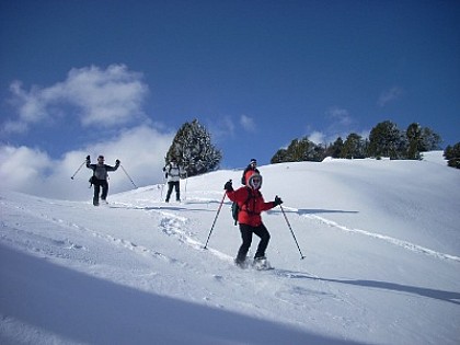
Between the forests of the north and the wide open pastures of the south of the Vercors, this long winter traverse (6 days snowshoeing) offers a wide variety of landscapes. The result: little hidden corners of paradise and a complete change of scenery! Itinerary : D1/ Die - Corrençon-en-Vercors (1150m) - Auberge de Roybon (1300 m) Welcome at 11:30 am at Die station. Transfer to Corrençon-en-Vercors. With snowshoes on, we hike up to the Pas de la Sambue and across the Herbouilly plain. First glimpses of the Hauts-Plateaux, alternating between open hay meadows and forest ridges. Our first accommodation is particularly well located. Walking time: 3h. Difference in altitude: + 400m / - 200m Night in gîte. D2/ Auberge de Roybon - La Chapelle-en-Vercors (900 m) Heading south, the Darbounouse clearing, the hay meadow of the farmers below, offers us the intimacy of the Hauts-Plateaux and the Nature Reserve. Hidden away on its slopes, Pot du Play allows us to snowshoe back to the valley of La Chapelle-en-Vercors and our welcoming hotel. Walking time: 5h30. Difference in altitude: + 400m / - 850m Night in hotel. D3/ La Chapelle-en-Vercors - Vassieux-en-Vercors (1100 m) A short morning transfer takes us to the Font-d'Urle karst plateau. As its name suggests, conditions here can be particularly difficult in bad weather. A ridge route offers splendid views over the Vallée de Quint, and the ascent of Puy de la Gagère takes us onto the Vassieux plateau. Walking time: 4h30. Difference in altitude: + 300m / - 600m Night in gîte. D4/ Vassieux-en-Vercors - Col du Rousset (1250 m) The cliffs of the southern Vercors plunge into the Clairette de Die region. Over the Col de Chironne, a summer pasture, the panorama takes us all the way to the Ventoux, and the natural Col de Rousset gives us access to the small family resort of the same name. Walking time: 5h30. Difference in altitude: + 650m / - 450m Overnight in a guesthouse. D5/ Col du Rousset - Chaumailloux (1650 m) A short transfer takes us to the crests of the Beure plateau and into the Nature Reserve. The multitude of itineraries allows us to progress on snowshoes through some of the wildest parts of the Hauts-Plateaux, with the Dévoluy massif, the Alps and Mont-Aiguille as a backdrop! We spend the evening in the old Chaumailloux sheepfold. Waking up in these landscapes takes us back to the days of the trappers! Walking time: 6h. Altitude difference: + 750m / - 600m Overnight in an unguarded refuge (no running water, dry toilets). D6/ Chaumailloux - Combeau (1400 m) The Vallon de Combeau, the final destination of our snowshoe traverse, can once again be approached via a variety of paths, and the feeling of isolation and unspoilt nature doesn't end until we reach the Auberge de Combeau. Walking time: 5h. Difference in altitude: + 400m / - 650m Transfer to Die station. Departure at 5pm. Snow conditions on the Traversée du Vercors vary throughout the winter and are unpredictable. The walking times indicated above may be longer depending on the quantity and quality of the snow. When there's no snow, we'll still run this tour, because we're hikers first and foremost, and the landscapes of the Hauts-Plateaux are splendid in the winter light. In that case, you'll have to wear your snowshoes a little, or do without them sometimes... So make sure you have walking shoes in very good condition.ar jour.

26150 Die
Book from 0 €Book
Show

What to visit in INDIGO XXIX

See more suggestions
Visit the iconic landmarks of INDIGO XXIX.
See more suggestions

Where to eat in INDIGO XXIX

See more suggestions
Establishments in INDIGO XXIX offer dishes for all tastes.
See more suggestions

Where to sleep in INDIGO XXIX

See more suggestions
Find lodging to suit your needs in INDIGO XXIX.
See more suggestions
Caution!
We have no information on the difficulty of this circuit. You may encounter some surprises along the way. Before you go, please feel free to inquire more and take all necessary precautions. Have a good trip! 🌳🥾