Tours
Activities
Places of interest
Where to eat
Where to sleep

Discover Montreal, Aude, a jewel of Languedoc-Roussillon

Are you in charge of the destination?
Nestled in the Cathar country of Aude, the town of Montreal in Languedoc-Roussillon offers a rich journey in discoveries and heritage. Stroll through the picturesque streets of the town and admire the medieval architecture dominated by the Gothic masterpiece, the Notre-Dame church. History enthusiasts can explore archaeological sites that testify to the region's glorious past.

Nearby, be charme...
See more

Walking around Montreal

See more suggestions
Walks and hikes around Montreal.
See more suggestions
Panoramic Trail in Malepère
124 m

Panoramic Trail in Malepère

Explore the wine cellars on the Malepère hills between the villages of Montréal and Arzens.  Magnificent panoramic views, a walk through the Malepère Forest (Bois du Chapitre and its botanical trail) in the harrier’s habitat.  Return from Arzens to Montréal via the GR78, the Way of St. James.  Yellow Markers  Start in the center of the village, just past the Tourist Information Center, by taking the Chemin de Ronde, then turn right onto Rue Porte Esquive. When you reach Place de l’Espérou, take the stairs down to Rue des Remparts. At the small intersection, turn left onto Rue des Pénitents, then right onto Avenue du Général de Gaulle.  Exit the village; enjoy the view of the Malepère hills and the farmland. Land consolidation has not had the same devastating effect here as it has elsewhere, where hedges and windbreaks have been removed.  Pass “Cammas de bas” on your left. A former “castle” (Middle Ages), you can still make out the “mound” (a mound of earth on which the tower was built, the sole defensive structure).  Turn left onto the path from which you can see the restored sheepfold. (Back when the Collegiate Church was occupied by the canons, woodcutters worked for them in the Chapitre woods, and this building was certainly their home.) In front of the building stand two large oak trees planted during the reign of Louis XIII (1610–1643).  At the D.F.C.I. (Forest Fire Defense) cistern, take the path farthest to the right. Turn right as you descend. Along the edge, you’ll find pyramidal orchids, broom, and junipers. You’ll follow a botanical trail for 3.5 km featuring interpretive displays.  After the climb, the meadows. View of the TV tower on Mont Naut (442 m), the highest point of the mountain range. On the right: the countryside around “Sanches” (a former priory).  Pass to the left of the oak trees and climb through the meadows where the following grow: wild alfalfa, orchids, daisies, bird’s-foot trefoil, and heather.  On the right, dead trees: elms (decimated by Dutch elm disease, a fungal pathogen accidentally imported from the U.S. by sea).  In the woods, turn left. The red sign informs you that hunting is restricted and vipers are protected.  Exit the woods. At this point, keep an eye out for harriers (male or female) flying over the fields in search of food (see silhouette opposite). On the left, a park.  Pass “Calvayrac” on your left.  Junction with the road. Opposite, “Les Jasses.” Take a detour to Mont Naut to enjoy the panoramic view. After the bend, head up the small, rutted road leading to the summit.  Note: Position yourself facing the village of Montréal; you’ll see “Sanches” on your left, a former priory at the bottom of the Piège valley. Across from you lies the Lauragais plain, and behind the foothills of the Massif Central: the Montagne Noire. To the right is the Razès, and slightly behind it, the sharply defined Pic de Bugarach (1,230 m). On the hill behind, “Les Jasses,” a forestry operation where work is made difficult by the steep slopes.  On the way down, straight ahead: to the left, the Pic de Bugarach, then to the right, the Madres (a rounded dome) and the Ariège Pyrenees. On a clear day, the Pic du Midi is further to the right. Retrace your steps.  Turn left at the fork, then head down the quiet road, which soon follows the ridge and offers a view of the landscape: “Calvayrac” in the meadows—a postcard-perfect view. Montréal stands out in the background. Along the roadside, often perched on thorny bushes, you’ll see shrikes (they hang their prey on the thorns of the bushes, creating a pantry for themselves).  Notice the ground movement to the left, below the road—a textbook example of “solifluxion slabs.” This term refers to any movement of materials that have become plastic or liquid, detaching from a more stable underlying bedrock. It involves clay-rich materials that can turn into mud due to water infiltration. This loupe (terrace) detached from the underlying layer and slid over it (see diagram on the reverse).  “Le Prunet,” a goat farm. The road passes through the farm buildings and then descends between two woodlands, one of which, on the left, is fenced. Frequented by goats, the understory is kept clear and thus protected from fire hazards. The other, on the right side of the road and unfenced, is impenetrable and therefore poses a greater risk, highlighting the importance of maintaining livestock farming in these Mediterranean regions.  Take the path on the right beneath the road toward Arzens or the Alternative Route* (direct return to Montreal via the D43).  Vineyards come into view in the Malepère AOC. Notice the vine stakes, which were once carved from acacia wood (now replaced by treated pine).  “Bellevue,” past the property, is a damp ravine where tall trees grow (thriving in the moist soil): ash, acacia, walnut, wild cherry, and poplar—all very tall as they reach for the light.  The vineyards become more numerous as you descend.  Arrival in the village of Arzens (which once had several tile factories, one of which still exists on the D119). Follow the main road and pass in front of the market hall (shops). Continue straight ahead to join the alternate route of the Way of St. James: the Pyrenean Foothills Trail, where you’ll find the red-and-white trail markers again.  Turn left onto the Chemin de l’Horte (at the fire hydrant) and continue straight ahead.  Walk along the stream lined with willows, blackthorns, and cherry trees. Horsetail grows abundantly along the water’s edge. This plant, which colonized the swamps of the Carboniferous Period (the age of the dinosaurs), has survived to the present day, although it has become smaller. Its hollow stem contains a large amount of silica, which is why it was once used to scrub pots. Cross through the vineyards.  A steady climb along the path.  Pass “La Tuilerie Haute” and “La Tuilerie Basse” on your left (likely sites where roof tiles were once manufactured). In the farmlands, harriers and kestrels are frequently spotted.  Pass “Levrault” on your right and turn left.  Junction with the road leading to Montréal. Viewpoint overlooking the northeastern slope of the mountain range.  After the cypress hedge, turn left. On the right, a view of the Collegiate Church of Montréal.  Junction with the road taken on the way there. Turn right. Return to the parking lot. 

5 h
23 km
Easy
Show
From the footprints loop to the pilgrims passage
5.6 km

From the footprints loop to the pilgrims passage

This loop offers a wide range of landscapes: plateau, cypresses, vines, plane trees, forest path, oaks, weeping willows and as a reward a beautiful view of the Montagne Noire ! Signs: Yellow Start from the parking lot of the Town Hall. In front of the sign, turn left and follow the signs. At the level of the covered market, turn left. At the fork, in the middle of the latter, a small building contains the communal well of 1788 called "Fontaine Grande", which, with the help of a wind turbine dating from 1899, supplied the village with water. Turn right and do the same at the next fork. Always follow the tarred road that climbs up, lined with oaks, cypresses and acacias. Once on the plateau, on the right, you will see a cypress hedge along a vineyard, at the end of which you can admire a beautiful alley of plane trees leading to the agricultural estate of "Barthe". Then there is a junction with the forest road where we find plenty of oaks. After crossing the stream, some weeping willows signal the beginning of the wood, inhabited by jays, buzzards and surely some nocturnal birds of prey that nest there. By following the markings, the trail will take you through a succession of meandering hills and descents where tracks of wild boars are visible. Along a cultivated field, entering the wood, after 50m/160ft, turn left where a long descent is waiting for you. At the farm of "Cantaloup", turn right and 200m/650ft further down, turn right again at a small calvary, going along a dirt track between the crops towards the farm of "Béteille". In the village of Alairac, turn right on the road, pass the post office and after the communal hall (foyer) , turn right on the road to "Font Biello" (GR78). At the level of the Jouvénes stream, discover the old fountain of the village of Alairac. Going up 200m/650ft, in front of the small calvary, turn left, then pass in front of the domain of "Sévély". Just after, leave the road to take the stone path. On your right, the "Rougeats" estate and in the background, a breath-taking view of the Montagne Noire. Going straight ahead, cut the tarred road as well as the cypress hedge. At the end of the road, cross the small "stream of Saut", then the domain of the "Moulin de Madame" and there awaits you the square bell tower of the church of Arzens.

4 h
12 km
Easy
Show
Malepère Trail
8.4 km

Malepère Trail

Through the vineyards and the Malepère mountain range from Alairac to Lavalette, along a section of the GR 78 trail… will you be able to spot the red-legged partridge?  Start from the parking lot behind the Alairac elementary school in the center of the village (at the corner of the sign).  Head down Avenue de la Malepère, passing in front of City Hall, then continue straight ahead at the Y-junction toward Arzens and Montréal.  At the stop sign, cross the D211 and head straight ahead onto “Chemin des Castels.” On the left side of this road, a few almond trees line the slope.  Take the first path on the right, which descends slightly; there’s a wayside cross on the right-hand corner. Pass by the “Goutal” farm, where the remains of a windmill wheel and a hand-cranked pump stand.  The path winds through vineyards and farmland.  To the right, a view of Lavalette. Here, vineyards dominate the landscape.  Pass the two turns—first to the left, then to the right—and take in the sight of the great cedar of Lebanon, standing alone in the middle of the vineyard.  After the stadium, at the junction with the D48, turn right toward the village. Two old mills, to the left of the road, are a reminder that grain was once at the core of the village. At the cemetery, the oldest cross in the Aude department bears an engraved date: 1540.  There’s a slight uphill stretch as you enter the village; pass by the post office, and at the intersection, head straight ahead toward Roullens and Limoux on the D211.  In exiting the village, at the first left turn, continue straight ahead between the two properties lined with thuja trees.  This path crosses vineyards and farmland, then passes through the “Ganès” stream.  At the crossroad, continue to the right uphill. Follow the top edge of the field, then enter the woods along the trail. Follow the marked path that leads to “Lavax.”  Before reaching this property, take a sharp right turn and follow this trail downhill through the woods. As you cross the “Ganès” stream, take a moment to admire the tall trees in the valley hollow: willows, oaks, and acacias.  The road climbs steeply to the D18, which you take to the right for 50 meters.  Cross the road and follow the fence downhill to a small grove further down. Cross the small stream and follow the path to the right as it climbs and runs through the vineyards.  Red-legged partridges thrive in this area, and you might be lucky enough to spot them.  In the spring, wild pansies and violets stand out along the edges of the slope with their distinctive colors.  You’ll reach a junction with the road; follow it to the right. On the left, before the cemetery, there is an old windmill.  At the corner of the cemetery, on the Alairac loop, turn right to return to the school. 

4 h
11 km
Very easy
Show
To the abbey of Villelongue
11 km

To the abbey of Villelongue

Follow the old path that used to link the village to the abbey of Villelongue. Signs: Yellow markings The trail follows the old path that linked the village to the abbey and starts at the top of the village near the towers and medieval garden, at the foot of the Carsac stone. Take the small paved road to the left of the sign showing the three footpaths of Saint-Martin-le-Vieil. At the fork, leave the path "sentier des Capitelles" on the left , and carry on straight ahead. At the level of the vineyards, a marker will direct you to a path separating the different plots of land. This one will lead you through the vineyards and then, in the undergrowth, on a slightly sandy earth path. After a short hour's walk (half of the circuit), we arrive on the part of the path overlooking the abbey. We can then see the abbey, majestic, in its bosky bower. A visit of the abbey and the splendid garden is a must. For those who wish, a variant will take you to an old lime kiln.To reach it, cross the small bridge over the "La Vernassonne" and just after the last building on the left, take the path that climbs gently upwards: count one-hour round trip but it is worth it ! The return trip promises to be very pleasant; to do so, take the track starting from the parking lot and go along the edge of the wood. Then at the crossroads, turn right, make a small effort before reaching the plateau. The wooded part will be very nice in summer. When you reach the paved road, continue and then take the track on the right and, a little further on, a track on your right. During the descent at 50m on your right stands a “capitelle” (dry-stone hut) with as always, the doorway to the south.  As soon as you discover it, you will recognize the village and its two towers of the feudal castle, announcing you the end of the hike.

2 h
9.2 km
Very easy
Show
Le Circaète (Circaetus – « Snake Eagle »)
11 km

Le Circaète (Circaetus – « Snake Eagle »)

This trail offers an exceptional and varied flora, several holm oaks and wild flowers to admire. A waterfall and two viewpoints can also be found in this picturesque landscape Signs: Yellow and the orange circaète eagle From the sign in the village, take the D43 downhill.               After a turn on the right, turn left for 50m/164ft towards La Salle. Then take the earth track going up. At the top, turn left onto the small tarred road. Leave the road leading to La Salle on the right and follow the path.            At the crossroads of tracks, continue to the right in the direction of the crest line along the vineyard. Viewpoint on the left on Carcassonne and on the other side on the place called "Arnauteuille" and the village of Montclar further to the right. The vineyard gives way further on to a thicket of holm oaks. In the undergrowth, there is fragon and along the path these cistus, blue carnations of Montpellier (small blue flowers, thin and tall stems), sweet peas (pink and white. Pass in front of the magnificent holm oak (Auzina in Occitan) where wild boars rub to get rid of parasites. The traces of mud left by the animals are permanent on the trunk. Further on, turn right and go down. Take the small marked path, more pleasant than the previous one. The “asphalt grass” (its name comes from the smell it gives off when you crumple it) colonizes the edge of the path (opposite). Turn right at the crossroads, the path goes uphill and ends with a small steep slope leading you to the arboretum. At the very bottom, cross the brook and don't miss this small detour of 30 meters which leads you to a waterfall, a cool and humid place, colonized by horsetail and also occupied by a variety of fern, "le capillaire" (Maidenhair spleenwort). Take the path again and go up to the road D43, cross and turn left for about 120m/400ft. Take the upward path which leads to the Pech de Gabarre. At the junction with the track, turn right and follow this ridge overlooking the campsite. A nice view on the left, over Limoux and its tile factory (the big roof). The path climbs on the left quite abruptly, then descends steeply with, in the hollow, a muddy part. Continue on the highest path in the undergrowth. Strong rise on a gullied path.                At the highest point of the route, don't miss this little detour to the left which offers a panoramic view on the Pyrenees. Go back to the forest crossroads and go down the gravel track (steep descent) which runs along the lower part of the cereal crops where the harrier often flies.                 At the river, turn right. A steep ascent to the village. A drinking water tap is available in the parking lot on the other side of the road. After taking a breath, you will be able to walk through the streets of the circular village called "circulade".

4 h
11 km
Easy
Show
The wildboar
11 km

The wildboar

Sporty excursion where you will alternate between some rough climbs and pleasant passages in the woods at the shade of the oaks. The trail offers a multitude of landscapes: views of the vineyards, scrubland, hills, Pyrenees... Also enjoy the presence or traces of certain raptors and wild boars. Signs: Yellow markings and Orange Wild Boars From the sign in the village, continue up the D43 and drive past the parking lot. After leaving the village, at the fork, turn right uphill. Further on, leave the “Touloury” property on your right. On the plateau, you can breathe and admire on your right the Rouffiac and Preixan vineyards, then behind, the white vineyards of the plain and the Corbières in the background.  At the road, turn right: you enter an area of crop-livestock (cattle). At the "Boulbonne" farm, turn left. The residential buildings are protected from the sun by large lime trees.  Follow the fence on the left, this is a short climb. On the field on the left, the harrier St-Martin can often be seen (this grey raptor with black wingtips, flies like a glider at 2m from the ground to surprise field mice and voles). You may also see the lark, high in the sky, beating its wings very quickly and singing continuously. Very pleasant passage in the oak woods where you will enjoy this area of shade and coolness in summer.  Holm oaks and white oaks accompanied on the edge of the path by fragon (tall, very straight stem, small dark leaves, red balls). Cross the track which leads to "Lavax" and go up opposite. This path runs along the road D43 in the undergrowth. In wet weather, presence of wild boar tracks. Arriving on the road D43, take the track opposite and go down towards "Le Dégo". On the side of the road, notice the geraniums (pink-purple) and cistus (white). This area is often overflown by the circaetes whose cry will not leave you indifferent. Leave "Dégo" on the right and continue on the left.  This track was traced for the Forest Fire Defence. It is pleasant and in some places you can admire the view of the Pyrenees in the background and in front, a hill which shelters a private animal park.   50m after the junction leading to the property "La Soulette", there is a fork. Turn left onto a path descending through a coppice of oaks and strawberry trees. Leave the ruin (barely visible because it is covered with ivy) on the left and go straight ahead. It can be seen by the presence of cypress trees. Always go down the path.  Turn left to reach the brook. On the bank of the brook are two varieties of ferns including the scolopendre (long flat leaves). The path goes along the brook and by raising your head, you will see in this big dead trunk the holes of the woodpecker, the bird that gives the impression of making fun of us when he sings. The path goes up and crosses a rather high scrubland from where, in spring, the strong smell of broom is released. At the junction with the access path that leads to Bédounet, turn right and walk along the edge of the field on the grassy path that runs under the property. Observe the restored dovecote on the building and in the descent a view of the village of Montclar. The agriculture of the heights now gives way to the vineyards of the Malepère. On the right-hand side, you can see "Malfouich", a former agricultural property. The cypress hedge is quite typical of the crop protection against the wind. Once on the road, turn left and in the hollow, is built a stone building on which rests a rusty metal mechanism. It was the water point that the wind turbine was going up, later replaced by an engine that is now abandoned. Finally, a steep climb up to the village and at the crossroads, turn right.

3 h
9.9 km
Easy
Show
Strawberry Tree
12 km

Strawberry Tree

A beautiful hike through Mediterranean flora, among holm oaks, acacias, laurel, thyme, broom, heather, and lavender!  Start from the school parking lot at the sign.  From the D36 coming from Carcassonne, head toward the village. When you reach the intersection, pass the fountain on your right and continue along Route de la Malepère, then take the second right (Chemin de Garrau). This road climbs between the new buildings, and on the slope to the left, a walnut tree stands alongside the elms. After the last houses, the paved road ends and the path runs between holm oaks.  At the junction, head down to the right. A few acacia trees line the right-hand side of the path. Perhaps they were planted to make root-stock stakes? This trail descends through holm oaks, laurel, thyme, broom, and heather, leading to the stream, which you cross. The trail through the woods is very pleasant in summer, the oaks and strawberry trees overshadow the path. It climbs again and, further up, opens to a wider path. Rockroses, lavender, and thyme bushes along the sides. On the flat section, you’ll see the Sabran estate on the right.  The path joins the D36; head right for 100 meters. Check out the rest area set up by the ONF (National Forest Office) below the road on the right. It’s a great spot for a short break! Then, cross the road and head up the trail that leads into the oak forest. The vegetation here is typically Mediterranean. Pass “Cazals” on your left and continue along the pine forest.  The trail joins the D36 road again; take it to the left for 800 meters until you reach the “La Boulbonne” farm (end of the route).  *You can join the “Sentier du Sanglier” trail from the town of Montclar at the “La Boulbonne” farm.  For the return trip, there are two possible routes: 1) the same route as on the way there. 2) head back down the D36 to Roullens. 

1 h
4 km
Easy
Show

What to do in Montreal

See more suggestions
Activities for all tastes await you in Montreal, book them today.
See more suggestions
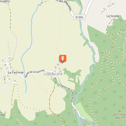
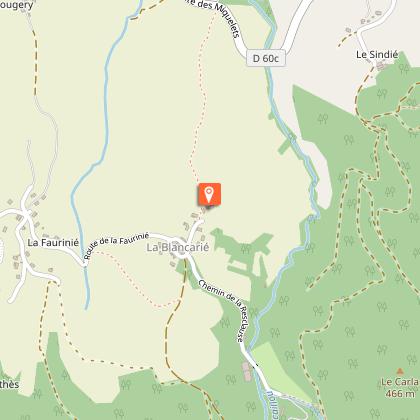
Le Mouscaillou
34 km

Le Mouscaillou

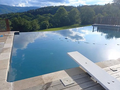
Towering majestically over you, the Montagne Noire Our large Guest House, authentic, spacious, very comfortable, surrounded of 5ha of prairies and oak woods invite to well-being. Need for tranquillity, contemplation: a panorama of exception, a large swimming pool with salt, beautiful beach wood vegetation, with on-site botanical trail. Here in the Parc Naturel Regional du Haut-Languedoc is planned to make you discover a rich and preserved nature. The Panda label is attested. For more physical activity: discovery of the mountain, the waterfall of the Mouscaillou, walk or bike the trails. Possibility to put in place of hiking tours with picnic. Maps and guidebooks available. Opportunity also to try our all-terrain scooters: initiation on-site warranties sensations. More than cultural: rich local heritage: Albi, Castres, Cordes, Carcassonne, Sorèze, Lautrec. After l aperitif offered on the moment of sharing and conviviality terrace, you can enjoy in our The large ground floor room opened by its three windowpanes on the shaded terrace and its remarkable panorama, fully reserved you. Wood, stone, green plants create a soft and warm atmosphere. You will take your meals and enjoy relaxing lounge chairs, his television, his library enriched with many works nature and tourism and its corner bar with fridge. Also on the ground floor, you have two toilets and a washing machine. L floor the rooms, with their wooden floors, colors in the milk of lime, custom decorations, beautiful openings of the mountains or the plain of Castres, offer you comfort and privacy. Three rooms with private wc and shower room; a fourth is added if necessary to one of them to form the family that will accommodate up to five people. You certainly understand that we need to take the time to have fun, which is why we you propo

112 chemin du Mouscaillou La B 81290 Escoussens
Book from 0 €Book
Show
The Great Paths
34 km

The Great Paths

Towering majestically above you: the Montagne Noire. Here in the Haut-Languedoc Regional Nature Park, everything is designed to help you discover a rich and unspoiled natural environment. The Panda label attests to this. This authentic, spacious, and very comfortable home, surrounded by five hectares of meadows and oak forests, invites you to relax and unwind. Looking for peace and quiet, or a chance to reflect? Enjoy an exceptional panoramic view, a large saltwater pool (shared), a beautiful wooden deck surrounded by greenery, and an on-site botanical trail. For more physical activities: explore the mountains and the Mouscaillou waterfall on foot or by bike along marked trails. Maps and guidebooks are available. Be sure to try our all-terrain scooters as well—get an on-site introduction; thrills guaranteed. For cultural experiences: rich local heritage, Albi, Castres, Mazamet, Cordes, Sorèze, the springs, lakes, and waterways of the Canal du Midi, and Carcassonne. ** THE COTTAGE ** You enter on the ground floor into a large open room with floor-to-ceiling windows opening onto the terrace, which offers a pleasant mix of sun and shade, the lawn, and its remarkable panoramic view. Wood, stone, and houseplants create a soft and warm atmosphere. You can relax in the living room’s armchairs, watch TV, browse the library—which is well-stocked with books on nature and tourism—or enjoy the bar area with a fridge; there’s also a separate living room. You’ll also find another living room and a very large, professionally equipped kitchen: a large refrigerator with a separate freezer compartment, a professional-grade gas stove, a gas oven and an electric oven, a microwave, a sink, and a dishwasher. Upstairs, the four bedrooms—with their hardwood floors, lime-washed walls, personalized decor, and beautiful views of the mountains or the Castres plain—offer comfort and privacy thanks to enhanced insulation. There are three bathrooms and three separate toilets. Your stay is all-inclusive: sheets, towels, and linens are provided; beds are made upon your arrival; and end-of-stay cleaning is included.

112 chemin du Mouscaillou La B 81290 Escoussens
Book from 884 EURBook
Show
Via Ferrata in Mazamet
36 km

Via Ferrata in Mazamet

Looking for big thrills? Desire to surpass yourself? The via ferrata of Mazamet is for you! In the the Arnette gorges, in Mazame, via ferrata and giant zip line, under the footbridge. Acrobats and adventurers will enjoy this safe activity which completes, since 2022 the current tourist offer. This land is located in a protected natural site carried by an outstanding historic heritage (Cormouls-Houlès remarkabe gardens, St-Sauveur ruins, classified archeological site), and a rich and diverse wildlife. Nearby, after crossing the Mazamet's Hymalayan footbridge at 70 meters high over the Arnette river, you will find the medieval village of Hautpoul and its gardens, as well as, on the GR7, the House of Wood and Toy, its arboretum and its orchard. A nice wander along the 'Art Net' to picnic in th the shadows of chestnut trees. - Via Ferrata with ziplines : . Access: 20 mn . Drop : 90 m . Length: 880 ml . Difficulty: AD à D+ . Duration: 2 h 30 . Way back: 20 mn - Via Ferrata without zipline . Access: 30 mn . Drop: 110 m . Length: 370 ml . Difficulty: AD à D+ . Duration: 1 h 30 . Way back: 20 mn - Via Ferrata (upper part of Hautpoul) . Access: 20 mn . Drop: 60 m . Length: 130 ml . Difficulty: PD . Duration: 45 mn . Way back: 25 mn Minimum gear required: . Helmet . Harness . Closed shoes . Rest Karabiner & short lanyard . 2 wide aperture autoblock gate karabiners . Karabiner aerolink specifically for continuous safe line . Lanyard aeroline Ferrata . Double lanyard with shock absorber . Gloves General recommendations: Access to the Via Ferrata of Mazamet is prohibited: - to children measuring less than 1,35m and minors who are not accompanied by un experienced adult ; - outside opening hours and over night ; - in adverse weather conditions and especially when the route is slipppery and affected by snow, ice and stormy conditions. You agree to undertake this activity at your own risk. If you have little or no experience in this type of activity, please contact the services of a guide. Equipment rental: Mazamet Tourist Office Online booking: www.tourisme-castresmazamet.com/billetterie Rates: 18€/pers. Groups more than 5 persons: 16,50€/pers. Groups more than 10 persons : 15€/pers. Deposit: 400€ (on the day of the rental, chèque ou Crédit card) For beginners or persons needing a guide, you can contact: - Aude Escapades - Laurence Combes 06 03 50 00 85 - Axecime - Yannick Saulnier 06 08 42 27 13

95 rue de la Resse 81200 Mazamet
Book from 0 €Book
Show
Le moulin des Sittelles
51 km

Le moulin des Sittelles

The Moulin and the Pavillon d'Adélaïde seem to be in great discussion by the river. Located in the heart of a triangle Toulouse-Carcassonne-Albi, Castres doors and at the foot of the granitic massif du Sidobre, Burlats is a pretty responsible village of medieval history and Occitan culture. The Pavilion in Adelaide, the home of Adam, the Castle are evidence of a rich history. Along the River Valley floor village is surrounded by forest and forested mountains. The quality of water and improvements on the Agout make Burlats a privileged place for the practice of canoeing. The Moulin des Sittelles opens its windows on a green natural landscape and large spaces for approval. It has premises and equipment adapted for the reception of groups of children and adults, for all types of stays.Located in the heart of a triangle Toulouse-Carcassonne-Albi, Castres doors and at the foot of the granitic massif du Sidobre, Burlats is a pretty responsible village of medieval history and Occitan culture. The Pavilion in Adelaide, the home of Adam, the Castle are evidence of a rich histo Bed & Breakfast Group at the centre of Burlats, with terrace and walled garden, overlooking the village square and the banks of the river Agout. Total capacity of 94 beds, divided into rooms of different capacities: single rooms, double, four, five, six or even seven people in beds 90x190cm bunk or not. Rooms on the first and second floor, each with a washbasin. Many rooms with private shower. Ground floor: rooms activity or class, room multi-activity, two dining rooms, kitchen equipped for groups; room music with instrumentarium and recording studio, home computer with internet access. Approval of National Education, youth and Sports.gite's group at the centre of Burlats, with terrace and walled garden, overlooking the village square and the banks of the river Agout. Total capacity of 94 beds, divided into rooms of different capacities: single rooms, double, four, five, six or even seven people in beds 90x190cm bunk or not. Rooms on the first and second floor, each with a washbasi

9 places des Tisserands Village 81100 Burlats
Book from 0 EURBook
Show

What to visit in Montreal

See more suggestions
Take a boat tour around Montreal.
See more suggestions

Where to eat in Montreal

See more suggestions
Food enthusiasts will love Montreal's restaurants.
See more suggestions
Where to sleep in Montreal

See more suggestions
Book a pleasant stay in Montreal.
See more suggestions
CHAMBRES D'HÔTES DE MONTCAUSSON
29 km

CHAMBRES D'HÔTES DE MONTCAUSSON

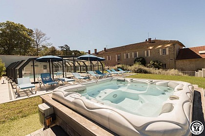
Beautiful estate surrounded by listed parkland, 7km from Revel-Lac-Saint-Ferréol. Features: jacuzzi, infrared sauna, heated communal swimming pool, billiards table, function room for 250 people. Come and enjoy comfort, peace and relaxation at Domaine de Montcausson! This beautiful property, with a stream running through it and surrounded by listed parkland with trees over a hundred years old, is the ideal place to stay, just 7km from the art town of Revel and Lake Saint-Ferréol. Both business and leisure guests are welcome here, and can take advantage of the communal heated swimming pool (from April to October), spa, sauna, yoga room and massage room. The Domaine also offers a 250m² function room for hire, which can also be converted into a seminar room, as well as 2 gîtes d'étape (additional 24 beds). A small breakfast room (or seminar room) for up to 20 people is also available. The 18th-century residence has 5 guest rooms with refined, personalised decor (lift between the ground and ground floors). All have a view over the park, TV and Wi-Fi internet access, reversible air conditioning, private bathroom with walk-in shower and separate WC. The ground-floor bathroom also has a bath. The entrance hall features a pool table and an Arcade console with thousands of video games. The dining room and lounge will be shared with your guests. Of course, no events (weddings, seminars) will be organised at the same time as your reservation. TELETRAVAIL: a desk and an armchair are available, as well as an electrical socket for plugging in a laptop (extension lead and power strip on request), high-speed internet connection (wifi), 4G telephone coverage (operator: Free pro).

Domaine de Montcausson 31250 REVEL
Show
Caution!
We have no information on the difficulty of this circuit. You may encounter some surprises along the way. Before you go, please feel free to inquire more and take all necessary precautions. Have a good trip! 🌳🥾