Tours
Activities
Places of interest
Where to eat
Where to sleep
Explore the charms of Saint-germain, Haute-Saône, Franche-Comté
Are you in charge of the destination?Nestled in the lush countryside of Franche-Comté, Saint-germain, Haute-Saône offers an experience beyond the ordinary. Whether seeking escape or authenticity, this haven is bound to captivate. Begin your visit with a walk along hiking trails winding through verdant hills for a breath of fresh air. History enthusiasts will appreciate the medieval fortifications and half-timbered houses, showcasing ...See more
Walking around Saint-germain
See more suggestionsWalks and discoveries in Saint-germain.
See more suggestions


What to do in Saint-germain
See more suggestionsExplore Saint-germain through its many bookable activities.
See more suggestions


IGN cards
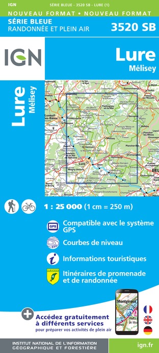
3520SB - LURE MÉLISEY
Editor : IGN
Collection : TOP 25 ET SÉRIE BLEUE
Scale : 1:25 000
13.90€

TOP100D68 - HAUT-RHIN TERRITOIRE DE BELFORT COLMAR MULHOUSE BELFORT PNR DES BALLONS DES VOSGES
Editor : IGN
Collection : TOP 100
Scale : 1:100 000
8.40€

130 VESOUL LANGRES VALLÉE DE LA SAÔNE
Editor : IGN
Collection : TOP 100
Scale : 1:100 000
8.40€

TOP100D88 - VOSGES ÉPINAL NEUFCHÂTEAU ST-DIÉ-DES-VOSGES GÉRARDMER PNR DES BALLONS DES VOSGES
Editor : IGN
Collection : TOP 100
Scale : 1:100 000
8.40€

TOP100D70 - HAUTE-SAÔNE VESOUL LURE VALLÉE DE LA SAÔNE
Editor : IGN
Collection : TOP 100
Scale : 1:100 000
8.40€

201 ALSACE MASSIF DES VOSGES
Editor : IGN
Collection : TOP 200
Scale : 1:200 000
6.80€

89026 - GRANDES TRAVERSÉES DU JURA - GTJ
Editor : IGN
Collection : DECOUVERTE DES CHEMINS
Scale : 1:105 000
9.10€

D70-88-90 HAUTE-SAÔNE VOSGES TERRITOIRE DE BELFORT
Editor : IGN
Collection : CARTES DÉPARTEMENTALES IGN
Scale : 1:150 000
5.90€

D67-68 BAS-RHIN HAUT-RHIN
Editor : IGN
Collection : CARTES DÉPARTEMENTALES IGN
Scale : 1:150 000
5.90€

NR09 BOURGOGNE FRANCHE-COMTÉ
Editor : IGN
Collection : CARTES RÉGIONALES IGN
Scale : 1:250 000
6.80€

SUISSE
Editor : IGN
Collection : DÉCOUVERTE DES PAYS DU MONDE IGN
Scale : 1:303 000
7.00€

ALLEMAGNE
Editor : IGN
Collection : DÉCOUVERTE DES PAYS DU MONDE IGN
Scale : 1:800 000
7.00€

EUROPE
Editor : IGN
Collection : DÉCOUVERTE DES PAYS DU MONDE IGN
Scale : 1:2 500 000
7.00€
What to visit in Saint-germain
See more suggestionsVisit the iconic landmarks of Saint-germain.
See more suggestions


Where to eat in Saint-germain
See more suggestionsRestaurants in Saint-germain offer a friendly atmosphere.
See more suggestions


Where to sleep in Saint-germain
See more suggestionsFind lodging to suit your needs in Saint-germain.
See more suggestions


