Tours
Activities
Places of interest
Where to eat
Where to sleep

Experience the allure of Marre, Meuse, Lorraine

Are you in charge of the destination?
Are you looking for a picturesque getaway in Lorraine? Marre, located in the Meuse, is the perfect place to explore the historical and natural wealth of the region. As you stroll through this village, soak in its authentic atmosphere and discover its fascinating heritage.

Marre is conveniently located near the famous battlefields of Verdun. This is a must-visit for history enthusiasts, where you...
See more

Walking around Marre

See more suggestions
Hikes for all levels in Marre.
See more suggestions
HIGHLIGHTS OF THE BATTLE OF VERDUN
8.3 km

HIGHLIGHTS OF THE BATTLE OF VERDUN

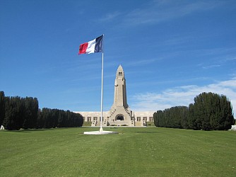
In 1920 the Government decided to create a Red Zone at Verdun, to mark the soil rendered sterile by shell fragments and polluting chemicals. Ten years later, it received its first covering of some 10 million black pines, sent from Austria. The nine destroyed villages included in this Red Zone will never again see the light of day, but the Prefect of the Meuse assures they will be maintained as memorials, by continuing to nominate a mayor to each one. Starting from the Tourism Office, join the Green Way Cycle Path in the Parc Japiot opposite. 4.5 miles. Continue straight on, as far as the Canal Lock at BRAS-SUR-MEUSE. Cross the bridge to reach the opposite bank and follow the canal as far as the next bridge. Leave the Cycle Path, join the road and turn left, to reach the Stop sign opposite the Boulangerie. Turn right onto the main road, then left opposite the restaurant 8.2 miles. Follow the main road and climb up to the Tranchée des Baïonnettes. 8.75 miles. Continue to climb, then after passing the restaurant, turn right and arrive at the Ossuaire de Douaumont. If you climb on foot the 204 steps inside the tower, you will have a 360 degree panoramic view of the entire battlefield 9.25 miles. Retrace your route to the Stop sign. To visit the disappeared village of Douaumont, go left and then immediately right and take the dead-end road to the disappeared village of Douaumont, then return to the main road. Alternatively, to go direct to the Fort de Douaumont, at the Stop sign turn right and descend to the next turning. At the Monument to the Unknown Soldier, turn left, towards the Fort de Douaumont. 9.7 miles. On the road to the Fort de Douaumont, you will cross over the Boyau de Londres. 10 miles. On reaching the Fort de Douaumont, dismount and climb on foot onto the roof of the Fort, where you will have a panorama view of the horizon which in 1916 marked the German frontier. You can also take the path on the left between the shell craters, which in 300 yards leads you to the lookout point. 10.3 miles. Return back to the Monument to the Unknown Soldier and turn left. On your left you will pass Abri (Shelter) 320 and on your right the National Cemetery. 11.8 miles. At the crossroads, turn left and pedal as far as the disappeared village of Fleury-devant-Douaumont. 12.2 miles. Continue straight on and pass the Mémorial de Verdun, dedicated to the Great War 1914-1918. 12.4 miles. Carry on to the Souville Lion, the monument which marks the nearest point to Verdun reached by the Germans in 1916, and where they were finally stopped. 12.75 miles. At the crossroads turn right and descend towards Verdun. You can visit the Souville fortified plateau by taking the small path on the left. There you can visit the unique Bussière twin turret, the Pamart machine gun casemates, and the ammunition shelters. 12.9 miles. On the road descending to Verdun, stop to admire the Maginot Monument on the left. A little further along there is a picnic area in the forest where you can rest. 15.3 miles. After crossing the railway bridge, at the Stop sign, cross over and pass by the Faubourg Cemetery. At the next Stop sign turn right, then immediately left, and pass the Braquier Dragée factory. At the roundabout, turn right and pass the Parc de Londres. Then at the next roundabout, turn left towards the Tourism Office.

4 h
35 km
Medium
1 Bis Rue de la Liberté 55100 Verdun
Show
Left bank : through the walking and cycling path
8.3 km

Left bank : through the walking and cycling path

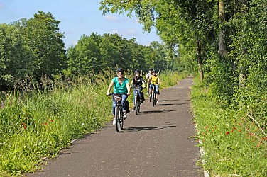
This tour allows you to discover the Left Bank and the beauty of the landscapes of the Meuse Valley along the canal. Dead man’s hill (Le Homme-mort) has suffered some of the most deadliest combats just as much as those on the right bank. Today, it is a pleasant wooded mound that you can enjoy visiting. This course is perfect for a first try of the electric bike. Easy and with little difference in altitude, it will be perfect for a nice stroll with family or friends ! Limited in supply and manpower, the Kronprinz army cannot attack simultaneously on both banks of the Meuse. In order to obtain better results on the right bank, C.Q.G. German prepared the second phase of its offensive whose main objective was to take control of the hills of Mort-Homme (Dead man’s hill) and the Côte 304. These two natural observatories regulated the fires of the French artillery; it is in fact a crucial stake for the offensive continuation. The fighting raged on there for weeks, destroying villages of Esnes-EN-ARGONNE and Chattancourt. Rapidly, the battle peaks became untenable volcanoes; suicidal assaults fade to move on to countless murderous gunshots . To protect themselves from bombing, both sides took refuge on the hillside, digging tunnels. On August 20, 1917, the generals Guillaumat and Pétain begin a to put victorious offensive which has the effect four German divisions attached to the sector Mort-Homme-cote 304 to flight. To the thousands of prisoners, material and armaments captured, must also be added more than twenty thousand victims whose units appear on the current monuments. In this inferno, the village of Cumières will disappear completely and will never be rebuilt.

4 h
48 km
Easy
2 Rue René Panau 55100 Verdun
Show

What to do in Marre

See more suggestions
Enjoy unforgettable moments in Marre by booking activities for everyone.
See more suggestions
What to visit in Marre

See more suggestions
Visit the iconic landmarks of Marre.
See more suggestions
Destroyed village of Cumières-le-Mort-Homme
2.8 km

Destroyed village of Cumières-le-Mort-Homme

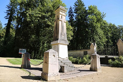
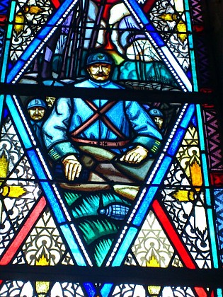
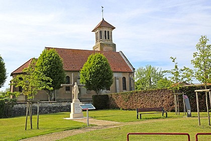
This village, the only one on the left bank of the Meuse among the nine villages destroyed during the war of 1914-18, had 205 inhabitants in 1913. It has very ancient origins, as a sepulchral well dating from the Neolithic period was discovered there in 1873. In the Middle Ages, one of the lords of Cumières began to extort all those who passed through his lands, particularly the inhabitants of Verdun. The latter banded together against him and destroyed his castle in 1439. Nearly five centuries later, the entire village would suffer the same fate, but for different reasons. Indeed, after the German army launched its massive offensive in February 1916 to capture Verdun from the heights on the right bank of the Meuse, the German general staff decided to outflank the French resistance from the west... The Germans first sought to seize the heights of Mort-Homme during a particularly deadly battle that lasted 10 days, from March 6 to 16, 1916. They succeeded and extended their attack on March 20 towards Hill 304, located further west. The fighting was fierce under a veritable deluge of fire and in appalling weather conditions. Further to the east, Cumières, held by the 5th Battalion of the 254th Infantry Regiment, was attacked from May 16 to 23, 1916. The village fell into German hands on May 24, 1916, despite the heroic defense by French infantrymen. It was not until August 20, 1917, that the ruins of the village of Cumières were recaptured by the Marching Regiment of the Foreign Legion. At the end of the war, in 1918, Cumières was placed in the "red zone" along with the entire Mort-Homme hill, then received the unique status of "destroyed village" along with eight other equally devastated villages in the Meuse. Between the two wars, veterans, very active in honoring the memory of the countless soldiers who died, were wounded, or disappeared in the mud of this significant battlefield, helped erect the impressive skeleton monument on Mort-Homme in 1922 and eventually added the name of this bloody hill to that of the destroyed village of Cumières, "Died for France," just like the 10,000 soldiers who fell in this Mort-Homme sector. Finally, like in the other eight destroyed villages on the right bank of the Meuse, Cumières le Mort-Homme erected the Saint-Rémi chapel on August 6, 1933, using the stones from the old church to remind people that this was once a happy village, at the foot of its hill. To see: The Saint-Rémi chapel built with the stones from the old church (paintings by Lucien Lantier); The war memorial; The skeleton monument (a striking work by sculptor Jacques Froment-Meurice, erected by the association of veterans of the 63rd Infantry Division) at the top of Mort-Homme hill; The remains of the mill's former lock.

55100 CUMIERES LE MORT HOMME
Show

Where to eat in Marre

See more suggestions
The flavors of Marre await you.
See more suggestions

Where to sleep in Marre

See more suggestions
Find an ideal lodging in Marre.
See more suggestions
Caution!
We have no information on the difficulty of this circuit. You may encounter some surprises along the way. Before you go, please feel free to inquire more and take all necessary precautions. Have a good trip! 🌳🥾