Tours
Activities
Places of interest
Where to eat
Where to sleep

Explore Chapelle-des-bois, Doubs: Jewel of Franche-Comté

Are you in charge of the destination?
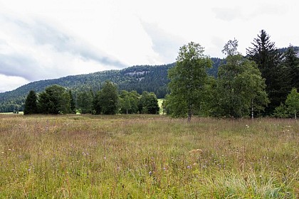
This page guides you through the attractions and activities accessible from Chapelle-des-bois, Doubs, Franche-Comté, ideal for enriching your stay. Nestled in the heart of the Haut-Jura Regional Natural Park, Chapelle-des-bois is a true paradise for nature lovers and outdoor enthusiasts. Enjoy its hiking trails that wind through lush landscapes and treat yourself to moments of relaxation by the nu...See more

Walking around Chapelle-des-bois

See more suggestions
Enjoy outdoor walks in Chapelle-des-bois.
See more suggestions
The Mortes and Bellefontaine Lakes
122 m

The Mortes and Bellefontaine Lakes

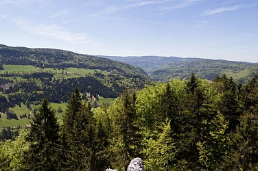
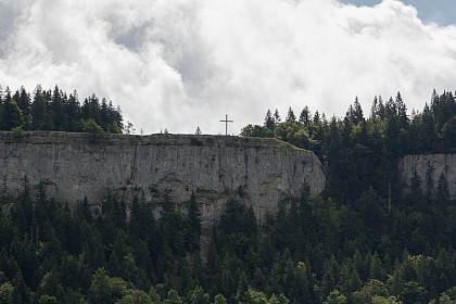
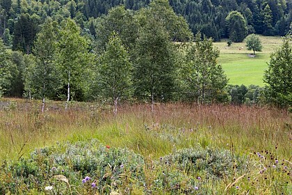
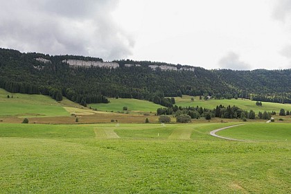
From the viewpoints on Roche Champion and Roche Bernard, the striking Nordic nature of the High Jura's lakes, peat bogs and mountain forests grabs hikers' attention. From the village's small central square, at the hike's starting point, the trail follows the D 46 towards the town hall (white and red waymarking). At "chemin des Sources", a road to the left crosses the combe, borders a peat bog and ascends to La Madone. The path skews off to the left crossing a wooded meadow. At the Reservoir, the trail ascends to the right through a pasture and leads to LA ROCHE CHAMPION. Occasionally rocky, this path continues between the rocky barrier and the swiss border, heads past the Git de l’Echelle and on a wider path, leads to Sur-le-Risoux-des-Lacs, and, turning right, to the Rocky Crossroads. The unmissable belvedere of Roche Bernard can be accessed to the left within 5 mins. From the Rocky Crossroads, a stony forest road, "heads down the hill" (yellow and red waymarking) before leading to the Customs Barrack. Follow the road to the left (white and red waymarking). Head past the ON THE LAKES viewpoint and continue on a white path that overlooks the peat bogs through La Feuillat until you reach les Grands Pins. The trail then follows the D 18 to the right (yellow waymarking) and at the first crossing (the Chalet of Mandrillons) takes a left turn onto the road towards Chaux Mourant before reaching les Assignats. To the right a forest path interspersed with clearings leads to the Chez Bourgeois and Chez Jean Bouveret hamlets. Continuing in the same direction, the trail which is mostly a forest path opens onto the D18 at LES MORTES.  Follow the road to the left and take the little road to the les Mortes hamlet (yellow and blue waymarking) to reach Les Mortes Little Woods Crossroads to the left via the D46. The trail takes the D 46 E to the left and leads a crossroads with "chemin des Bornes". A path heads uphill to the right, enters the forest and descends to La Toumire and later La Chaumeau. The path the heads back uphill to the right along the edge of the la Chaumeau pasture, branches off to the left along a trail through the meadows towards to the road to les Chaumelles. Cross the road and, on the other side, a combe and a wooded meadow that lead to les Champs Nouveaux. Take the road to LES LANDRY to your right (white and red waymarking), and then a road west of the village to return to CHAPELLE-DES-BOIS.

5 h
16 km
Easy
Show
Chaux Mourant Forest
5.5 km

Chaux Mourant Forest

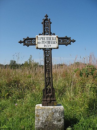
Opposite the Risoux mountain, on the sunbathed hillside of the Bellefontaine combe, stretches the Chaux Mourant forest. From the viewpoint on the Roche Devant, its rocky, dry and illuminated ridge can be fully appreciated. Starting at the TOURIST INFORMATION CHALET, this trail follows the road (yellow waymarking) towards the church, turning right after the municipal hall (white and red waymarking) before immediately heading left on a gravel path along the cemetery and reaching the Le Clos signpost. A small road ascends to the left (yellow and red waymarking) until it reaches Chaux Mourant. Then follow "route des près" to the left until you reach the last houses. Pass between the buildings and gradually progress through the forest to reach Chaux Mourant Forest, The Four Paths and ROCHE DEVANT. The viewpoint is approximately 10 meters to your left. At the ROCHE DEVANT signpost, the path to your right (yellow waymarking) will lead you to Les Chaumelles and then head left. Follow the fall line to reach Castel-des-Buses. To the right, the bordering path (meadows and plantations) will take you towards Pré Jean-Guy. Head past Chalet Peccaud and continue on until you reach a crossroads named LES VIGNES at the heart of the High Morbier Marsh Combe and its dispersed habitat. Continue through the meadow and follow a small road to your right for approximately 100 m, then take a large dirt road to reach Les Violes. A forest path heads up and then becomes hilly to the south. It cuts through a clearing before exiting the forest and joining up with a small paved road at the Sous le Chalet signpost. Turn right towards SACRÉ CŒUR. The Sacré Cœur viewpoint can be accessed within 2 minutes. The road heads downwards in a wide bend at the Chaux Mourant crossroads, from here you can return to the village of Bellefontaine the same way you came.

3 h
12 km
Very easy
Show
Le Lernier
9.2 km

Le Lernier

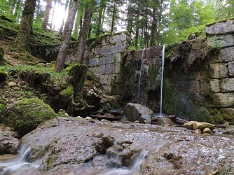
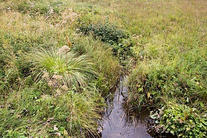
South of the Mouthe valley, a succession of forests and pastures, punctuated by two belvederes: a recent one at the Côte Feuillée to learn about ski jumping and its history, and the Roche Blanche in Chatelblanc. Starting at Cébriot (stream) facing the town hall, the trail heads up the village (white and red waymarking) to LERNIER, before (yellow and blue waymarking) following the D 46 and reaching l’Estanguillon. The path heads up to the right through a valley with a small stream before exiting onto Sur la Chenoz where the first house's dam is proof of the existence of a former mill. The path then turns abruptly to the right, to access the COTE FEUILLEE. The trail continues on a path that descends into a forest to the left (pay attention to the waymarking) until it reaches the Place à bois des Serments. The path to the right, which is suitable for vehicles (white and red waymarking) passes through a combe to les Serments, and then (yellow and blue waymarking) comes to Bois des Ravières. The Bridaux forebay waterfall and the vestiges of its mill can be accessed within 5 mins via LA SCIE. Be careful! The route heads upwards towards Chatelblanc and quickly reaches (100 m) La Combette de la Roche. A grassy trail crosses through a pasture (MTB path) before exiting onto the Grand Réservoir. The panoramic view from Roche Blanche is then accessible within 5 mins (there and back). Be careful! When you have returned from the viewpoint, the good farm road that pleasantly overlooks the combe to the east joins up with "Chemin de la Roche" after a sharp bend to the left. A barely-signposted trail to the right in the combe (MTB path) cuts through the meadows, joins up with a path and opens out into the heart of Chaux-Neuve, behind the old cheese dairy.

3 h
9.3 km
Very easy
Show
Grand Goulet and Trois Commères
9.4 km

Grand Goulet and Trois Commères

Departing from Morbier - the village having given its name to the famous black-streaked cheese and to grandfather clocks - this diverse circuit will lead you to the foot of the Trois Commères, and, at its peak, to the "balcon des Crottes" with a plunging view over the Morez viaducts. Starting at LA BUCLE CAMPSITE, the trail borders the campsite (yellow waymarking) before coming to "Rue des Pontets", at the roundabout, and heading right up "rue Germain Paget" for 300 m. A good grassy path heads to the right and past the la Bucle farm, before turning left and up into the forest via a forest path that leads to Les Préhez. The road to your right in the combe will lead you to the Goulet. Head behind the building and follow the leftmost path. A steep forest path will then lead you to the ridge at Sur les Côtes. Opposite you, take the gravel road (yellow and red waymarking) that quickly branches off to the right and leads to the Trois Commères via a narrow trail. Continue on abother forest path to reach a road signposted LES TROIS COMMERES. To your left, the road descends to the La Bucle Pass. At the pass, follow along the path (yellow waymarking), and then take the winding trail to your left towards the BALCON DES CROTTES. The steep trail overlooking and following alongside the railway will take you to Les Crottes. The MORBIER church is accessible within 5 mins to your left via the Viaducts. On returning to les Crottes, follow the trail along the mountain slope (yellow and red waymarking) and then take the stony path that heads up Sur la Gare. Go down the road to your left (yellow waymarking). A trail bordering the Bruyères lake will take you to the Bucle campsite parking lot.

3 h
8.4 km
Easy
Show

What to do in Chapelle-des-bois

See more suggestions
Enjoy the activities available in Chapelle-des-bois for moments of relaxation and fun.
See more suggestions

What to visit in Chapelle-des-bois

See more suggestions
Attend events organized in Chapelle-des-bois.
See more suggestions
Where to eat in Chapelle-des-bois

See more suggestions
Discover the culinary diversity of Chapelle-des-bois.
See more suggestions

Where to sleep in Chapelle-des-bois

See more suggestions
Choose a comfortable accommodation in Chapelle-des-bois.
See more suggestions
Caution!
We have no information on the difficulty of this circuit. You may encounter some surprises along the way. Before you go, please feel free to inquire more and take all necessary precautions. Have a good trip! 🌳🥾