Alert
Alerts
Type of practice
Mountainbiking
Easy
Presentation
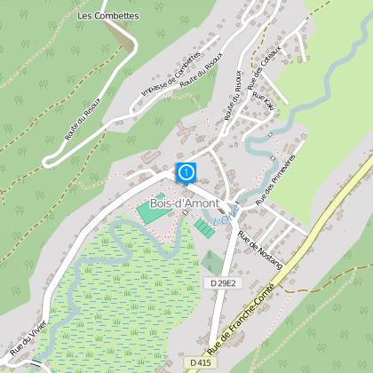
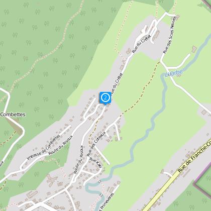
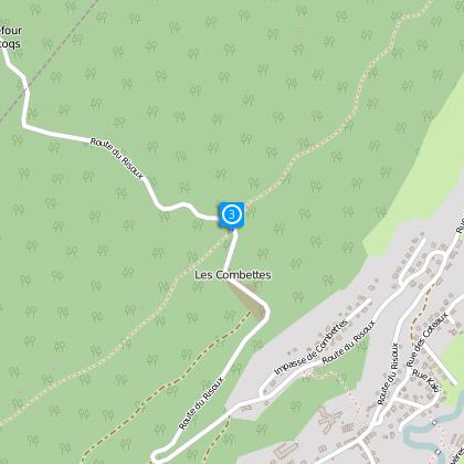
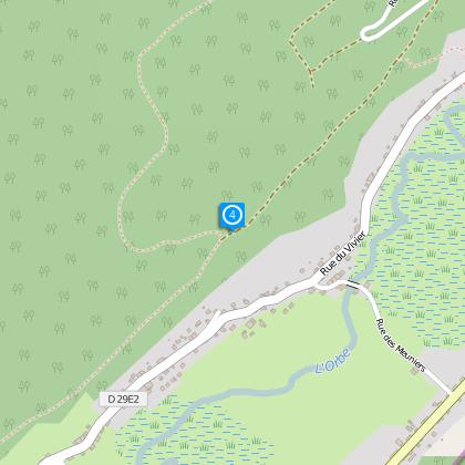
Map
Steps
Cirkwi brief's
Ratings and reviews
See around
Tour of the Combettes

The Cirkwi brief
Discover the Thrilling Tour des Combettes: An Adventure in Bois d'Amont
Embarking on the Tour des Combettes offers more than just a regular mountain bike ride. Crafted by the Office de Tourisme de la Station des Rousses, this route promises a unique blend of athletic challenge and scenic tranquility. Winding through both dense forests and serene valleys, riders are treated to breathtaking vistas of Bois d'Amont and the Orbe Valley. While the path may be short, covering a distance of 6.5 km, it doesn't skimp on excitement, demanding a significant level of effort to conquer its climbs. The journey encapsulates the spirit of adventure, inviting both the eager amateur and the seasoned cyclist to delve into the natural beauty of this remarkable region.
Brief Technical Overview of the Route
This challenging circuit spans approximately 6.2 km, with an elevation range fluctuating between 1057 meters and 1220 meters above sea level. The total positive elevation gain stands at roughly 209 meters, emphasizing the route’s sportive nature. Participants should prepare for a stimulating ride that tests both endurance and climbing skills, against a backdrop of steep inclines and rapid descents. Such characteristics make the Tour des Combettes a demanding yet rewarding pursuit for mountain biking aficionados seeking to test their mettle against the rugged terrain of Bois d'Amont.
Seasonal Tips for Cyclists
When planning to tackle the Tour des Combettes, timing and preparation are key. In spring, the melting snow reveals lush landscapes, yet trails may be muddy; robust, waterproof gear is advisable. Summer offers the most reliable weather, but don't forget to hydrate and wear sun protection. Autumn’s cooler temperatures are ideal for cycling, though fallen leaves can make paths slippery. Winter riding is for the brave, as snow can cover trails—consider fat biking for a unique experience. Always check weather forecasts beforehand, and ensure that your bike is suitably equipped for the terrain and conditions.
Bois d'Amont: A Cultural Gem
Bois d'Amont, the starting point of this remarkable journey, is more than just a picturesque village; it's a location steeped in history and culture. Nestled in the heart of the Jura Mountains, it exemplifies the rich heritage of woodworking and ski manufacturing that has shaped the region for centuries. Its proximity to the Orbe Valley further enhances its allure, offering a tapestry of natural beauty and French-Swiss influence that has captivated visitors and residents alike. The Tour des Combettes not only showcases the area's physical challenges but also invites cyclists to immerse themselves in the fabric of this unique cultural landscape.
Climate Insights for Bois d'Amont Visitors
The climate of Bois d'Amont is predominantly continental, marked by cool to cold winters and warm, pleasant summers. This variation presents an ideal window for cycling adventures from late spring to early autumn, when temperatures are moderate, and rainfall is less frequent. July and August stand out as particularly favorable months for outdoor activities, benefiting from extended daylight hours and the verdant splendor of the region. Whether you're weaving through the cooling forests or ascending sunlit peaks, Bois d'Amont’s climate adds an invigorating dimension to the Tour des Combettes experience.
Automatically generated.
Technical Information
Mountainbiking
Difficulty
Easy
Dist.
6.2 km
Type of practice
Mountainbiking
Easy
Show more
Altimetric profile
Starting point
Lat : 46.53785Lng : 6.13651
Steps

Data author

Ratings and reviews
To see around