Tours
Activities
Places of interest
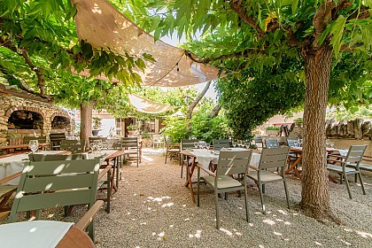
Where to eat
Where to sleep

Explore Gargas from Coquillade Provence Hotel

Are you the owner?
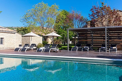
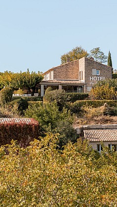
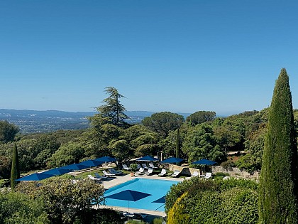
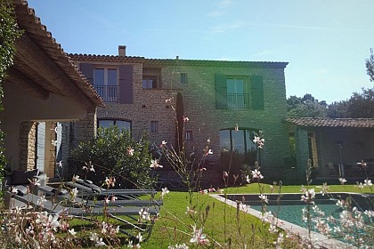
Nestled in the heart of Vaucluse, the region of Gargas offers natural and cultural wonders that will enchant landscape lovers and local discovery enthusiasts. Staying at Coquillade Provence, you'll have the chance to explore the ochres of Roussillon, spectacular geological formations with dazzling hues. Just a few kilometers away, the village of Gordes, listed among the most beautiful villages in ...See more

Walking around COQUILLADE PROVENCE

See more suggestions
Explore the walking circuits of COQUILLADE PROVENCE.
See more suggestions
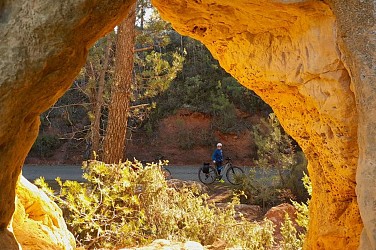
The Ochres by bike
3.2 km

The Ochres by bike

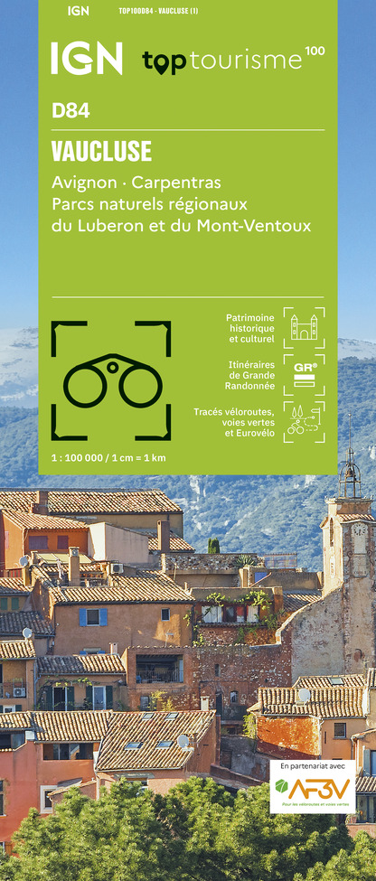
A colourful route! With exceptional landscapes, ochre sites, underground or open-air quarries and colourful villages. Across of the pharmacy, go right to reach below the small roundabout and turn left towards Lombards. Calmly climb to reach a crossing. At the stop sign, turn right and follow the route"The Ochres by bike". Reach the Mines of Bruoux. Then continue to the hamlet of Lombards. Exit through the right and get to the crossroads. 1 - Take a sharp right and at the corner of the campsite, turn left. Come out on the D227 and take a left for 2km. At the crossing with the D4, continue across on the D227 towards Roussillon. Climb two hairpin bends, take two lefts and enter the village streets. Go around a blockand reach to the left foot the ramp leading to the ochre trail. 2 – Go forward to La Burlière avenue (D105), pass a speed bump and at the next junction, go left. Reach a roundabout and continue left towards Apt. Reach another speed bump and at the Y junction, continue straight on the D104 towards Apt. Get to the Conservatoire of Ochres. 3 – Follow the D104, glide through the curves and at the straight line, look out for the small road to the left. Follow it and reach the D4. Cross with the utmost caution and take the small road across, leading to Lombards. Enter a residential area and reach the crossroads you didn't pass on your way going (point 1). 1 – Turn right and return to Gargas by the same route as the one used to go.

2 h
18 km
Easy
Show
The Ochres by bike
3.2 km

The Ochres by bike

A colourful route! With exceptional landscapes, ochre sites, underground or open-air quarries and colourful villages. Across of the pharmacy, go right to reach below the small roundabout and turn left towards Lombards. Calmly climb to reach a crossing. At the stop sign, turn right and follow the route"The Ochres by bike". Reach the Mines of Bruoux. Then continue to the hamlet of Lombards. Exit through the right and get to the crossroads. 1 - Take a sharp right and at the corner of the campsite, turn left. Come out on the D227 and take a left for 2km. At the crossing with the D4, continue across on the D227 towards Roussillon. Climb two hairpin bends, take two lefts and enter the village streets. Go around a blockand reach to the left foot the ramp leading to the ochre trail. 2 – Go forward to La Burlière avenue (D105), pass a speed bump and at the next junction, go left. Reach a roundabout and continue left towards Apt. Reach another speed bump and at the Y junction, continue straight on the D104 towards Apt. Get to the Conservatoire of Ochres. 3 – Follow the D104, glide through the curves and at the straight line, look out for the small road to the left. Follow it and reach the D4. Cross with the utmost caution and take the small road across, leading to Lombards. Enter a residential area and reach the crossroads you didn't pass on your way going (point 1). 1 – Turn right and return to Gargas by the same route as the one used to go.

2 h
18 km
Easy
Show
Aiguebrun valley
7.2 km

Aiguebrun valley

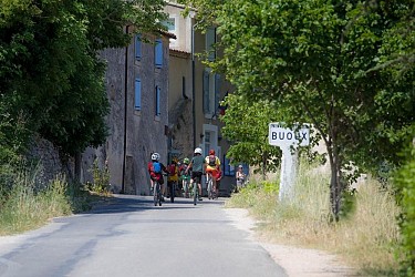
The magical trilogy! Aiguebrun, the plateau of Claparèdes and picturesque villages. The soul of Luberon... Go right on the D113 and turn left. Outside the town hall, go straight. At the corner of the inn, go down to the left. Come out on the D113 (traffic!), cross the bridge and go left until the hamlet of Deyme. Continue on the dirt road, then rise slowly towards the plateau. 1 - At the crossroads"Les Ramades'', turn right and descend to the cliff edge. Continue left on the trail that winds over the void. Further down, turn right and descend the hairpin bends"Chemin dei frau", formerly in cobblestone (careful, the GR® cuts the 1st turn). At the bottom of the hairpin bends, take a right. At the next intersection, turn left, cross the bridge and go up across. 2 - At the crossroads"Aiguebrun'', turn left, then 30m further, turn left towards"Sivergues''. After a succession of steep paths and small descents, spot on a flat stone the sign"Sivergues''. Leave the banks of the Aiguebrun and rise gradually. Continue on the rocky path until the town of Sivergues. 3 - Climb the cobblestone across. Turn left and reach the entrance of the village. At the car park, take a left onto the Chantebelle track and at the 1st turn, continue straight on the path. Skip two corners and continue down the gravel path. Pass a cobblestone section and reach to the valley bottom. Go to the right, cross the ford of Aiguebrun and go up the opposite bank. Pass a cobblestone section and continue across on the rocky path. Pass a corner on the left then turn right at the next intersection. Go up the trail that weaves through the horse paddock. Reach the plateau and continue across on the shaded path that passes between old walls. 4 - At the crossroads"Barbe Blanche", turn left and take the small road through the Claparèdes plateau. At the crossroads"Chante Duc", continue straight, hurtle down 3 hairpin bends and continue to Buoux.

4 h
11 km
Medium
Show
Cliff of the Madeleine
7.3 km

Cliff of the Madeleine

fullness and wonder at the wild beauty of a long cliff ridge ... Take a left at the exit of the parking and join the road junction. Take the D60 on the left towards Lioux and its cliff. 1-At the exit of the first right turn (tank), turn left onto a dirt road (PR). Get out higher on the D60 and take it to the left. At the entrance of the bend, turn right on a footpath at the foot of the cliff (PR). At the height of the first houses of Lioux, join again the D60 on the left (not marked), then reach the nearby church and the wash house opposite. Continue the road, exit the village of Lioux and continue to the right on a stony path (PR). Walk along the foot of the cliff and climb a steep ramp. Unblock between two houses, turn left and immediately right then continue the path between vineyards, truffle and lavender (PR). 2- - At the mas of La Verrerie, turn right and climb the ancestral path to the crests. Take a bend, turn right and continue 20 m further on the right path (PR). Start to descend along the ridges, then 150 m lower, to sneak right on a path that approaches the edge of the cliff of La Madeleine (local PR, green mark up dots). Get out on the path more marked then repeat twice this escapade right on the edge of cliff. Follow the rocky trail in the scrubland, descend and climb a rock jump (walk) to reach the top of a shoulder (cairn). 3- Continue the path along the ridges. Further on, continue on the path on the right to follow the cliff edge (green dots). Join again the main rocky path (PR and green dots) and go straight up to the top of a bump. Sneak behind on the trail that skirts left over the grove of trees (green dots), then 30 m lower, dive on the right path (PR and green dots). 4- Unclog on an esplanade near the old mill. Go down the paved path and walk along the foot of the cliff. Pass the cemetery and reach the D60. Turn left and go down the road to the hamlet of La Combe.

3 h
7.3 km
Medium
Show
Monts-de-Vaucluse by horseback
7.4 km

Monts-de-Vaucluse by horseback

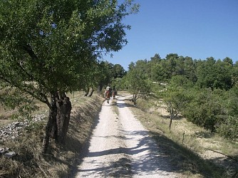
A long walk where forests and crops, rocky valleys and open areas, wild valleys and villages of stone succeed each other. When leaving the car park, take a left. Right after the coffee bar, take a right and then a narrow and rocky passage (marked horse routes). At the top, turn left and then right along the road to reach the D102A. Go down to the right for 50 m and rush in on the track to the left. At the intersection “Plantades”, turn on the left, reach the ditch of La Rourette (pole) and take a right on the path leading to the D102A. Cross the road and continue across until the village of Murs.1- Go through the village towards Venasque (D4), continue straight at the first intersection and turn left on a small road. Below, at the crossroads “Les vallons”, continue straight. Take the rise then turn right onto the old path to the Col de Murs.2- At the Col de Murs, go left, continue on the main track for 3.5 km and reach the D244. Cross the road and turn right lower down on a trail. Lead back to the D244 and the Col 100 m downstream.3- At the col des Trois Termes (pole), turn left on the D177, then 50 m further down, go down the path to the left until the creek of Puy Neuf. There, climb the other side and after a steep slope, cross the area of the Dalle des Busans. At the exit of a road, turn right, then 200 m further, turn left on a path along an old meadow. Go straight, turn slightly on the left and then switch until you reach a wider path. Cross a short passage between two walls (can be avoided by taking a right turn) and go straight on the paved road to the D15.4- At the intersection “Fontanille”, leave the marked horse routes and go up the road to the left for 750 m. Go down a gravel path and reach the heights of the gorges of Véroncle (lectern). Continue straight on the path (PR) that descends to the hamlet of Grailles. Upon arrival on the tarmac, turn left (markup GRP®), cross the small bridge, go along an old mill, then go up the path on the left. Turn right 50 m further, then immediately on the right again, to land on a track (markup PR). Cross and remain across on the small road that leads back to Joucas.

5 h
21 km
Medium
Show
The balconies of Aiguebrun by mountain bike
7.5 km

The balconies of Aiguebrun by mountain bike

A stroll in the shape of a large 8, to be wandered as of the age of 8 years and up to 88 years, on a 8-speed mountain bike! From the car park at the northern entrance of the village, go right on D113 and turn left. Outside the town hall, turn right and climb the steep narrow road. Pass a hairpin turn and reach the plateau. In front of the Sainte-Marie chapel adjoining the cemetery, continue on the track to the right (GR®)). After a large field, take a quick left and hurtle down the slope to the farm of Jas (be careful)!). Turn left along the small road, go through the farm and continue for 300m. 1 - At the crossroads ''Petit Auron'', follow the road to the left, cross the bridge and turn left on the path that accesses the Château de l'Environnement. When arriving at the first buildings, turn right and walk the dirt road. At the next intersection (cross), continue straight on the shaded path. Continue the Chemin des Escoufines until Buoux by going around the hill. 2 - Coming out on the D113, take the road across over 30m and at the corner of the inn, go down the path to the right. Come out on the D113 (traffic!), cross the bridge and go left until the hamlet of Deyme. Continue on the dirt road, then rise slowly towards the plateau. 3 - At the crossroads ''Les Ramades'', continue straight first, and after a round trip of 300m, it's possible to reach the beautiful view of the cliff edge. Pass along the truffle fields, turn left in front of a house and 200m further, take the right track. At the crossroads ''Chante Duc'', turn left, hurtle down the 3 hairpin turns of the small road and reach Buoux nestled a little lower.

2 h
12 km
Very easy
Show
The Villars secrets
7.6 km

The Villars secrets

Far from the well-known areas, a summary of natural wonders and rural heritage, between ochres, cultures, oak groves and scrublands. Opposite the town hall, turn right towards Rustrel. When at the village hall, dive right onto a path that goes into the housing estate boundary (fence). Turn left onthe road, cross La Riaille and at the intersection ''Clastre'', continue straight. 500m further, take the left path (GR®) entering the classified massive and an ?environmentally sensitive area (ESA). Pass two corners and rise to the left at the top of the hill. 1 - At the crossroads"Trou des Américains" visit the pond 100m to the right and back to point 1. Continue on the right trail (GR®and travel through all the ochre massif. Coming out on the road ''La Glaurivette'', cross the D214. 2 - Take the opposite track (RP), then cross the D179. Advance on 80m on the path of Fumeirasse and turn left. At the bottom, turn right and go slowly straight tothe crossroads"Fumeirasse''. Continue the path completely to the left and reach a crossing (point 429). 3 - Go straight until the chapel and go back to point 3. There, ride up the steep path and continue on it. At the top of the second steep path, turn right. Reach to a track. Go up on the right on 650m. Do not miss to the left the road which descends slightly (local RP, green markings). 4 - In a right turn (cairn)Go across and go straight at the first intersection (cairn). Slowly descend on 700m and turn right on a path that winds through the scrubland (green markings). After two turns, cross the ravine, up to the junction with another path. 5 - Go down the road for 15m and take the first road to the left. Go straight and turn left to reach the D179 below. Cross the road, pass the Hameau des Marchands, go along the recreation centre and reach the D214. Continue straight through the protected pedestrian crossing. At the crossroads"Saint-Joseph'', climb the ramp to the right (no entry sign) and take the second right to return to the centre of Villars.

4 h
13 km
Medium
Show

What to do in COQUILLADE PROVENCE

See more suggestions
Book your activities in COQUILLADE PROVENCE now and get ready for adventure.
See more suggestions

What to visit in COQUILLADE PROVENCE

See more suggestions
Discover the nightlife of COQUILLADE PROVENCE.
See more suggestions

Where to eat in COQUILLADE PROVENCE

See more suggestions
The restaurants of COQUILLADE PROVENCE await you.
See more suggestions

Where to sleep in COQUILLADE PROVENCE

See more suggestions
Book a pleasant stay in COQUILLADE PROVENCE.
See more suggestions
Caution!
We have no information on the difficulty of this circuit. You may encounter some surprises along the way. Before you go, please feel free to inquire more and take all necessary precautions. Have a good trip! 🌳🥾